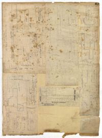
Page 63 of the City Engineer's Plat Book with five plats. Plat 1 features wharves located near East Bay Street, and shows several docks and buildings. Plat 2 shows wharfs shows a wharf and several buildings located near East Bay Street. Plat 3 features a wharf located near East Bay Street and shows multiple buildings and docks. Plat 4 features a wharf located between East Bay Street and the Cooper River channel, and also shows several buildings. Plat 5 shows lots located on and near Market Street, between East Bay and Concord Street. Plat 6 features a wharf located between East Bay Street and the Cooper River, and also shows several buildings.
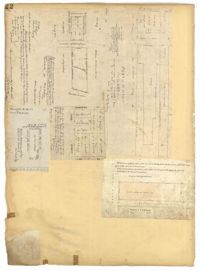
Page 22 of the City Engineer's Plat Book with five plats. Plat 1 shows lots located near the Charleston Harbor, Concord Street, Pinckney Street, and Pritchard Street. Plat 2 shows lots and structures located near the intersection of Concord Street and Pinckney Street, including a single-story building, a wharf, and a label reading "City property leased." Plat 3 shows a lot on Broad Street labelled "Lot of David McCredie." Plat 4 Shows lots located near Park Street, and between Shepherd Street and Line Street. Plat 5 shows lots near the intersection of Broad Street and Gadsden's Alley labelled with the names of banks.
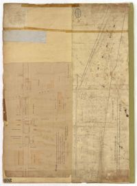
Page 205 of the City Engineer's Plat Book with two plats. Plat 1 shows "Lots in the Village of Rikersville," and shows Mechanics Street, 21 acres of marsh, a building labelled "Car Factory," a building labelled "Machinery," a building labelled "Wheat Mill," a canal, and a pond. Plat 2 shows lots and structures located between Pinckney Street and Market Street. Plat 2 also shows Hayne Street, Guignard Street, Church Street, Anson Street, Rafer's Alley, East Bay Street, a building labelled "Cotton Press," a park, and a building labelled "The Market."
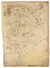
Page 67 of the City Engineer's Plat Book with two plats. Plat 1 features three lots located on Meeting Street, with stores and yards labelled. Plat 2 shows a stretch of land near the Ashley River, and the intersection of Calhoun and Lucas Street. Plat 2 also shows a large building labelled "West Point Rice Mill" and a stretch labelled "Mill Pond."
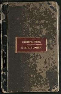
Meeting minutes volume kept by the Kahal Kadosh Beth Elohim Board of Trustees, 1866-1875. The entries in this volume concern all synagogue business, finances, membership, and plans of the amalgamation between the KKBE and Shearith Israel congregations. This volume also includes entries from 1863 regarding destruction caused in the midst of the Civil War.
The Arthur B. Flagg Journal and Commonplace Book is comprised of information relating to rice and other agricultural farming on the Brookgreen Plantation post Civil War. The journal also serves as a record of the laborers working on the property as well as medical and financial data. The names of the laborers are listed as: Abby, Abram, Amanda, Andrew, Ane/Anne, Anthony, August, Bella, Bena, Bennett, Bep, Billey/Billy, Blue, Bob, Brop, Brown, Cazee, Ceasar, Charles, Charlott, Cirus, Conner, Cuffee, Delia, Edward, Ellen, Fontine, Frances, Francis, Frank, Henrietta, Isaac, Jack, Jackson, Jacob, Jeny, Joanna, John, Jonah, Josephine, Kittyann, Little M, Lucas, Marcus, Martha, Mary, Mier, Nanny, Napolion, Ned, Nippy, Patty, Paul, Phobea, Prince, Rachal, Richard, Rondal, Ropel, Simon, Smith, Solomon, Susan, Toney, Victor, Wil, Wiloughby, Zach, and Zalia.
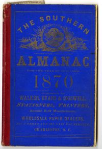
Volume Three in the Cote Bas and Mepkin Plantations Collection is a Southern Almanac for the Year of our Lord 1870 repurposed as a journal by Peter Gourdin. Entries include planting, farming and irrigation information from Cote Bas and Mepkin Plantations. Other entries concern rice, cotton, payments made for goods and services, social activities and clippings on various topics such as the Union Reform Party and voting for freedmen.
Joseph Walker Barnwell, Gottingen, Germany, writes to unknown family member discussing the current political situations among the countries of Europe, including England, France, Germany, Austro-Hungary and Russia.