Search
« Previous |
201 - 300 of 1,613
|
Next »
Search Results
Date:
1977-1983
Description:
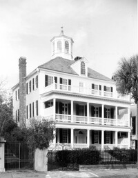
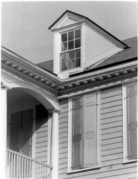
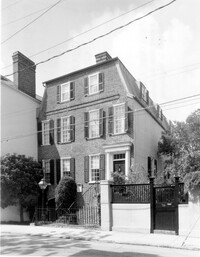
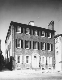
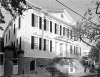
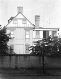
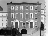
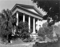
32 South Battery, Colonel John Ashe House, ca. 1762. Main House - View of SW (Front and Side) elevation. 4" x 5" B/W photo.
Date:
1977-1983
Description:
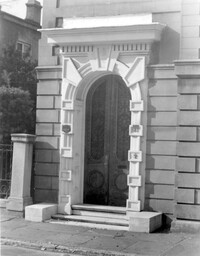
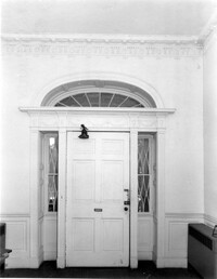
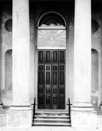
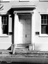
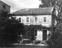
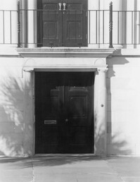
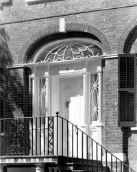
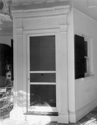
81 Rutledge Avenue, Glover-Sottile House, ca. 1826. Detail View of entry, East (Front) elevation. 4" x 5" B/W photo.
Date:
1977-1983
Description:
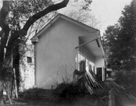
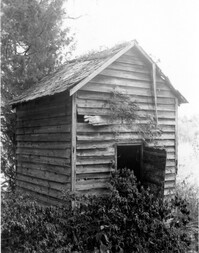
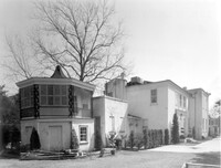
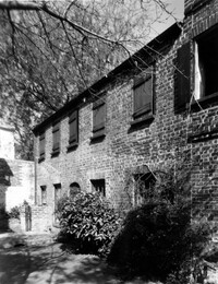
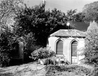
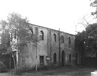
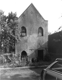
31 Legare Street, Hannah Heyward House, ca. 1789. Stable - View of North (Side) elevation. 4" x 5" B/W photo.
Date:
1977-1983
Description:
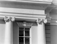
82 - 86 Broad Street, ca 1753. Detail View of columns (East end), South (Rear) elevation. 4" x 5" B/W photo.
Date:
1977-1983
Description:
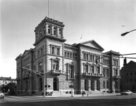
83 Broad Street, Federal Courthouse and Post Office, ca. 1896. View of NE (Front and Side) elevation. 4" x 5" B/W photo.
Date:
1977-1983
Description:
83 Broad Street, Federal Courthouse and Post Office, ca. 1896. View of South (Rear) elevation. 4" x 5" B/W photo.
Date:
1977-1983
Description:
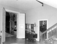
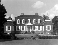
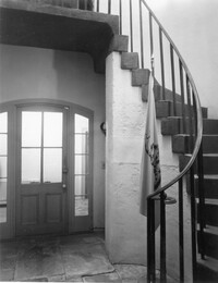
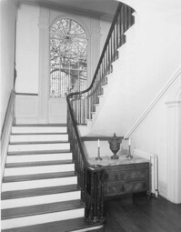
Berkley County, Mulberry Plantation, ca. 1714. Main House - Interior View. 1st Floor - Stair Hall, looking SW. 4" x 5" B/W photo.
Date:
1977-1983
Description:
90 Hasell Street, Synagogue of Kahal Kadosh Beth Elohim, ca. 1840. View of South (Side) elevation. 4" x 5" B/W photo.
Date:
1977-1983
Description:
90 Hasell Street, Synagogue of Kahal Kadosh Beth Elohim, ca. 1840. View of East (Rear) elevation. 4" x 5" B/W photo.
Date:
1977-1983
Description:
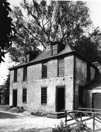
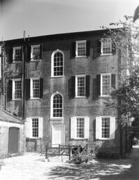
106 Tradd Street, Colonel John Stuart House, ca. 1772. Main House - View of NE (Rear and Side) elevation. 4" x 5" B/W photo.
Date:
1977-1983
Description:
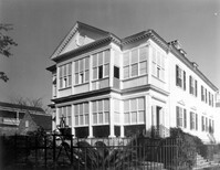
95 Rutledge Avenue, Grimke-Seabrook House, ca. 1819. View of SE (Front and Side) elevation. 4" x 5" B/W photo.
Date:
1977-1983
Description:
Charleston County, William Seabrook-Dodge Plantation, ca. 1810. Detail View of portico pediment, South (Front) elevation. 4" x 5" B/W photo.
Date:
1977-1983
Description:
Charleston County, William Seabrook-Dodge Plantation, ca. 1810. Detail View of dormer and cornice, South (Front) elevation. 4" x 5" B/W photo.
Date:
1977-1983
Description:
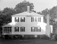
Charleston County, William Seabrook-Dodge Plantation, ca. 1810. View of SW (Front and Side) elevation. 4" x 5" B/W photo.
Date:
1977-1983
Description:
Charleston County, William Seabrook-Dodge Plantation, ca. 1810. View of NW (Rear and Side) elevation. 4" x 5" B/W photo.
Date:
1977-1983
Description:
Berkley County, Mulberry Plantation, ca. 1714. Main House - View of South (Front) elevation. 4" x 5" B/W photo.
Date:
1977-1983
Description:
Berkley County, Loch Dhu, ca. 1812. Smokehouse - View of Front and Side elevation. 4" x 5" B/W photo.
Date:
1977-1983
Description:
286 Calhoun Street, Jonathan Lucas House, ca. 1809. Main House - Interior View. 1st Floor - front entry, North elevation. 4" x 5" B/W photo.
Date:
1977-1983
Description:
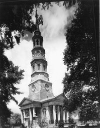
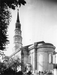
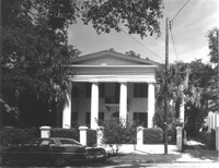
146 Church Street, St. Philip's Episcopal Church, ca. 1836. View of SW (Front and Side) elevation. 4" x 5" B/W photo.
Date:
1977-1983
Description:
146 Church Street, St. Philip's Episcopal Church, ca. 1836. Detail View of West (Front) entry. 4" x 5" B/W photo.
Date:
1977-1983
Description:
146 Church Street, St. Philip's Episcopal Church, ca. 1836. Detail View of Side (North) entry. 4" x 5" B/W photo.
Date:
1977-1983
Description:
146 Church Street, St. Philip's Episcopal Church, ca. 1836. View of SE (Rear and Side) elevation. 4" x 5" B/W photo.
Date:
1977-1983
Description:
89 - 91 Church Street, Catfish Row, ca. 1783. View of NE (Front and Side) elevation. 4" x 5" B/W photo.
Date:
1977-1983
Description:
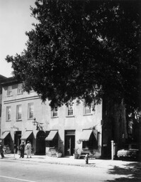
133 Church Street, Planter's Hotel, ca. 1809. View of East (Front) elevation. 4" x 5" B/W photo.
Date:
1977-1983
Description:
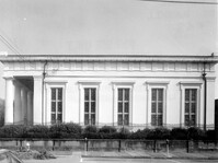
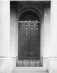
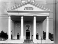
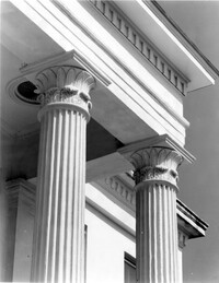
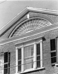
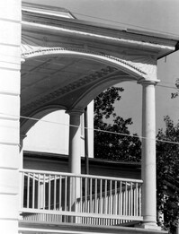
126 Coming Street, Cathedral Church of St. Luke and St. Paul, ca. 1816. Detail View of portico, West (Front) elevation. 4" x 5" B/W photo.
Date:
1977-1983
Description:
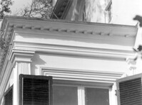
172 Rutledge Avenue, Ashley Hall, ca. 1802. Main House - Detail View of bay cornice, West (Side) elevation. 4" x 5" B/W photo.
Date:
1977-1983
Description:
172 Rutledge Avenue, Ashley Hall, ca. 1802. Main House - Detail View of bay, West (Side) elevation. 4" x 5" B/W photo.
Date:
1977-1983
Description:
172 Rutledge Avenue, Ashley Hall, ca. 1802. Carriage House - View of SE (Front and Side) elevation. 4" x 5" B/W photo.
Date:
1977-1983
Description:
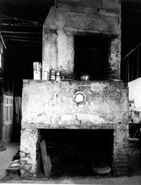
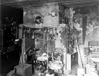
126 Tradd street, Dr. Peter Fayssoux House, ca. 1732. Kitchen House - Interior View. Detail of North fireplace with plaster. 4" x 5" B/W photo.
Date:
1977-1983
Description:
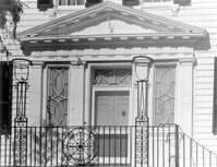
88 Broad Street, Josiah Smith Tenement, ca. 1795. Detail View of entry, South (Front) elevation. 4" x 5" B/W photo.
Date:
1977-1983
Description:
138 Wentworth Street, Edwin L. Kerrison House, ca. 1838. Guest House - View of East (Side) elevation. 4" x 5" B/W photo.
Date:
1977-1983
Description:
8 Meeting Street, Thomas Tucker House, ca.1806. Stable - View of NW (Front and Side) elevation. 4" x 5" B/W photo.
Date:
1977-1983
Description:
72 Tradd Street, Fotheringham-McNeil Tenements, ca. 1765. View of SE (Front and Side) elevation. 4" x 5" B/W photo.
Date:
1977-1983
Description:
8 Meeting Street, Thomas Tucker House, ca.1806. Kitchen House - View of West (Front) elevation. 4" x 5" B/W photo.
Date:
1977-1983
Description:
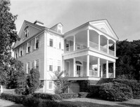
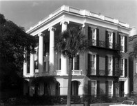
9 East Battery, Roper House, ca. 1842. View of SE (Front and Side) elevation. 4" x 5" B/W photo.
Date:
1977-1983
Description:
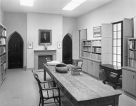
100 Meeting Street, Fireproof Building, ca. 1822. Interior View - 1st Floor. NW Room - East wall, South elevation. 4" x 5" B/W photo.
Date:
1977-1983
Description:
100 Meeting Street, Fireproof Building, ca. 1822. Interior View - 2nd Floor. Center South Room, West elevation. 4" x 5" B/W photo.
Date:
1977-1983
Description:
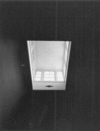
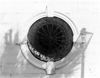
100 Meeting Street, Fireproof Building, ca. 1822. Interior View - 2nd Floor. Stair Hall - Detail of skylight. 4" x 5" B/W photo.
Date:
1977-1983
Description:
100 Meeting Street, Fireproof Building, ca. 1822. Detail View of South portico, Ground Floor, West elevation. 4" x 5" B/W photo.
Date:
1977-1983
Description:
7 Meeting Street, Josiah Smith House, ca. 1783. View of SE (Front and Side) elevation. 4" x 5" B/W photo.
Date:
1977-1983
Description:
86 Church Street, Isaac Mazyck House, ca. 1783. North Dependency - Interior View. Detail of West entry on South side. 4" x 5" B/W photo.
Date:
1977-1983
Description:
18 Meeting Street, Thomas Heyward House, ca. 1803. Main House - Detail View of entry from portico, South (Side) elevation. 4" x 5" B/W photo.
Date:
1977-1983
Description:
87 Church Street, Heyward-Washington House, ca. 1770. Kitchen House - Interior View. West Room, East elevation. 4" x 5" B/W photo.
Date:
1977-1983
Description:
87 Church Street, Heyward-Washington House, ca. 1770. Copy of 1929 photo. Main House - View of East (Front) elevation. 4" x 5" B/W photo.
Date:
1977-1983
Description:
87 Church Street, Heyward-Washington House, ca. 1770. Kitchen House - View of SE (Front and Side) elevation. 4" x 5" B/W photo.
Date:
1977-1983
Description:
86 Church Street, Isaac Mazyck House, ca. 1783. North Dependency, View of South (Front) elevation. 4" x 5" B/W photo.
Date:
1977-1983
Description:
87 Church Street, Heyward-Washington House, ca. 1770. Main House - View of SE (Front and Side) elevation. 4" x 5" B/W photo.
Date:
1977-1983
Description:
87 Church Street, Heyward-Washington House, ca. 1770. Main House - View of West (Rear) elevation. 4" x 5" B/W photo.
Date:
1977-1983
Description:
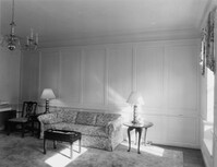
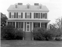
Georgetown County, Arcadia Plantation, ca. 1794. Interior View - 1st Floor, SW room. 4" x 5" B/W photo.
Date:
1977-1983
Description:
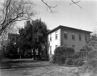
Georgetown County, Cat Island Plantation. View of NE (Front and Side) elevation. 4" x 5" B/W photo.
Date:
1977-1983
Description:
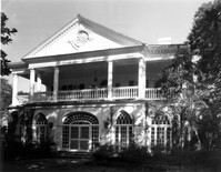
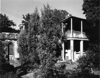
Beaufort County, Auldbrass Plantation, ca. 1951. Kennels, Stable, Covered Entry and Gate House (From Left to Right) - View of East elevation. 4" x 5" B/W photo.
Date:
1977-1983
Description:
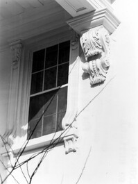
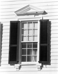
14 George Street, Middleton-Pinckney House, ca. 1796. Interior View - Detail of window. Representative of windows on the 1st and 2nd floors. 4" x 5" B/W photo.
Date:
1977-1983
Description:
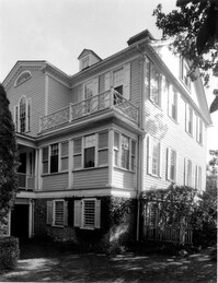
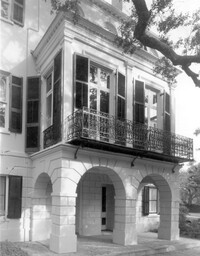
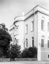
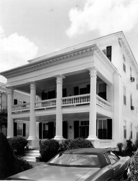
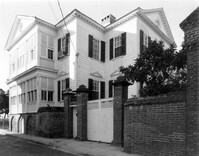
64 South Battery, William Gibbes House, ca. 1772. Main House - View of SW (Front and Side) elevation. 4" x 5" B/W photo.
Date:
1977-1983
Description:
St. Margaret, West End, William Lowndes House, date unknown. View of South (Front) elevation. 4" x 5" B/W photo.
Date:
1977-1983
Description:
116 Broad Street, John Rutledge House, ca. 1763. Main House - View of West (Side) elevation. 4" x 5" B/W photo.
Date:
1977-1983
Description:
80 Broad Street, Charleston City Hall, ca. 1800. Detail View of Ground Floor entry, South (Front) elevation. 4" x 5" B/W photo.
Date:
1977-1983
Description:
80 Broad Street, Charleston City Hall, ca. 1800. View of NW (Rear and Side) elevation. 4" x 5" B/W photo.
Date:
1977-1983
Description:
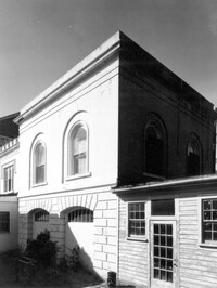
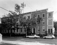
101 - 107 Bull Street, Bee's Row, ca. 1853. View of North (Front) elevation. 4" x 5" B/W photo.
Date:
1977-1983
Description:
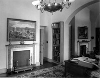
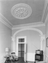
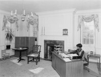
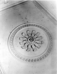
69 Barre Street, Gov. Thomas Bennett House, ca. 1822. Main House - Interior View. 2nd Floor - Center Hall Room, looking North. View shows ceiling medallion, cornice, pilasters and archway (archway enclosed with partition). 4" x 5" B/W photo.
Date:
1977-1983
Description:
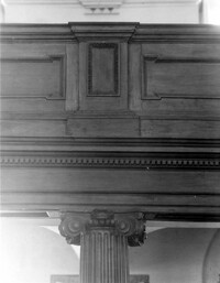
80 Meeting Street, St. Michael's Episcopal Church, ca. 1751. Interior View - Detail of balcony panel railing & supporting column cap. 4" x 5" B/W photo.
Date:
1977-1983
Description:
80 Broad Street, Charleston City Hall, ca. 1800. Detail view of Ground Floor circular window grille, West (Side) elevation. 4" x 5" B/W photo.
Date:
1977-1983
Description:
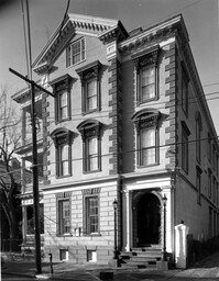
167 Broad Street, Heilbron-Gibbon House, ca. 1836. View of SW (Front and Side) elevation. 4" x 5" B/W photo.
Date:
1977-1983
Description:
180 Broad Street, Coop-O'Connor House, ca. 1855. View of SE (Front and Side) elevation. 4" x 5" B/W photo.
Date:
1977-1983
Description:
125 Broad Street, Charles Robert Valk House, ca. 1886. View of North (Front) elevation. 4" x 5" B/W photo.
Date:
1977-1983
Description:
125 Broad Street, Charles Robert Valk House, ca. 1886. View of South (Rear) elevation. 4" x 5" B/W photo.
Date:
1977-1983
Description:
160 Broad Street, William Wragg House, ca. 1855. View of South (Front) elevation. 4" x 5" B/W photo.
Date:
1977-1983
Description:
138 Wentworth Street, Edwin L. Kerrison House, ca. 1838. Main House - Detail View of portico capitals and cornices, South (Front) elevation. 4" x 5" B/W photo.
Date:
1977-1983
Description:
138 Wentworth Street, Edwin L. Kerrison House, ca. 1838. Main House - View of enclosed portico, West (Side) elevation. 4" x 5" B/W photo.
Date:
1977-1983
Description:
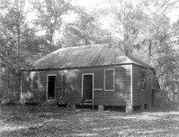
Orangeburg County, Rocks Plantation (The Rocks), ca. 1805. Slave Cabin - View of SE (Front and Side) elevation. 4" x 5" B/W photo.
Date:
1977-1983
Description:
Orangeburg County, Rocks Plantation (The Rocks), ca. 1805. Main House - View of East (Side) elevation. 4" x 5" B/W photo.
Date:
1977-1983
Description:
2 - 4 Court House Square, Daniel Blake Tenements, ca. 1760. Interior View - 1st Floor. SW Room, East elevation. 4" x 5" B/W photo.
Date:
1977-1983
Description:
2 - 4 Court House Square, Daniel Blake Tenements, ca. 1760. Interior View - 1st Floor. SW Room, West elevation. 4" x 5" B/W photo.
Date:
1977-1983
Description:
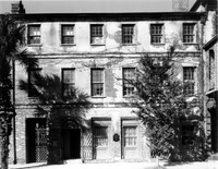
2 - 4 Court House Square, Daniel Blake Tenements, ca. 1760. View of South (Front) elevation (#2 on right, #4 on left). 4" x 5" B/W photo.
Date:
1977-1983
Description:
18 Bull Street, William Blacklock House, ca. 1800. Main House - Detail View of 2nd Floor center bay and attic fan windows, South (Front) elevation 4" x 5" B/W photo.
Date:
1977-1983
Description:
Charleston County, Cassina Point Plantation, ca. 1847. View of South (Front) elevation. 4" x 5" B/W photo.
Date:
1977-1983
Description:
108 Beaufain Street, John Steinmeyer House, ca. 1840. Kitchen House - Interior View. 1st Floor - South Room, West elevation. 4" x 5" B/W photo.
Date:
1977-1983
Description:
18 Bull Street, William Blacklock House, ca. 1800. Main House - Detail View of 1st Floor entry, South (Front) elevation 4" x 5" B/W photo.
Date:
1977-1983
Description:
48 Elizabeth Street, Aiken-Rhett House, ca.1818. Main House - Interior View. 3rd Floor - North Central Stair Hall. Detail of ceiling medallion. 4" x 5" B/W photo.
Date:
1977-1983
Description:
48 Elizabeth Street, Aiken-Rhett House, ca.1818. Main House - Interior View. 1st Floor - NW Room, entry from street. Detail of railing. 4" x 5" B/W photo.
Date:
1977-1983
Description:
69 Church Street, Capers-Motte House, ca. 1745. View of Kitchen and Slave Quarters and Laundry Building (on left), SW (Front and Side) elevation. 4" x 5" B/W photo.
Date:
1977-1983
Description:
6 Gibbes Street, Parker-Drayton House, ca.1806. Detail View of Ground Floor center entry, South (Front) elevation. 4" x 5" B/W photo.
Date:
1977-1983
Description:
69 Church Street, Capers-Motte House, ca. 1745. View of Laundry Building and Privy (on left), South (Front) elevation. 4" x 5" B/W photo.
Date:
1977-1983
Description:
116 Broad Street, John Rutledge House, ca. 1763. Main House - Detail View of portico support, South (Front) elevation. 4" x 5" B/W photo.
Date:
1977-1983
Description:
116 Broad Street, John Rutledge House, ca. 1763. Main House - Detail View of portico and railing, West (Side) elevation. 4" x 5" B/W photo.
Date:
1977-1983
Description:
116 Broad Street, John Rutledge House, ca. 1763. Carriage House (ca. 1853) - View of SE (Side and Front) elevation. 4" x 5" B/W photo.
Date:
1977-1983
Description:
116 Broad Street, John Rutledge House, ca. 1763. Carriage House (ca. 1853) - View of South (Front) elevation. 4" x 5" B/W photo.
Date:
1977-1983
Description:
116 Broad Street, John Rutledge House, ca. 1763. Carriage House (ca. 1853) - View of North (Rear) elevation. 4" x 5" B/W photo.
Date:
1977-1983
Description:
93 Rutledge Avenue, Seabrook-Trenholm House, ca. 1819. Detail View of console and 2nd Floor windows, South (Side) elevation. 4" x 5" B/W photo.
Date:
1977-1983
Description:
64 South Battery, William Gibbes House, ca. 1772. Main House - Detail View of 2nd Floor window, South (Front) elevation. 4" x 5" B/W photo.
Date:
1977-1983
Description:
94 Rutledge Avenue, Isaac Jenkins Mikell House, ca. 1851. Main House - View of South (Side) elevation, looking East. 4" x 5" B/W photo.
Date:
1977-1983
Description:
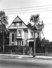
21 King Street, Patrick O'Donnell House, ca. 1852. Main House - View of NE (Front and Side) elevation. 4" x 5" B/W photo.
Date:
1977-1983
Description:
100 Meeting Street, Fireproof Building, ca. 1822. Interior View - 1st Floor. West corridor, North elevation. 4" x 5" B/W photo.
Date:
1977-1983
Description:
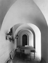
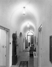
100 Meeting Street, Fireproof Building, ca. 1822. Interior View - Ground Floor. Stair Hall, West elevation. 4" x 5" B/W photo.
Date:
1977-1983
Description:
8 South Battery, Colonel William Washington House, ca. 1768. Main House - View of SW (Front and Side) elevation. 4" x 5" B/W photo.
Date:
1977-1983
Description:
8 South Battery, Colonel William Washington House, ca. 1768. Main House - View of NE (Rear and Side) elevation. 4" x 5" B/W photo.
Date:
1977-1983
Description:
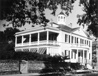
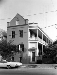
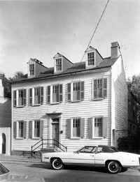
1 Atlantic Street, Benjamin Smith House, ca. 1820-1830. View of North (Front) elevation. 4" x 5" B/W photo.
Date:
1977-1983
Description:
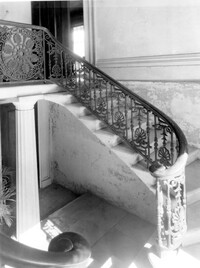
21 East Battery, Edmonston-Alston House, ca. 1828. Main House - Interior View. Ground Floor - Stair Hall, South elevation. 4" x 5" B/W photo.
Date:
1977-1983
Description:
94 Rutledge Avenue, Isaac Jenkins Mikell House, ca. 1851. Main House - View of SE (Side and Rear) elevation, East end of building. 4" x 5" B/W photo.
Date:
1977-1983
Description:
456 King Street, William Aiken House, ca. 1811. Main House - Detail View of 1st Floor portico, West (Front) elevation. 4" x 5" B/W photo.
Date:
1977-1983
Description:
64 South Battery, William Gibbes House, ca. 1772. Main House - Detail View of 1st Floor entry, South (Front) elevation. 4" x 5" B/W photo.