Search
« Previous |
201 - 230 of 230
|
Next »
Search Results
Date:
1970
Description:
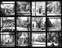
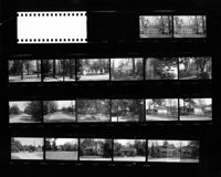
Summerville Historic District. Contact Sheet 5 - Multiple Views including Houses, Churches, and Town Hall. Summerville, S.C.;8" x 10" B/W photo. Box 20, Folder: Miscellaneous Photos: Scanned Contact Sheets. One copy.
Date:
1970
Description:
Cathedral of St. Luke and St. Paul, 126 Coming Street. Contact Sheet 8 - Views of Educational Building and Church. Charleston, S.C.;1" x 6" B/W photo. Box 20, Folder: Miscellaneous Photos: Scanned Contact Sheets. One copy.
Date:
1970
Description:
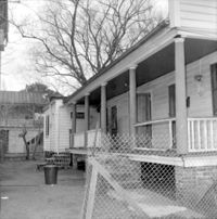
Denmark Vesey House, 56 Bull Street. View of SW (Front and Side) elevation. Charleston, S.C.;8" x 8" B/W photo. Box 7, Folder 2-1-46. Five copies.
Date:
1970
Description:
Denmark Vesey House, 56 Bull Street. View of SW (Front and Side) elevation. Charleston, S.C.;2.25" x 2.25" B/W photo. Box 7, Folder 2-1-46, Contact Sheet 17. One copy.
Date:
1970
Description:
Denmark Vesey House, 56 Bull Street. View of SW (Front and Side) elevation. Charleston, S.C.;2.25" x 2.25" B/W photo. Box 7, Folder 2-1-46, Contact Sheet 17. One copy.
Date:
1970
Description:
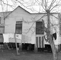
Denmark Vesey House, 56 Bull Street. View of SE (Front and Side) elevation. Charleston, S.C.;8" x 8" B/W photo. Box 7, Folder 2-1-46. One copy.
Date:
1970
Description:
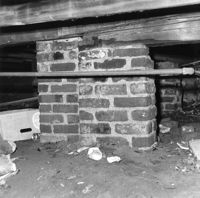
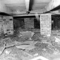
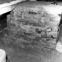
Denmark Vesey House, 56 Bull Street. View of old and new Brick Piers under house. Charleston, S.C.;8" x 8" B/W photo. Box 7, Folder 2-1-46. One copy.
Date:
1970
Description:
Denmark Vesey House, 56 Bull Street. View of old Brick Piers under house. Charleston, S.C.;8" x 8" B/W photo. Box 7, Folder 2-1-46. One copy.
Date:
1970
Description:
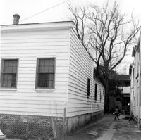
Denmark Vesey House, 56 Bull Street. View of North (Rear) elevation . Charleston, S.C.;8" x 8" B/W photo. Box 7, Folder 2-1-46. One copy.
Date:
1970
Description:
Denmark Vesey House, 56 Bull Street. View of Brick Piers under house. Charleston, S.C.;8" x 8" B/W photo. Box 7, Folder 2-1-46. One copy.
Date:
1970
Description:
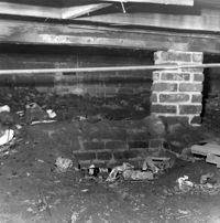
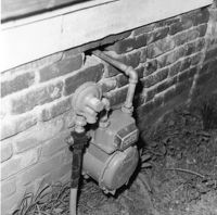
Denmark Vesey House, 56 Bull Street. View of Foundation, South (Front) elevation. Charleston, S.C.;8" x 8" B/W photo. Box 7, Folder 2-1-46. One copy.
Date:
1970
Description:
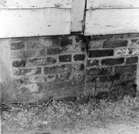
Denmark Vesey House, 56 Bull Street. View of Foundation. Charleston, S.C.;8" x 8" B/W photo. Box 7, Folder 2-1-46. One copy.
Date:
1970
Description:
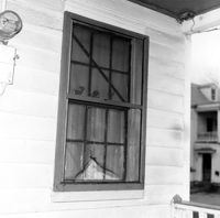
Denmark Vesey House, 56 Bull Street. Detail View of Window, West (Side) elevation. Charleston, S.C.;8" x 8" B/W photo. Box 7, Folder 2-1-46. One copy.
Date:
1970
Description:
Denmark Vesey House, 56 Bull Street. Detail View of Steps, North (Rear) elevation. Charleston, S.C.;8" x 8" B/W photo. Box 7, Folder 2-1-46. One copy.
Date:
1970
Description:
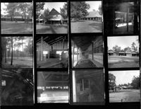
Indian Fields Methodist Campground, Off of S.C. County Rd 73 (Horse Traill Road). Contact Sheet 11 - Multiple Views. St. George, S.C.;10" x 8" B/W photo. Box 20, Folder: Miscellaneous Photos: Scanned Contact Sheets. One copy.
Date:
1970
Description:
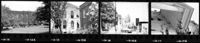
Middleburg Plantation, Middleburg Lane. Contact Sheet 14 - Multiple Views of Unidentified Building and Steam Engine Ruins. Huger, S.C.;10" x 6" B/W photo. Box 20, Folder: Miscellaneous Photos: Scanned Contact Sheets. One copy.
Date:
1970
Description:
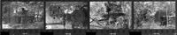
Pompion Hill Chapel, Pompion Hill Lane. Contact Sheet 14 - Detail Views of building. Huger, S.C.;9" x 1.5" B/W photo. Box 20, Folder: Miscellaneous Photos: Scanned Contact Sheets. One copy.
Date:
1970
Description:
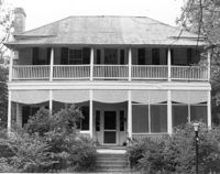
Unidentified House. Unidentified Location, South Carolina.;6.5" x 10" B/W photo. Box 20, Folder: Miscellaneous Photos: Unidentified Images. Three copies.
Date:
1970
Description:
Old Carroll House (Carroll Place), Junction of Quaker and Wire Roads. View of North (Front) elevation. St. George, S.C.;8" x 10" B/W photo. Box 20, Folder: Miscellaneous Photos: Unidentified Images. One copy.
Date:
1970
Description:
Unidentified House. Unidentified Location, South Carolina.;6.5" x 10" B/W photo. Box 20, Folder: Miscellaneous Photos: Unidentified Images. Two copies.
Date:
1970
Description:
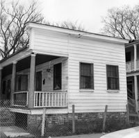
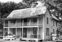
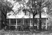
Robert Marion, Sr. House. View of Front elevation. Pinville Historic District. St. Stephen, S.C.;8" x 10" B/W photo. Box 3, Folder 1-9-1 (I). One copy.
Date:
1970
Description:
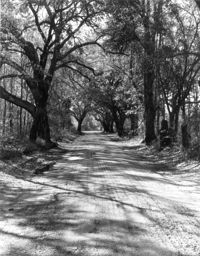
Unidentified View. Unidentified Location, South Carolina.;10" x 8" B/W photo. Box 20, Folder: Miscellaneous Photos: Unidentified Images. One copy.
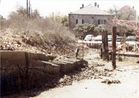
Date:
1970
Description:
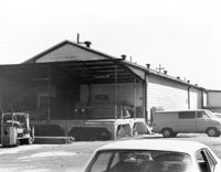
Unidentified Structure. Unidentified Location, South Carolina. Photo labeled, "Frame Warehouse".;8" x 10" B/W photo. Box 20, Folder: Miscellaneous Photos: Unidentified Images. One copy.
Date:
1970
Description:
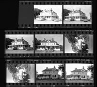
Runnymede Plantation, 3760 Ashley River Road. Contact Sheet 17 - Multiple Views of Main House. Charleston, S.C.;5" x 4.5" B/W photo. Box 20, Folder: Miscellaneous Photos: Unidentified Images. One copy.
Date:
1970
Description:
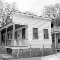
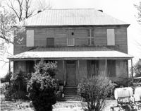
Charles Stevens House (Northampton Plantation House), 2008 Pinopolis Road. View of Front (?) elevation. Pinopolis, S.C.;6.5" x 9.5" B/W photo. Box 3, Folder 1-9-1 (I). One copy.
Date:
1970
Description:
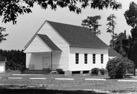
Wassamassaw Chapel (Wassamassaw Baptist Church), Wassamassaw Lane. View of SE (Front and Side) elevation. Moncks Corner, S,C,;8" x 10" B/W photo. Box 18, Folder: Berkeley County: Miscellaneous: Wassamassaw Chapel. One copy.
Date:
1970
Description:
Stallsville. Contact Sheet with multiple views of various houses, commercial buildings, and roads. Summerville, S.C.;8" x 10" B/W photo. Box 3, Folder 3-1-1. One copy.
Date:
1970
Description:
Unidentified View. Unidentified Location, South Carolina.;5" x 7" B/W photo. Box 20, Folder: Miscellaneous Photos: Unidentified Images. One copy.
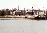
Date:
1970
Description:
Unidentified View. Charleston, S.C.;5" x 7" Color photo. Box 20, Folder: Miscellaneous Photos: Unidentified Images. One copy.
Date:
1970
Description:
Unidentified View. Charleston, S.C.;5" x 7" Color photo. Box 20, Folder: Miscellaneous Photos: Unidentified Images. One copy.