Search
« Previous |
211 - 220 of 231
|
Next »
Search Results
Date:
1970
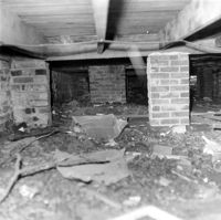
Description:
Denmark Vesey House, 56 Bull Street. View of Brick Piers under house. Charleston, S.C.;8" x 8" B/W photo. Box 7, Folder 2-1-46. One copy.
Date:
1970
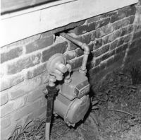
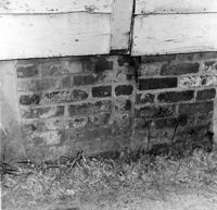
Description:
Denmark Vesey House, 56 Bull Street. View of Foundation, South (Front) elevation. Charleston, S.C.;8" x 8" B/W photo. Box 7, Folder 2-1-46. One copy.
Date:
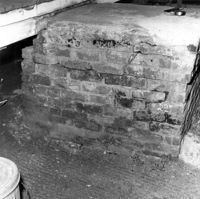
1970
Description:
Denmark Vesey House, 56 Bull Street. View of Foundation. Charleston, S.C.;8" x 8" B/W photo. Box 7, Folder 2-1-46. One copy.
Date:
1970
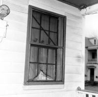
Description:
Denmark Vesey House, 56 Bull Street. Detail View of Window, West (Side) elevation. Charleston, S.C.;8" x 8" B/W photo. Box 7, Folder 2-1-46. One copy.
Date:
1970
Description:
Denmark Vesey House, 56 Bull Street. Detail View of Steps, North (Rear) elevation. Charleston, S.C.;8" x 8" B/W photo. Box 7, Folder 2-1-46. One copy.
Date:
1970
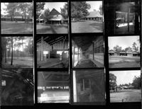
Description:
Indian Fields Methodist Campground, Off of S.C. County Rd 73 (Horse Traill Road). Contact Sheet 11 - Multiple Views. St. George, S.C.;10" x 8" B/W photo. Box 20, Folder: Miscellaneous Photos: Scanned Contact Sheets. One copy.
Date:
1970
Description:
Middleburg Plantation, Middleburg Lane. Contact Sheet 14 - Multiple Views of Unidentified Building and Steam Engine Ruins. Huger, S.C.;10" x 6" B/W photo. Box 20, Folder: Miscellaneous Photos: Scanned Contact Sheets. One copy.
Date:
1970
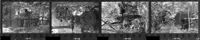
Description:
Pompion Hill Chapel, Pompion Hill Lane. Contact Sheet 14 - Detail Views of building. Huger, S.C.;9" x 1.5" B/W photo. Box 20, Folder: Miscellaneous Photos: Scanned Contact Sheets. One copy.
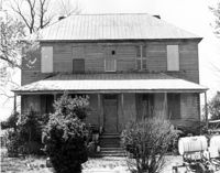
Date:
1970
Description:
Unidentified House. Unidentified Location, South Carolina.;6.5" x 10" B/W photo. Box 20, Folder: Miscellaneous Photos: Unidentified Images. Three copies.
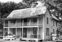
Date:
1970
Description:
Old Carroll House (Carroll Place), Junction of Quaker and Wire Roads. View of North (Front) elevation. St. George, S.C.;8" x 10" B/W photo. Box 20, Folder: Miscellaneous Photos: Unidentified Images. One copy.