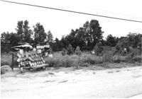
Lot with sweetgrass basket stand, on site affected by the widening of U.S. Route 17. Presumably located in Mount Pleasant or vicinity. Surveyor notations on back of photo: "Dkt.: 10.597. Property owner: Mary B. McConnell. Tract: 81. Station: 440±30 Rt. Date: Sept. 17, 1968." [See collection description for explanation of surveyor notations.]