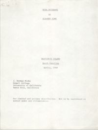
Typescript essay by J. Herman Blake entitled, "Rosa Brisbane on Slavery Time" consisting of an interview with Rosa Brisbane, Daufuskie Island native whose parents were slave.
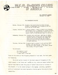
A press release from the national office of the W.E.B. DuBois Clubs of America describing the events of the Orangeburg Massacre and its misrepresentation in the media. This release was to be distributed to local chapters of the DuBois Clubs to educate its members on the events of the Orangeburg Massacre, to suggest ways for them to get involved in promoting awareness, and to advocate for mass mobilization against racial repression.
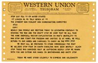
Western Union Telegram sent by members of the Kentucky Conference on the War and the Draft relating the shared struggle of the Freedom Movement and the Anti-war movement. The Kentucky Conference was planned to occur on February 11, 1968 and was expected to attract as many as 500 people.
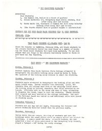
A fact sheet released by Atlanta University relating the events of the Orangeburg Massacre and advocating dressing in black on February 15th, 1968 to commemorate the lives of the three men slain on the day of their funerals.
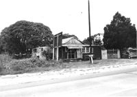
House in dilapidated condition and sweetgrass basket stand on site affected by the widening of U.S. Route 17. Presumably located in Mount Pleasant or vicinity. Surveyor notations on back of photo: "Dkt.: 10.597. Property owner: Linda Huger, Estate. Tract: 84 & 85. Station: 448± Lt. Date: Sept. 17, 1968." [See collection description for explanation of surveyor notations.]
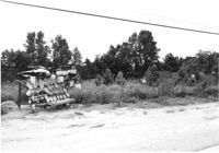
Lot with sweetgrass basket stand, on site affected by the widening of U.S. Route 17. Presumably located in Mount Pleasant or vicinity. Surveyor notations on back of photo: "Dkt.: 10.597. Property owner: Mary B. McConnell. Tract: 81. Station: 440±30 Rt. Date: Sept. 17, 1968." [See collection description for explanation of surveyor notations.]
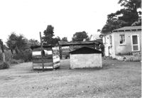
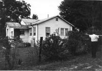
Rear view of house and sheds on site affected by the widening of U.S. Route 17. Presumably located in Mount Pleasant or vicinity. Surveyor notations on back of photo: "Dkt.: 10.597. Property owner: John Gailliard. Tract: 102. Station: 466±40 Rt. Date: Sept. 17, 1968." [See collection description for explanation of surveyor notations.]
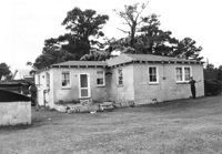
House (corner view, rear) on site affected by the widening of U.S. Route 17. Presumably located in Mount Pleasant or vicinity. Surveyor notations on back of photo: "Dkt.: 10.597. Property owner: John Gailliard. Tract: 102. Station: 466±40 Rt. Date: Sept. 17, 1968." [See collection description for explanation of surveyor notations.]
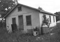
House (corner view, rear) on site affected by the widening of U.S. Route 17. Presumably located in Mount Pleasant or vicinity. Surveyor notations on back of photo: "Dkt.: 10.597. Property owner: Charles Dingle. Tract: 98. Station 462±50 Rt. Date: Sept. 17, 1968." [See collection description for explanation of surveyor notations.]
House (rear view) on site affected by the widening of U.S. Route 17. Presumably located in Mount Pleasant or vicinity. Surveyor notations on back of photo: "Dkt.: 10.597. Property owner: George Frederick, Estate. Tract: 91. Station: 456±20 Rt. Date: Sept. 17, 1968." [See collection description for explanation of surveyor notations.]