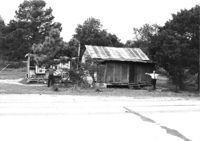
House in dilapidated condition and small outbuilding on site affected by the widening of U.S. Route 17. Presumably located in Mount Pleasant or vicinity. Surveyor notations on back of photo: "Dkt.: 10.597. Property owner: Fay Collington, Estate. Tract: 38. Station: 286± Lt. Date: Sept. 17, 1968." [See collection description for explanation of surveyor notations.]
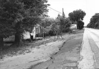
House on site affected by the widening of U.S. Route 17. Charleston Oil Co. billboard in background. Presumably located in Mount Pleasant or vicinity. Surveyor notations on back of photo: "Dkt.: 10.597. Property owner: Luke Scoff, Est. Tract: 29. Station: 273± Rt. Date: Sept. 17, 1968." [See collection description for explanation of surveyor notations.]
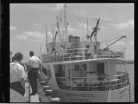
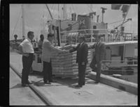
Black and white negative of members of the Beaufort County Development Commission, E. B. "Eddie" Boyer, Executive Director wathcing the unloading of the Anna-Regil, 1968; 13 x 10 cm.
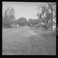
Black and white negative of the scene of an accident at Beachwood Trailer Park taken for Henry Dunbar of State Farm Mutual Automobile Insurance Company, Charleston, S.C. with railroad crossing in background, 1968; 6 x 6 cm.