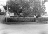
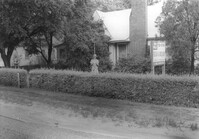
House on site affected by the widening of State Road 13 (Remount Road). View of street corner. Corner of Hardy Avenue and Remount Road. Directional sign for The Taxidermy House. Surveyor notations on back of photo: "Dkt.: 10.562. Property owner: Harry R. Parkinson, et al. Tract: 61. Date: Jul. 19, 1967." [See collection description for explanation of surveyor notations.]
House on site affected by the widening of State Road 13 (Remount Road). View of street corner. Corner of S-10-282 (Sumner Avenue and North Rhett Avenue(?). Surveyor notations on back of photo: "Dkt.: 10.562. Property owner: Leonella Padgett. Tract: 148. Date: Jul. 19, 1967." [See collection description for explanation of surveyor notations.]
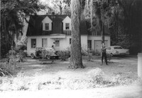
House on site affected by the widening of State Road 13 (Remount Road). Surveyor notations on back of photo: "Dkt.: 10.562. Property owner: Alline S. Crum. Tract: 139. Date: Jul. 19, 1967." [See collection description for explanation of surveyor notations.]
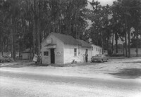
Avondale Laundry and Dry Cleaners, on site affected by the widening of State Road 13 (Remount Road). Trailer park in background. Surveyor notations on back of photo: "Dkt.: 10.562. Property owner: Edwards Realty Co. Tract: 4. Date: Jul. 12, 1967." [See collection description for explanation of surveyor notations.]
Avondale Laundry and Dry Cleaners, on site affected by the widening of State Road 13 (Remount Road). Trailer park in background. Surveyor notations on back of photo: "Dkt.: 10.562. Property owner: Edwards Realty Co. Tract: 4. Date: Jul. 12, 1967." [See collection description for explanation of surveyor notations.]
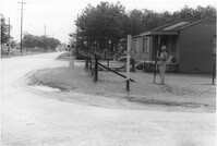
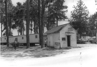
Mike's (possibly a garage), on site affected by the widening of State Road 13 (Remount Road). Trailer park in background. Surveyor notations on back of photo: "Dkt.: 10.562. Property owner: Edwards Realty Co. Tract: 5. Date: Jul. 12, 1967." [See collection description for explanation of surveyor notations.]
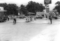
Shell gas station, on site affected by the widening of State Road 13 (Remount Road). Gulf gas Station: across the street. Surveyor notations on back of photo: "Dkt.: 10.562. Property owner: Shell Oil Co., Inc. Tract: 2. Date: Jul. 12, 1967." [See collection description for explanation of surveyor notations.]
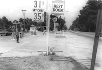
Texaco gas station, on site affected by the widening of State Road 13 (Remount Road). Neighboring Gulf gas Station: in background. Surveyor notations on back of photo: "Dkt.: 10.562. Property owner: W.L. Dyches, et al. Tract: 23. Date: Jul. 12, 1967." [See collection description for explanation of surveyor notations.]
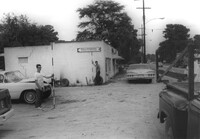
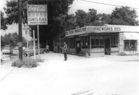
Clint's Place - Variety Store, corner of Craig Road, on site affected by the widening of State Road 13 (Remount Road). View of street corner. Surveyor notations on back of photo: "Dkt.: 10.562. Property owner: Samuel C. Rollings. Tract: 10. Date: Jul. 12, 1967." [See collection description for explanation of surveyor notations.]
House on site affected by the widening of State Road 13 (Remount Road). Surveyor notations on back of photo: "Dkt.: 10.562. Property owner: Harry R. Parkinson, et al. Tract: 61. Date: Jul. 19, 1967." [See collection description for explanation of surveyor notations.]