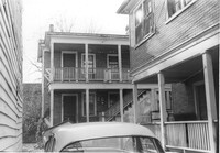
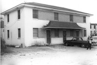
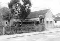
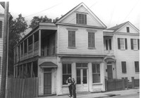
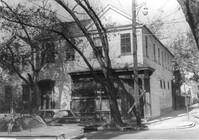
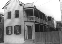
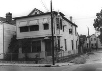
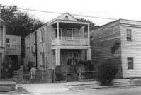
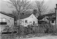
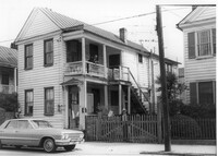
Portions of three houses on site affected by the construction of the Crosstown. Address: 501 Rutledge Avenue. Surveyor notations on back of photo: "Dkt.: 10.524. Property owner: William DeLesline, et al. Tract: 108. Station: 84±85 Lt. Date: Dec. 1, 1964." [See collection description for explanation of surveyor notations.]
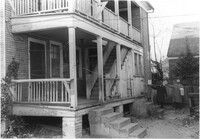
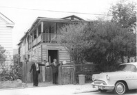
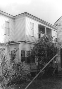
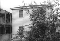
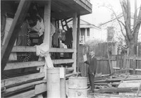
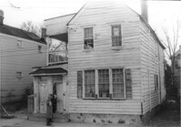
House (portion of rear) on site affected by the construction of the Crosstown. Address: 501 Rutledge Avenue. Surveyor notations on back of photo: "Dkt.: 10.524. Property owner: William DeLesline, et al. Tract: 108. Station: 84±35 Lt. Date: Dec. 1, 1964. [See collection description for explanation of surveyor notations.]
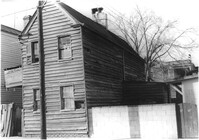
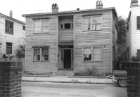
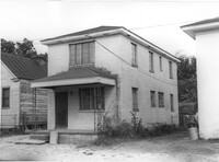
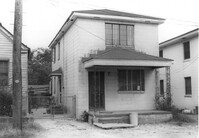
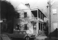
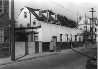
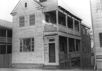
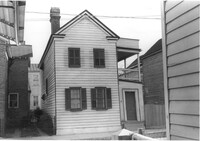
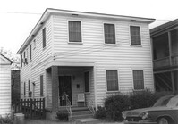
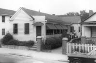
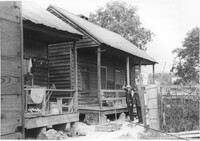
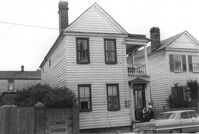
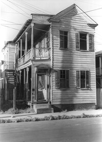
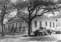
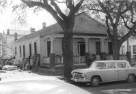
House on site affected by the construction of the Crosstown. Address: 156 Line Street. Surveyor notations on back of photo: "Dkt.: 10.524. Property owner: Urban Kennedy, Est. Tract: 103. Station: 83+90 Rt. Date: Dec. 1, 1964. In R/W - Bought. [See collection description for explanation of surveyor notations.]
House on site affected by the construction of the Crosstown. Address: 156 Line Street. Surveyor notations on back of photo: "Dkt.: 10.524. Property owner: Urban Kennedy, Est. Tract: 103. Station: 83+90 Rt. Date: Dec. 1, 1964. In R/W - Bought. [See collection description for explanation of surveyor notations.]
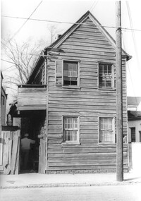
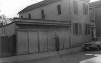
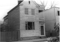
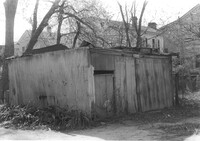
Structure (garage?) on site affected by the construction of the Crosstown. Address: 161B Line Street [161 Line Street]. Neighboring house in picture; see US Route 17 Photo 363. Surveyor notations on back of photo: "Dkt.: 10.524. Property owner: John H. Rathjen, et al. Tract: 104. Station: 83+05 Rt. Date: Dec. 1, 1964. Owner to move from R/W." [See collection description for explanation of surveyor notations.]
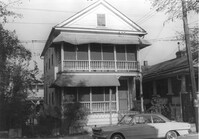
House on site affected by the construction of the Crosstown. Address: 115 Bogard Street. Surveyor notations on back of photo: "Dkt.: 10.524. Property owner: Susan D. Butler, Est. Tract: 57. Station: 73+65 Lt. Date: Oct. 14, 1964. Portion in R/W to be removed." [See collection description for explanation of surveyor notations.]
House on site affected by the construction of the Crosstown. Address: 115 Bogard Street. Surveyor notations on back of photo: "Dkt.: 10.524. Property owner: Susan D. Butler, Est. Tract: 57. Station: 73+65 Lt. Date: Oct. 14, 1964. Portion in R/W to be removed." [See collection description for explanation of surveyor notations.]
House (rear view) on site affected by the construction of the Crosstown. Address: 7½ Rosemont Street [7 Rosemont Street]. Surveyor notations on back of photo: "Dkt.: 10.524. Property owner: Lauretta Izzard. Tract: 52. Station: 72+00 Rt. Date: Oct. 14, 1964. In R/W - Bought." [See collection description for explanation of surveyor notations.]
Apartment building on site affected by the construction of the Crosstown. Address: 123 Bogard Street. Surveyor notations on back of photo: "Dkt.: 10.524. Property owner: Henry W. Smith. Tract: 48. Station: 73+10 CL. Date: Oct. 14, 1964. In R/W - Bought." [See collection description for explanation of surveyor notations.]
House on site affected by the construction of the Crosstown. Address: 121 Bogard Street. Surveyor notations on back of photo: "Dkt.: 10.524. Property owner: Henry W. Smith. Tract: 48. Station: 72+85 Rt. Date: Oct. 14, 1964. In R/W - Bought." [See collection description for explanation of surveyor notations.]
House on site affected by the construction of the Crosstown. Address: 121 Bogard Street. Surveyor notations on back of photo: "Dkt.: 10.524. Property owner: Henry W. Smith. Tract: 48. Station: 72+85 Rt. Date: Oct. 14, 1964. In R/W - Bought." [See collection description for explanation of surveyor notations.]
House on site affected by the construction of the Crosstown. Address: 126 Bogard Street. Surveyor notations on back of photo: "Dkt.: 10.524. Property owner: Isiah Williams. Tract: 49. Station: 10+40 Rt. (Bogard Street). Date: Oct. 14, 1964. Proximity." [See collection description for explanation of surveyor notations.]
House on site affected by the construction of the Crosstown. Address: 122 Bogard Street. Surveyor notations on back of photo: "Dkt.: 10.524. Property owner: Anthony E. Walker. Tract: 51. Station: 10+20 Rt. (Bogard Street). Date: Oct. 14, 1964." [See collection description for explanation of surveyor notations.]
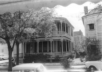
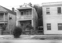
House on site affected by the construction of the Crosstown. Address: 502 Rutledge Avenue. Surveyor notations on back of photo: "Dkt.: 10.524. Property owner: Anna R.D. Hollings, Est. Tract: 115. Station: 86+00 Rt. Date: Dec. 1, 1964. In R/W - Bought." [See collection description for explanation of surveyor notations.]
House on site affected by the construction of the Crosstown. Address: 500 Rutledge Avenue. Surveyor notations on back of photo: "Dkt.: 10.524. Property owner: James F. Simmons. Tract: 116. Station: 85+90 Rt. Date: Dec. 1, 1964. In R/W - Bought." [See collection description for explanation of surveyor notations.]
House on site affected by the construction of the Crosstown. Address: 500 Rutledge Avenue. Surveyor notations on back of photo: "Dkt.: 10.524. Property owner: James F. Simmons. Tract: 116. Station: 85+90 Rt. Date: Dec. 1, 1964. In R/W - Bought." [See collection description for explanation of surveyor notations.]
House on site affected by the construction of the Crosstown. Address: 182 Spring Street. First floor appears to have been a store. Surveyor notations on back of photo: "Dkt.: 10.524. Property owner: A.J.R. Kornahrens. Tract: 27. Station: 65+75 Rt. Date: Oct. 13, 1964. In R/W - Bought." [See collection description for explanation of surveyor notations.]
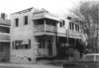
Carl's House (rear and side view) on site affected by the construction of the Crosstown. Address: 493 Rutledge Avenue. Looking towards street corner. Surveyor notations on back of photo: "Dkt.: 10.524. Property owner: Elise C. Goldberg, et al. Tract: 105. Station: 84+40 Rt. Date: Dec. 1, 1964. In R/W - Bought." [See collection description for explanation of surveyor notations.]
House (side view, rear) on site affected by the construction of the Crosstown. Address: 110 Sheppard Street. Surveyor notations on back of photo: "Dkt.: 10.524. Property owner: Alma L. Browning, et al. Tract: 147. Station: 19+95 CL S.B. lane. Date: Dec. 2, 1964. In R/W - Bought." [See collection description for explanation of surveyor notations.]
House on corner of Sheppard and Ashe Street, on site affected by the construction of the Crosstown. Address: 125 Sheppard Street. Surveyor notations on back of photo: "Dkt.: 10.524. Property owner: Joseph A. Moore, et al. Tract: 130. Station: 91+90 Rt. Date: Dec. 2, 1964. In R/W - Bought." [See collection description for explanation of surveyor notations.]
House on site affected by the construction of the Crosstown. Address: 122 Sheppard Street. View at street corner. Surveyor notations on back of photo: "Dkt.: 10.524. Property owner: Archie B. Hollins. Tract: 136. Station: 17+40 Lt. S.B. lane. Date: Dec. 2, 1964. In R/W - Bought." [See collection description for explanation of surveyor notations.]
House on site affected by the construction of the Crosstown. Address: 12 Todd Street. Surveyor notations on back of photo: "Dkt.: 10.524. Property owner: Buster Jones, et al. Tract: 123. Station: 88+65 CL Rt. Date: Dec. 2, 1964. In R/W - Bought." [See collection description for explanation of surveyor notations.]
House on site affected by the construction of the Crosstown. Address: 12 Todd Street. Surveyor notations on back of photo: "Dkt.: 10.524. Property owner: Buster Jones, et al. Tract: 123. Station: 88+65 CL Rt. Date: Dec. 2, 1964. In R/W - Bought." [See collection description for explanation of surveyor notations.]
House on site affected by the construction of the Crosstown. Address: 128 Sheppard Street. Surveyor notations on back of photo: "Dkt.: 10.524. Property owner: Kawarsuan, Inc. Tract: 133. Station: 16+40 Lt. S.B. lane. Date: Dec. 2, 1964. Condemned." [See collection description for explanation of surveyor notations.]
House on site affected by the construction of the Crosstown. Address: 14 Todd Street. Surveyor notations on back of photo: "Dkt.: 10.524. Property owner: Mable E. Brown. Tract: 124. Station: 88+80 Lt. Date: Dec. 2, 1964. In R/W - Bought." [See collection description for explanation of surveyor notations.]
House on site affected by the construction of the Crosstown. Address: 14 Todd Street. Surveyor notations on back of photo: "Dkt.: 10.524. Property owner: Mable E. Brown. Tract: 124. Station: 88+80 Lt. Date: Dec. 2, 1964. In R/W - Bought." [See collection description for explanation of surveyor notations.]
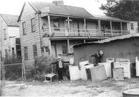
Structure (shed?) (rear view), with several household appliances (stoves?) in the yard, on site affected by the construction of the Crosstown. Address: 11 Presidents Place. Surveyor notations on back of photo: "Dkt.: 10.524. Property owner: Star Gospel Mission. Tract: 15. Station: 24+50 Rt. (Spring Street). Date: Oct. 13, 1964. Portion in R/W to be removed." [See collection description for explanation of surveyor notations.]
House (freedman's cottage) on site affected by the construction of the Crosstown. Address: 261 Ashley Avenue. Surveyor notations on back of photo: "Dkt.: 10.524. Property owner: Frank H. McGill, Estate. Tract: 77. Station: 78+40 Rt. Date: Oct. 14, 1964. In R/W - Bought." [See collection description for explanation of surveyor notations.]
Corner view of house on site affected by the construction of the Crosstown. Address: 112 Bogard Street. View of street corner. Surveyor notations on back of photo: "Dkt.: 10.524. Property owner: Susan D. Butler, Est. Tract: 65. Station: 76+00 CL Rt. Date: Oct. 14, 1964. In R/W - Bought." [See collection description for explanation of surveyor notations.]
House (rear view) on site affected by the construction of the Crosstown. Address: 118C Bogard Street [118 Bogard Street]. Surveyor notations on back of photo: "Dkt.: 10.524. Property owner: Irvin S. Duffy. Tract: 60. Station: 74+55 Lt. Date: Oct. 14, 1964. In R/W - Bought." [See collection description for explanation of surveyor notations.]
House on site affected by the construction of the Crosstown. Address: 118C Bogard Street [118 Bogard Street]. Surveyor notations on back of photo: "Dkt.: 10.524. Property owner: Irvin S. Duffy. Tract: 60. Station: 74+55 Lt. Date: Oct. 14, 1964. In R/W - Bought." [See collection description for explanation of surveyor notations.]
House on site affected by the construction of the Crosstown. Address: 164 President Street. Surveyor notations on back of photo: "Dkt.: 10.524. Property owner: Sarah G. Jenkins. Tract: 41. Station: 70+75 Lt. Date: Oct. 14, 1964. Corner in R/W." [See collection description for explanation of surveyor notations.]
House on site affected by the construction of the Crosstown. Address: 164 President Street. Surveyor notations on back of photo: "Dkt.: 10.524. Property owner: Sarah G. Jenkins. Tract: 41. Station: 70+75 Lt. Date: Oct. 14, 1964. Corner in R/W." [See collection description for explanation of surveyor notations.]
House on site affected by the construction of the Crosstown. Address: 125 Bogard Street. Surveyor notations on back of photo: "Dkt.: 10.524. Property owner: Mattie Jackson. Tract: 47. Station: 72+65 Lt. Date: Oct. 14, 1964. In R/W - Bought." [See collection description for explanation of surveyor notations.]
House on site affected by the construction of the Crosstown. Address: 125 Bogard Street. Surveyor notations on back of photo: "Dkt.: 10.524. Property owner: Mattie Jackson. Tract: 47. Station: 72+65 Lt. Date: Oct. 14, 1964. In R/W - Bought." [See collection description for explanation of surveyor notations.]
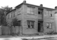
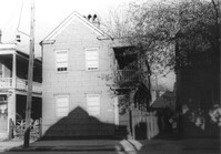
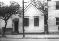
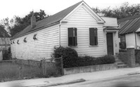
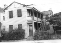
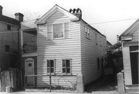
House on site affected by the construction of the Crosstown. Address: 161 Line Street. (Possibly a freedman's cottage with altered entry and porch.) Surveyor notations on back of photo: "Dkt.: 10.524. Property owner: Christopher C. Polite, Est. Tract; 94. Station: 81+90 CL. Date: Dec. 1, 1964. In R/W - Bought." [See collection description for explanation of surveyor notations.]
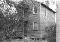
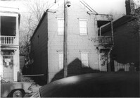
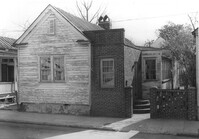
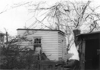
House (rear view) on site affected by the construction of the Crosstown. Address: 161 Line Street. Surveyor notations on back of photo: "Dkt.: 10.524. Property owner: Christopher C. Polite, Est. Tract; 94. Station: 81+90 CL. Date: Dec. 1, 1964. In R/W - Bought." [See collection description for explanation of surveyor notations.]
Porch of house with laundry hanging, and lot strewn with scrap wood, on site affected by the construction of the Crosstown. Address: 12 Norman Street. Surveyor notations on back of photo: "Dkt.: 10.524. Property owner: James Alston. Tract: 19. Station: 68+10 Lt. Date: Oct. 13, 1964. Portion in R/W to be removed by property owner." [See collection description for explanation of surveyor notations.]
House on site affected by the construction of the Crosstown. Address: 18-20 Wescott Street. Surveyor notations on back of photo: "Dkt.: 10.524. Property owner: Ralph E. Thornley, et al. Tract: 11. Station: 62+10 Lt. Date: Oct. 13, 1964. Portion in R/W to be removed. [See collection description for explanation of surveyor notations.]
House on site affected by the construction of the Crosstown. Address: 181 Spring Street. Surveyor notations on back of photo: "Dkt.: 10.524. Property owner: Cecelia Elizabeth Cook, Est. Tract: 17. Station: 64+10 Rt. Date: Oct. 13, 1964. Partially In R/W - Bought." [See collection description for explanation of surveyor notations.]
House on site affected by the construction of the Crosstown. Address: 193 Spring Street. Surveyor notations on back of photo: "Dkt.: 10.524. Property owner: Louise A. Robertson. Tract: 13. Station: 23+75 Rt. (Spring Street). Date: Oct. 13, 1964. Portion in R/W to be removed." [See collection description for explanation of surveyor notations.]
House on site affected by the construction of the Crosstown. Address: 193 Spring Street. Surveyor notations on back of photo: "Dkt.: 10.524. Property owner: Louise A. Robertson. Tract: 13. Station: 23+75 Rt. (Spring Street). Date: Oct. 13, 1964. Portion in R/W to be removed." [See collection description for explanation of surveyor notations.]
House on site affected by the construction of the Crosstown. Address: 3 Todd Street. Surveyor notations on back of photo: "Dkt.: 10.524. Property owner: John W. Bonaparte, et al. Tract: 118. Station: 87+75 Rt. Date: Dec. 1, 1964. In R/W - Bought." [See collection description for explanation of surveyor notations.]
House on site affected by the construction of the Crosstown. Address: 10 Todd Street. Surveyor notations on back of photo: "Dkt.: 10.524. Property owner: Gabriel W. Bonaparte. Tract: 122. Station: 88+65 Rt. Date: Dec. 2, 1964. In R/W - Bought." [See collection description for explanation of surveyor notations.]
House on site affected by the construction of the Crosstown. Address: 9 Todd Street. Surveyor notations on back of photo: "Dkt.: 10.524. Property owner: Daniel Frasier. Tract: 121. Station: 87+90 Lt. Date: Dec. 2, 1964. Partially in R/W." [See collection description for explanation of surveyor notations.]
House on site affected by the construction of the Crosstown. Address: 7 Todd Street. Surveyor notations on back of photo: "Dkt.: 10.524. Property owner: Daniel Frasier. Tract: 120. Station: 87+90 Lt. Date: Dec. 2, 1964. In R/W - Bought." [See collection description for explanation of surveyor notations.]
Structure on site affected by the construction of the Crosstown. Address: 3 Todd Street. On property of previous photos 413-415. Surveyor notations on back of photo: "Dkt.: 10.524. Property owner: John W. Bonaparte, et al. Tract: 118. Station: 87+35 Rt. Date: Dec. 1, 1964. In R/W - Bought." [See collection description for explanation of surveyor notations.]
Shed on site affected by the construction of the Crosstown. Address: 119 Sheppard Street. Surveyor notations on back of photo: "Dkt.: 10.524. Property owner: Scott M. Boyle. Tract: 139. Station: 17+25 Rt. N.B. lane. Date: Dec. 2, 1964. Outside R/W." [See collection description for explanation of surveyor notations.]
House (corner view) on site affected by the construction of the Crosstown. Address: 123 Sheppard Street. View of street corner. Surveyor notations on back of photo: "Dkt.: 10.524. Property owner: Salem Baptist Church. Tract: 137. Station: 16+60 CL Rt. N.B. lane. Date: Dec. 2, 1964. In R/W - Bought." [See collection description for explanation of surveyor notations.]
House on site affected by the construction of the Crosstown. Address: 123 Sheppard Street. Surveyor notations on back of photo: "Dkt.: 10.524. Property owner: Salem Baptist Church. Tract: 137. Station: 16+60 CL Rt. N.B. lane. Date: Dec. 2, 1964. In R/W - Bought." [See collection description for explanation of surveyor notations.]