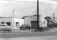
Building on site affected by the construction of Interstate 26 (I-26). On corner of Meeting Street and ? View of street corner. Surveyor notations on back of photo: "Dkt.: 10.510. Property owner: Ada M. Crosby Life Est. Tract: 66-C. Station: 5810+60 Lt. Line B (Meeting Street). Date: Sept. 12, 1962. Proximity." [See collection description for explanation of surveyor notations.]
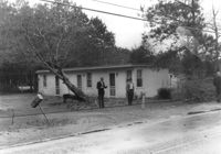
House on site affected by the construction of Interstate 26 (I-26). On Meeting Street/Meeting Street Road. Surveyor notations on back of photo: "Dkt.: 10.510. Property owner: Geo. Fabian, Jr. Tract: 67. Station: 5797+40 Lt. (Meeting Street). Date: Sept. 12, 1962. In R/W - Bought." [See collection description for explanation of surveyor notations.]
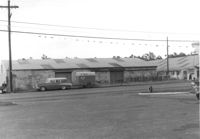
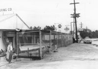
Renken Boat Co, on site affected by the widening of Route 171 (Folly Road). Surveyor notations on back of photo: "Dkt.: 10.494. Property owner: Renken Finance Co. Tract: 19. Station: 157+00 Lt. Date: Mar. 21, 1962. Proximity. [See collection description for explanation of surveyor notations.]
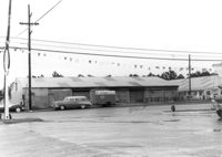
Renken Boat Co, on site affected by the widening of Route 171 (Folly Road). Surveyor notations on back of photo: "Dkt.: 10.494. Property owner: Renken Finance Co. Tract: 19. Station: 157+00 Lt. Date: Mar. 21, 1962. Proximity. [See collection description for explanation of surveyor notations.]
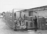
Renken Boat Co, on site affected by the widening of Route 171 (Folly Road). Surveyor notations on back of photo: "Dkt.: 10.494. Property owner: Renken Finance Co. Tract: 19. Station: 157+00 Lt. Date: Mar. 21, 1962. Proximity. [See collection description for explanation of surveyor notations.]
Renken Boat Co, on site affected by the widening of Route 171 (Folly Road). Surveyor notations on back of photo: "Dkt.: 10.494. Property owner: Renken Finance Co. Tract: 19. Station: 157+00 Lt. Date: Mar. 21, 1962. Proximity. [See collection description for explanation of surveyor notations.]
Renken Boat Co, on site affected by the widening of Route 171 (Folly Road). Surveyor notations on back of photo: "Dkt.: 10.494. Property owner: Renken Finance Co. Tract: 19. Station: 157+00 Lt. Date: Mar. 21, 1962. Proximity. [See collection description for explanation of surveyor notations.]
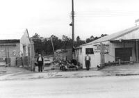
Building on site affected by the widening of Route 171 (Folly Road). (May be apartments or a motel.) Surveyor notations on back of photo: "Dkt.: 10.494. Property owner: James E. Smoot, et al. Tract: 34. Station: 170+80 Rt. Date: Mar. 21, 1962. Proximity. [See collection description for explanation of surveyor notations.]
Building on site affected by the widening of Route 171 (Folly Road). (May be apartments or a motel.) Surveyor notations on back of photo: "Dkt.: 10.494. Property owner: James E. Smoot, et al. Tract: 34. Station: 170+80 Rt. Date: Mar. 21, 1962. Proximity. [See collection description for explanation of surveyor notations.]
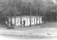
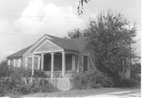
House on or in vicinity of King Street Extn., on site affected by the construction of Interstate 26 (I-26). Surveyor notations on back of photo: "Dkt.: 10.490. Property owner: V.C. Chemical Co. Tract: 1. Station: 5808+50 Rt. (Line F). Date: September 11, 1962. In R/W - Bought." [See collection description for explanation of surveyor notations.]