Structure on site affected by the construction of Interstate 26 (I-26). Surveyor notations on back of photo: "Dkt.: 10.490. Property owner: Ashley River Realty Co. Tract: 142. Station: 5876+60 Lt. Date: August 29, 1962. In R/W - Bought." [See collection description for explanation of surveyor notations.]
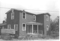
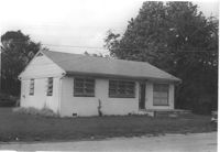
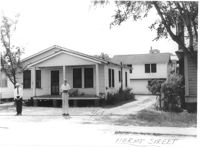
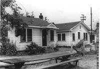
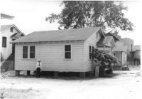
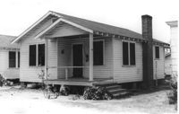
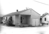
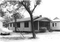
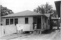
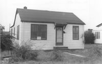
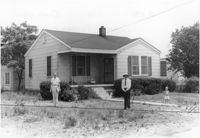
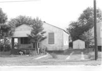
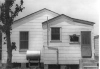
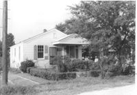
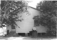
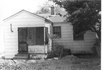
House on site affected by the construction of Interstate 26 (I-26). Address: 2172 Heriot Street. Possibly residence of lumber yard employee. Stack of lumber at side of house. Surveyor notations on back of photo: "Dkt.: 10.490. Property owner: G.S. Carter & Son., Inc. Tract: 143. Station: 5878±. Date: August 29, 1962. In R/W - Bought." [See collection description for explanation of surveyor notations.]
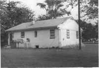
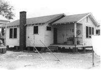
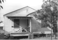
House (rear view) on site affected by the construction of Interstate 26 (I-26). Address: 2172 Heriot Street. Possibly residence of lumber yard employee. Surveyor notations on back of photo: "Dkt.: 10.490. Property owner: G.S. Carter & Son., Inc. Tract: 143. Station: 5878±. Date: August 29, 1962. In R/W - Bought." [See collection description for explanation of surveyor notations.]
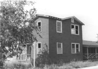
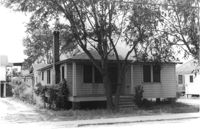
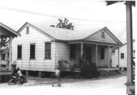
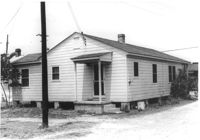
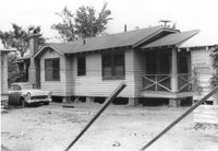
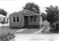
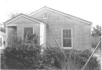
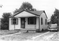
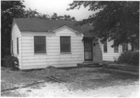
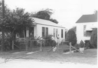
House on site affected by the construction of Interstate 26 (I-26). Address: 2170 Heriot Street. Possibly residence of lumber yard employee. Surveyor notations on back of photo: "Dkt.: 10.490. Property owner: G.S. Carter & Son., Inc. Tract: 143. Station: 5878±. Date: August 29, 1962. In R/W - Bought." [See collection description for explanation of surveyor notations.]
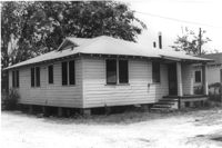
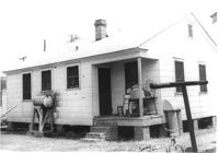
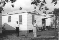
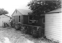
House (rear view) on site affected by the construction of Interstate 26 (I-26). Address: 2170 Heriot Street. Possibly residence of lumber yard employee. Stacks of lumber at side of house and in foreground. Surveyor notations on back of photo: "Dkt.: 10.490. Property owner: G.S. Carter & Son., Inc. Tract: 143. Station: 5878±. Date: August 29, 1962. In R/W - Bought." [See collection description for explanation of surveyor notations.]
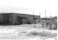
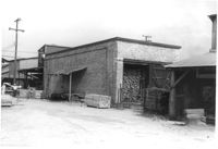
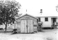
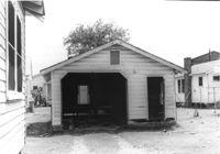
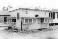
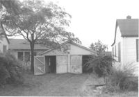
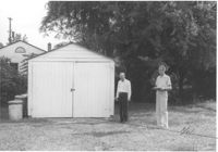
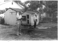
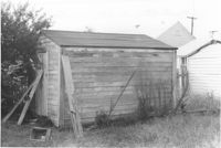
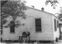
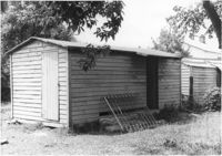
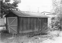
Storage structure on site affected by the construction of Interstate 26 (I-26). Address: Heriot Street. Presumably part of lumber yard. Surveyor notations on back of photo: "Dkt.: 10.490. Property owner: G.S. Carter & Son., Inc. Tract: 143. Station: 5878±. Date: August 29, 1962. In R/W - Bought." [See collection description for explanation of surveyor notations.]
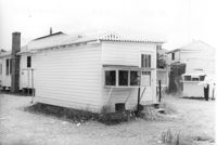
Storage structures for lumber on site affected by the construction of Interstate 26 (I-26). Address: Heriot Street. Presumably part of lumber yard. Surveyor notations on back of photo: "Dkt.: 10.490. Property owner: G.S. Carter & Son., Inc. Tract: 143. Station: 5878±. Date: August 29, 1962. In R/W - Bought." [See collection description for explanation of surveyor notations.]
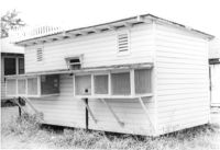
Storage structure for lumber on site affected by the construction of Interstate 26 (I-26). Address: Heriot Street. Presumably part of lumber yard. Surveyor notations on back of photo: "Dkt.: 10.490. Property owner: G.S. Carter & Son., Inc. Tract: 143. Station: 5878±. Date: August 29, 1962. To be cut off at R/W." [See collection description for explanation of surveyor notations.]
Storage structures for lumber on site affected by the construction of Interstate 26 (I-26). Address: Heriot Street. Presumably part of lumber yard. Surveyor notations on back of photo: "Dkt.: 10.490. Property owner: G.S. Carter & Son., Inc. Tract: 143. Station: 5878±. Date: August 29, 1962. To be cut off at R/W." [See collection description for explanation of surveyor notations.]
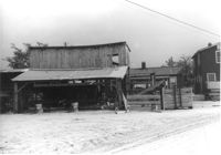
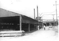
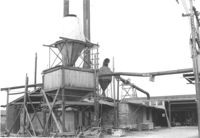
Storage structure for lumber and other structure (for lumber processing?) on site affected by the construction of Interstate 26 (I-26). Address: Heriot Street. Presumably part of lumber yard. Surveyor notations on back of photo: "Dkt.: 10.490. Property owner: G.S. Carter & Son., Inc. Tract: 143. Station: 5878±. Date: August 29, 1962. To be cut off at R/W." [See collection description for explanation of surveyor notations.]
Storage structure for lumber and other structure (lumber processing?) on site affected by the construction of Interstate 26 (I-26). Address: Heriot Street. Presumably part of lumber yard. Surveyor notations on back of photo: "Dkt.: 10.490. Property owner: G.S. Carter & Son., Inc. Tract: 143. Station: 5878±. Date: August 29, 1962. To be cut off at R/W." [See collection description for explanation of surveyor notations.]
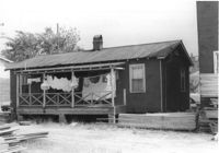
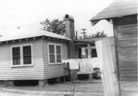
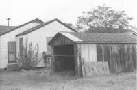
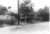
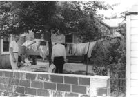
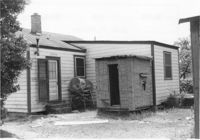
Storage structure for lumber and rear of house with laundry hanging from back porch rafter, on site affected by the construction of Interstate 26 (I-26). Address: Heriot Street. Presumably part of lumber yard. Surveyor notations on back of photo: "Dkt.: 10.490. Property owner: G.S. Carter & Son., Inc. Tract: 143. Station: 5878+40 Lt. Date: August 29, 1962. To be cut off at R/W." [See collection description for explanation of surveyor notations.]
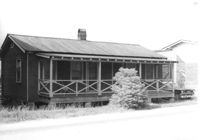
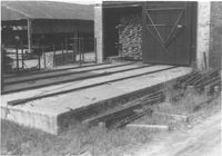
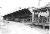
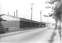
Road alongside length of building, on site affected by the construction of Interstate 26 (I-26).Address: Heriot Street. Presumably part of lumber yard. Surveyor notations on back of photo: "Dkt.: 10.490. Property owner: G.S. Carter & Son., Inc. Tract: 143. Station: 5878+40 Lt. Date: August 29, 1962. To be cut off at R/W." [See collection description for explanation of surveyor notations.]
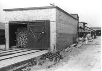
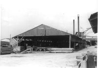
Industrial structure, on site affected by the construction of Interstate 26 (I-26). Address: Heriot Street. Presumably part of lumber yard. Surveyor notations on back of photo: "Dkt.: 10.490. Property owner: G.S. Carter & Son., Inc. Tract: 143. Station: 5878±. Date: August 29, 1962. For information." [See collection description for explanation of surveyor notations.]
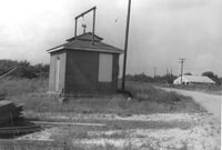
Small brick building, possibly a utility shed, on site affected by the construction of Interstate 26 (I-26). Coastal Motor Service (Photo 1307) in background, across the road. Surveyor notations on back of photo: "Dkt.: 10.490. Property owner: St. Phillips and St. Michael Pub. Service [St. Phillips and St. Michael Public Service]. Tract: 145. Station: 5877+67 Rt. 83' CL. Date: September 11, 1962. Moving item." [See collection description for explanation of surveyor notations.]
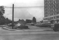
The Darlington Apartments and parking lot, on site affected by the construction of Interstate 26 (I-26). Located at Mt. Pleasant Street and King Street. Address: 2100 Mt. Pleasant Street. Surveyor notations on back of photo: "Dkt.: 10.490. Disregard." [See collection description for explanation of surveyor notations.]
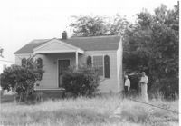
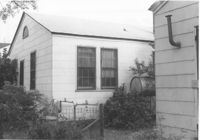
House on site affected by the construction of Interstate 26 (I-26). Surveyor notations on back of photo: "Dkt.: 10.490. Property owner: Charleston Rifle Club. Tract: 146-A. Station: 3+30 on CL of frontage road from Mechanic Street to Heriot Street. Date: September 11, 1962. In R/W - Bought." [See collection description for explanation of surveyor notations.]
House (rear view) on site affected by the construction of Interstate 26 (I-26). Surveyor notations on back of photo: "Dkt.: 10.490. Property owner: Charleston Rifle Club. Tract: 146-A. Station: 3+30 on CL of frontage road from Mechanic Street to Heriot Street. Date: September 11, 1962. In R/W - Bought." [See collection description for explanation of surveyor notations.]
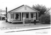
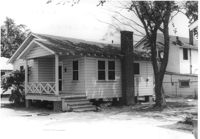
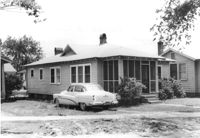
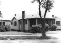
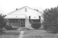
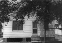
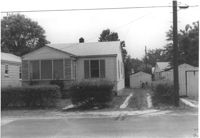
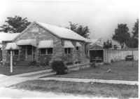
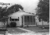
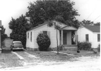
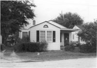
House on site affected by the construction of Interstate 26 (I-26). Address: 2167 Heriot Street. Surveyor notations on back of photo: "Dkt.: 10.490. Property owner: Louise S. Carter. Tract: 147. Station: 85' Lt. (Sta. 5879+50). Date: May 15, 1962. In R/W - Bought." [See collection description for explanation of surveyor notations.]
House (rear view) on site affected by the construction of Interstate 26 (I-26). Address: 2167 Heriot Street. Surveyor notations on back of photo: "Dkt.: 10.490. Property owner: Louise S. Carter. Tract: 147. Station: 85' Lt. Sta. 5879+50). Date: May 15, 1962. In R/W - Bought." [See collection description for explanation of surveyor notations.]
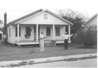
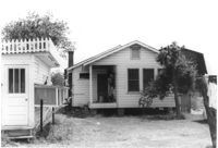
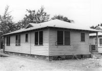
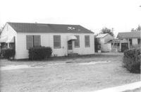
House on site affected by the construction of Interstate 26 (I-26). Address: 2163 Heriot Street. Surveyor notations on back of photo: "Dkt.: 10.490. Property owner: Thos. W. Towns [Thomas W. Towns]. Tract: 147-A. Station: 130' Lt. Sta. 5879+45). Date: May 15, 1962. Proximity." [See collection description for explanation of surveyor notations.]
House (side view) on site affected by the construction of Interstate 26 (I-26). Address: 2163 Heriot Street. Surveyor notations on back of photo: "Dkt.: 10.490. Property owner: Thos. W. Towns [Thomas W. Towns]. Tract: 147-A. Station: 135' Lt. Sta. 5880+10. Date: May 15, 1962. Proximity." [See collection description for explanation of surveyor notations.]
House at 2161 Heriot Street, on site affected by the construction of Interstate 26 (I-26). Address: 2159 Heriot Street. Surveyor notations on back of photo: "Dkt.: 10.490. Property owner: Henry Yaschik. Tract: 147-B. Station: 175' Lt. Sta. 5879+35. Date: May 15, 1962. Proximity." [See collection description for explanation of surveyor notations.]
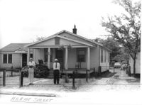
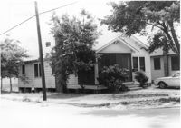
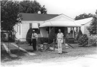
Houses on site affected by the construction of Interstate 26 (I-26). Address: 2157 Heriot Street. Surveyor notations on back of photo: "Dkt.: 10.490. Property owner: Thos. W. Towns [Thomas W. Towns]. Tract: 147-C. Station: 215' Lt. Sta. 5879 and fronting on Heriot Street. Date: May 15, 1962. Men on R/W 'bought.'" [See collection description for explanation of surveyor notations.]
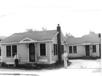
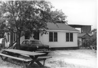
Houses on site affected by the construction of Interstate 26 (I-26).Address: 2157 Heriot Street. Picnic table in foreground. Surveyor notations on back of photo: "Dkt.: 10.490. Property owner: Thos. W. Towns [Thomas W. Towns]. Tract: 147-C. Station: 210' Lt. Sta. 5879+45. 215' Lt. Sta. 5879+80. Date: May 15, 1962. Proximity." [See collection description for explanation of surveyor notations.]
House on site affected by the construction of Interstate 26 (I-26). Address: 2157 Heriot Street. Picnic table in foreground. Surveyor notations on back of photo: "Dkt.: 10.490. Property owner: Thos. W. Towns [Thomas W. Towns]. Tract: 147-C. Station: 230' Lt. Sta. 5880+40. Date: May 15, 1962. Proximity." [See collection description for explanation of surveyor notations.]
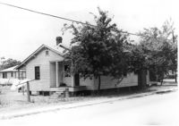
House on site affected by the construction of Interstate 26 (I-26). Address: 2153 Heriot Street. Surveyor notations on back of photo: "Dkt.: 10.490. Property owner: J.C. Locklair. Tract: 147-D. Station: 255' Lt. Sta. 5879+10 fronting on Heriot Street. Date: May 15, 1962. Proximity." [See collection description for explanation of surveyor notations.]
House on site affected by the construction of Interstate 26 (I-26). Address: 2153 Heriot Street. Surveyor notations on back of photo: "Dkt.: 10.490. Property owner: J.C. Locklair. Tract: 147-D. Station: 5879± Lt. Date: august 29, 1962. Proximity." [See collection description for explanation of surveyor notations.]
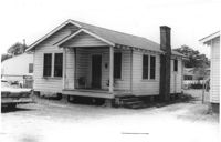
House on site affected by the construction of Interstate 26 (I-26). Address: 3 Carters Court. Surveyor notations on back of photo: "Dkt.: 10.490. Property owner: Louise S. Carter. Tract: 148. Station: 100' Lt. Sta. 5880+25. Date: May 15, 1962. In R/W - Bought." [See collection description for explanation of surveyor notations.]
House on site affected by the construction of Interstate 26 (I-26). Address: 3 Carters Court. Surveyor notations on back of photo: "Dkt.: 10.490. Property owner: Louise S. Carter. Tract: 148. Station: 100' Lt. Sta. 5880+25. Date: May 15, 1962. In R/W - Bought." [See collection description for explanation of surveyor notations.]
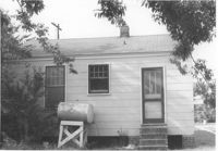
House on site affected by the construction of Interstate 26 (I-26). Address: 4 Carters Court. Surveyor notations on back of photo: "Dkt.: 10.490. Property owner: Louise S. Carter. Tract: 149. Station: 35' Lt. Sta. 5881+00. Date: May 15, 1962. In R/W - Bought." [See collection description for explanation of surveyor notations.]
House (rear view) on site affected by the construction of Interstate 26 (I-26). Address: 4 Carters Court. Surveyor notations on back of photo: "Dkt.: 10.490. Property owner: Louise S. Carter. Tract: 149. Station: 35' Lt. Sta. 5881+00. Date: May 15, 1962. In R/W - Bought." [See collection description for explanation of surveyor notations.]
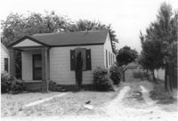
House on site affected by the construction of Interstate 26 (I-26). Address: 2 Carters Court. Surveyor notations on back of photo: "Dkt.: 10.490. Property owner: Louise S. Carter. Tract: 150. Station: 25' Lt. Sta. 5880+55. Date: May 15, 1962. In R/W - Bought." [See collection description for explanation of surveyor notations.]
House (rear view) on site affected by the construction of Interstate 26 (I-26). Address: 2 Carters Court. Surveyor notations on back of photo: "Dkt.: 10.490. Property owner: Louise S. Carter. Tract: 150. Station: 25' Lt. Sta. 5880+55. Date: May 15, 1962. In R/W - Bought." [See collection description for explanation of surveyor notations.]
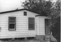
House on site affected by the construction of Interstate 26 (I-26). Address: Carters Court. Surveyor notations on back of photo: "Dkt.: 10.490. Property owner: Louise S. Carter. Tract: 151. Station: 30' Lt. Sta. 5880+10. Date: May 15, 1962. In R/W - Bought." [See collection description for explanation of surveyor notations.]
House (rear view) on site affected by the construction of Interstate 26 (I-26). Address: Carters Court. Surveyor notations on back of photo: "Dkt.: 10.490. Property owner: Louise S. Carter. Tract: 151. Station: 30' Lt. Sta. 5880+10. Date: May 15, 1962. In R/W - Bought." [See collection description for explanation of surveyor notations.]
House on site affected by the construction of Interstate 26 (I-26). Address: 2171 Heriot Street. Surveyor notations on back of photo: "Dkt.: 10.490. Property owner: Louise S. Carter. Tract: 152. Station: 30' Lt. Sta. 5879+50. Date: May 15, 1962. In R/W - Bought." [See collection description for explanation of surveyor notations.]
House(rear view) on site affected by the construction of Interstate 26 (I-26). Address: 2171 Heriot Street. Surveyor notations on back of photo: "Dkt.: 10.490. Property owner: Louise S. Carter. Tract: 152. Station: 30' Lt. Sta. 5879+50. Date: May 15, 1962. In R/W - Bought." [See collection description for explanation of surveyor notations.]
House on street corner, on site affected by the construction of Interstate 26 (I-26). Address: 1346 Rutledge Avenue. View of street corner; corner of Rutledge Avenue and Heriot Street. Surveyor notations on back of photo: "Dkt.: 10.490. Property owner: Louise S. Carter. Tract: 153. Station: 5879+60 Rt. Date: May 15, 1962. In R/W - Bought." [See collection description for explanation of surveyor notations.]
House on street corner (rear corner view), on site affected by the construction of Interstate 26 (I-26). Address: 1346 Rutledge Avenue. Surveyor notations on back of photo: "Dkt.: 10.490. Property owner: Louise S. Carter. Tract: 153. Station: 5879+60 Rt. Date: May 15, 1962. In R/W - Bought." [See collection description for explanation of surveyor notations.]
House on site affected by the construction of Interstate 26 (I-26). Address: 1344 Rutledge Avenue. Surveyor notations on back of photo: "Dkt.: 10.490. Property owner: Louise S. Carter. Tract: 154. Station: 5880+00 Rt. Date: May 15, 1962. In R/W - Bought." [See collection description for explanation of surveyor notations.]
House (rear view) and shed/garage, on site affected by the construction of Interstate 26 (I-26). Address: 1344 Rutledge Avenue. Surveyor notations on back of photo: "Dkt.: 10.490. Property owner: Louise S. Carter. Tract: 154. Station: 5880+00 Rt. (house). 5880+00 Lt. (garage). Date: May 15, 1962. In R/W - Bought." [See collection description for explanation of surveyor notations.]
House (side view) on site affected by the construction of Interstate 26 (I-26). Address: 1344 Rutledge Avenue. Surveyor notations on back of photo: "Dkt.: 10.490. Property owner: Louise S. Carter. Tract: 154. Station: 5880+00 Rt. Date: May 15, 1962. In R/W - Bought." [See collection description for explanation of surveyor notations.]
House on site affected by the construction of Interstate 26 (I-26). Address: 1342 Rutledge Avenue. Surveyor notations on back of photo: "Dkt.: 10.490. Property owner: Louise S. Carter. Tract: 155. Station: 5880+40 Rt. Date: May 15, 1962. In R/W - Bought." [See collection description for explanation of surveyor notations.]
Garage on site affected by the construction of Interstate 26 (I-26). Address: 1340 Rutledge Avenue. Surveyor notations on back of photo: "Dkt.: 10.490. Property owner: Louise S. Carter. Tract: 155. Station: 5880+40 Rt. (house). 5880+10 Lt. (garage). Date: May 15, 1962. In R/W - Bought." [See collection description for explanation of surveyor notations.]
House (corner view, rear) on site affected by the construction of Interstate 26 (I-26). Address: 1342 Rutledge Avenue. Surveyor notations on back of photo: "Dkt.: 10.490. Property owner: Louise S. Carter. Tract: 155. Station: 5880+40 Rt. Date: May 15, 1962. In R/W - Bought." [See collection description for explanation of surveyor notations.]
House on site affected by the construction of Interstate 26 (I-26). Address: 1340 Rutledge Avenue. Surveyor notations on back of photo: "Dkt.: 10.490. Property owner: Louise S. Carter. Tract: 156. Station: 5880+80 Rt. Date: May 15, 1962. In R/W - Bought." [See collection description for explanation of surveyor notations.]
House (corner view, rear) on site affected by the construction of Interstate 26 (I-26). Address: 1340 Rutledge Avenue. Surveyor notations on back of photo: "Dkt.: 10.490. Property owner: Louise S. Carter. Tract: 156. Station: 5880+80 Rt. Date: May 15, 1962. In R/W - Bought." [See collection description for explanation of surveyor notations.]
Structure (possibly a bird coop) on site affected by the construction of Interstate 26 (I-26). Address: 1338 Rutledge Avenue. Surveyor notations on back of photo: "Dkt.: 10.490. Property owner: Louise S. Carter. Tract: 157. Station: 5880+90 Lt. Date: May 15, 1962. In R/W - Bought." [See collection description for explanation of surveyor notations.]
Structure (possibly a bird coop) on site affected by the construction of Interstate 26 (I-26). Address: 1338 Rutledge Avenue. Surveyor notations on back of photo: "Dkt.: 10.490. Property owner: Louise S. Carter. Tract: 157. Station: 5880+90 Lt. Date: May 15, 1962. In R/W - Bought." [See collection description for explanation of surveyor notations.]
Structure (possibly a bird coop) on site affected by the construction of Interstate 26 (I-26).Address: 1338 Rutledge Avenue. Surveyor notations on back of photo: "Dkt.: 10.490. Property owner: Louise S. Carter. Tract: 157. Station: 5880+90 Lt. Date: May 15, 1962. In R/W - Bought." [See collection description for explanation of surveyor notations.]
House on site affected by the construction of Interstate 26 (I-26). Address: 1338 Rutledge Avenue. Surveyor notations on back of photo: "Dkt.: 10.490. Property owner: Louise S. Carter. Tract: 157. Station: 50' Rt. Sta. 5881+25. Date: May 15, 1962. In R/W - Bought." [See collection description for explanation of surveyor notations.]
House (rear view) on site affected by the construction of Interstate 26 (I-26). Address: 1338 Rutledge Avenue. Surveyor notations on back of photo: "Dkt.: 10.490. Property owner: Louise S. Carter. Tract: 157. Station: 50' Rt. Sta. 5881+25. Date: May 15, 1962. In R/W - Bought." [See collection description for explanation of surveyor notations.]
House at corner of Rutledge Avenue and Courtland Avenue, on site affected by the construction of Interstate 26 (I-26). Address: 1336 Rutledge Avenue. Surveyor notations on back of photo: "Dkt.: 10.490. Property owner: Annie E. Kirby. Tract: 158. Station: 5881+90 Rt. Date: August 29, 1962. In R/W - Bought." [See collection description for explanation of surveyor notations.]
House at corner of Rutledge Avenue and Courtland Avenue (rear view), on site affected by the construction of Interstate 26 (I-26). Address: 1336 Rutledge Avenue. Surveyor notations on back of photo: "Dkt.: 10.490. Property owner: Annie E. Kirby. Tract: 158. Station: 5881+90 Rt. Date: August 29, 1962. In R/W - Bought." [See collection description for explanation of surveyor notations.]
Garage and house at corner of Rutledge Avenue and Courtland Avenue, on site affected by the construction of Interstate 26 (I-26). Address: 1336 Rutledge Avenue. Surveyor notations on back of photo: "Dkt.: 10.490. Property owner: Annie E. Kirby. Tract: 158. Station: 5881+90 Rt. Date: August 29, 1962. In R/W - Bought." [See collection description for explanation of surveyor notations.]
House on site affected by the construction of Interstate 26 (I-26). Address: 2136 Courtland Avenue. Surveyor notations on back of photo: "Dkt.: 10.490. Property owner: Leo Zack. Tract: 159. Station: 5881±80 Rt. Date: August 29, 1962. In R/W - Bought." [See collection description for explanation of surveyor notations.]
Garage or shed and house (rear view) on site affected by the construction of Interstate 26 (I-26). Address: 2136 Courtland Avenue. Surveyor notations on back of photo: "Dkt.: 10.490. Property owner: Leo Zack. Tract: 159. Station: 5881±80 Rt. Date: August 29, 1962. In R/W - Bought." [See collection description for explanation of surveyor notations.]
House on site affected by the construction of Interstate 26 (I-26). Address: 2132 Courtland Avenue. Surveyor notations on back of photo: "Dkt.: 10.490. Property owner: Margaret Walker. Tract: 160. Station: 5881±80 Lt. Date: August 29, 1962. In R/W - Bought." [See collection description for explanation of surveyor notations.]
House (rear view) on site affected by the construction of Interstate 26 (I-26). Address: 2130 Courtland Avenue. Surveyor notations on back of photo: "Dkt.: 10.490. Property owner: Margaret Walker. Tract: 160. Station: 5881±80 Lt. Date: August 29, 1962. In R/W - Bought." [See collection description for explanation of surveyor notations.]
House on site affected by the construction of Interstate 26 (I-26). Address: 2128 Courtland Avenue. Surveyor notations on back of photo: "Dkt.: 10.490. Property owner: George DeVore, et al. Tract: 161. Station: 100' Lt. Sta. 5882+30. Date: May 15, 1962. Proximity." [See collection description for explanation of surveyor notations.]
House (corner view, rear) on site affected by the construction of Interstate 26 (I-26). Address: 2127 Courtland Avenue. Surveyor notations on back of photo: "Dkt.: 10.490. Property owner: Geo. L. Johnson [George L. Johnson]. Tract: 162. Station: 5883±70 Lt. Date: August 29, 1962. Proximity." [See collection description for explanation of surveyor notations.]
Garage on site affected by the construction of Interstate 26 (I-26). Address: 2127 Courtland Avenue. Surveyor notations on back of photo: "Dkt.: 10.490. Property owner: Geo. L. Johnson [George L. Johnson]. Tract: 162. Station: 5883±90 Lt. Date: August 29, 1962. Portion In R/W - Bought." [See collection description for explanation of surveyor notations.]
House and garage (at end of driveway), on site affected by the construction of Interstate 26 (I-26). Address: 2127 Courtland Avenue. Surveyor notations on back of photo: "Dkt.: 10.490. Property owner: Geo. L. Johnson [George L. Johnson]. Tract: 162. Station: 5883±70 Lt. Date: August 29, 1962. Proximity." [See collection description for explanation of surveyor notations.]
House on site affected by the construction of Interstate 26 (I-26). Address: 2129 Courtland Avenue. Surveyor notations on back of photo: "Dkt.: 10.490. Property owner: The Beach Co. Tract: 163. Station: 5883±50 Lt. Date: August 29, 1962. In R/W - Bought." [See collection description for explanation of surveyor notations.]
House (rear view) on site affected by the construction of Interstate 26 (I-26). Address: 2129 Courtland Avenue. Surveyor notations on back of photo: "Dkt.: 10.490. Property owner: The Beach Co. Tract: 163. Station: 5883±50 Lt. Date: August 29, 1962. In R/W - Bought." [See collection description for explanation of surveyor notations.]
House and driveway on site affected by the construction of Interstate 26 (I-26). Address: 2131 Courtland Avenue. Surveyor notations on back of photo: "Dkt.: 10.490. Property owner: John H. Cass, et al. Tract: 164. Station: 40' Lt. Sta. 5883+40. Date: May 15, 1962. In R/W - Bought." [See collection description for explanation of surveyor notations.]
House (rear view) on site affected by the construction of Interstate 26 (I-26). Address: 2131 Courtland Avenue. Surveyor notations on back of photo: "Dkt.: 10.490. Property owner: John H. Cass, et al. Tract: 164. Station: 5883+40. Date: May 15, 1961. In R/W - Bought." [See collection description for explanation of surveyor notations.]
House and shed at end of driveway on site affected by the construction of Interstate 26 (I-26). Address: 2133 Courtland Avenue. Surveyor notations on back of photo: "Dkt.: 10.490. Property owner: J.H. Black, et al. Tract: 165. Station: 5883±10 Lt. Date: August 29, 1962. In R/W - Bought." [See collection description for explanation of surveyor notations.]
House (rear view) on site affected by the construction of Interstate 26 (I-26). Address: 2133 Courtland Avenue. Surveyor notations on back of photo: "Dkt.: 10.490. Property owner: J.H. Black, et al. Tract: 165. Station: 5883±10 Lt. Date: August 29, 1962. In R/W - Bought." [See collection description for explanation of surveyor notations.]
House and shed at end of driveway on site affected by the construction of Interstate 26 (I-26). Address: 2135 Courtland Avenue. Surveyor notations on back of photo: "Dkt.: 10.490. Property owner: W.H. Smith, Jr. Tract: 166. Station: 5883+25 Rt. Date: May 15, 1962. In R/W - Bought." [See collection description for explanation of surveyor notations.]
House (rear view) on site affected by the construction of Interstate 26 (I-26). Address: 2135 Courtland Avenue. Surveyor notations on back of photo: "Dkt.: 10.490. Property owner: W.H. Smith, Jr. Tract: 166. Station: 5883+25 Rt. Date: May 15, 1962. In R/W - Bought." [See collection description for explanation of surveyor notations.]
House and shed at end of driveway on site affected by the construction of Interstate 26 (I-26). Address: 2137 Courtland Avenue. Surveyor notations on back of photo: "Dkt.: 10.490. Property owner: Baynard C. Lynes. Tract: 167. Station: 50' Rt. Sta. 5883+10. Date: May 15, 1962. In R/W - Bought." [See collection description for explanation of surveyor notations.]
House (rear view) on site affected by the construction of Interstate 26 (I-26). Address: 2137 Courtland Avenue. Surveyor notations on back of photo: "Dkt.: 10.490. Property owner: Baynard C. Lynes. Tract: 167. Station: 50' Rt. Sta. 5883+10. Date: May 15, 1962. In R/W - Bought." [See collection description for explanation of surveyor notations.]
View from street of house and sheds on site affected by the construction of Interstate 26 (I-26). Address: 1334 Rutledge Avenue. Surveyor notations on back of photo: "Dkt.: 10.490. Property owner: Heyward Barnes. Tract: 168. Station: 125' Rt. Sta. 5882+70. Date: May 15, 1962. Proximity." [See collection description for explanation of surveyor notations.]
House on site affected by the construction of Interstate 26 (I-26). Address: 1334 Rutledge Avenue. Surveyor notations on back of photo: "Dkt.: 10.490. Property owner: Heyward Barnes. Tract: 168. Station: 125' Rt. Sta. 5882+70. Date: May 15, 1962. Proximity." [See collection description for explanation of surveyor notations.]
Sheds on site affected by the construction of Interstate 26 (I-26). Address: 1334 Rutledge Avenue. Surveyor notations on back of photo: "Dkt.: 10.490. Property owner: Heyward Barnes. Tract: 168. Station: 85' Rt. Sta. 5882+90. Date: May 15, 1962. In R/W - Bought." [See collection description for explanation of surveyor notations.]
Portion of lot, brick wall, and house (rear view) on site affected by the construction of Interstate 26 (I-26). Address: 1332 Rutledge Avenue. Surveyor notations on back of photo: "Dkt.: 10.490. Property owner: Cornelia B. Orvin. Tract: 169. Station: 100' Rt. Sta. 5883+25. Date: May 15, 1962. Owner to clear R/W." [See collection description for explanation of surveyor notations.]
House (rear view) and backyard on site affected by the construction of Interstate 26 (I-26). Address: 1332 Rutledge Avenue. Surveyor notations on back of photo: "Dkt.: 10.490. Property owner: Cornelia B. Orvin. Tract: 169. Station: 130' Rt. Sta. 5883+00. Date: May 15, 1962. Proximity." [See collection description for explanation of surveyor notations.]
House and shed at end of driveway on site affected by the construction of Interstate 26 (I-26). Address: 1332 Rutledge Avenue. Surveyor notations on back of photo: "Dkt.: 10.490. Property owner: Cornelius B. Orvin. Tract: 169. Station: 100' Rt. Sta. 5883+25. Date: May 15, 1962. Owner to clear R/W." [See collection description for explanation of surveyor notations.]
House on site affected by the construction of Interstate 26 (I-26). Address: 2136 Montford Avenue. Surveyor notations on back of photo: "Dkt.: 10.490. Property owner: Werner R. Mohrmann. Tract: 170. Station: 5884 ±20 Rt. Date: August 29, 1962. In R/W - Bought." [See collection description for explanation of surveyor notations.]
House (rear view) on site affected by the construction of Interstate 26 (I-26). Address: 2136 Montford Avenue. Surveyor notations on back of photo: "Dkt.: 10.490. Property owner: Werner R. Mohrmann. Tract: 170. Station: 5884 ±20 Rt. Date: August 29, 1962. In R/W - Bought." [See collection description for explanation of surveyor notations.]
Shed on site affected by the construction of Interstate 26 (I-26). Address: 2136 Montford Avenue. Surveyor notations on back of photo: "Dkt.: 10.490. Property owner: Werner R. Mohrmann. Tract: 170. Station: 5884 ±20 Rt. Date: August 29, 1962. In R/W - Bought." [See collection description for explanation of surveyor notations.]
House on site affected by the construction of Interstate 26 (I-26). Address: 2134 Montford Avenue. Surveyor notations on back of photo: "Dkt.: 10.490. Property owner: Penn Realty Co. Tract: 171. Station: 50' Rt. Sta. 5884+25. Date: May 15, 1962. In R/W - Bought." [See collection description for explanation of surveyor notations.]
House (rear view) on site affected by the construction of Interstate 26 (I-26). Address: 2134 Montford Avenue. Surveyor notations on back of photo: "Dkt.: 10.490. Property owner: Penn Realty Co. Tract: 171. Station: 50' Rt. Sta. 5884+25. Date: May 15, 1962. In R/W - Bought." [See collection description for explanation of surveyor notations.]
House on site affected by the construction of Interstate 26 (I-26).Address: 2132 Montford Avenue. Surveyor notations on back of photo: "Dkt.: 10.490. Property owner: Wm. P. Mahon [William P. Mahon]. Tract: 172. Station: 5884+30 Rt. Date: May 15, 1962. In R/W - Bought." [See collection description for explanation of surveyor notations.]
House (rear view) on site affected by the construction of Interstate 26 (I-26). Address: 2132 Montford Avenue. Surveyor notations on back of photo: "Dkt.: 10.490. Property owner: Wm. P. Mahon [William P. Mahon]. Tract: 172. Station: 5884+30 Rt. Date: May 15, 1962. In R/W - Bought." [See collection description for explanation of surveyor notations.]
House on site affected by the construction of Interstate 26 (I-26). Address: 2130 Montford Avenue. Surveyor notations on back of photo: "Dkt.: 10.490. Property owner: Rosa Lee Knight. Tract: 173. Station: 5884+50 Lt. Date: May 15, 1962. In R/W - Bought." [See collection description for explanation of surveyor notations.]
House (rear view) on site affected by the construction of Interstate 26 (I-26). Address: 2130 Montford Avenue. Surveyor notations on back of photo: "Dkt.: 10.490. Property owner: Rosa Lee Knight. Tract: 173. Station: 5884+50 Lt. Date: May 15, 1962. In R/W - Bought." [See collection description for explanation of surveyor notations.]
Shed on site affected by the construction of Interstate 26 (I-26). Address: 2130 Montford Avenue. Surveyor notations on back of photo: "Dkt.: 10.490. Property owner: Rosa Lee Knight. Tract: 173. Station: 5884+00 Lt. Date: May 15, 1962. In R/W - Bought." [See collection description for explanation of surveyor notations.]
House on site affected by the construction of Interstate 26 (I-26). Address: 2128 Montford Avenue. Surveyor notations on back of photo: "Dkt.: 10.490. Property owner: Chas. W. Jenkins, Jr. [Charles W. Jenkins, Jr.]. Tract: 174. Station: 35' Lt. Sta. 5884+60. Date: May 15, 1962. In R/W - Bought." [See collection description for explanation of surveyor notations.]
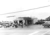
Gulf gas station, on site affected by the widening of Route 171 (Folly Road). Surveyor notations on back of photo: "Dkt.: 10.494. Property owner: Tremarco Corp. Tract: 46. Station: 178+90 Rt. Date: Mar. 21, 1962. Owner to move pumps. [See collection description for explanation of surveyor notations.]
House (rear view) on site affected by the construction of Interstate 26 (I-26). Address: 2128 Montford Avenue. Surveyor notations on back of photo: "Dkt.: 10.490. Property owner: Chas. W. Jenkins, Jr. [Charles W. Jenkins, Jr.]. Tract: 174. Station: 35' Lt. Sta. 5884+60. Date: May 15, 1962. In R/W - Bought." [See collection description for explanation of surveyor notations.]
Shed on site affected by the construction of Interstate 26 (I-26). Address: 2128 Montford Avenue. Surveyor notations on back of photo: "Dkt.: 10.490. Property owner: Chas. W. Jenkins, Jr. [Charles W. Jenkins, Jr.]. Tract: 174. Station: 50' Lt. Sta. 5884+00. Date: May 15, 1962. In R/W - Bought." [See collection description for explanation of surveyor notations.]
View from street of houses on site affected by the construction of Interstate 26 (I-26). Addresses: 2126 Montford Avenue and its neighbor at 2124 Montford Avenue. Surveyor notations on back of photo: "Dkt.: 10.490. Property owner: Emory Hendrix, et al. Tract: 175. Station: 5884+80 Lt. Date: August 29, 1962. In R/W - Bought." [See collection description for explanation of surveyor notations.]
House on site affected by the construction of Interstate 26 (I-26). Address: 2126 Montford Avenue. Surveyor notations on back of photo: "Dkt.: 10.490. Property owner: Emory Hendrix, et al. Tract: 175. Station: 5884+80 Lt. Date: August 29, 1962. In R/W - Bought." [See collection description for explanation of surveyor notations.]
House (rear view) on site affected by the construction of Interstate 26 (I-26). Address: 2126 Montford Avenue. Surveyor notations on back of photo: "Dkt.: 10.490. Property owner: Emory Hendrix, et al. Tract: 175. Station: 5884+80 Lt. Date: August 29, 1962. In R/W - Bought." [See collection description for explanation of surveyor notations.]
House on site affected by the construction of Interstate 26 (I-26). Address: 2124 Montford Avenue. Surveyor notations on back of photo: "Dkt.: 10.490. Property owner: Etta M. Petrakis. Tract: 176. Station: Approx. 130' Lt. Sta. 5884+75. Date: May 15, 1962. Proximity." [See collection description for explanation of surveyor notations.]
House on site affected by the construction of Interstate 26 (I-26). Address: 2125 Montford Avenue. Surveyor notations on back of photo: "Dkt.: 10.490. Property owner: John M. Heirs. Tract: 177. Station: 100' Lt. Sta. 5886+25. Date: May 15, 1962. In R/W - Bought." [See collection description for explanation of surveyor notations.]
House (rear view) on site affected by the construction of Interstate 26 (I-26). Address: 2125 Montford Avenue. Surveyor notations on back of photo: "Dkt.: 10.490. Property owner: John M. Heirs. Tract: 177. Station: 100' Lt. Sta. 5886+25. Date: May 15, 1962. In R/W - Bought." [See collection description for explanation of surveyor notations.]