A report from the mayor, city council, and various governmental departments of Charleston, S.C. for the year 1938. The Year Book opens with an address from the mayor, Henry W. Lockwood, followed by reports from various departments.
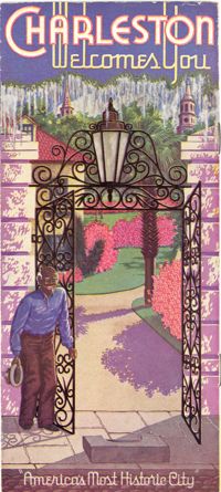
Travel brochure. Includes brief description of Charleston history, points of interest, hotels, and recreational activities, and a map featuring travel routes to Charleston between Jacksonville, Florida to New York, New York. Designed by Advertising Service Agency and printed by J.J. Furlong & Sons, Charleston, SC. Two sheets : ill., map ; 23 x 41 cm., folded (quartered) to 23 x 10 cm.
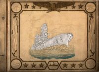
A photograph album created by William Muckenfuss for Mrs. Frances A. Robb, in the 1940s. Album contains photographs of various Charleston buildings, houses, landmarks, sites, events, battleships, and people as well as other Lowcountry places. Mrs. Robb lived on Wentworth Street and several photographs are of her home and neighborhood.
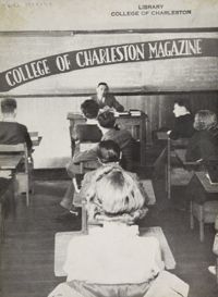
The College of Charleston Magazine is a monthly publication released by the College of Charleston's Chrestomathic Society during the academic year. This volume is comprised of the bound together publications for the Winter of 1938 and Spring of 1939.
This album consists of photographs, travel permits, newspaper clippings, and other documents related to the Legendre Iran Expedition for the American Museum of Natural History. Photos show Gertrude and Sidney Legendre camping and hunting with George Goodwin from the Museum.
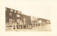
Photograph of the United Fruit Company dock after the September 29, 1938, tornadoes. (Based on Sanborn Maps, the dock was located at the foot of Laurens Street, Southern Railway Pier 2.)
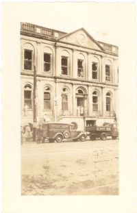
Photograph of City Hall after the tornadoes of September 29, 1938, showing the damage done to the building. Two trucks, including an Automatic Grocery truck, are parked in front of building. Onlookers are on the sidewalk in front of building; men stand at doorways and windows.
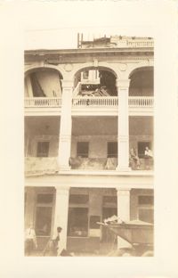
Photograph of the Timrod Hotel [ca. 101 Meeting Street], after the tornadoes of September 29, 1938, showing the damage done to the building. East elevation. Men are sitting on the second story piazza ledge. Men stand on the sidewalk by a truck that is carrying debris. [Note: The hotel was later demolished in the 1960s.]
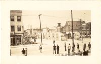
Looking northwest on Market Street from the U.S. Custom House on East Bay Street, after the tornadoes of September 29, 1938, showing damaged and ruined Market Sheds. Also shows the damaged buildings on North Market Street. Onlookers and cars are in the street. Partial view of ca. 225 East Bay Street (now gone) is on the left.
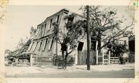
Photograph of a house on Fishburne Street demolished by the tornado of 1938. Neighboring house in view at left. (Both houses would have been on the north side of the 200 block of Fishburne Street.) Handwritten on back of photo: "2nd tornado on Fishburne Street near President Street. Demolished about 60 houses here. This 2nd tornado damage about $6,000,000. 300 houses condemned. Sept. 29, '38."