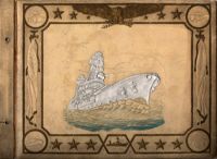
Travel brochure. Includes brief description of Charleston history, points of interest, hotels, and recreational activities, and a map featuring travel routes to Charleston between Jacksonville, Florida to New York, New York. Designed by Advertising Service Agency and printed by J.J. Furlong & Sons, Charleston, SC. Two sheets : ill., map ; 23 x 41 cm., folded (quartered) to 23 x 10 cm.
The College of Charleston Magazine is a monthly publication released by the College of Charleston's Chrestomathic Society during the academic year. This volume is comprised of the bound together publications for the Winter of 1938 and Spring of 1939.
This album consists of photographs, travel permits, newspaper clippings, and other documents related to the Legendre Iran Expedition for the American Museum of Natural History. Photos show Gertrude and Sidney Legendre camping and hunting with George Goodwin from the Museum.
A report from the mayor, city council, and various governmental departments of Charleston, S.C. for the year 1938. The Year Book opens with an address from the mayor, Henry W. Lockwood, followed by reports from various departments.
Photograph of Church Street, looking south from the corner of Broad Street at 49 Broad (right foreground), showing the scene on the street after the tornadoes of September 29, 1938. Fallen tree lies across the street; debris and water cover the street. Onlookers are on the street. 105 Church and 107 Church can also be seen.
Photograph of Lamboll Street elevation of 19 King Street [Thomas Lamboll House] after the tornadoes of September 29, 1938, showing the damage done to the piazzas and roof. Men are standing on the roof.
Photograph of City Hall after the tornadoes of September 29, 1938, showing the damage done to the building. Men stand on the landing at the entry to the building.
Photograph showing several dwellings in Fiddlers Green damaged or destroyed by the tornado of 1938. Handwritten on back of photo: "1st tornado hit Fiddlers Green, Negro section by Ashley Bridge, Hilly Street [should be Lilly Street], Sept. 29, '38."
Photograph of the I.M. Pearlstine Building on Cumberland Street, located between East Bay and State Street, after the tornadoes of September 29, 1938, showing the damage done to the building. Portion of signage is visible at the right of the photograph, "I.M." and "Budwe[iser]"; signage for "Rex" is also on building (at left). Onlookers stand among the debris on the street.
Photograph of First Scots Presbyterian Church [57 Meeting Street] after the tornadoes of September 29, 1938, showing the damage done to the building. The Nathaniel Russell House can be seen in the background. Cars are parked on the street in front of the church.
Photograph of the ruins of a building on King Street after the tornadoes of September 29, 1938. Shows the debris of a completely demolished structure and the damaged roof of the neighboring building. Based on newspaper accounts, this is probably the site of the Rectory of the Church of the Sacred Heart at King and Huger Streets. Three men stand on the sidewalk facing the debris; other men are standing on a pile of debris.
Looking east on Market Street after the tornadoes of September 29, 1938, showing the Market Sheds in ruins. A damaged car is parked along side of the debris. The Old Church of the Redeemer can be seen in the background.
Photograph of 38 South Battery and 40 South Battery [Frederick Heinz Houses] and a portion of 42 South Battery, after the tornadoes of September 29, 1938, showing the damage done to the houses.
Photograph 19 King Street [Thomas Lamboll House] after the tornadoes of September 29, 1938, showing the damage done to the house. King Street elevation.