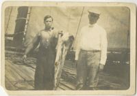
Black-and-white image of two men on deck of boat, one holding a fish. Inscription on back of image reads, "W.E. McLeod on right with member of crew holding a dolphin just caugh. On schooner Helen H. Benedict heading for New York August 1912."
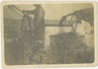
Black-and-white image of two people on deck of schooner, one at the wheel. Inscription on back of image reads, "Capt. H.J. Flynn right, of the schooner Helen H. Benedict bound for New York August 1912 from Charleston S.C."
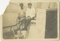
Black-and-white image of two men sitting on deck of schooner. Inscription on back of image reads, "Captain H.J. Flynn- right and mate. Schooner Helen H. Benedit heading for N.Y. August 1912."
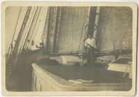
Black-and-white image of man on boat. Inscription on back of image reads, "Capt. H.J. Flynn on Schooner Helen H. Benedict heading for New York August 1912 from Charleston S.C."
A report from the mayor, city council, and various governmental departments of Charleston, South Carolina for the year 1912. The Year Book opens with an address from the mayor, John P. Grace, followed by reports from various departments
The College of Charleston Magazine is a monthly publication released by the College of Charleston's Chrestomathic Society during the academic year. This volume is comprised of the bound together publications from the months of October 1912-April 1913, including the Annual Number.
Page 229 of the City Engineer's Plat Book with two plats. Plat 1 features lots located on Queen Street, near its intersections with Mazyck Street, Friend Street, King Street, and Meeting Street. Plat 2 features lots located between Sans Souci Street and Simons Street, and between Rutledge Avenue and King Street.
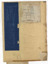
Page 227 of the City Engineer's Plat Book with two plats. Plat 1 shows lots and structures located on Grove Street, between King Street and Russell Street. Plat 2 features a "Plot of Ground Surrounding Charleston Colored Industrial School." Plat 2 also shows Fishburne Street, Mount Street, Congress Street, and President Street.
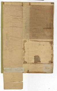
Page 192 of the City Engineer's Plat Book with five plats. Plat 1 shows lots between Congress Street and King Street, from Gadsden Street to a city block past Moultrie Street. Plat 2 shows lots between Rutledge Street and King Street, and from Moultrie Street to a lot past Gadsden Street. Plat 3 shows a city block between Moultrie Street and Huger Street, and between Payne Street and Rutledge Street. Plat 4 shows lots near Rutledge Avenue, between Grove Street and Simons Street. Plat 4 also shows a street car line on Rutledge Avenue. Plat 5 shows lots between Sumter Street and Congress Street.