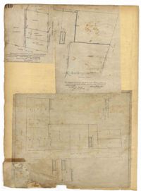
Page 110 of the City Engineer's Plat Book with three plats. Plat 1 shows lots located near the corner of Champney Street and Exchange Street, including labels for brick buildings, a label reading "EAST SHORE TERMINAL." Plat 2 shows lots and structures located near South Bay Street, between Church Street and Meeting Street. Plat 3 shows lots and some structures located near the intersection of Bogard Street and Percy Street.
Page 120 of the City Engineer's Plat Book with five plats, labelled two through six. Plat 2 shows lots and buildings located near Cumberland Street, between Church Street and Philadelphia Street. Plat 3 shows lots located near the intersection Pinckney Street and Anson Street. Plat 4 shows lots and structures located on Hasell Street. Plat 5 shows lots and buildings along East Bay Street. Plat 6 shows lots and structures located between wharf street and the Cooper River.
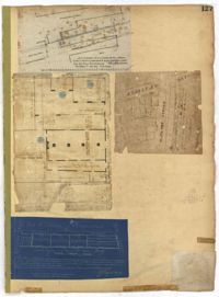
Page 127 of the City Engineer's Plat Book with four plats. Plat 1 shows lots and wharves, including Accommodation Wharf and Brown's Wharf. Plat 2 shows structures on Anson Street. Plat 3 shows lots located near the intersection of Pinckney Street and Anson Street. Plat 4 shows lots located on and near Gadsden Street, between Pinckney Street and King Street.
Page 133 of the City Engineer's Plat Book with one plat. The plat features Colonial Lake, located between Broad Street and Beaufain Street, and between Rutledge Street and Lynch Street.
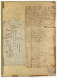
Page 211 of the City Engineer's Plat Book with two plats. Plat 1 features "Pregnal's Ship Yard," located near Concord Street, Laurens Street, Vernon Street, and Wharf Street. Plat 1 also shows structures with labels such as "Rough Rice Storehouse," "Mill," "Coal Yard Office," and "Stable." Plat 2 shows numerous streets including Meeting Street, King Street, Boundary Street, Columbus Street, and Bay Street.
Page 218 of the City Engineer's Plat Book with two plats. Plat 1 features a proposed extension to Boigard Street, located between Ashley Street and Rutledge Avenue. Plat 1 also shows Payne Street, Line Street, and a lot labeled "Thompson's Garden." Plat 2 shows lots and structures located between St. Philips Street and King Street, and between Radcliffe Street and Warren Street.
Page 97 of the City Engineer's Plat Book with three plats. Plat 1 shows a stretch of land extending from Cunnington Street to Columbus Street, with a projected rout for America Street. Plat 1 also shows Hampstead Mall, Meeting Street, several creeks, some city lands, and a stretch of King Street. Plat 2 shows land from near Line Street to Hudson Street, between King Street and Meeting Street. Plat 2 also features structures, including several freight depots. Plat 3 shows a lot labelled "Lands of Fourth Brigade," between Brigade Street and William Street.
Page 90 of the City Engineer's Plat Book with four plats. Plat 1 shows lots located between King Street and Russell Street, near Grove Street and Poinsett Street. Plat 2 shows lots located between Meeting Street and King Street, with a strip of land labelled "S.C.R.R.," a common acronym for the South Carolina Rail Road. Plat 3 features lots located near Boigard Street. Plat 4 features land located on the Ashley River, near Grove Street, shows a stream and several structures.
Page 84 of the City Engineer's Plat Book with five plats. Plat 1 shows lots located near Meeting Street, between Sheppard Street and Line Street. Plat 2 shows lots located along Race Street, between Rutledge Street and King Street. Plat 3 shows lots located between King Street and Meeting Street, and shows a stretch of Russell Street. Plat 4 features a lot and several buildings located near the intersection of Line Street and Meeting Street. Plat 4 also shows a label reading "The Rail Road" and another reading "Rail Road Company." Plat 5 features a lot on Hanover Street, and also shows a lot labelled "Cemetery."
Page 32 of the City Engineer's Plat Book with three plats. Plat 1 shows lots located near the intersection of Tradd Street and Limehouse Street. Plat 2 shows lots located near Elliott Street, Broad Street, and Line Street, near the intersections with Rose Lane, Laurel Street, Percy Street, and Coming Street. Plat 3 shows lots and buildings located between St. Phillip Street and King Street, and Radcliffe Street and Warren Street.
The Kiawah Stock Account Book, 1877-1882, is kept by a member of the Vanderhorst Family for their estate Kiawah Plantation on Kiawah Island, South Carolina. Entries include information on the numbers of livestock sold, list of expenses and marketing and account statements for the overseer Quash Stevens.
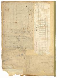
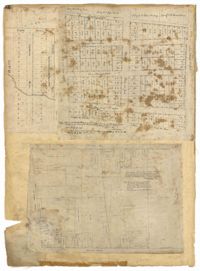
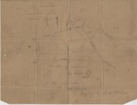
25 acres of land containing two dams, a reserve, and pine and oak trees owned by George Holmes near 7 mile south of lands owned by J. Meetze. Names associated with this plat include George Holmes, J. Meetze and Simons.
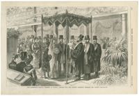
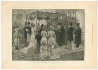
Black-and-white offset print reproduction depicting the marriage ceremony of Leopold de Rothschild and Marie Perugia, held in the Central Synagogue on Great Portland Street in London. Published in the February 19, 1881, edition of Frank Leslie's Illustrated Newspaper.
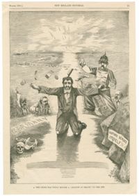
Caricature by Leon Barritt published in the March 1881 edition of the New England Pictorial. The associated article reads : "From an American point of view the opposition to the Jews, which has lately been revived in Germany, seems to be due partly to a survival of the unchristian spirit of medieval Christianity, but more immediately to the hatred which thrift always inspires in the unthrifty. The military ardor which has converted Germany into a great camp has drafted the flower of German youth into army barracks, and diverted the best energy of the people from productive pursuits. At the same time it has impoverished the masses by indirect heavy taxes to support the military establishment, and still heavier indirect taxes in cutting off the supply of productive labor. Though many Jewish youth in Germany have proved the native courage of the race on recent battlefields, the more peaceful instincts of the race have led them to seek in commerce and in the professions the distinction which the Christian youths have looked for in military and official positions. And now the cry is that the Jews monopolize the sources of wealth, and that they crowd the professions and other pursuits of peace and profit. The charge is doubtless largely true, but that fact is as much to the honor of the Jews as it is to the dishonor of those whose lower civilization has allowed them to be distanced in the competitions of peaceful industry, intelligence, persistence and thrift. If the physically and numerically weaker race can distance their stronger and more numerous competitors in the arts of peace, the fact must be taken as evidence that mind counts for more than stature, and thrift and labor for more than military ardor, in the free conflicts of modern civilization."
Black-and-white offset print reproduction depicting the marriage ceremony of Leopold de Rothschild and Marie Perugia, held in the Central Synagogue on Great Portland Street in London. Published in the January 29, 1881, edition of The Illustrated London News.
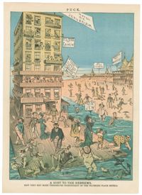
Caricature by Frederick Burr Opper published in the May 11, 1881, edition of Puck. The caption reads : "How they may make themselves independent of the watering place hotels."
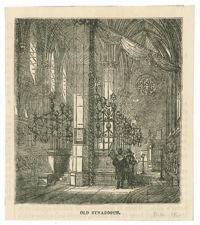
Black-and-white offset print reproduction of the interior of the Old New Synagogue in Prague. Published in the December 1881 edition of Frank Leslie's Popular Monthly.
Black-and-white photogravure of the Western Wall in Jerusalem. Photogravure by Goupil & Cie after a painting by Jean Léon Gérôme. From Gérôme, a collection of the works of J. L. Gérôme in one hundred photogravures, Volume 2, edited by Edward Strahan, published New York: Samuel L. Hall.