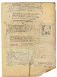
Page 11 of the City Engineer's Plat Book with five plats. Plat 1 shows a plot of land on the Charleston Harbor located near the intersection of East Bay Street and Queen Street. Plat 2 shows lots located between Conin Creek and King Street, and between Vanderhorst Street and "Manigault alias Boundary Street." Plat 3 shows plots and buildings located near the intersection of Liberty Street and St. Philip Street. Plat 4 features a plots, including one belonging to the "German Lutheran Church," located between King Street and Archdale Street.
Page 163 of the City Engineer's Plat Book with two plats. Plat 1 shows lots and structures located on Friend Street, near its intersections with Queen Street, Broad Street, and an unlabeled street. Plat 2 shows lots located on King Street, near where it intersects with Broad Street.
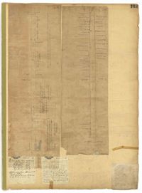
A set of annual reports of the the Fire Department from 1859-1872. Reports missing for years 1862-1865. The annual reports open with a statement from the Fire Chief and include multiple lists of department expenses, financial cost of fires, the cause of the fires, and locations of city property pertaining to the fire department.
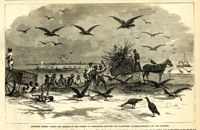
Caption: 'Southern scenes.--fight for garbage in the streets of Charleston between the scavengers (turkey-buzzards) and the Negroes.' [full date December 11, 1869.]
Page 27 of the City Engineer's Plat Book with five plats. Plat 1 shows lots located on Broad Street, between the intersections with East Bay Street and State Street. Plat 2 shows lots on Chapel Street. Plat 3 shows lots near Savage Street and Tradd Street. Plat 4 shows lots on Savage Street. Plat 5 shows lots near the intersection of Broad Street and East Bay Street.
Page 106 of the City Engineer's Plat Book with ten plats. Plat 1 features a lot and its buildings located near the intersection of King Street and Tradd Street. Plat 2 features a lot and buildings located between Church Street and Water Street, near where the latter intersects with East Bay Street. Plat 3 shows lots located near the intersection of King Street and Grove Street. Plat 4 features a plat and building located on Church Street. Plat 5 features a lot located on the intersection of East Bay Street and Elliott Street. Plat 6 shows a lot located between two streets leading to wharves. Plat 7 shows lots, wharves, and docks located near the intersection of Market Street and East Bay Street. Plat 8 features a wharf and lot located near the intersection of Legare Street and South Bay Street. Plat 9 shows lots located on and near the intersection of Broad Street and East Bay Street. Plat 10 shows lots and some structures located on East Bay Street.