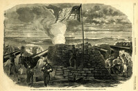
Caption: 'The Siege of Charleston--the morning call to the Rebels.--sketched from the naval battery by Mr. Theodore R. Davis.--[see page 603.]' [full date September 19, 1863.]
Caption: 'The siege of Charleston--View from the sea-face of Fort Wagner.--sketched by Mr. Theodore R. Davis.--[See Page 621.]' [full date September 26, 1863.]
Caption: 'Departure of the Great Southern Expedition from Beaufort, North Carolina.--sketched by an amateur.--[see page 119.]' [full date February 21, 1863.]
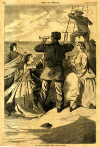
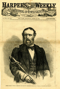
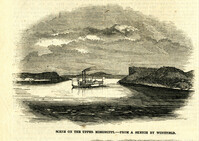
Caption: 'Admiral Samuel F. DuPont, Commanding the fleet off Charleston--photographed by Gutekurst, of Philadelphia.--see page 270.' [Full date April 25, 1863]
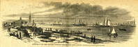
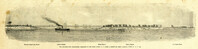
Caption: 'The advance upon Charleston--entrance to the Stono River, S.C.--from a sketch by Lieut. Coleman, 100th N.Y.S. Vol.' Also identified with captions: 'Kiawah Island and River. John's Island. Stono River. Cole's Island. Old Rebel Fort.' [full date April 25, 1863.]
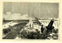
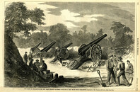
Caption: 'The Siege of Charleston--the new Black Island Batteries, four and a half miles from Charleston.--sketches by Mr. Theodore R. Davis.--[see page 651.]' [full date October 10, 1863.]
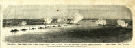
Caption: 'Panoramic view of Charleston Harbor--advance of iron-clads to the attack, April 7. Union--A. Keokuk. B. Nahunt. C. Nantucket. D. Catskill. E. Ironsides. F. Patapsco. G. Montauk. H. Passaie. K. Weehawken. Rebel--1. Morris Island sand battery. 2. Fort Wagner. 3. Battery Bee, on Cummings Point. 4. [Fort] Johnson. 5. Fort Ripley. 6. Sumter. 7. Charleston City. 8. Castle Pinckney. 9. Fort Redan. 10. Fort Moultrie. 11. Moultrie House. 12. Fort Beauregard. 13. Harbor obstructions. 14. Cooper River. 15. Ashley River.' [full date May 2, 1863.]