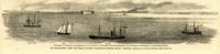
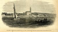
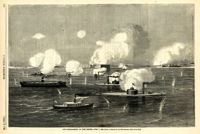
Caption: 'Our blockading fleet off North Channel, Charleston Harbor, South Carolina.--sketched by a Naval Officer.--[see page 79.] References--A. Fort Sumter.--B. Charleston City.--C. Fort Moultrie.--D. Rebel tug at work on the obstructions.--E. Obstructions.--F. Fort Johnson.--G. Mount Pleasant Batteries.' Also identified in image: South Carolina, Blunt, Daylight and Stars and Stripes (ships of the fleet). [full date January 31, 1863.]
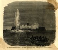
Caption: 'The siege of Charleston--attempt to blow up the "Ironsides" by a Rebel torpedo.--sketched by an occasional contributor. [see page 695.] [full date October 31, 1863.]
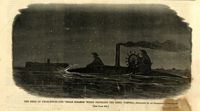
Caption: 'The siege of Charleston--the "Segar Steamer" which propelled the Rebel torpedo.--sketched by an occasional contributor. [see page 695.]' [full date October 31, 1863.]
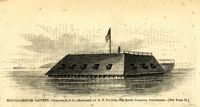
Caption: 'Middle-ground Battery, Charleston, S.C.--sketched by A.P. Palmer, 21st South Carolina Volunteers.--[see page 70.]' [full date January 31, 1863.]
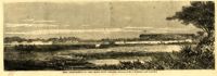
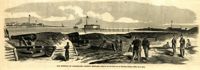
Caption: 'The Siege of Charleston--Johnsonville and Rebel fortifications.--[sketched from Black Island by Mr. Theodore R. Davis.]' [full date September 26, 1863.]
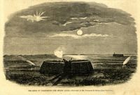
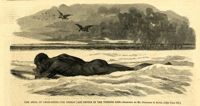
Caption: 'The Siege of Charleston--the Rebels' last device in the torpedo line.--sketched by Mr. Theodore R. Davis.--[see page 603.] [full date September 19, 1863.]