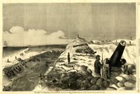
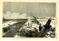
Caption: 'The siege of Charleston--View from the sea-face of Fort Wagner.--sketched by Mr. Theodore R. Davis.--[See Page 621.]' [full date September 26, 1863.]
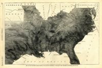
Caption: 'Map of the Southern states, showing the relative proportion of slaves in the different localities.--[see page 142.]' [full date February 28, 1863.]
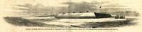
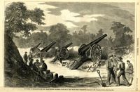
Caption: 'Folley's (sic) Battery, near the lighthouse, at Charleston, South Carolina.--from a sketch by A.P. Palmer, 21st South Carolina Volunteers.--[see page 79.]' [full date January 31, 1863.]
Caption: 'The Siege of Charleston--the morning call to the Rebels.--sketched from the naval battery by Mr. Theodore R. Davis.--[see page 603.]' [full date September 19, 1863.]
Caption: 'The siege of Charleston--View from the sea-face of Fort Wagner.--sketched by Mr. Theodore R. Davis.--[See Page 621.]' [full date September 26, 1863.]
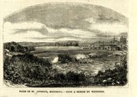
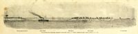
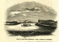
Caption: 'The advance upon Charleston--entrance to the Stono River, S.C.--from a sketch by Lieut. Coleman, 100th N.Y.S. Vol.' Also identified with captions: 'Kiawah Island and River. John's Island. Stono River. Cole's Island. Old Rebel Fort.' [full date April 25, 1863.]
Caption: 'The Siege of Charleston--the new Black Island Batteries, four and a half miles from Charleston.--sketches by Mr. Theodore R. Davis.--[see page 651.]' [full date October 10, 1863.]
Caption: 'The bombardment of Fort Sumter, as seen through the "look out" in the pilot-house of one of the monitors, April 7.--from a sketch by our Special Artist.' [full date May 9, 1863]