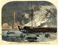
[Color image]. Caption: 'The ship "Jacob A. Wetervelt" on fire in the harbor of New York, April 11, 1860.--[see preceding page.]' [full date April 21, 1860.]
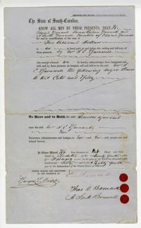
A slave bill of sale from the executors of the deceased Edward Barnwell's estate for the enslaved men Wet Cato and Billy, referenced as "negro slaves." The reverse side includes all individuals involved in the sale and the date.
Page 37 of the City Engineer's Plat Book with three plats. Plat 1 shows lots located on Herriot Street. Plat 2 shows lots located on the block between Rutledge Street and Smith Street, and Morris Street and Radcliffe Street. Plat 3 shows lots and buildings located on King Street, with a stretch labelled "Unitarian Church Land."
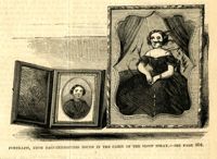
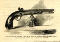
Caption: 'Articles fished out from the cabin of the sloop Spray--Naval pistol supposed to have been used in the murder, and a locket.--see page 304.' [full date April 14, 1860.]
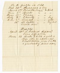
Ledger for Vernizobre Bank construction (bank termed as a repair to a river) ca. 1860, including entries dated 1859. Ledger itemizes expenses associated with the building of Vernizobre bank and includes payments to various landowners for use of their slave hands and carts. 4p.
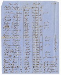
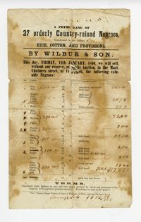
A record of sale with the title "A Prime Gang of 27 orderly Country-raised Negroes" by Wilbur & Son. Makes notation regarding the sale at a public auction for the following slaves: Sam, Amy, Rodger, Doll, Bella, Moll, Myrcam, Phoebe, Harriet, Mary, Sye, Joe, Flora, Scipio, Daniel, Jane, Emma, High Bob, Thomas and numerous children not referenced by name. Includes associated figures in dollars and the ages and qualifications of each slave.
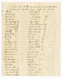
This document is the last will and testament of Mary Ellison that discusses the distribution of her finances, estate and personal items. Makes the notation that she leaves her daugher Harriet "my negro slaves" listed as Binah, George, May, Robert, Betsey, Jerry, Sam, Jane, Sukey, Sukie's children, Lizzie, Caroline and Eliza.
Page 30 of the City Engineer's Plat Book with one plat. The plat features the West Point Rice Mill on the Ashley River Channel. It shows numerous buildings and structures, a creek, and the nearby Bull Street, Montague Street, Barre Street, and Gadsden Street.
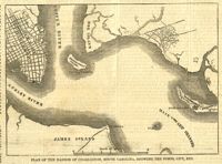
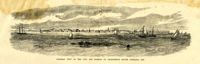
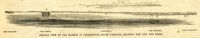
Caption: 'Profile view of the harbor of Charleston, South Carolina, showing the city and forts.' Identified in the image: Fort Johnston (sic), Fort Sumter, Charleston, Fort Moultrie and Mount Pleasant. [full date December 29, 1860.]