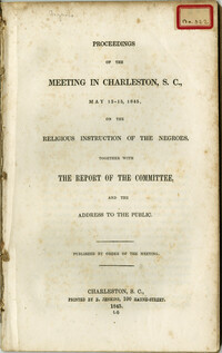
Minutes from a governmental committee regarding the teaching of Christianity to slaves. Consists of answers to questions asked of prominent slave owners throughout the state. There is a focus on the oral education of slaves as well as a white presence in any black congregation to ensure the slaves did not organize any retaliatory actions. Focuses on the demographics of the Christian slave population. Originally bound in v. 22 of the Thomas Smith Grimke pamphlet collection.
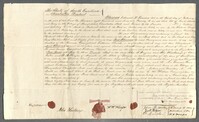
Title with Covenants between James B. Heyward and Rawlins Lowndes and a Renunciation of Dower from Gertrude Laura Lowndes to James B. Heyward, 1845. 4p.
A ribbon-bound document conveying a tract of land to the German Evangelical Lutheran Church. The document begins by affirming that John A. Wagener, John Hurkamp, and H.H. Hoops paid off their mortgage on the land. The document also describes the land's location as being near "lands now or lately in use by the Hebrew Congregation as a cemetery" and near land used as a cemetery for people of color.
Page 118 of the City Engineer's Plat Book with four plats. Plat 1 shows lots and structures on East Bay Street. Plat 2 shows lots along Meeting Street. Plat 3 shows lots located near the intersection of Inspection Street and Marsh Street. Plat 4 shows lots and structures along Anson Street, between George Street and Boundary Street.
Page 108 of the City Engineer's Plat Book with five plats. Plat 1 features lots and some structures located near South Bay Street's intersections with Meeting Street and Church Street. It also shows a lot labelled "Battery Garden." Plat 2 shows lots located near East Bay Street. Plat 3 features White Point Garden, also known as Battery Park, located south of South Battery Street, near the Church Street and Meeting Street. Plat 4 shows a lot located near the intersection of Meeting Street and Broad Street. Plat 5 shows land located between Broad Road and the Ashley River, and includes labels marking salt marshes, cleared lands, a fish pond.
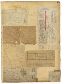
Page 105 of the City Engineer's Plat Book with seven plats. Plat 1 shows several lots located on Chalmers Street. Plat 2 shows lots located near the intersection of East Bay Street and Market Street, and several structures, including docs and wharves. Plat 3 features lots and structures located on Chalmers Street. Plat 4 features a lot located on the intersection of Church Street and Waters Street, and shows several structures. Plat 5 shows a lot and several structures located on Waters Street. Plat 6 features a lot and buildings located on Broad Street. Plat 7 features the profiles of streets where tidal drains will be built. The profiles include Calhoun Street, Mazyck Street, Logan Street, Tradd Street, Coming Street, Chesnut Street, Spring Street, and Meeting Street.
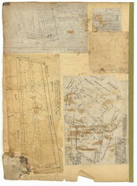
Page 55 of the City Engineer's Plat Book with five plats. Plat 1 shows lots near the intersection of Broad Street and Queen Street. Plat 2 shows lots and some buildings on Broad Street. Plat 3 shows land and buildings between Broad Street and Short Street, near their intersections with Mazyck Street. Plat 4 shows lots near Broad Street, Franklin Street, and Trapman Street. Plat 5 shows lots between Broad Street and Short Street, near their intersections Mayzck Street.
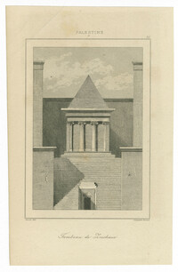
Black-and-white steel engraving of the Tomb of Zechariah in the Valley of Jehoshaphat (Kidron Valley) in Jerusalem. Engraving after a drawing by Louis François Cassas. From Palestine : description géographique, historique, et archéologique by Salomon Munk, published Paris: Firmin Didot frères.