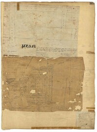
Page 161 of the City Engineer's Plat Book with two plats. Plat 1 shows lots located near the intersection of South Street and Drake Street, and also shows America Street. Plat 2 shows a "Plan of Hampstead," which shows Meeting Street, a public square, Blake Street, Drake Street, Bay Street, Amherst Street, Reid Street, and Reid Street.
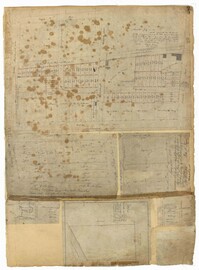
Page 243 of the City Engineer's Plat Book with three plats. Plat 1 features lots along Cumberland Street, near where it intersects with State Street. The second plat features "City Lands West of President Street and South of Congress Street." It also labels reading "Old Folks Holme," "Grave Yard Old Folks Home," "City Board of Public School Commissioners," and "Colored Industrial School." Plat 3 shows lots located west of Meeting Street, and also shows Cooper Street, Lee Street, Sheppard Street, and Sumter Street.
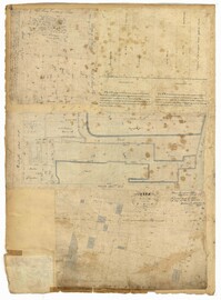
Page 75 of the City Engineer's Plat Book with six plats. Plat 1 features lots located between Radcliffe Street and Calhoun Street, and between Smith Street and Rutledge Street. Plat 1 also shows Vanderhorst Street, Thomas Street, and Warren Street. Plat 2 shows lots located near Morris Street, between St. Philips Street and Coming Street. Plat 3 shows lots located near the intersection of Morris Street and Coming Street, including a lot labelled "Cemetery" and another lot labelled "Hebrew Cemetery." Plat 4 shows land located near Thomas Street, between Doughty Street and Hutson Street, and also labels a pond. Plat 5 shows lots located between Pine Street and Gadsden Creek. Plat 6 shows lots and some buildings located between Pinckney Street and Smith Street.
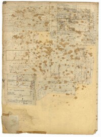
Page 74 of the City Engineer's Plat Book with four plats. Plat 1 shows lots and some buildings located near Line Street, between King Street and a "Rail Road Company Road." Plat 2 shows lots located along Amherst Street, including one labelled "Cemetery of the Evangelical German Lutheran Church." Plat 3 shows land located between Washington Street and the Charleston Harbor, and includes several structures, a pond, docks, a wharf, and a canal. Plat 4 shows lots and some structures located near the intersection of Smith Street and Calhoun Street.
Page 50 of the City Engineer's Plat Book with seven plats. Plat 1 shows wharves and other structures located on East Bay Street. Plat 2 shows lots and buildings located on the intersection of Tradd Street and Meeting Street. Plat 3 shows lots located near the intersection of Broad Street and Rutledge Street. Plat 4 shows lots and buildings located near Gibbes Street. Plat 5 shows lots located near the intersection of Society Street and East Bay Street. Plat 6 shows lots and buildings near Broad Street. Plat 7 shows lots located between South Bay Street and the Ashley River, near Legare Street.
Page 34 of the City Engineer's Plat Book with four plats. Plat 1 shows lots located on South Bay Street. Plat 2 shows land located between Beaufain Street and Queen Street, near Smith Street, Wilson Street, and Franklin Street. Plat 3 shows lots located near Beaufain Street's intersections with Pitt Street and Wilson Street. Plat 4 features a lot and its buildings located on Meeting Street.
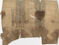
Copy of a plan of lots No.1-7, 9-11 on Cumberland Street in Charleston, Ward No.3. Indicates some buildings including a brick stable at No. 9 and DeBorr’s house and lot. “Lands of Mr. Edwards" is written above the lots. Names associated with this plat include De Borr, Edwards, and Charles Parker. Notable geographic locations include Church Street, Corr Alley or Philadelphia Street, Cumberland Street, and Ward Number 3.