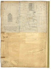
Page 138 of the City Engineer's Plat Book with three plats. Plat 1 features a lot located on Hasell Street, with a large building labelled "St. Mary's Church." Plat 2 shows lots and structures located between Rutledge Street and Trapmann Street, and between Queen Street and Broad Street. Plat 3 features a lot located on Radcliffe Street, between Rutledge Street and Smith Street.
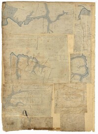
Page 88 of the City Engineer's Plat Book with eight plats. Plat 1 shows a stream and marshland starting at the Ashley River. Plat 2 features land located near the Ashley River and Grove Street. It also features several structures, some marshland, and a creek. Plat 3 shows land located near Grove Street, including some structures, some marshland, and a stream. Plat 4 shows land located Grove Street, including some buildings, a creek, and marshland. Plat 5 shows lots located between a stretch of marsh and Rutledge Avenue. Plat 5 also shows Congress Street, Legare Street, Huger Street, Moultrie Street, and a race track. Plat 6 features Washington Race Course, located between Grove Street and Moultrie Street, and between Congress Street and an unlabeled Street. Plat 7 shows "34 acres of Marsh" located between the Ashley River and a public cemetery. Plat 8 shows marshland located on the Ashley River, near "new Spring Street" and a creek.
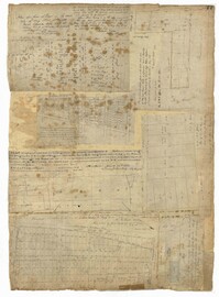
Page 77 of the City Engineer's Plat Book with seven plats, labelled 1 through 8 with Plat 3 missing. Plat 1 shows lots located between Smith Street and King Street, and between Morris Street and Radcliffe Street. Plat 1 also shows Coming Street and St. Philips Street, and a label reading "Bethlohim Congregation." Plat 2 shows lots and some structures near the intersection of King Street and Warren Street. Plat 4 shows lots between Smith Street and King Street, and north of Radcliffe Street. Plat 4 also shows Coming Street, St. Philips Street, Morris Street, and a lot labelled "Bethlehem Congregation." Plat 5 shows lots located near the intersection of Morris Street and St. Philips Street. Plat 6 shows lots located between Morris Street and "Hunter St now Line," and east of Coming Street. Plat 8 features a lot and structures located on the corner of St. Philips Street and Morris Street.
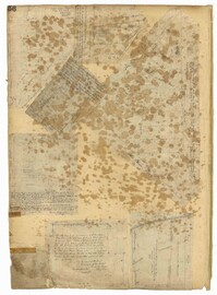
Page 56 of the City Engineer's Plat Book with seven plats. Plat 1 shows lots between Savage Street and Tradd Street. Plat 2 shows lots and some buildings on South Bay Street. Plat 3 shows lots between Savage Street and Broad Street. Plat 4 shows a lot and several buildings at the intersection of Friend and Queen Street. Plat 5 shows land near the corner of Legare Street and Gibbes Street, and a few buildings. Plat 6 shows a lot on the west side of Friend Street. Plat 7 shows lots located between Broad Street and Tradd Street, and between Lynch Street and the Ashley River.
Page 47 of the City Engineer's Plat Book with four plats. Plat 1 shows lots between America Street and Meeting Street, and between Moultrie Street and Line Street. Plat 1 also includes a stretch of Moultrie Street and Hampton Street extending from Meeting Street to King Street. Plat 2 shows the plan of a wharf and channel located on East Bay Street, and includes several planned buildings and structures. Plat 3 shows lots of land located between East Bay Street and the "Edge of Channel of Cooper Street." Plat 4 shows lots located near East Bay Street's intersections with Water Street and Lynches Lane. Plat 4 shows several buildings, "Flat Broken ground," low lands, and a "Shoal dry at Low Water."
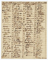
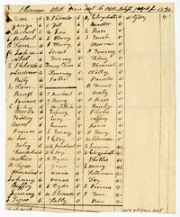
The Horlbeck Daybook, 1835-1837, was kept by members of the Horlbeck building and architectural business. Included in the daybook are lists of work done for clients such as remodeling, repair, or construction. Buildings worked on include the jail, St. Stephen's Chapel, the Fire Master's Department, and the Poor House. The descriptions include types of materials used and the number of Black and White employees working. Black employees consist of enslaved and freed persons.
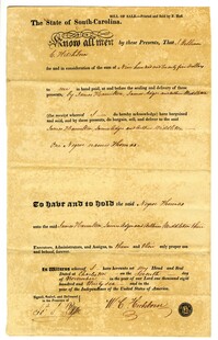
A bill of sale for the enslaved man listed as "negro named Thomas" for $925. The sale is between James Adger, James Hamilton and Arthur Middleton who bought Thomas from J. William C. Hitchinson.
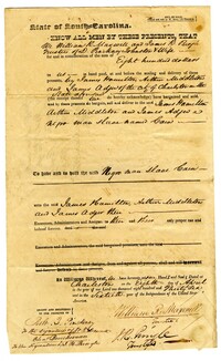
A bill of sale for the enslaved man listed as "Negro man slave Caius." The enslaved man was bought by James Hamilton, Arthur Middleton, and James Adger for the sum of $800 from William R. Maxwell and James R. Pringle.
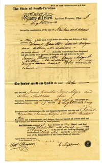
A bill of sale for the enslaved women listed as "negro woman named Robin." The enslaved woman was bought by James Hamilton, James Adger and Arthur Middleton from E. Lightwood for $900.
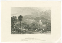
Black-and-white engraving of Rachel's Tomb in Bethlehem. Engraving by William Finden after a drawing by J. M. W. Turner from a sketch by Archibald Edmonstone. From Landscape illustrations of the Bible, consisting of views of the most remarkable places mentioned in the Old and New Testaments, published London: John Murray.
Contract for the purchase of a seat in the women's gallery of the Synagogue de Nazareth, located on the Rue Notre-Dame-de-Nazareth, in Paris. Seat paid for by Anselme Halphen.
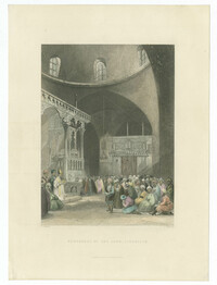
Hand-colored steel engraving of the interior of the Istanbuli Synagogue in Jerusalem. Engraving by James C. Redaway after a drawing by J. Salmon. From Syria, the Holy Land, Asia Minor, &c. Illustrated, Volume 3, by John Carne. Published London & Paris : Fisher, Son & Co.
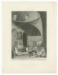
Black-and-white steel engraving of the interior of the Istanbuli Synagogue in Jerusalem. Engraving by James C. Redaway after a drawing by J. Salmon. From Syria, the Holy Land, Asia Minor, &c. Illustrated, Volume 3, by John Carne. Published London & Paris : Fisher, Son & Co.
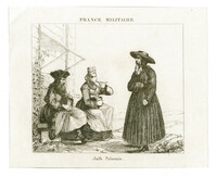
Black-and-white engraving of Jews from Poland. From France militaire. Histoire des armées françaises de terre et de mer de 1792 à 1833., Volume 3, by Abel Hugo.