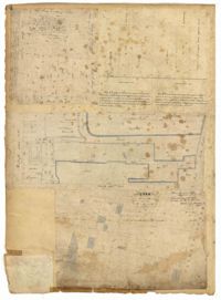
Page 106 of the City Engineer's Plat Book with ten plats. Plat 1 features a lot and its buildings located near the intersection of King Street and Tradd Street. Plat 2 features a lot and buildings located between Church Street and Water Street, near where the latter intersects with East Bay Street. Plat 3 shows lots located near the intersection of King Street and Grove Street. Plat 4 features a plat and building located on Church Street. Plat 5 features a lot located on the intersection of East Bay Street and Elliott Street. Plat 6 shows a lot located between two streets leading to wharves. Plat 7 shows lots, wharves, and docks located near the intersection of Market Street and East Bay Street. Plat 8 features a wharf and lot located near the intersection of Legare Street and South Bay Street. Plat 9 shows lots located on and near the intersection of Broad Street and East Bay Street. Plat 10 shows lots and some structures located on East Bay Street.
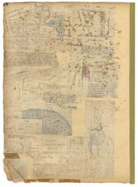
Page 108 of the City Engineer's Plat Book with five plats. Plat 1 features lots and some structures located near South Bay Street's intersections with Meeting Street and Church Street. It also shows a lot labelled "Battery Garden." Plat 2 shows lots located near East Bay Street. Plat 3 features White Point Garden, also known as Battery Park, located south of South Battery Street, near the Church Street and Meeting Street. Plat 4 shows a lot located near the intersection of Meeting Street and Broad Street. Plat 5 shows land located between Broad Road and the Ashley River, and includes labels marking salt marshes, cleared lands, a fish pond.
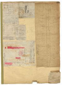
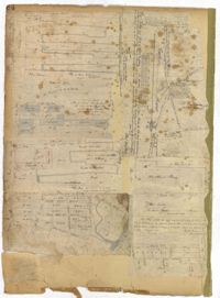
Page 109 of the City Engineer's Plat Book with six plats. Plat 1 shows lots located near the intersection of Exchange Street and Champney Street. Plat 2 shows lots and some buildings located on Church Street. Plat 3 shows lots located along Elliott Street, between East Bay and Church Street. Plat 4 shows lots and structures located near the corner of Church Street and Atlantic Street. Plat 5 shows lots and structures located near the corner of Church Street and Atlantic Street. Plat 6 shows lots and structures located near the intersection of East Bay Street and Guignard Street.
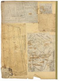
Page 183 of the City Engineer's Plat Book with five plats. Plat 1 shows lots located along Simons Street, between King Street and a stretch of marshland. Plat 2 shows lots on and near "Simmons" Street. It also shows lots near King Street and Romney Court. Plat 3 shows lots located near the intersection of King Street and Grove Street. Plat 4 shows lots and structures located near the intersection of Simons Street and King Street. Plat 5 shows lots along Simons Street, located between King Street and a stretch of marshland.
1879, 1838, 1786, 1877, 1835, 1847, 1805, and 1807
Description:
Page 72 of the City Engineer's Plat Book with eight plats. Plat 1 is labelled as a "Plan of Mazyckborough" and shows land located near the intersections of Charlotte Street with Alexander Street and Washington Street. Plat 1 also shows marshlands, streams, and the Cooper River. Plat 2 features a lot and its structures located on Henrietta Street. Plat 3 shows lots located between Concord Street and the edge of the Cooper River Channel, and also shows Wharf Street. Plat 5 shows land and buildings located on Washington Street, and includes some marshland and a stream labelled "Creek to Cooper River." Plat 6 shows a "Plan of a Part of Wraggsborough" located between Elizabeth Street and the Cooper River Channel. The plat also labels some marshlands, part of a creek, Mazyckborough, the Village of Hampstead, "The Mall," Chapel Street, and Washington Street. Plat 7 shows a lot located near the intersection of King Street and Calhoun Street, and shows several structures including a kitchen. Plat 8 shows a plan for a market located on Boundary Street, near Water Street, Front Street, and Gadsden's Canal.
Page 74 of the City Engineer's Plat Book with four plats. Plat 1 shows lots and some buildings located near Line Street, between King Street and a "Rail Road Company Road." Plat 2 shows lots located along Amherst Street, including one labelled "Cemetery of the Evangelical German Lutheran Church." Plat 3 shows land located between Washington Street and the Charleston Harbor, and includes several structures, a pond, docks, a wharf, and a canal. Plat 4 shows lots and some structures located near the intersection of Smith Street and Calhoun Street.
Page 64 of the City Engineer's Plat Book with six plats. Plat 1 features wharves near Concord Street and shows several other structures. Plat 2 shows "Dock Street or Queen Street" located towards the south, a structures and a creek near the center, and a lot labelled "Capt. Balls Lot" towards the north. Plat 2 also has a large label reading "Cooper River." Plat 3 shows lots located near Cumberland Street between Church Street and Philadelphia Street, and shows several structures on the lots. Plat 4 shows wharves and several buildings located between East Bay Street and the Cooper River. Plat 5 shows a stretch of land between King Street and a body of water, and also shows a stretch of Hasell Street. Plat 6 shows lots on Queen Street, and includes a lot labelled "St. Philips Church Yard." Plat 7 shows lots located near Queen Street, and has a label reading "St. Philips Church Yard."
The Horlbeck Daybook, 1835-1837, was kept by members of the Horlbeck building and architectural business. Included in the daybook are lists of work done for clients such as remodeling, repair, or construction. Buildings worked on include the jail, St. Stephen's Chapel, the Fire Master's Department, and the Poor House. The descriptions include types of materials used and the number of Black and White employees working. Black employees consist of enslaved and freed persons.
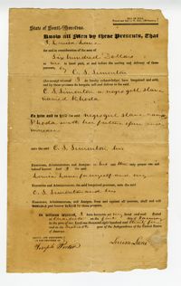
This document is a bill of sale at Charleston, South Carolina for a slave named Rhoda, referenced as "negro girl slave," sold to C.S. Simonton from Louisa Lane for $600.