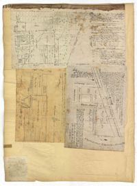
Page 130 of the City Engineer's Plat Book with three plats. Plat 1 shows lots located on a city block between Meeting Street and Scarborough Street and between Boundary Street and George Street. Plat 2 shows lots and structures located on East Bay Street. Plat 3 shows lots located on the Cooper River channel of the Charleston Harbor, near Concord Street and Wharf Street.
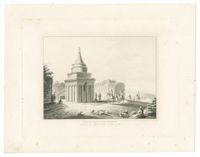
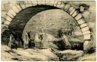
Black-and-white engraving of the Tomb of Absalom in Jerusalem. After a drawying by Luigi Mayer. From A series of twenty-four views illustrative of the Holy Scriptures, published London: R. Bowyer & M. Parkes.
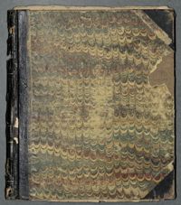
The Henry Ravenel Crop Book, 1809-1832 is a book divided into two separate sections that also includes loose notes found within the book. The first section records the names and ages of the enslaved children born on the plantation and the names of their parents. The second half of the book, which appears upside down as the book was flipped for a new section, records the weather conditions, crop farming and the tasks completed by the slaves. The loose papers record the names of the enslaved people, slaves divided and allotted to Henry, Thomas, Rene and William Ravenel, the number of male and female slaves and a note to sell a family of slaves with their names and ages.
The Henry Ravenel Account Book, 1822-1833 is a book kept by Henry Ravenel documenting the purchases of goods by enslaved people as well as accounts of various members of the Dubon and Porcher families for personal goods.
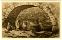
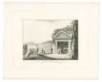
Black-and-white engraving of the Tombs of the Sanhedrin in Jerusalem. After a drawing by Luigi Mayer. From A series of twenty-four views illustrative of the Holy Scriptures, published London: R. Bowyer & M. Parkes.
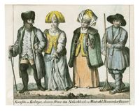
Hand-colored lithograph of a merchant from Kaluga with his wife shown in both summer and winter clothes. From Vollständige Völkergallerie in getreuen Abbildungen aller Nationen by Friedrich Wilhelm Goedsche.