Letter from George Weedon to Nathanael Greene regarding the climate of the state of Virginia, the imminent attack of Lord Cornwallis, and the campaign to raise recruitment. Weedon goes on to discuss the climate of the South, in general, the disadvantage of South Carolina, and the lack of action from North Carolina.
Letter from Thomas Farr to John Laurens regarding the situation of the British in Charlestowne; the shortage of supplies, the lack of reinforcements, and the fear of an imminent American attack on their forces on James Island. Farr goes on to request protection for the few stores of food he has left, as he has given everything to the Continental army and would not like those of his estate to starve.
Letter from Abraham Lott to Nathanael Greene regarding the failure of the ‘Rhode Island Expedition,’ led by Comte d’Estaing, and general social writing.
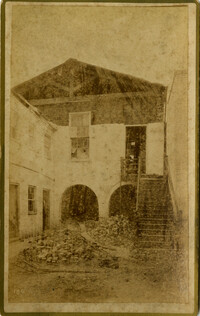
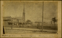
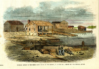
Charleston Earthquake scene. Written on front, at bottom: 'Sailor's Home, Charleston, S.C. after the Earthquake.' Sign at top of building reads: 'Charleston Port Society.'
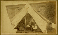
Caption: 'Cook's Earthquake Views of Charleston and Vicinity. Taken after the 31st of August, 1886. No.100, a family tent.' Image of an African-American nanny with three children.
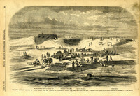
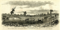
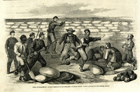
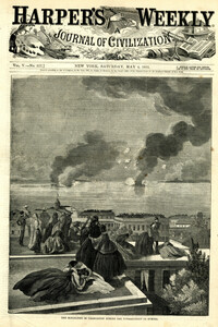
Caption: 'The new batteries erected on Morris Island for the defence of Charleston Harbor and the reduction of Fort Sumpter (sic).--from a sketch by our Special Artist in Charleston, S.C.--see page 295.' Identified with additional captions are: 1.The Iron-clad Steven's Battery on Cumming's Point. 2. Encampment on Morris Island. 3.Star of the West Battery. 4.Columbia Battery. [full date March 30, 1861.]
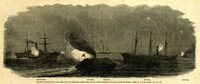
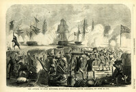
Caption: 'The War in South Carolina--the Rebel rams from Charleston Harbor attacking the Federal blockading squadron, January 31.--from a sketch by a Naval Officer.--see page 365.' Also identified in the image: Keystone State, Rebel Ram, Housatonic, Mercedita and Rebel Ram. [full date February 28, 1863.]
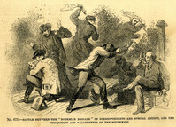
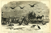
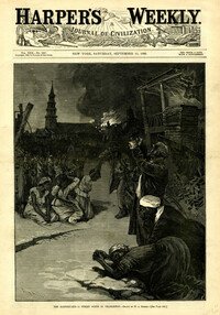
Caption: 'Southern scenes.--fight for garbage in the streets of Charleston between the scavengers (turkey-buzzards) and the Negroes.' [full date December 11, 1869.]
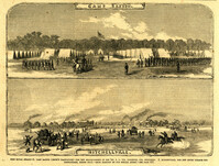
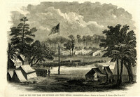
Caption: 'Port Royal Island--1. Camp Saxton (Smith's Plantation)--the new headquarters of the 1st S.C. Vol. (Colored), Col. Higginson. 2. Mitchellville, the new south village for Contrabands, Hilton Head.--from sketches by our Special Artist.--see page 317.' [full date February 7, 1863.]
Caption: 'The War in Virginia--railroad bridges over the Rappahannock, at Rappahannock Station.--from a sketch by our Special Artist, Edwin Forbes.' [full date October 31, 1863.]
Caption: 'Eastport, Mississippi, General Thomas's head-quarters, January, 1865.--sketched by Adam Rohe.--[see page 110.] [full date February 18. 1865.]
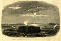
Caption: 'Terrified effects of a shell from a Rebel ram, bursting on board the U.S. gunboat Keystone State, January 31.--from a sketch by an Officer.--see page 365.' [full date February 28, 1863.]
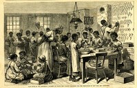
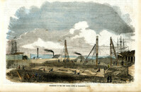
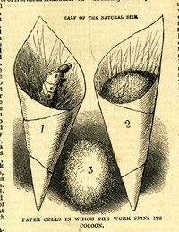
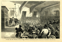
Caption: 'Main room of the Industrial Academy, in which the various processes for the production of raw silk are conducted.' [full date August 17, 1878.]
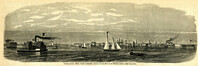
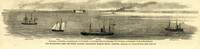
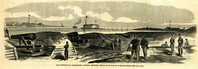
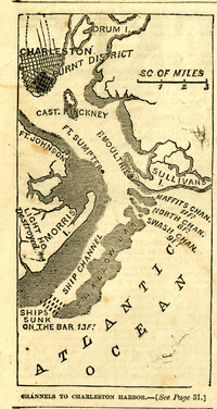
Caption: 'Our blockading fleet off North Channel, Charleston Harbor, South Carolina.--sketched by a Naval Officer.--[see page 79.] References--A. Fort Sumter.--B. Charleston City.--C. Fort Moultrie.--D. Rebel tug at work on the obstructions.--E. Obstructions.--F. Fort Johnson.--G. Mount Pleasant Batteries.' Also identified in image: South Carolina, Blunt, Daylight and Stars and Stripes (ships of the fleet). [full date January 31, 1863.]
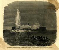
Caption: 'The siege of Charleston--attempt to blow up the "Ironsides" by a Rebel torpedo.--sketched by an occasional contributor. [see page 695.] [full date October 31, 1863.]
Caption: 'The siege of Charleston--the "Segar Steamer" which propelled the Rebel torpedo.--sketched by an occasional contributor. [see page 695.]' [full date October 31, 1863.]
Caption: 'Middle-ground Battery, Charleston, S.C.--sketched by A.P. Palmer, 21st South Carolina Volunteers.--[see page 70.]' [full date January 31, 1863.]
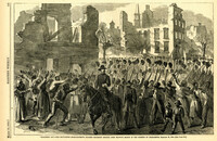
Caption: ' "Marching on!"--the Fifty-Fifth Massachusetts Colored Regiment singing John Brown's March in the streets of Charleston, February 21, 1865.--[see page 172.]' [full date March 18, 1865.]
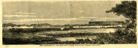
Caption: 'The Siege of Charleston--Johnsonville and Rebel fortifications.--[sketched from Black Island by Mr. Theodore R. Davis.]' [full date September 26, 1863.]
[Color image.] Main caption: 'After the Earthquake at Charleston.--drawn by W.A. Rogers and W.P. Snyder from sketches by Frederic Remington and A.J. Gustin.--[see page 610.]' Caption upper left: 'Open air preaching.' Caption upper right: 'Subsistence Committee.' Caption lower left: 'Negro prayer-meeting.' Caption lower right: 'Relief committee.' [full date September 18, 1886.]
Caption: 'Siege of Charleston--the magazine of Fort Moultrie exploded by a shell from the grounded monitor Weehawken, Sept. 8.--from a sketch by our own Special Artist, W.T. Crane.' [full date October 3, 1863.]
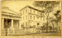
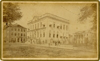
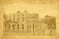
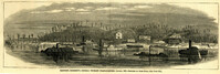
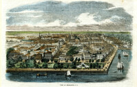
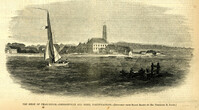
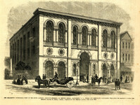
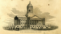
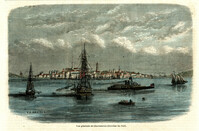
Caption: 'The Charleston Convention--view of the South Carolina Institute building, in Meeting Street, Charleston, S.C., where the Democratic Convention will hold its meeting during the present month of April.--from a sketch by our Special Artist.--see page 804.' [full date April 14, 1860.]
Caption: 'The bombardment of Fort Sumter, as seen through the "look out" in the pilot-house of one of the monitors, April 7.--from a sketch by our Special Artist.' [full date May 9, 1863]
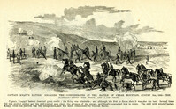
Caption: 'Captain Knapp's Battery engaging the Confederates at the Battle of Cedar Mountain, August 9th, 1862--this battery fired the first and last shot.'
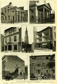
Caption: 'The Ruins Of Charleston.--photographed by W.E. Wilson, Savannah, Georgia. 1. The Guard House. 2. St. Michael's Church. 3. News and Courier Office. 4. St. Philip's Church. 5. No.27 Broad Street. 6. Hibernian Hall. 7. The Medical College.'
Caption (in German): 'Grosse Bersammlung von Seceders vor dem Stadthause in Charleston, S.C.' {Large crowd of Secessionists in front of City Hall, Charleston, S.C.}
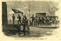
[Color image.] Caption (in French): 'Les troupes federales evacuant le fort Moultrie, apres avoir detruit le materiel de guerre.--D'apres les croquis de M.W.S. (Voir la Revuie de la semaine.)' [Federal troops evacuate Fort Moultrie, after destroying war materials.--from the sketch by M.W.S. (see the Review of the Week)].
Caption: 'Concert for the inmates of the Charity Hospital, Blackwell's Island.--drawn by C.E.H. Bonwill.--(see page 150.).' [full date February 14, 1874.]
Caption: 'Defences of Charleston--the Rebel iron-clads in Charleston Harbor.--from a sketch by A.P. Palmer, formerly of Company B, 21st Regiment (Confederate) S.C. Vol.--see page 317.' [full date February 7, 1863.]
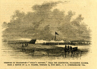
Caption: 'Defences of Charleston--"Folly's Battery," near the lighthouse, Charleston Harbor. From a sketch by A.P. Palmer, Company B, 21st Regt., S.C. (Confederate) Vol.' [full date February 7, 1863.]
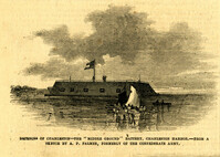
Caption: 'Defences of Charleston--the "Middle Ground" Battery, Charleston Harbor.--from a sketch by A.P. Palmer, formerly of the Confederate Army.' [full date February 7, 1863.]
Caption: 'The Siege of Charleston--the Rebels' last device in the torpedo line.--sketched by Mr. Theodore R. Davis.--[see page 603.] [full date September 19, 1863.]
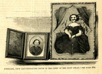
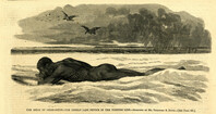
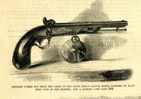
Caption: 'Articles fished out from the cabin of the sloop Spray--Naval pistol supposed to have been used in the murder, and a locket.--see page 304.' [full date April 14, 1860.]
Caption: 'Cook's Earthquake Views of Charleston and Vicinity. Taken after the 31st of August, 1886. No.66, _____ Alston, East Battery.' Charleston city directory for 1886 shows various members of the Alston family at 21 East Battery.
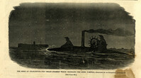
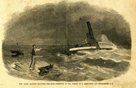
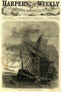
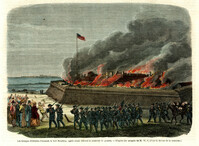
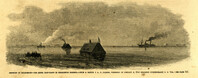
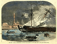
[Color image]. Caption: 'The ship "Jacob A. Wetervelt" on fire in the harbor of New York, April 11, 1860.--[see preceding page.]' [full date April 21, 1860.]
Caption: 'Charleston Earthquake. Photographs by Dr. E.P. Howland, taken on his visit to Charleston and the earthquake region of Ten Mile Hill and Summervile. Over 150 Photographs were taken. House of Mrs. Snowden, President of Confederate Home.'
Caption: 'Cook's Earthquake Views of Charleston and Vicinity. Taken after the 31st of August, 1886. No.61, Mrs. B.D. Lazarus, Hasel [sic] St.' Charleston city directory for 1886 shows Mrs. B.D. Lazarus at 64 Hassell Street.
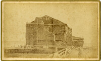
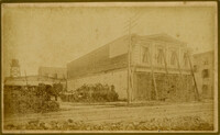
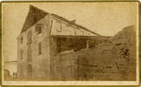
Caption: ' Cook's Earthquake Views of Charleston and Vicinity. Series No.2. No.164, Storehouse of Bennett's Mill.' Note on the catalog card show storehouse located at East end of Wentworth Street.
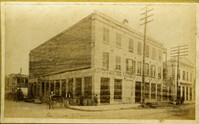
Caption: 'Cook's Earthquake Views of Charleston and Vicinity. Taken after the 31st of August, 1886. No.136, Meeting Street, cor. [of] Market.' Henry Steitz Produce is pictured. Charleston City directory for 1886 lists Henry Steitz, Fruits & Produce, at 113-115 Market Street.
Caption: 'Cook's Earthquake Views of Charleston and Vicinity. Taken after the 31st of August, 1886. No.115, Corner [of] Market and Anson Streets.' Sign on building reads: 'Ship & Family Groceries.' Written on front, at bottom: 'Charleston Earthquake view - cor. Market and Anson sts.'
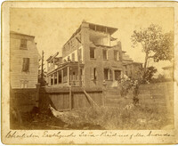
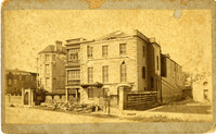
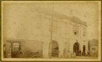
Charleston Earthquake scene. Written on reverse: 'East Battery, just below Atlantic Street. Edmonston [sic] House, later the Charles Alston residence. Now (1947) the residence of J.J. Pringle Smith. Old Holmes house on left. Earthquake of 1886 - Charleston, S.C.'
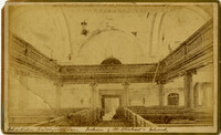
Caption: 'Cook's Earthquake Views of Charleston and Vicinity taken after the 31st of August, 1886. No.2, St. Michael's Church, Interior.' Handwritten along bottom: 'Charleston Earthquake scene - interior of St. Michael's Church.' Very similar to MK 4133.
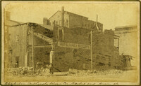
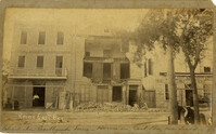
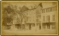
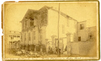
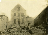
Charleston Earthquake scene. Possibly from Cook's Earthquake views, No.31, Tenement houses on East Bay. Written on front, at bottom: 'Charleston Earthquake scene - house on East Bay near Tradd.' Sign on building at left, reads: 'Ship & Family Groceries' known to be at the corner of East Bay and Queen. Sign on building at right, reads: '65' and possibly 'Sahlmann.' 1886 Charleston city directory lists L. Sahlmann, Hay & Grain, at 83 East Bay.
Caption: 'Cook's Earthquake Views of Charleston and Vicinity. Taken after the 31st of August, 1886. No.36, Court House, City Hall, and Fireproof Building.'
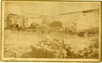
Caption: 'Cook's Earthquake Views of Charleston and Vicinity. Series No.2.' No.156, Scene near Brown's Wharf.' Charleston city directory for 1886 lists Brown's Wharf as opposite Vendue Range.
Caption: 'Cook's Earthquake Views of Charleston and Vicinity. Taken after the 31st of August, 1886. No. 55, Major R.C. Gilchrist, Bee St[reet].' Charleston city directory for 1886 shows Robert C. Gilchrist at 12 Bee Street.
Caption: 'Cook's Earthquake Views of Charleston and Vicinity. Series No.2. No.190, Kerr's Wharf. Charleston city directory for 1886 lists Kerr's Wharf as opposite Cordes.
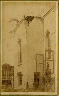
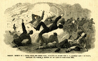
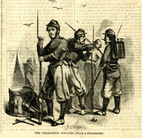
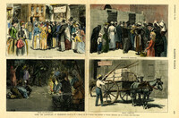
Caption: 'South Carolina.--The recent earthquakes at Charleston--typical scenes of the calamity. From sketches by C. Upham--see page 71. 1. Scene on the stairway of the Charleston Hotel during a shock. 2. Taking down St. Philip's Steeple. 3. Scene on Marion Square, opposite the Citadel--a city of tents.' [full date September 18, 1886.]


![[Elliott Street]](https://rspace.library.cofc.edu/iiif/image/50708/full/200,/0/default.jpg)