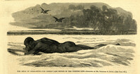
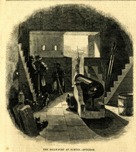
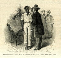
Caption: 'The Siege of Charleston--the Rebels' last device in the torpedo line.--sketched by Mr. Theodore R. Davis.--[see page 603.] [full date September 19, 1863.]
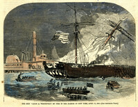
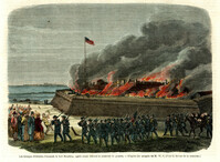
[Color image]. Caption: 'The ship "Jacob A. Wetervelt" on fire in the harbor of New York, April 11, 1860.--[see preceding page.]' [full date April 21, 1860.]
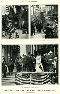
Main caption: 'The President at the Charleston Exposition. Photographs by Frederick Moore.' Caption top left: 'The President speaking in the auditorium.' Caption top right: 'Negro tea-pickers singing pickaninny songs to the President.' Caption bottom center: 'The presidential party reviewing the parade.' Further captioning identifies: 'The President, Sec. Wilson, Mayor Smythe, Mrs. Roosevelt.'
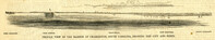
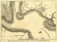
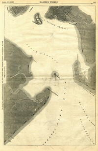
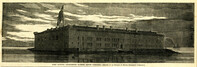
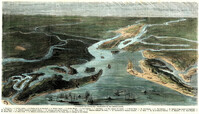
Caption: 'Profile view of the harbor of Charleston, South Carolina, showing the city and forts.' Identified in the image: Fort Johnston (sic), Fort Sumter, Charleston, Fort Moultrie and Mount Pleasant. [full date December 29, 1860.]
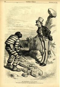
Political cartoon, caption: 'The Commandments in South Carolina. "We've pretty well smashed that; but I suppose, Massa Moses, you can get another one."' [full date September 26, 1874]
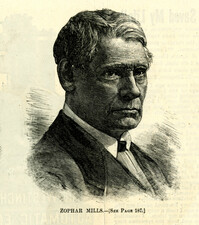
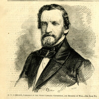
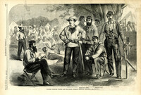
Caption: 'Colonel William Wilson and his staff (Wilson's Fighting Brigade)--[see page 311].' Identified in image: Quartermaster Bradley, Lieutenant Colonel Creighton, Adjutant James J. Hearey, Paymaster Peter Duffy, Col. William Wilson, Surgeon D.C. Pease. [full date May 18, 1861.]
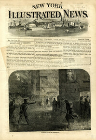
Caption: 'Firing on the "Star of the West" from the South Carolina battery on Morris Island, January 10, 1861.--[see page 54.]' [full date January 26, 1861]
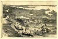
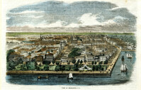
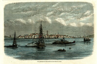
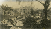
Caption: 'Birds-eye view of the city of Charleston, South Carolina, showing the approaches of our gun-boats and our army.--[see page 431.]' [full date July 5, 1862.]
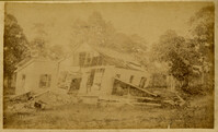
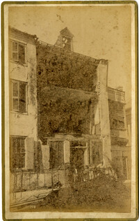
Caption: 'Cook's Earthquake Views of Charleston and Vicinity. Series No.2. No.182, Porch of Lazarus House.' Hassell Street. Charleston city directory for 1886 shows Mrs. B.D. Lazarus at 64 Hassell Street.
Caption: 'Cook's Earthquake Views of Charleston and Vicinity. Taken after the 31st of August, 1886. No.61, Mrs. B.D. Lazarus, Hasel [sic] St.' Charleston city directory for 1886 shows Mrs. B.D. Lazarus at 64 Hassell Street.
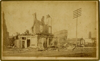
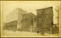
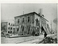
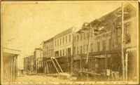
Caption: 'Cook's Earthquake Views of Charleston and Vicinity. Taken after the 31st of August, 1886. No.27, Hayne Street - ruins of three large buildings.' Sign on column at left reads: 'Charleston Bag Factory.' Charleston city directory for 1886 shows a bag factory at 15-19 Hayne Street.
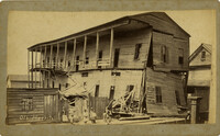
Charleston Earthquake scene. Written on front, at bottom: 'Sailor's Home, Charleston, S.C. after the Earthquake.' Sign at top of building reads: 'Charleston Port Society.'
Charleston Earthquake scene. Labeled 'Old Hospital' in lower left corner, with 'Trapman Street' handwritten at bottom, front. Additional note on reverse: 'See Cook No.189 [from Series 2, which is captioned as 'Ruins of Colored hospital.']
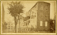
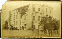
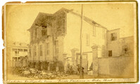
Caption: 'Cook's Earthquake Views of Charleston and Vicinity. Taken after the 31st of August, 1886. No.4, Roper Hospital.' Shows Roper Hospital when at Queen Street location.
Caption: 'Cook's Earthquake Views of Charleston and Vicinity. Taken after the 31st of August, 1886. No.70, E.B. Hume, Legare Street.' Charleston city directory for 1886 shows Errington B. Hume at 17 Legare Street.
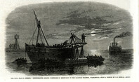
Caption: 'The Civil War in America: Confederates sinking torpedoes by moonlight in the harbour channel, Charleston.--from a sketch by our Special Artist.' [full date May 16, 1863.]
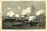
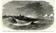
Caption: 'The Civil War in America: the Federal ironclad Keokuk as she appeared on the morning after the fight.--from a sketch by our Special Artist.--see page 542.' [full date May 16. 1863.]
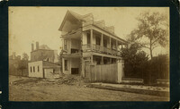
Caption: 'Cook's Earthquake Views of Charleston and Vicinity. Taken after the 31st of August, 1886. No.114, residence Col. Inglesby.' Charleston city directory for 1886 shows Charles Inglesby at 20 Meeting Street.
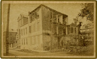
Caption: 'Cook's Earthquake Views of Charleston and Vicinity. Taken after the 31st of August, 1886. No.60, J.M. Wilson, Meeting St.' Charleston city directory for 1886 shows James M. Wilson at 39 Meeting Street.
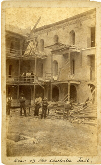
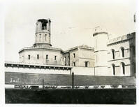
Caption: 'Charleston Earthquake. Photographs by Dr. E.P. Howland, taken on his visit to Charleston and the earthquake region of Ten Mile Hill and Summerville. Over 150 Photographs were taken. Charleston Jail and cracked wall, unsafe and condemned.'
Caption: 'Cook's Earthquake Views of Charleston and Vicinity. Taken after the 31st of August, 1886. No.78, Residence Wm. Johnson, Wentworth Street.' Charleston city directory for 1886 shows a William Johnson at 107 Wentworth Street.
[Color image.] Caption (in French): 'Evenements des Etats-Unis: Charleston et ses fortifications. [Events of the United States: Charleston and its fortifications.] 1--Charleston. 2--Riviere Ashley [Ashley River]. 3--Chemin de fer de Savannah [Savannah Railway]. 4--Riviere Cooper [Cooper River]. 5--Riviere Wando [Wando River]. 6--Fort Pinkney [Castle Pinckney]. 7--Fort Ripley. 8--Fort Johnson (ile James) [James Island]. 9--Riviere Stone [Stono River]. 10--Fort Sumter. 11--Fort Moultrie. 12--Batterie Gregg (pointe de Gumming) [Battery Gregg (Cummings Point)]. 13--Fort Wagner. 14--Batteries rasantes du general Gilmore [grazed batteries of General Gilmore]. 15--Ouvrages pris par les federaux. [Works undertaken by the Federals]. 16--Phare Inlet [Lighthouse inlet]. 17--Batteries federales (ile Folly) [Federal Batteries (Folly Island)]. 18--Canonnieres et vaisseaux cuirasses [gunboats and ironclads]. 19--Hotel. 20--Ile et batteries Sullivan [Sullivan Island and Batteries]. 21--Moultrie. 22--Mont Pleasant [Mount Pleasant]. 23--Breach Inlet. 24--Shem Creek. 25--Batteries construite par les confederes sur l'ile James, dans le voisinage du fort Johnson [Batteries built by the Confederates on James Island, in the vicinity of Fort Johnson].
[Color image.] Caption (in French): 'Les troupes federales evacuant le fort Moultrie, apres avoir detruit le materiel de guerre.--D'apres les croquis de M.W.S. (Voir la Revuie de la semaine.)' [Federal troops evacuate Fort Moultrie, after destroying war materials.--from the sketch by M.W.S. (see the Review of the Week)].
Charleston Earthquake scene. Possibly from Cook's Earthquake Views. No.68, John Kenney, Tradd Street. Charleston city directory for 1886 shows listing for John B. Kenney at 142 Tradd.
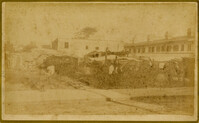
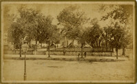
Caption: 'Cook's Earthquake Views of Charleston and Vicinity. Series No.2. No.190, Kerr's Wharf. Charleston city directory for 1886 lists Kerr's Wharf as opposite Cordes.
Caption: 'Cook's Earthquake Views of Charleston and Vicinity. Taken after the 31st of August, 1886. No.93, No.11 King Street.' Written on front, at bottom: 'Charleston Earthquake scene - Private residence on King St. near South Battery.'
Caption: 'Cook's Earthquake Views of Charleston and Vicinity. Series No.2. No.187, residence of Mr. A. Lengnick.' Charleston city directory for 1886 shows Albert Lengnick at 11 Pitt Street.
Caption: 'Cook's Earthquake Views of Charleston and Vicinity. Taken after the 31st of August, 1886. No.149, Robb's Lot.' Handwritten on reverse: ' Robb's Lot E. side [of] King bet[ween] Market & Horlbeck.'
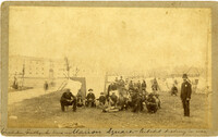
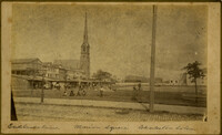
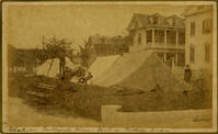
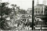
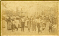
Handwritten at bottom, front: 'Charleston Earthquake scene - Marion Square - Citadel Academy in rear.' Tent village populated primarily by African-Americans. Policeman standing to the right.
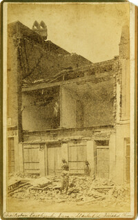
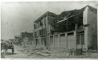
Caption: 'Cook's Earthquake Views of Charleston and Vicinity. Taken after the 31st of August, 1886. No.136, Meeting Street, cor. [of] Market.' Henry Steitz Produce is pictured. Charleston City directory for 1886 lists Henry Steitz, Fruits & Produce, at 113-115 Market Street.
Caption: 'Cook's Earthquake Views of Charleston and Vicinity. Taken after the 31st of August, 1886. No.115, Corner [of] Market and Anson Streets.' Sign on building reads: 'Ship & Family Groceries.' Written on front, at bottom: 'Charleston Earthquake view - cor. Market and Anson sts.'
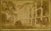
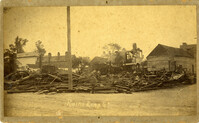
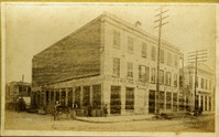
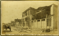
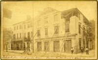
Caption: 'Cook's Earthquake Views of Charleston and Vicinity. Taken after the 31st of August, 1886. No.24, Market Street, north side.' Charleston Port Society building is pictured. Written on front, at bottom: 'View on Market St. at Charleston, S.C. after the Earthquake.'
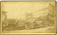
Charleston Earthquake scene. Copy of No.24 of Cook's Earthquake views. Shows damage to the buildings on the north side of Market Street, including the Sailor's Home.
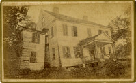
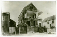
Caption: 'Cook's Earthquake Views of Charleston and Vicinity. Taken after the 31st of August, 1886. No.59, Pringle Smith, Meeting Street.' Written on front, at bottom: 'Earthquake scene Charleston, So.Ca.'
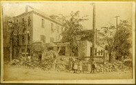
Caption: 'Cook's Earthquake Views of Charleston and Vicinity. Taken after the 31st of August, 1886. No.25, Vendue Range.' Written on front, at bottom: 'Charleston Earthquake scene - Vendue Range, foot of Queen St. near the wharf.' Sign for John Werner visible. Charleston city directory for 1886 shows business at 27 Vendue Range.
Caption: 'Cook's Earthquake Views of Charleston and Vicinity. Taken after the 31st of August, 1886. No.86, tents, Rutledge St[reet] Terrace.' Handwritten at bottom, front: 'Charleston Earthquake views - tents on Rutledge Terrace.'
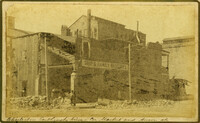
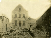
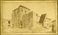
Caption: 'Cook's Earthquake Views of Charleston and Vicinity. Taken after the 31st of August, 1886. No.135, Corner State and Chalmers Streets.' Written on front, at bottom: 'Charleston Earthquake views - ruins cor[ner] Chalmers & State Str.'
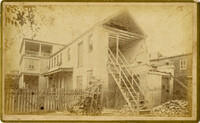
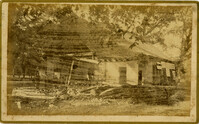
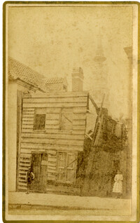
Charleston Earthquake Scene. Possibly from Cook's Earthquake Views, No.56, Alderman Murray's residence, Wentworth Street.' Charleston city directory for 1886 shows Andrew B. Murray at 175 Wentworth.