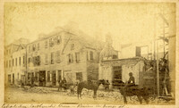
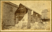
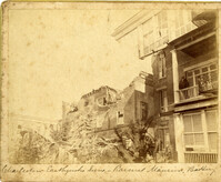
Caption: 'Cook's Earthquake Views of Charleston and Vicinity. Taken after the 31st of August, 1886. No.116, wreck in George Street.' Written on front, at bottom: 'Charleston Earthquake view - Ruins in George St.'
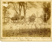
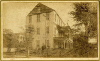
Caption: 'Charleston Earthquake. Photographs by Dr. E.P. Howland, taken on his visit to Charleston and the earthquake region of Ten Mile Hill and Summerville. Over 150 photographs were taken. Orphans and tents in which they lived.' Written on front, at bottom: 'Charleston Earthquake scene - orphans, standing the yard of the Orphan House.'
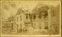
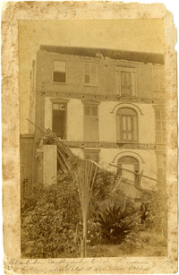
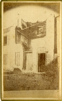
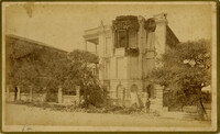
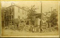
Written on reverse: 'House in which young Mr. Robson was killed. Two young ladies were buried in the ruins were rescued. Coming near Cannon.' Possibly from Cook's Earthquake Views, No.132, residence of J.N. Robson, from west. Written on front, at bottom: 'Charleston Earthquake view. Residence of Mr. J.N. Robson, whose eldest son was killed.' Charleston city directory for 1886 shows James N. Robson at 200 Coming Street.
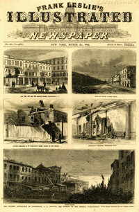
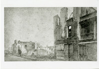
Main caption: 'The present appearance of Charleston, S.C., showing the effects of the Federal bombardment.--from recent sketches by our special artist.' Caption top left: 'Nos.165, 167 and 169 Meeting Street, Charleston, S.C.' Caption top right: 'East Bay Street, looking south.' Caption middle left: 'Kitchen attached to 53 Wentworth Street--effect of two shells.' Caption middle right: 'Gentleman's ordinary, Charleston Hotel.' Caption bottom: 'Vendue Range.' [full date March 25, 1865.]
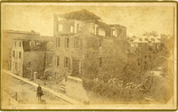
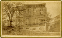
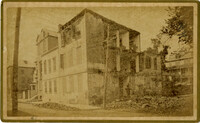
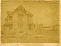
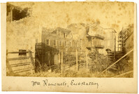
Charleston Earthquake scene. Possibly from Cook's Earthquake Views, no.63. William Ravenel, East Battery, rear. Written on front, at bottom: 'Wm Ravenel's, East Battery.'