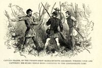
Caption: 'Folley's (sic) Battery, near the lighthouse, at Charleston, South Carolina.--from a sketch by A.P. Palmer, 21st South Carolina Volunteers.--[see page 79.]' [full date January 31, 1863.]
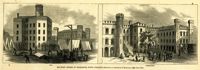
Caption: 'Military Prisons at Charleston, South Carolina.--Sketched by Lieutenant F. Milward--[See Page 110]' the Jail and Work-House are both identified. [full date February 18, 1865.]
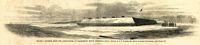
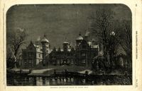
Caption (in German): 'Die im Ban [Bau] begriffene schwimmende Batterie in Charleston, S.C.' [The nascent Floating Battery in Charleston, S.C.] [full date February 16, 1861.]
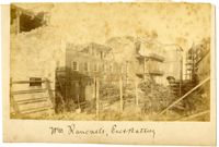
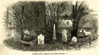
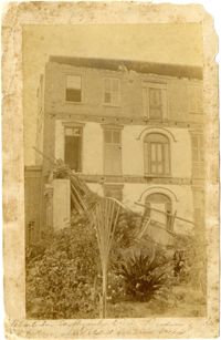
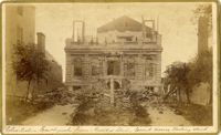
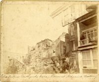
Charleston Earthquake scene. Possibly from Cook's Earthquake Views, no.63. William Ravenel, East Battery, rear. Written on front, at bottom: 'Wm Ravenel's, East Battery.'
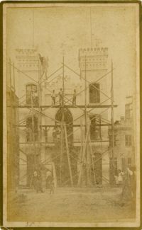
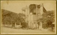
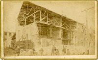
Caption: 'Cook's Earthquake Views of Charleston and Vicinity. Taken after the 31st of August, 1886. No.129, College as torn down.' Handwritten at bottom, front: 'Charleston Earthquake views - Charleston College. Both wings gone.'
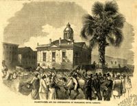
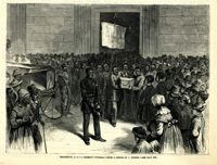
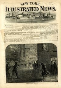
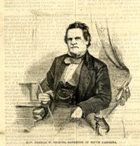
Caption: 'Scene on the arrival of Lieutenant Hall, U.S.A., with despatches (sic) from Major Anderson for Governor Pickens, at the Executive Mansion, Charleston, S.C., immediately after the firing on the Star of the West.--from a sketch by our Special Artist.--see page 151.' [full date January 26, 1861.]
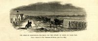
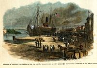
Caption: 'Departure of the Great Southern Expedition from Beaufort, North Carolina.--sketched by an amateur.--[see page 119.]' [full date February 21, 1863.]
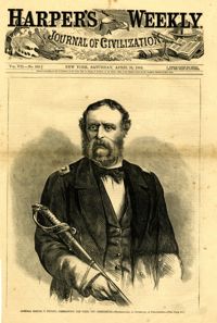
Caption: 'Admiral Samuel F. DuPont, Commanding the fleet off Charleston--photographed by Gutekurst, of Philadelphia.--see page 270.' [Full date April 25, 1863]
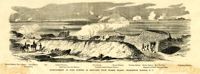
Caption: 'Bombardment of Fort Sumter, as sketched from Morris Island, Charleston Harbor, S.C.' Identified in image: Mortar Battery, Fort Johnson; James Island; City; Castle Pinckney; Fort Sumter; Mount Pleasant; Floating Battery; Mortar Battery; Fort Moultrie; Enfilading Battery; Iron Battery; Sand-bag cover for reserve; Traverse behind Trapier Battery and Magazine covered with sand bags.
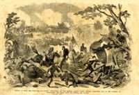
Caption: 'Battle of Bull Run, July 21st, 1861--Grand "Skedaddle" of the Federal troops under General McDowell, and of the citizens of Washington who came down to witness the battle.'
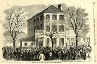
Caption: 'The Old Flag again on Sumter--raised (on a temporary staff formed of an oar and boathook) by Captain H.M. Bragg, of General Gillmore's staff, February 18th, 1865.'
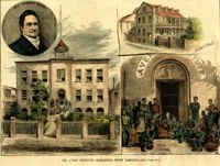
[Color image.] Caption: 'The Avery Institute, Charleston, South Carolina.--[see page 867.]' Also identified in image: Rev. Charles Avery and Teachers' Home.
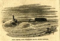
Caption: 'The night guard of boats on Charleston Bar during the first of the bombardment of Fort Sumpter (sic), to prevent reinforcements being sent to Major Anderson, April 12th, 1861.--from a sketch by our artist on Morris Island.'
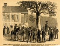
Caption: 'View of Darlington Court-House and the Sycamore-Tree where Amy Spain, the Negro slave, was hung by the citizens of Darlington, South Carolina.--[Sketched by N.N. Edwards.]' [full date September 30, 1865.]
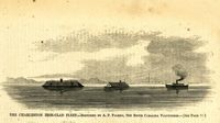
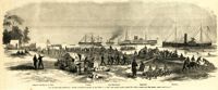
Caption: 'The advance upon Charleston--pioneer movement--landing of the 100th N.Y. Vols. upon Cole's Island, March 28.--from a sketch by our Special Artist.--see page 6.' Also identified with labels: Camp of 100th N.Y. Vols., Pawnee, Com. McDonough, Expounder and Belvidere. [full date April 25, 1863.]
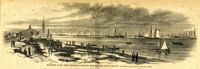
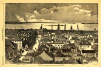
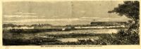
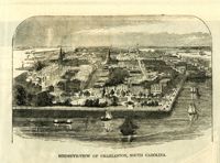
Caption: 'The city of Charleston, South Carolina.--[see page 62.]' Also identified in image: Broad Street, "Mercury" office, Custom-house, Castle Pinckney, Fort Moultrie, Fort Sumter and Morris Island. [full date January 26, 1861.]
Caption: 'The Siege of Charleston--attack on Battery Gregg, September 5, 1863.--from a sketch by Mr. Theodore R. Davis. [See page 629.]' [full date October 3, 1863.]
Caption: 'The Siege of Charleston--the boats for the attack of Gregg on their way. From a sketch by Mr. Theodore R. Davis.--[see page 629.]' [full date October 3, 1863.]
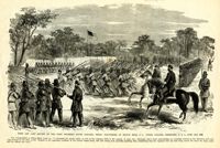
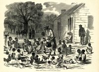
Caption: 'First and last review of the First Regiment, South Carolina Negro Volunteers, on Hilton Head, S.C., under Colonel Fessenden, U.S.A., June 25th, 1862.'
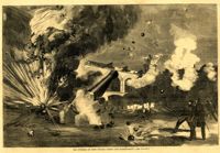
Caption: 'Siege of Charleston--the magazine of Fort Moultrie exploded by a shell from the grounded monitor Weehawken, Sept. 8.--from a sketch by our own Special Artist, W.T. Crane.' [full date October 3, 1863.]
[Color image.] Caption: 'Unloading a transport with ambulances for the Army, at Wilmington, N.C.--View looking up Water Street.--sketched by our Special Artist.' [full date April 15, 1865.]
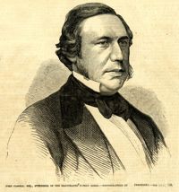
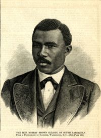
Caption: 'The Hon. Robert Brown Elliott, of South Carolina. From a photograph by Gardner, Washington, D.C.--see page 150.' [full date February 14,1874.]
Caption: 'Cook's Earthquake Views of Charleston and Vicinity. Taken after the 31st of August, 1886. No.70, E.B. Hume, Legare Street.' Charleston city directory for 1886 shows Errington B. Hume at 17 Legare Street.
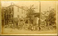
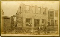
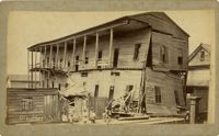
Written on reverse: 'House in which young Mr. Robson was killed. Two young ladies were buried in the ruins were rescued. Coming near Cannon.' Possibly from Cook's Earthquake Views, No.132, residence of J.N. Robson, from west. Written on front, at bottom: 'Charleston Earthquake view. Residence of Mr. J.N. Robson, whose eldest son was killed.' Charleston city directory for 1886 shows James N. Robson at 200 Coming Street.
Caption: 'Cook's Earthquake Views of Charleston and Vicinity. Taken after the 31st of August, 1886. No.149, Robb's Lot.' Handwritten on reverse: ' Robb's Lot E. side [of] King bet[ween] Market & Horlbeck.'
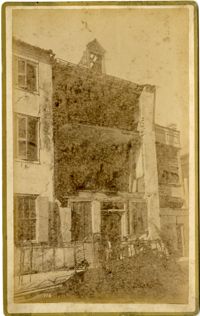
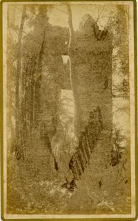
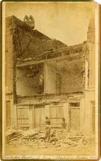
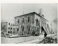
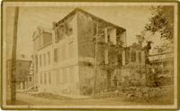
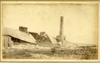
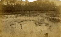
Charleston Earthquake scene. Labeled 'Old Hospital' in lower left corner, with 'Trapman Street' handwritten at bottom, front. Additional note on reverse: 'See Cook No.189 [from Series 2, which is captioned as 'Ruins of Colored hospital.']
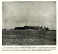
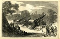
Caption: 'The Siege of Charleston--the new Black Island Batteries, four and a half miles from Charleston.--sketches by Mr. Theodore R. Davis.--[see page 651.]' [full date October 10, 1863.]
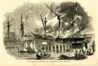
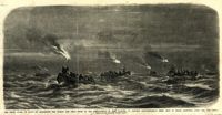
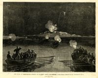
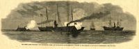
Caption: 'The Rebel rams engaging our blockading fleet off Charleston, South Carolina, January 31, 1863.--sketched by an occasional correspondent.--[see page 127.]' [full date January 21, 1863.]
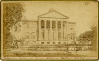
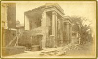
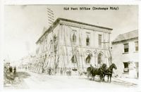
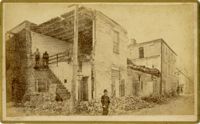
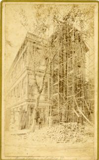
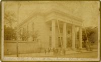
Caption: 'Cook's Earthquake Views of Charleston and Vicinity. Taken after the 31st of August, 1886. No.8, U.S. Court House.' Written on bottom, at front: 'Charleston Earthquake scene - United States Court House, Meeting Street.'
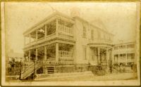
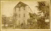
Caption: 'Cook's Earthquake Views of Charleston and Vicinity. Taken after the 31st of August, 1886. No.91, Brawley House, Legare Street.' Charleston city directory for 1886 shows Wm. H. Brawley at 9 Legare Street.
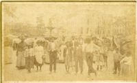
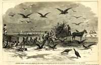
Caption: 'Southern scenes.--fight for garbage in the streets of Charleston between the scavengers (turkey-buzzards) and the Negroes.' [full date December 11, 1869.]
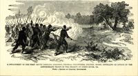
Caption: 'A detachment of the First South Carolina (Colored) Federal Volunteers, Colonel Beard, repelling an attack of the Confederate troops in the vicinity of Doboy River, Ga. From a sketch by Colonel Brewerton.'
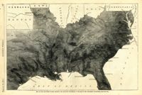
Caption: 'Map of the Southern states, showing the relative proportion of slaves in the different localities.--[see page 142.]' [full date February 28, 1863.]
Caption: 'Cook's Earthquake Views of Charleston and Vicinity. Taken after the 31st of August, 1886. No.125, Scene near Atlantic Wharf.' Charleston city directory for 1886 lists Atlantic Wharf at the rear of the Post Office.
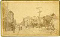
Caption: 'Cook's Earthquake Views of Charleston and Vicinity. Taken after the 31st of August, 1886. No.82, East Bay Street.' Sign for Jas [James] Ackermann at 114 East Bay is visible.
Caption: 'Cook's Earthquake Views of Charleston and Vicinity. Taken after the 31st of August, 1886. No.99, Rear of Scotch Church.' Handwritten at bottom, front: 'Charleston Earthquake scene - Rear of First Presbyterian Church.'
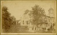
Caption: 'Cook's Earthquake Views of Charleston and Vicinity. Taken after the 31st of August, 1886. No.99, Rear of Scotch Church.' First (Scots) Presbyterian Church on Meeting Street.
Caption: 'Cook's Earthquake Views of Charleston and Vicinity. Series No.2. No.170, Buist residence, Rutledge Street.' Written on front, at bottom: Buist Residence, 43 Rutledge St.' Charleston city directory for 1886 shows listing for Samuel S. Buist at 43 Rutledge Avenue.
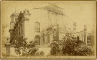
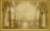
Caption: 'Cook's Earthquake Views of Charleston and Vicinity. Taken after the 31st of August, 1886. No.79, St. Mary's Church. [And handwritten] Hasell Street.'