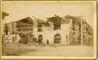
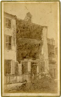
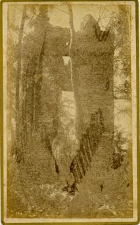
Caption: 'Cook's Earthquake Views of Charleston and Vicinity. Series No.2. No.159, Storehouses Adger's Wharf.' Charleston city directory for 1886 lists Adger's Wharf as opposite Tradd Street on East Bay.
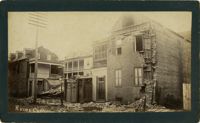
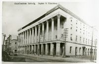
Charleston Earthquake scene. Possibly a copy of No.11 of Cook's Earthquake Views. Shows damage to the Charleston Hotel, demolished in 1960, which stood at 200 Meeting Street. 'Charleston Hotel, Hayne & Pinckney' is typewritten onto the image. Hayne and Pinckney Streets were two of the boundary streets that surrounded the hotel.
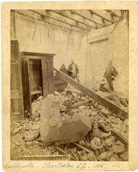
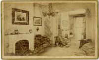
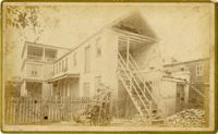
Charleston Earthquake scene. Sign at bottom of image: 'Mr. August Melm's room, 21 King Street.' Also, written on front, at bottom: 'Earthquake - Charleston S.C. 1886.' Charleston city directory for 1886 lists August Melm, a local attorney, as boarding at 21 King Street.
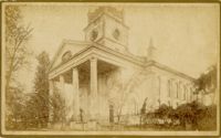
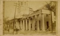
Caption: 'Cook's Earthquake Views of Charleston and Vicinity. Taken after the 31st of August, 1886. No. 17, St. Paul's Church.' St. Luke and St. Paul's Episcopal Cathedral, Coming Street.
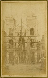
Caption: 'Cook's Earthquake Views of Charleston and Vicinity. Taken after the 31st of August, 1886. No.76, First Baptist Church, front.' Handwritten at bottom, front: 'Charleston Earthquake scene - First Baptist Church, Church Street.'
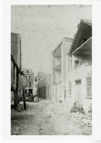
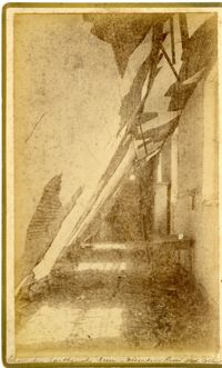
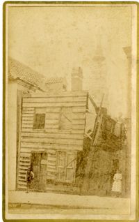
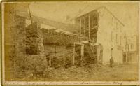
Charleston Earthquake scene. Possibly from Cook's Earthquake views, No.157, scene near Accomodation Wharf. Written on front, at bottom: 'Charleston Earthquake Scene - ruins on Accomodation Wharf.' Charleston city directory for 1886 lists Accomodation Wharf as opposite 176 East Bay Street.
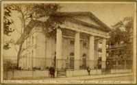
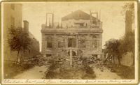
Caption: 'Cook's Earthquake Views of Charleston and Vicinity. Taken after the 31st of August, 1886. No.8, U.S. Court House.' Written on bottom, at front: 'Charleston Earthquake scene - United States Court House, Meeting Street.'