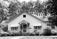
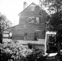
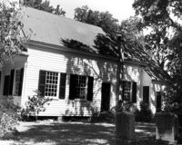
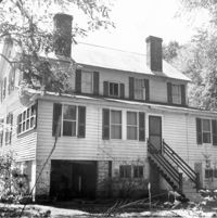
Unidentified House (ca. 20th century) - Non-contributory to Historic District. View of Side and Front elevation. McClellanville Historic District. McClellanville, S.C.;6.5" x 10" B/W photo. Box 14, Folder 2-10-5. Three copies.
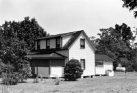
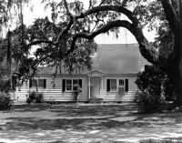
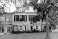
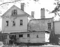
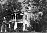
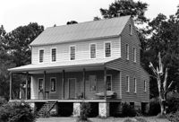
Wedge Plantation (William Lucas House), Wedge Plantation Road. Main House - View of Rear elevation. McClellanville, S.C.;8" x 10" B/W photo. Box 15, Folder 2-10-6. One copy.
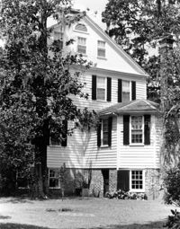
Wedge Plantation (William Lucas House), Wedge Plantation Road. Main House - View of Front addition. McClellanville, S.C.;10" x 8" B/W photo. Box 15, Folder 2-10-6. One copy.
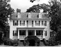
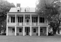
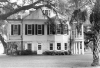
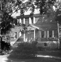
Wedge Plantation (William Lucas House), Wedge Plantation Road. Main House - View of Front elevation. McClellanville, S.C.;8" x 10" B/W photo. Box 15, Folder 2-10-6. One copy.
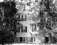
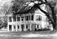
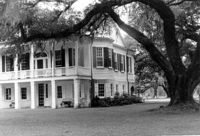
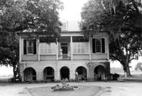
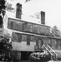
Wedge Plantation (William Lucas House), Wedge Plantation Road. Main House - View of Side elevation. McClellanville, S.C.;8" x 10" B/W photo. Box 15, Folder 2-10-6. One copy.
Wedge Plantation (William Lucas House), Wedge Plantation Road. Main House - View of Side elevation. McClellanville, S.C.;10" x 8" B/W photo. Box 15, Folder 2-10-6. One copy.
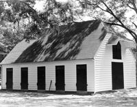
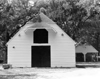
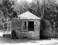
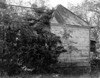
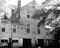
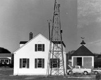
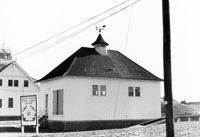
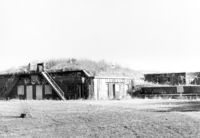
Wedge Plantation (William Lucas House), Wedge Plantation Road. Outbuilding #1 - View of Side and Front elevation. McClellanville, S.C.;8" x 10" B/W photo. Box 15, Folder 2-10-6. One copy.
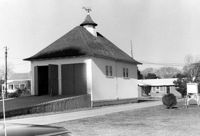
Wedge Plantation (William Lucas House), Wedge Plantation Road. Outbuilding #2 - View of Rear and Side elevation. McClellanville, S.C.;8" x 10" B/W photo. Box 15, Folder 2-10-6. One copy.
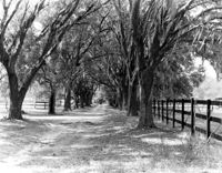
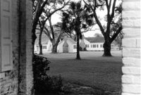
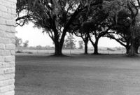
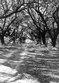
Wedge Plantation (William Lucas House), Wedge Plantation Road. View of Oak Allee. McClellanville, S.C.;8" x 10" B/W photo. Box 15, Folder 2-10-6. One copy.
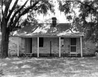
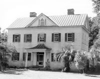
The Grove Plantation (Ernest F. Hollings ACE Basin National Wildlife Refuge). View of South (Front) elevation. Adams Run, S.C.;6.5" x 10" B/W photo. Box 15, Folder 2-11-1. One copy.
The Grove Plantation (Ernest F. Hollings ACE Basin National Wildlife Refuge). View of South (Front) elevation. Adams Run, S.C.;6.5" x 10" B/W photo. Box 15, Folder 2-11-1. Three copies.
The Grove Plantation (Ernest F. Hollings ACE Basin National Wildlife Refuge). View of SE (Front and Side) elevation. Adams Run, S.C.;6.5" x 10" (and 8" x 10") B/W photo. Box 15, Folder 2-11-1. Two copies.
The Grove Plantation (Ernest F. Hollings ACE Basin National Wildlife Refuge). View of SE (Front and Side) elevation. Adams Run, S.C.;6.5" x 10" B/W photo. Box 15, Folder 2-11-1. Three copies.
The Grove Plantation (Ernest F. Hollings ACE Basin National Wildlife Refuge). View of East (Side) elevation. Adams Run, S.C.;6.5" x 10" B/W photo. Box 15, Folder 2-11-1. One copy.
The Grove Plantation (Ernest F. Hollings ACE Basin National Wildlife Refuge). View of West (Side) elevation. Adams Run, S.C.;6.5" x 10" B/W photo. Box 15, Folder 2-11-1. One copy.
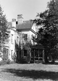
The Grove Plantation (Ernest F. Hollings ACE Basin National Wildlife Refuge). View of the North (Rear) elevation. Adams Run, S.C.;6.5" x 10" B/W photo. Box 15, Folder 2-11-1. One copy.
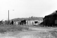
The Grove Plantation (Ernest F. Hollings ACE Basin National Wildlife Refuge). View of Outbuildings. Adams Run, S.C.;6.5" x 10" B/W photo. Box 15, Folder 2-11-1. One copy.
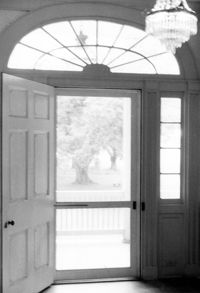
The Grove Plantation (Ernest F. Hollings ACE Basin National Wildlife Refuge). Interior View - 2nd Floor. Detail of Front Door. Adams Run, S.C.;10" x 6.5" B/W photo. Box 15, Folder 2-11-1. One copy.
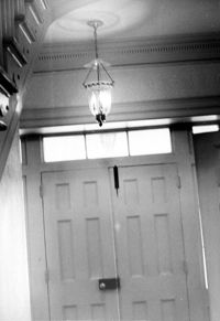
The Grove Plantation (Ernest F. Hollings ACE Basin National Wildlife Refuge). Interior View - 1st Floor. Detail of Front Door. Adams Run, S.C.;10" x 6.5" B/W photo. Box 15, Folder 2-11-1. One copy.
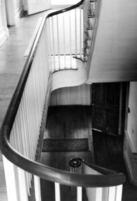
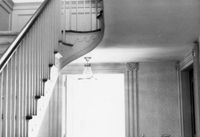
The Grove Plantation (Ernest F. Hollings ACE Basin National Wildlife Refuge). Interior View - 1st Floor. Detail of Stairwell. Adams Run, S.C.;10" x 6.5" B/W photo. Box 15, Folder 2-11-1. One copy.
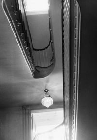
The Grove Plantation (Ernest F. Hollings ACE Basin National Wildlife Refuge). Interior View - 2nd Floor. Detail of Stairwell. Adams Run, S.C.;10" x 6.5" B/W photo. Box 15, Folder 2-11-1. Four copies.
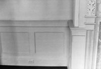
The Grove Plantation (Ernest F. Hollings ACE Basin National Wildlife Refuge). Interior View - 2nd Floor. Detail of Front Room Wainscot. Adams Run, S.C.;6.5" x 10" B/W photo. Box 15, Folder 2-11-1. One copy.
The Grove Plantation (Ernest F. Hollings ACE Basin National Wildlife Refuge). Interior View - 1st Floor. Detail of Stairs and Back Door. Adams Run, S.C.;6.5" x 10" B/W photo. Box 15, Folder 2-11-1. One copy.
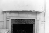
The Grove Plantation (Ernest F. Hollings ACE Basin National Wildlife Refuge). Interior View - 2nd Floor. Detail of Mantle in West Rear Room. Adams Run, S.C.;6.5" x 10" B/W photo. Box 15, Folder 2-11-1. One copy.
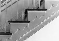
The Grove Plantation (Ernest F. Hollings ACE Basin National Wildlife Refuge). Interior View - 2nd Floor. Detail of Staircase trim. Adams Run, S.C.;6.5" x 10" B/W photo. Box 15, Folder 2-11-1. One copy.
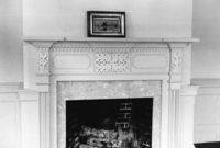
The Grove Plantation (Ernest F. Hollings ACE Basin National Wildlife Refuge). Interior View - 2nd Floor. Detail of Mantle in Front Room. Adams Run, S.C.;6.5" x 10" B/W photo. Box 15, Folder 2-11-1. One copy.
The Grove Plantation (Ernest F. Hollings ACE Basin National Wildlife Refuge). Interior View - 2nd Floor. Detail of Cornice in Front Room. Adams Run, S.C.;6.5" x 10" B/W photo. Box 15, Folder 2-11-1. One copy.
The Grove Plantation (Ernest F. Hollings ACE Basin National Wildlife Refuge). View of Property. Adams Run, S.C.;6.5" x 10" B/W photo. Box 15, Folder 2-11-1. Two copies.
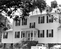
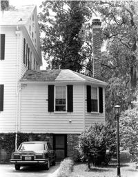
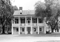
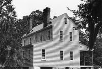
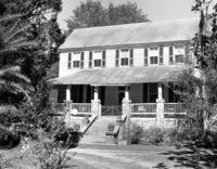
Barnwell House (Prospect Hill Plantation), Sugar Hill Road. View of South (Front) elevation. Hollywood, S.C.;8" x 10" B/W photo. Box 16, Folder 2-11-5. One copy.
Barnwell House (Prospect Hill Plantation), Sugar Hill Road. View of NW (Side and Rear) elevation. Hollywood, S.C.;10" x 8" B/W photo. Box 16, Folder 2-11-5. One copy.
Barnwell House (Prospect Hill Plantation), Sugar Hill Road. View of East (Side) elevation. Hollywood, S.C.;8" x 10" B/W photo. Box 16, Folder 2-11-5. One copy.
Barnwell House (Prospect Hill Plantation), Sugar Hill Road. View of NW (Rear and Side) elevation. Hollywood, S.C.;8" x 10" B/W photo. Box 16, Folder 2-11-5. One copy.
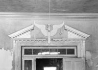
Barnwell House (Prospect Hill Plantation), Sugar Hill Road. Interior View - Detail of Architrave. Hollywood, S.C.;8" x 10" B/W photo. Box 16, Folder 2-11-5. One copy.
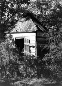
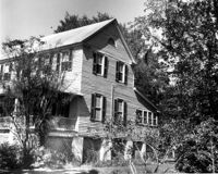
Barnwell House (Prospect Hill Plantation), Sugar Hill Road. Outbuilding - View of Side elevation. Hollywood, S.C.;10" x 8" B/W photo. Box 16, Folder 2-11-5. One copy.
Barnwell House (Prospect Hill Plantation), Sugar Hill Road. Outbuilding - View of Side elevation. Hollywood, S.C.;8" x 10" B/W photo. Box 16, Folder 2-11-5. One copy.
Barnwell House (Prospect Hill Plantation), Sugar Hill Road. Outbuilding - View of Side elevation. Hollywood, S.C.;10" x 8" B/W photo. Box 16, Folder 2-11-5. One copy.
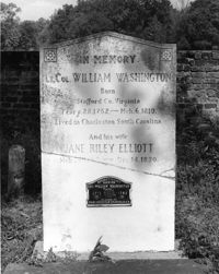
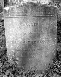
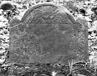
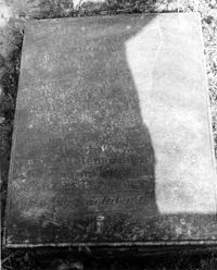
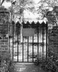
Colonel William Washington Cemetery. Tombstone of Colonel William Washington (1810) and Jane Riley Elliott - View of Front. Ravenel, S.C.;10" x 8" B/W photo. Box 16, Folder 2-11-11. Two copies.
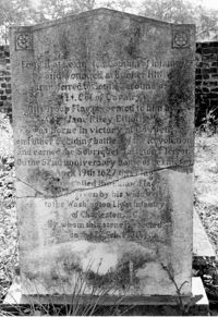
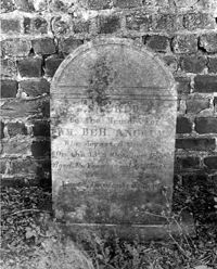
Colonel William Washington Cemetery. Tombstone of Colonel William Washington (1810) and Jane Riley Elliott - View of Rear. Ravenel, S.C.;10" x 6.5" B/W photo. Box 16, Folder 2-11-11. Two copies.
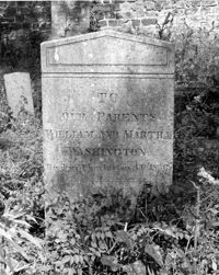
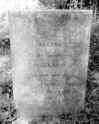
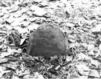
Colonel William Washington Cemetery. Tombstone of William and Martha Washington (1830). Ravenel, S.C.;10" x 8" B/W photo. Box 16, Folder 2-11-11. One copy.
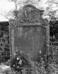
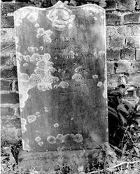
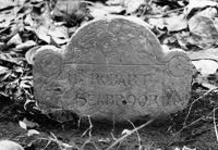
Colonel William Washington Cemetery. Tombstone of William Washington Ancrum (1854). Ravenel, S.C.;10" x 8" B/W photo. Box 16, Folder 2-11-11. One copy.
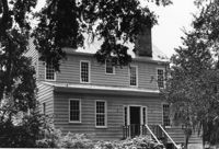
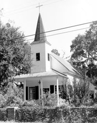
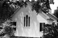
Christ Church Episcopal - Adams Run, State Highway 174. View of West (Front) elevation. Hollywood, S.C.;10" x 8" B/W photo. Box 16, Folder 2-11-12. One copy.
Christ Church Episcopal - Adams Run, State Highway 174. View of West (Front) elevation. Hollywood, S.C.;10" x 6.5" B/W photo. Box 16, Folder 2-11-12. Three copies.
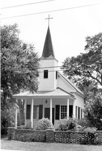
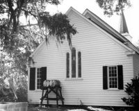
Christ Church Episcopal - Adams Run, State Highway 174. View of South (Side) elevation. Hollywood, S.C.;6.5" x 10" B/W photo. Box 16, Folder 2-11-12. Three copies.
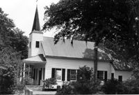
Christ Church Episcopal - Adams Run, State Highway 174. View of North (Side) elevation. Hollywood, S.C.;6.5" x 10" B/W photo. Box 16, Folder 2-11-12. Three copies.
Christ Church Episcopal - Adams Run, State Highway 174. View of South (Side) elevation. Hollywood, S.C.;8" x 10" B/W photo. Box 16, Folder 2-11-12. One copy.
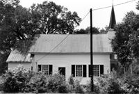
Christ Church Episcopal - Adams Run, State Highway 174. View of East (Rear) elevation. Hollywood, S.C.;6.5" x 10" B/W photo. Box 16, Folder 2-11-12. Three copies.
Christ Church Episcopal - Adams Run, State Highway 174. View of East (Rear) elevation. Hollywood, S.C.;8" x 10" B/W photo. Box 16, Folder 2-11-12. One copy.
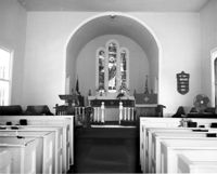
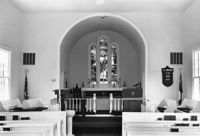
Christ Church Episcopal - Adams Run, State Highway 174. View of Interior. West (Front) elevation. Hollywood, S.C.;8" x 10" B/W photo. Box 16, Folder 2-11-12. One copy.
Christ Church Episcopal - Adams Run, State Highway 174. View of Interior. West (Front) elevation. Hollywood, S.C.;6.5" x 10" B/W photo. Box 16, Folder 2-11-12. Three copies.
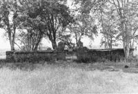
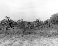
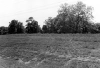
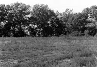
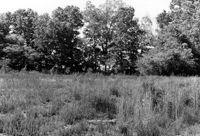
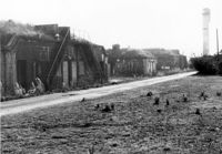
Stono River Rebellion Site (Cato's Rebellion Site), North Side of U.S. Highway 17, west of the Wallace River. View looking West. Hollywood, S.C.;6.5" x 10" B/W photo. Box 16, Folder 2-11-16. One copy.
Stono River Rebellion Site (Cato's Rebellion Site), North Side of U.S. Highway 17, west of the Wallace River. View looking NW. Hollywood, S.C.;6.5" x 10" B/W photo. Box 16, Folder 2-11-16. One copy.
Stono River Rebellion Site (Cato's Rebellion Site), North Side of U.S. Highway 17, west of the Wallace River. View looking North. Hollywood, S.C.;6.5" x 10" B/W photo. Box 16, Folder 2-11-16. One copy.
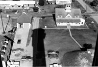
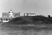
U.S. Coast Guard Historical District, I'on Avenue. Aerial View - South elevation. Sullivans Island, S.C.;6.5" x 10" (and 3.5" x 5") B/W photo. Box 16, Folder 2-13-1. Two copies.
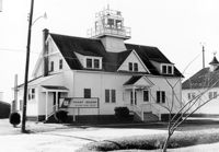
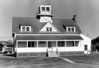
U.S. Coast Guard Historical District, I'on Avenue. Administration Building - View of North (Front) elevation. Sullivans Island, S.C.;6.5" x 10" (and 3.5" x 5") B/W photo. Box 16, Folder 2-13-1. Two copies.
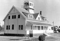
U.S. Coast Guard Historical District, I'on Avenue. Administration Building - View of East (Side) elevation. Sullivans Island, S.C.;6.5" x 10" (and 3.5" x 5") B/W photo. Box 16, Folder 2-13-1. Two copies.
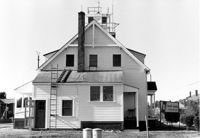
U.S. Coast Guard Historical District, I'on Avenue. Administration Building - View of SW (Side and Rear) elevation. Sullivans Island, S.C.;6.5" x 10" (and 3.5" x 5") B/W photo. Box 16, Folder 2-13-1. Two copies.
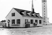
U.S. Coast Guard Historical District, I'on Avenue. Administration Building - View of South (Rear) elevation. Sullivans Island, S.C.;6.5" x 10" (and 3.5" x 5") B/W photo. Box 16, Folder 2-13-1. Two copies.
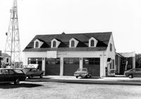
U.S. Coast Guard Historical District, I'on Avenue. Garage - View of East (Front) elevation. Sullivans Island, S.C.;6.5" x 10" (and 3.5" x 5") B/W photo. Box 16, Folder 2-13-1. Two copies.
U.S. Coast Guard Historical District, I'on Avenue. Garage - View of South (Side) elevation. Sullivans Island, S.C.;6.5" x 10" (and 3.5" x 5") B/W photo. Box 16, Folder 2-13-1. Two copies.
U.S. Coast Guard Historical District, I'on Avenue. Garage - View of NE (Side and Rear) elevation. Sullivans Island, S.C.;6.5" x 10" (and 3.5" x 5") B/W photo. Box 16, Folder 2-13-1. Two copies.
U.S. Coast Guard Historical District, I'on Avenue. Boat House - View of NW (Side and Front) elevation. Sullivans Island, S.C.;6.5" x 10" (and 3.5" x 5") B/W photo. Box 16, Folder 2-13-1. Two copies.
U.S. Coast Guard Historical District, I'on Avenue. Boat House - View of SE (Side and Rear) elevation. Sullivans Island, S.C.;6.5" x 10" (and 3.5" x 5") B/W photo. Box 16, Folder 2-13-1. Two copies.
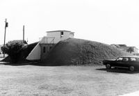
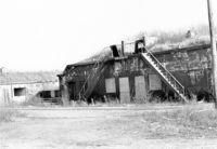
U.S. Coast Guard Historical District, I'on Avenue. Bunker - View of North (Front) elevation. Sullivans Island, S.C.;6.5" x 10" (and 3.5" x 5") B/W photo. Box 16, Folder 2-13-1. Two copies.
U.S. Coast Guard Historical District, I'on Avenue. Bunker - View of NW (Side and Front) elevation. Sullivans Island, S.C.;6.5" x 10" (and 3.5" x 5") B/W photo. Box 16, Folder 2-13-1. Two copies.
U.S. Coast Guard Historical District, I'on Avenue. Bunker - View of South (Rear) elevation. Sullivans Island, S.C.;6.5" x 10" (and 3.5" x 5") B/W photo. Box 16, Folder 2-13-1. Two copies.
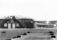
Battery Gadsden (Charleston County Public Library, Edgar Allen Poe Branch), 1921 I'on Avenue. View of East Wing, North (Front) elevation - looking West. Sullivans Island, S.C.;6.5" x 10" B/W photo. Box 16, Folder 2-13-6. One copy.
Battery Gadsden (Charleston County Public Library, Edgar Allen Poe Branch), 1921 I'on Avenue. View of East Wing and 2nd Gun Platform from East end, North (Front) elevation. Sullivans Island, S.C.;6.5" x 10" B/W photo. Box 16, Folder 2-13-6. One copy.
Battery Gadsden (Charleston County Public Library, Edgar Allen Poe Branch), 1921 I'on Avenue. View of 2nd Gun Platform from East end, North (Front) elevation. Sullivans Island, S.C.;6.5" x 10" B/W photo. Box 16, Folder 2-13-6. One copy.
Battery Gadsden (Charleston County Public Library, Edgar Allen Poe Branch), 1921 I'on Avenue. View of East Wing and 2nd Gun Platform from East end, NW (Front and Side) elevation. Sullivans Island, S.C.;6.5" x 10" B/W photo. Box 16, Folder 2-13-6. One copy.
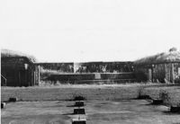
Battery Gadsden (Charleston County Public Library, Edgar Allen Poe Branch), 1921 I'on Avenue. View of all three Wings, NW (Side and Front) elevation - looking East. Sullivans Island, S.C.;6.5" x 10" B/W photo. Box 16, Folder 2-13-6. One copy.
Battery Gadsden (Charleston County Public Library, Edgar Allen Poe Branch), 1921 I'on Avenue. View of West Wing, North (Front) elevation - looking East. Sullivans Island, S.C.;6.5" x 10" B/W photo. Box 16, Folder 2-13-6. One copy.