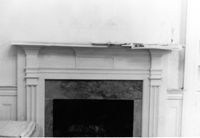
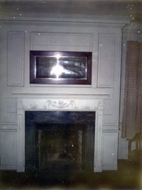
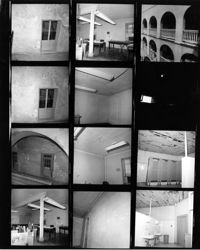
The Grove Plantation (Ernest F. Hollings ACE Basin National Wildlife Refuge). Interior View - 2nd Floor. Detail of Mantle in West Rear Room. Adams Run, S.C.;6.5" x 10" B/W photo. Box 15, Folder 2-11-1. One copy.
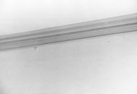
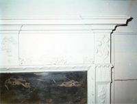
The Grove Plantation (Ernest F. Hollings ACE Basin National Wildlife Refuge). Interior View - 2nd Floor. Detail of Cornice in Front Room. Adams Run, S.C.;6.5" x 10" B/W photo. Box 15, Folder 2-11-1. One copy.
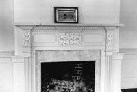
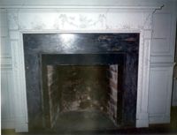
The Grove Plantation (Ernest F. Hollings ACE Basin National Wildlife Refuge). Interior View - 2nd Floor. Detail of Mantle in Front Room. Adams Run, S.C.;6.5" x 10" B/W photo. Box 15, Folder 2-11-1. One copy.
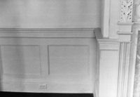
The Grove Plantation (Ernest F. Hollings ACE Basin National Wildlife Refuge). Interior View - 2nd Floor. Detail of Front Room Wainscot. Adams Run, S.C.;6.5" x 10" B/W photo. Box 15, Folder 2-11-1. One copy.
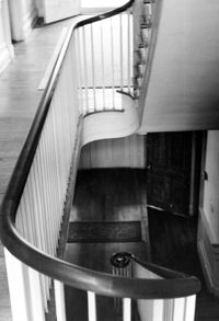
The Grove Plantation (Ernest F. Hollings ACE Basin National Wildlife Refuge). Interior View - 1st Floor. Detail of Stairs and Back Door. Adams Run, S.C.;6.5" x 10" B/W photo. Box 15, Folder 2-11-1. One copy.
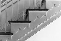
The Grove Plantation (Ernest F. Hollings ACE Basin National Wildlife Refuge). Interior View - 2nd Floor. Detail of Staircase trim. Adams Run, S.C.;6.5" x 10" B/W photo. Box 15, Folder 2-11-1. One copy.
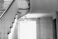
The Grove Plantation (Ernest F. Hollings ACE Basin National Wildlife Refuge). Interior View - 2nd Floor. Detail of Stairwell. Adams Run, S.C.;10" x 6.5" B/W photo. Box 15, Folder 2-11-1. Four copies.
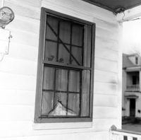
Johns Island Presbyterian Church, 2550 Bohicket Road. Manse - Front elevation. Johns Island, S.C.;6.5" x 10" B/W photo. Box 12, Folder 2-5-4. Two copies.
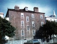
Dean Hall Plantation - Main House. View of NW (Front) elevation. Oakley, SC. NOTE: Property relocated to Beaufort County in 1971.;8" x 10" B/W photo. Box 2, Folder 1-8-8. One copy.
Middleburg Plantation, Middleburg Lane. Commissary - View of Front and Side elevation. Huger, S.C.;6.5" x 9.5" B/W photo. Box 4, Folder 1-12-4. One copy.
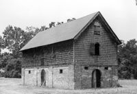
The Grove Plantation (Ernest F. Hollings ACE Basin National Wildlife Refuge). View of Outbuildings. Adams Run, S.C.;6.5" x 10" B/W photo. Box 15, Folder 2-11-1. One copy.
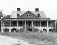
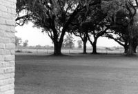
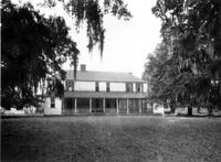
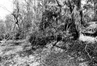
The Grove Plantation (Ernest F. Hollings ACE Basin National Wildlife Refuge). View of Property. Adams Run, S.C.;6.5" x 10" B/W photo. Box 15, Folder 2-11-1. Two copies.
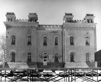
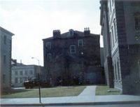
Old Citadel (South Carolina State Arsenal, Embassy Suites Hotel), 337 Meeting Street. View of North (Rear) elevation. Charleston, S.C.;8" x 10" B/W photo. Box 5, Folder 2-1-5. One copy.
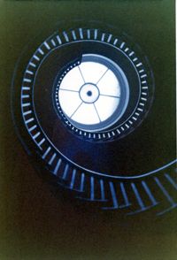
Lowndes Grove Plantation, 260 St. Margaret Street. Main House - Interior View. Detail of Flying Staircase, from ground, looking up. Charleston, S.C. NOTE: Print severely faded, color digitally restored.;5" x 3.5" Color photo. Box 8, Folder 2-1-148. One copy.
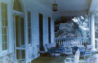
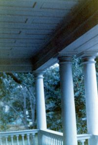
Lowndes Grove Plantation, 260 St. Margaret Street. Main House - View of 2nd Floor Porch, NW (Front and Side) elevation. Charleston, S.C. NOTE: Print severely faded, color digitally restored.;3.5" x 5" Color photo. Box 8, Folder 2-1-148. One copy.
Lowndes Grove Plantation, 260 St. Margaret Street. Main House - Detail View of 2nd Floor Porch, SW elevation. Charleston, S.C. NOTE: Print severely faded, color digitally restored.;5" x 3.5" Color photo. Box 8, Folder 2-1-148. One copy.
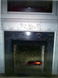
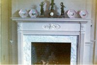
Lowndes Grove Plantation, 260 St. Margaret Street. Main House - Interior View. Detail of Mantle. Charleston, S.C. NOTE: Print severely faded, color digitally restored.;3.5" x 5" Color photo. Box 8, Folder 2-1-148. One copy.
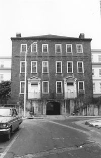
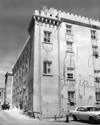
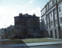
Old Citadel (South Carolina State Arsenal, Embassy Suites Hotel), 337 Meeting Street. View of SW (Front and Side) elevation. Charleston, S.C.;10" x 8" B/W photo. Box 5, Folder 2-1-5. One copy.
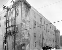
Old Citadel (South Carolina State Arsenal, Embassy Suites Hotel), 337 Meeting Street. View of NW (Side and Rear) elevation. Charleston, S.C.;8" x 10" B/W photo. Box 5, Folder 2-1-5. One copy.
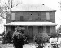
Old Carroll House (Carroll Place), Junction of Quaker and Wire Roads. View of North (Front) elevation. St. George, S.C.;8" x 10" B/W photo. Box 20, Folder: Miscellaneous Photos: Unidentified Images. One copy.
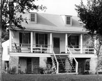
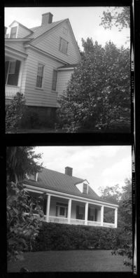
Rockville Historic District - Hagood House (Micah Jenkins House), Grace Chapel Road. View of South (Front) elevation. Wadmalaw Island, S.C.;8" x 10" B/W photo. Box 17, Folder 2-14-16. One copy.
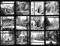
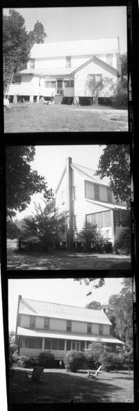
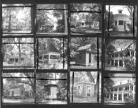
T. Hayne Stall House. Contact Sheet 1 - View of Front and Side elevations. Stallsville Area. Summerville, S.C.;7.5" x 2.25" B/W photo. Box 17, Folder 3-1-1. One Copy.
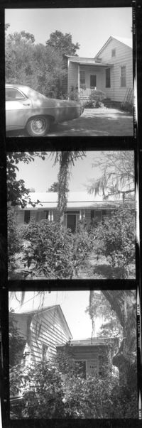
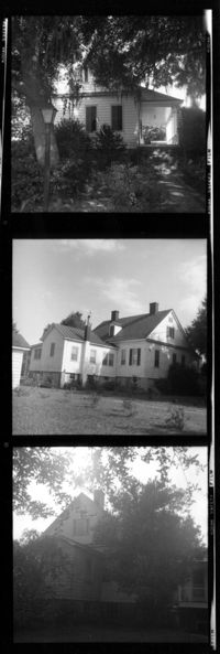
Collins House. Contact Sheet 1 - View of Front and Side elevations. Stallsville Area. Summerville, S.C.;7.5" x 2.25" B/W photo. Box 17, Folder 3-1-1. One Copy.