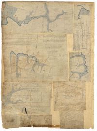
Page 88 of the City Engineer's Plat Book with eight plats. Plat 1 shows a stream and marshland starting at the Ashley River. Plat 2 features land located near the Ashley River and Grove Street. It also features several structures, some marshland, and a creek. Plat 3 shows land located near Grove Street, including some structures, some marshland, and a stream. Plat 4 shows land located Grove Street, including some buildings, a creek, and marshland. Plat 5 shows lots located between a stretch of marsh and Rutledge Avenue. Plat 5 also shows Congress Street, Legare Street, Huger Street, Moultrie Street, and a race track. Plat 6 features Washington Race Course, located between Grove Street and Moultrie Street, and between Congress Street and an unlabeled Street. Plat 7 shows "34 acres of Marsh" located between the Ashley River and a public cemetery. Plat 8 shows marshland located on the Ashley River, near "new Spring Street" and a creek.
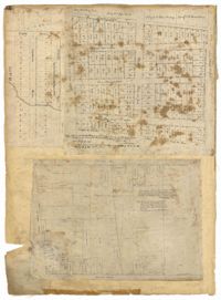
Page 66 of the City Engineer's Plat Book with fourteen plats. Plat 1 features buildings located near the intersection of King Street and Clifford Street. Plat 2 shows lots and structures located near the intersection of "Comings Street" and Wentworth Street. Plat 3 shows a lot and structures located on Pitt Street. Plat 4 shows lots located on a city block between Smith Street and Pitt Street, and between Montague Street and Wentworth Street. Plat 5 shows lots located on a city block between Montague Street and Wentworth Street, and between South Street and Rutledge Street. Plat 6 features a lot located near the intersection of "Comings Street" and Montague Street. Plat 7 shows lots and some structures located near the intersection of Bull Street and Coming Street. Plat 8 shows a lot and buildings located on Bull Street. Plat 9 Shows lots located near the intersection of Smith Street and Boundary Street. Plat 10 shows lots located on a city block between Lynch Street and Rutledge Street, and between Bull Street and Montague Street. Plat 11 shows lots and structures located near the intersection of Pitt Street and Bull Street. Plat 12 is features a lot located at the intersection of Pitt Street and Bull Street. Plat 13 Features lots located near the intersection of Bull Street and Lynch Street. Plat 14 shows lots located on Queen Street.
Page 32 of the City Engineer's Plat Book with three plats. Plat 1 shows lots located near the intersection of Tradd Street and Limehouse Street. Plat 2 shows lots located near Elliott Street, Broad Street, and Line Street, near the intersections with Rose Lane, Laurel Street, Percy Street, and Coming Street. Plat 3 shows lots and buildings located between St. Phillip Street and King Street, and Radcliffe Street and Warren Street.
Page 26 of the City Engineer's Plat Book with two plats. Plat 1 is a plan for a public square located near the intersection of Pinkney Street and Boundary Street, and shows a creek. Plat 2 features a lot located on the Ashley River channel and "Commings Creek," located near the intersections of Pinckney Street and Boundary Street, and Bull Street and Rutledge Street. Plat 2 also labels a pond, an island, and "Cannon's Point." Plat 3 shows lots located between Boundary Street and Bull Street, near the intersections with Barre Street, Gadsden Street, Lynch Street, Rutledge Street, Pitt Street, and "Comming Street."