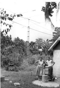
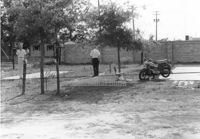
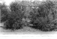
Lot with tall mast, on site affected by the construction of Interstate 26 (I-26). Surveyor notations on back of photo: "Dkt.: 10.471. Property owner: W.W. Gregory. Tract: 46. Station: 5330+00 Rt. Date: Aug. 23, 1960. Owner to move mast." [See collection description for explanation of surveyor notations.]
Property on site affected by the construction of Interstate 26 (I-26). Surveyor notations on back of photo: "Dkt.: 10.471. Property owner: Douglas E. Bohler, et al. Tract: 90. Station: 5374+20 to 5377+00 Lt. Date: Aug. 23, 1960. In R/W - Bought." [See collection description for explanation of surveyor notations.]
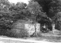
Property and structure (shed?) on Dorchester Road, on site affected by the construction of Interstate 26 (I-26). Surveyor notations on back of photo: "Dkt.: 10.480. Property owner: Mrs. Dorothy V. Bartee. Tract: 178. Station: 132+42 Rt. (Route 642) [Dorchester Road]. Date: May 30, 1961. In R/W - Bought." [See collection description for explanation of surveyor notations.]
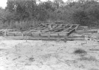
Pile of wood framing on lot, on site affected by the construction of Interstate 26 (I-26). Surveyor notations on back of photo: "Dkt.: 10.480. Property owner: Williams Furniture Co., et al. Tract: 103-B. Station: 5583+55 Rt. Date: May 2, 1961. In R/W - Bought." [See collection description for explanation of surveyor notations.]
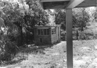
Structure (storage shed/garage) on site affected by the construction of Interstate 26 (I-26). Possibly on Rivers Avenue. Surveyor notations on back of photo: "Dkt.: 10.486. Property owner: Otis R. Burbage. Tract: 22 & 34. Station: 14+80 Rt. Date: May 30, 1961. In R/W to be moved." [See collection description for explanation of surveyor notations.]
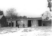
Yard and two small wooden structures on site affected by the construction of Interstate 26 (I-26). Surveyor notations on back of photo: "Dkt.: 10.480. Property owner: Hugh A. Wingo, et al. Tract: 205. Station: 5691+35 Lt. Date: May 31, 1961. In R/W - Bought." [See collection description for explanation of surveyor notations.]
Property and structure (shed?) on Dorchester Road, on site affected by the construction of Interstate 26 (I-26). Surveyor notations on back of photo: "Dkt.: 10.480. Property owner: James C. Thomas. Tract: 177. Station: 131+80 Rt. (Route 642) [Dorchester Road]. Date: May 30, 1961. In R/W - Bought." [See collection description for explanation of surveyor notations.]
Property and structure (shed?) on Dorchester Road, on site affected by the construction of Interstate 26 (I-26). Surveyor notations on back of photo: "Dkt.: 10.480. Property owner: Frank R. Mangrum. Tract: 176. Station: 131+20 Rt. (Route 642) [Dorchester Road]. Date: May 30, 1961. In R/W - Bought." [See collection description for explanation of surveyor notations.]
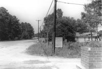
Lot on site affected by the construction of Interstate 26 (I-26). Surveyor notations on back of photo: "Dkt.: 10.480. Property owner: O.H. Julian. Tract: 169. Station: 5680+80 Crosses CL. Date: May 30, 1961. In R/W - Bought." [See collection description for explanation of surveyor notations.]
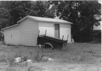
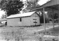
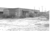
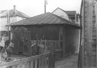
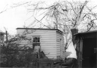
Wooden structure (possibly garage, shed, barn) on site affected by the construction of Interstate 26 (I-26). Surveyor notations on back of photo: "Dkt.: 10.480. Property owner: William A. Graham. Tract: 239. Station: 5701+00 Lt. Date: May 31, 1961. In R/W - Bought." [See collection description for explanation of surveyor notations.]
Structure (garage or shed) on site affected by the construction of Interstate 26 (I-26). Possibly on Rivers Avenue. Surveyor notations on back of photo: "Dkt.: 10.486. Property owner: Cleve G. Murray. Tract: 12. Station: 11+20 Lt. Date: May 30, 1961. In R/W - Bought." [See collection description for explanation of surveyor notations.]
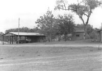
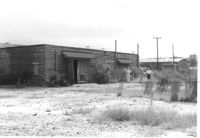
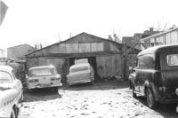
Structures on site affected by the construction of Interstate 26 (I-26). Surveyor notations on back of photo: "Dkt.: 10.480. Property owner: Preston H. Mundy. Tract: 104. Station: 5574+35 Lt. (Line J). Date: May 2, 1961. In R/W - Bought." [See collection description for explanation of surveyor notations.]
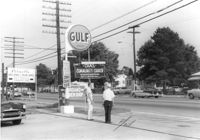
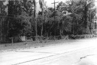
Roadside on site affected by the construction of Interstate 26 (I-26). Dorchester Road where Faith Street(?) intersects. Signage for Gulf gas station, Palmetto Welding & Iron Works, Jordan's Barber Shop, and Chas. Community Church in foreground. Surveyor notations on back of photo: "Dkt.: 10.480. Property owner: Tremarco, Inc. Tract: 173. Station: 129+30 Lt. (Route 642) [Dorchester Road]. Date: May 30, 1961. Move." [See collection description for explanation of surveyor notations.]
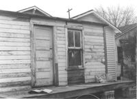
Small cinderblock structure (shed?) on site affected by the construction of Interstate 26 (I-26). [Building address number 185.] Surveyor notations on back of photo: "Dkt.: 10.480. Property owner: Janet H. & Robert Carl Wilson. Tract: 262. Station: 5713+50 Lt. Date: May 31, 1961. In R/W - Bought." [See collection description for explanation of surveyor notations.]
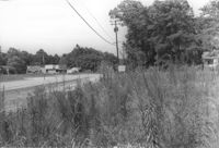
Site affected by the widening of Route 171 (Folly Road). Folly Road Pantry, B&H Grocery, and Phillips 66 gas Station: in background. Surveyor notations on back of photo: "Dkt.: 10.494. Property owner: H.W. Halter, et al. Tract: 78. Station: 298+44 Rt. Date: Mar. 21, 1962. Loss in R/W. [See collection description for explanation of surveyor notations.]
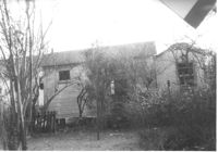
Structure (shed?) in dilapidated condition and wooden fence on site affected by the construction of Interstate 26 (I-26). Surveyor notations on back of photo: "Dkt.: 10.490. Property owner: Nathaniel Phoenix. Tract: 46. Station: 5799+60 Lt. Line 'G'. Date: September 11, 1962. In R/W - Bought." [See collection description for explanation of surveyor notations.]
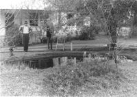
Pool and pump, on site affected by the widening of Route 171 (Folly Road). Surveyor notations on back of photo: "Dkt.: 10.494. Property owner: H.P. Duke. Tract: 51. Station: 186+65 Rt. Date: Mar. 21, 1962. Loss of pool and pump. [See collection description for explanation of surveyor notations.]
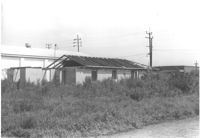
Structure on site affected by the construction of Interstate 26 (I-26). Surveyor notations on back of photo: "Dkt.: 10.490. Property owner: Ashley River Realty Co. Tract: 142. Station: 5876+60 Lt. Date: August 29, 1962. In R/W - Bought." [See collection description for explanation of surveyor notations.]
Structure on site affected by the construction of Interstate 26 (I-26). Surveyor notations on back of photo: "Dkt.: 10.490. Property owner: Ashley River Realty Co. Tract: 142. Station: 5876+60 Lt. Date: August 29, 1962. In R/W - Bought." [See collection description for explanation of surveyor notations.]
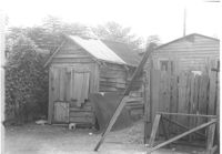
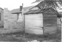
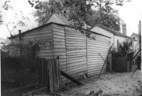
Wooden structure (shed?) and partially built cinder block wall, on site affected by the construction of Interstate 26 (I-26). Surveyor notations on back of photo: "Dkt.: 10.490. Property owner: Jacob Bennekin. Tract: 138-A. Station: 5859+70 Lt. Date: August 29, 1962. In R/W - Bought." [See collection description for explanation of surveyor notations.]
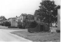
Neon entrance sign for Rose Garden Tourist Court, with two-story dwellings in background, on site affected by the construction of Interstate 26 (I-26). Address: 1317 King Street. Surveyor notations on back of photo: "Dkt.: 10.490. Property owner: The Long Corporation. Tract: 200. Station: 5+50 & 6+20 Lt. (Mt. Pleasant Street). Date: September 11, 1962. In R/W - Bought." [See collection description for explanation of surveyor notations.]
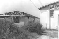
Unfinished cinder block structure next door to National Welders Supply Co., on site affected by the construction of Interstate 26 (I-26). Surveyor notations on back of photo: "Dkt.: 10.490. Property owner: Estell Stephney. Tract: 117. Station: 5830+05 Lt. Date: August 29, 1962. Rear of building to be removed by SCHD [SC Highway Department]." [See collection description for explanation of surveyor notations.]
Unfinished cinder block structure next door to National Welders Supply Co., on site affected by the construction of Interstate 26 (I-26). Surveyor notations on back of photo: "Dkt.: 10.490. Property owner: Estell Stephney. Tract: 117. Station: 5830+05 Lt. Date: August 29, 1962." [See collection description for explanation of surveyor notations.]
Wooden structure (shed or garage?) (rear view) on site affected by the construction of Interstate 26 (I-26). Address: 23 Jacobs Court. Surveyor notations on back of photo: "Dkt.: 10.517. Property owner: Furman G. Owens. Tract: 60-B. Station: 40+00 Lt. Northbound Lane, 5960+40 Lt. - Line 6. Date: March 5, 1963. In R/W - Bought." [See collection description for explanation of surveyor notations.]
Structures on site affected by the construction of Interstate 26 (I-26). Address: 20? Poinsett Street. Surveyor notations on back of photo: "Dkt.: 10.503. Property owner: B.W. Donnell, Est. Tract: 101. Station: 5921+00 Lt. Date: Feb. 20, 1963. In R/W - Bought." [See collection description for explanation of surveyor notations.]
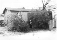
Structure (shed?) on site affected by the construction of Interstate 26 (I-26). Address: within the range of 20-32 Brigade Street. Surveyor notations on back of photo: "Dkt.: 10.503. Property owner: Gussie Feldman. Tract: 41. Station: 5903+92 Lt. Date: Feb. 19, 1963. In R/W - Bought." [See collection description for explanation of surveyor notations.]
Lot on site affected by the construction of Interstate 26 (I-26). Address: 1204 King Street. Surveyor notations on back of photo: "Dkt.: 10.503. Property owner: Francis Hartnett. Tract: 24. Station: 5897+10 Rt. & Lt. Date: Feb. 19, 1963. In R/W - Bought." [See collection description for explanation of surveyor notations.]
Structure on site affected by the construction of Interstate 26 (I-26). Address: 4 Maple Street. Surveyor notations on back of photo: "Dkt.: 10.503. Property owner: Frank Donnelly, et al. Tract: 48. Station: 5906+10 Lt. Date: Feb. 19, 1963. In R/W - Bought." [See collection description for explanation of surveyor notations.]
Lot on site affected by the construction of the Crosstown. Address: 1 Lee Street. Surveyor notations on back of photo: "Dkt.: 10.518. Property owner: Ada Hamilton. Tract: 67. Station: 52+05 Lt. N.B. lane Route 17. Date: Mar. 7, 1963." [See collection description for explanation of surveyor notations.]
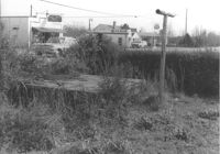
Lot between buildings, on site affected by the construction of Interstate 26 (I-26). Address: 35 Poinsett Street. Buses in background. Surveyor notations on back of photo: "Dkt.: 10.503. Property owner: S.C. Electric & Gas Co. [Tract number not indicated.] Station: 5922+50 Lt. Date: Feb. 20, 1963. Proximity." [See collection description for explanation of surveyor notations.]
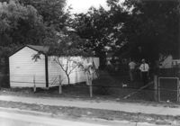
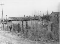
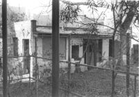
Structures (rear view) on site affected by the construction of Interstate 26 (I-26). Address: 18 Addison Street. Surveyor notations on back of photo: "Dkt.: 10.503. Property owner: Hessie Alston. Tract: 93. Station: 5918+75 Lt. Date: Feb. 20, 1963. In R/W - Bought." [See collection description for explanation of surveyor notations.]
Lot on site affected by the construction of the Crosstown. Address: 51 Aiken Street. Surveyor notations on back of photo: "Dkt.: 10.518. Property owner: Julia M. Pritchard. Tract: 52. Station: 46+50 Rt. N.B. lane Route 17. Date: Mar. 7, 1963. In R/W - Bought." [See collection description for explanation of surveyor notations.]
Part of a brick structure on lot, on site affected by the construction of Interstate 26 (I-26). Address: 1129 Meeting Street (rear). Surveyor notations on back of photo: "Dkt.: 10.503. Property owner: Coca Cola Bottling Co. Tract: 28. Station: 5899+05 Lt. Date: Feb. 19, 1963. Owner cleared R/W." [See collection description for explanation of surveyor notations.]
Structure (garage?) and cars in lot on site affected by the construction of the Crosstown. Address: 51 Aiken Street. Surveyor notations on back of photo: "Dkt.: 10.518. Property owner: Julia M. Pritchard. Tract: 52. Station: 46+50 Rt. N.B. lane Route 17. Date: Mar. 6, 1963. In R/W - Bought." [See collection description for explanation of surveyor notations.]
Wooden structures (sheds?) on site affected by the construction of Interstate 26 (I-26). Address: 92 Lee Street (rear). Surveyor notations on back of photo: "Dkt.: 10.517. Property owner: Robert L. Chamberlain, et al. Tract: 51. Station: 5953+60 CL - Line 6. Date: February 21, 1963. In R/W - Bought." [See collection description for explanation of surveyor notations.]
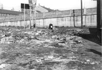
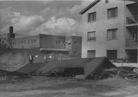
Construction debris and neighboring buildings on site affected by the construction of Interstate 26 (I-26). Address: 1220 King Street. Coca Cola Bottling Co. building (1129 Meeting Street) in background. Surveyor notations on back of photo: "Dkt.: 10.503. Property owner: House of God. Tract: 31. Station: 5900+30 Lt. Date: Feb. 19, 1963. In R/W - Bought." [See collection description for explanation of surveyor notations.]
Structure on site affected by the construction of the Crosstown. Address: 122 Sheppard Street. Surveyor notations on back of photo: "Dkt.: 10.524. Property owner: Archie B. Hollins. Tract: 136. Station: 17+40 Lt. S.B. lane. Date: Dec. 2, 1964. Outside R/W." [See collection description for explanation of surveyor notations.]
Structure and lot on site affected by the construction of the Crosstown. Address: 160 Cannon Street. Surveyor notations on back of photo: "Dkt.: 10.524. Property owner: Mabel M. Cecil McIherney. Tract: 7. Station: 62+75 CL Lt. Date: Oct. 13, 1964. Portion In R/W - Bought." [See collection description for explanation of surveyor notations.]
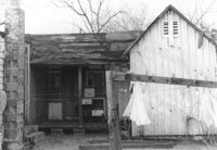
Structure (rear view) on site affected by the construction of the Crosstown. Address: 185 Spring Street. Surveyor notations on back of photo: "Dkt.: 10.524. Property owner: Star Gospel Mission. Tract: 15. Station: 24+50 Rt. (Spring Street). Date: Oct. 13, 1964. Portion in R/W to be removed." [See collection description for explanation of surveyor notations.]
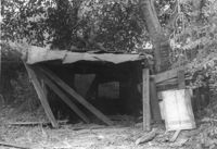
Structure (shed?) in dilapidated condition on site affected by the construction of the Crosstown. Address: 79 Kracke Street. Surveyor notations on back of photo: "Dkt.: 10.524. Property owner: Ella Lawrence, Est. Tract: 70. Station: 77+30 Lt. Date: Oct. 14, 1964. In R/W - Bought." [See collection description for explanation of surveyor notations.]
Structure (garage?) on site affected by the construction of the Crosstown. Address: 161B Line Street [161 Line Street]. Neighboring house in picture; see US Route 17 Photo 363. Surveyor notations on back of photo: "Dkt.: 10.524. Property owner: John H. Rathjen, et al. Tract: 104. Station: 83+05 Rt. Date: Dec. 1, 1964. Owner to move from R/W." [See collection description for explanation of surveyor notations.]
Structure on site affected by the construction of the Crosstown. Address: 3 Todd Street. On property of previous photos 413-415. Surveyor notations on back of photo: "Dkt.: 10.524. Property owner: John W. Bonaparte, et al. Tract: 118. Station: 87+35 Rt. Date: Dec. 1, 1964. In R/W - Bought." [See collection description for explanation of surveyor notations.]
Rear view of structure on site affected by the construction of the Crosstown. Address: 81 Kracke Street. Surveyor notations on back of photo: "Dkt.: 10.524. Property owner: Jerry M. Devoe. Tract: 69. Station: 77+40 Lt. Date: Oct. 14, 1964. In R/W - Bought." [See collection description for explanation of surveyor notations.]
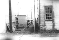
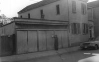
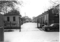
Looking down driveway between City Garage and building with gas pump, on site affected by the construction of the Crosstown. Address: 134 Line Street. Surveyor notations on back of photo: "Dkt.: 10.524. Property owner: City of Charleston. Tract: 128. Station: 91+00 CL Rt. Date: Dec. 2, 1964. Panoramic view." [See collection description for explanation of surveyor notations.]
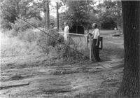
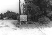
Lot on site affected by the widening of U.S. Route 17. Posted sign says: You just passed last motel for 50 miles, Mt. Pleasant Motel, ¼ mile back. Presumably located in Mount Pleasant or vicinity. Surveyor notations on back of photo: "Dkt.: 10.439. Property owner: Charleston County Public Works. Tract: 12. Station: 239+45 to 243+73 Rt. Date: Jul. 22, 1965. Range poles on 50' R/W & fence on 33' R/W - Cond." [See collection description for explanation of surveyor notations.]
Lot on site affected by the widening of U.S. Route 17. Posted sign says: Speed checked by radar. Presumably located in Mount Pleasant or vicinity. Surveyor notations on back of photo: "Dkt.: 10.439. Property owner: Francis F. Coleman, et al. Tract: 13. Station: 245+50 Rt. Date: Jul. 22, 1965. Range poles on 33' & 50' R/W showing house (portion)." [See collection description for explanation of surveyor notations.]
Lot on site affected by the widening of U.S. Route 17. Presumably located in Mount Pleasant or vicinity. Surveyor notations on back of photo: "Dkt.: 10.439. Property owner: Charleston County Public Works. Tract: 12. Station: 239+45 to 243+73 Rt. Date: Jul. 22, 1965. Looking from the east at range poles on 50' R/W & fence on 33' R/W - Cond." [See collection description for explanation of surveyor notations.]
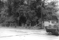
Lot on site affected by the widening of U.S. Route 17. Presumably located in Mount Pleasant or vicinity. Surveyor notations on back of photo: "Dkt.: 10.439. Property owner: Charleston Oil Co. Tract: 11. Station: 237+26 to 239+45 Rt. Date: Jul. 22, 1965. Range poles on 33' & 50' R/W - Cond." [See collection description for explanation of surveyor notations.]
Lot on site affected by the widening of U.S. Route 17. Posted sign says: You just passed last motel for 50 miles, Mt. Pleasant Motel, ¼ mile back. Portion of house visible. Presumably located in Mount Pleasant or vicinity. Surveyor notations on back of photo: "Dkt.: 10.439. Property owner: Charleston County Public Works. Tract: 12. Station: 240+00 Rt. Date: Jul. 22, 1965. Looking from west at range poles on 50' R/W & fence on 33' R/W - Cond." [See collection description for explanation of surveyor notations.]
Roadside lot on site affected by the widening of U.S. Route 17. Presumably located in Mount Pleasant or vicinity. Surveyor notations on back of photo: "Dkt.: 10.439. Property owner: Louise S. Carter. Tract: 3. Station: 230±50 Rt. Date: Jul. 22, 1965. Looking NE from Carter Ave. at range poles on 33' & 50' R/Ws - Cond." [See collection description for explanation of surveyor notations.]