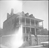
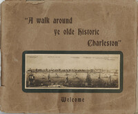
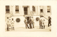
Souvenir booklet for guests of the Charleston Hotel, produced after the hotel's renovation and when it was under the new management of Francis G. Cart and W. Irving Davids. Includes a description of the hotel and its remodeling, along with a brief history of Charleston and photographs of points of interest. [16] p., ill., 11x15 cm. (Note: The Charleston Hotel was located on the 200 block of the east side of Meeting Street. It was demolished in 1960.)
The folio, Examples of Colonial Architecture in Charleston, S.C. and Savannah, Ga., features photographic plates of some of the most important houses and buildings in Charleston and Savannah. Photographs include exterior views of the buildings, gates, and entrances, as well as interior views of fireplaces, mantels, doors, rooms, and ceilings. Compiled and photographed by Edward A. Crane and E.E. Soderholtz. Published in 1895 by the Boston Architectural Club (Boston, Mass.).
Photographs taken by Sabina Elliott Wells in 1898-1899. Wells was a Charleston artist and designer; she was also a Newcomb potter. Photographs include scenes in Charleston and the Lowcountry, in northwest South Carolina (Table Rock and vicinity), and in western North Carolina (Flat Rock and vicinity). Scans were derived from negatives donated to Historic Charleston Foundation. (Note: Wells's diaries from 1898-1899 that document some of her travels, including sites represented in these photographs, are at the South Carolina Historical Society, "Sabina E. Wells papers, 1886-1942.")
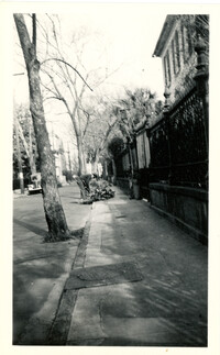
Guide for a walking tour of Charleston, containing a brief history of Charleston; descriptions of each location on the tour; and photographs of notable buildings. Published by Lanneau's Art Store (Charleston, S.C.). [6] p., [24] leaves : ill. ; 27 x 32 cm.
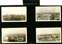
Four aerial views of Charleston looking across the peninsula. Top left: Looking northeast, possibly from St. Michael’s Church, showing Broad Street and the area to its north bounded by East Bay Street, and possibly Queen Street. Cars are parked along the street. Landmarks include the Confederate Home and its rear dormitory apartments, People's Building, Old Exchange Building, and the corner of Broad and Church Streets showing the Bank of South Carolina Building (50 Broad Street) before it was restored. A faint view of the U.S. Customhouse is at the far left. Top right: Looking southeast, possibly from the Francis Marion Hotel, with Meeting Street bisecting the view at a diagonal. Landmarks include the U.S. Customhouse, Charleston Hotel, People’s Building, and St. Philip’s Church. Bottom left: Looking south on King Street, possibly from the Francis Marion Hotel, showing King Street from approximately 360 King down to the bend near Market Street, and the view east of King Street. Vehicles can be seen on King Street. Landmarks include the Masonic Temple Building (270 King Street), the tower of the Peoples First National Bank Building (also known as the Hirsh Israel Building, 275 King Street), and the Hotel Calhoun (238-242 King Street). Bottom right: Looking southwest, possibly from St. Michael’s Church, toward James Island. Landmarks include the Fort Sumter House (1 King Street), Col. John Ashe House (32 South Battery), rear of First Scots Presbyterian Church (57 Meeting Street), Miles Brewton House (27 King Street), and the north elevation of the John E. Poyas House (69 Meeting Street).
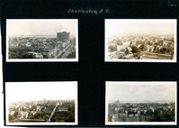
Four aerial views of Charleston looking across the peninsula. Top left: Looking northeast, possibly from City Hall. Landmarks include the rear dormitory apartments of the Confederate Home, St. Philip's Church, and the U.S. Customhouse. Top right: Looking north on Meeting Street, possibly from St. Michael’s Church, and showing the view west of Meeting Street. Vehicles, including a trolley car, can be seen on the street. Landmarks include the Timrod Hotel, Mills House Hotel, Fireproof Building, Circular Church, and Francis Marion Hotel (in the distance). Bottom left: Looking east on Calhoun Street, possibly from the Francis Marion Hotel, and showing the view east and west of Calhoun Street. Vehicles can be seen on the street. Landmarks include the Calhoun Monument in Marion Square, Citadel Square Baptist Church, and Emanuel A.M.E. Church. Bottom right: Looking north possibly from St. Michael’s Church. Landmarks include St. John's Lutheran Church, Unitarian Church, Grace Episcopal Church, and the Charleston Orphan House (in the distance at right).
This collection of gelatin silver photographs by Kenneth Clark consists of the original prints that were reproduced in three issues of the White Pine Series of Architectural Monographs, published by Russell F. Whitehead. The series was intended to provide 'intimate treatises of the architecture of the American colonies of the early Republic presented with well ordered completeness, to further a broader understanding and to create a permanent record of Early American architecture.'
In 1928, five issues highlighted Charleston architecture. The photographs feature Charleston buildings, street scenes, views, and architectural details. They appeared in three of the five Charleston issues: 'The Charm of Charleston: A New World City of Old World Memories' (vol. XIV, no. 2), 'Some Charleston Mansions' (vol. XIV, no. 4), and 'The Edwards-Smyth House' (vol. XIV, no.6).
A brief introduction about the atmosphere and architecture of Charleston precedes photographs of Charleston buildings, streets, and views. Also features a "Portfolio of Picturesque Charleston Sketches," pencil drawings by Alfred Hutty. Edited and published by Russell F. Whitehead (New York, ??1928). Photographs by Kenneth Clark. Measured drawings (measured and drawn by Kenneth Clark) from the George F. Lindsay Collection of Early American Documents. Also includes promotional essay entitled "Innovations in Manufacture and Distribution of Lumber: Weyerhaeuser 4-Square-Package Method'; wood construction details; and corporation information about Weyerhaeuser Forest Products (St. Paul, Minnesota). Volume 14, number 2, of The White Pine Series of Architectural Monographs. Twenty-two pages; page numbering of original begins at 171.
History and architectural description of the William Gibbes House [64 South Battery] by Roy Marvin, illustrated with photographs and measured drawings. Edited and published by Russell F. Whitehead (New York, ??1928). Photographs by Kenneth Clark. Measured drawings (measured and drawn by Kenneth Clark) from the George F. Lindsay Collection of Early American Documents. Also includes wood construction details and corporation information about Weyerhaeuser Forest Products (St. Paul, Minnesota). Volume 14, number 3, of The White Pine Series of Architectural Monographs. Twenty-two pages; page numbering of original begins at 195.
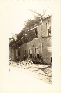
Photograph of Lamboll Street elevation of 19 King Street [Thomas Lamboll House] after the tornadoes of September 29, 1938, showing the damage done to the piazzas and roof. Men are standing on the roof.
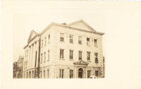
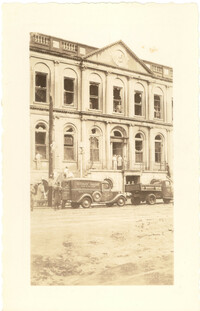
Photograph of City Hall after the tornadoes of September 29, 1938, showing the damage done to the building. Men stand on the landing at the entry to the building.
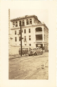
Photograph of the Charleston County Courthouse after the tornadoes of September 29, 1938, showing the damage done to the building. View of the corner elevation (Meeting Street and Broad Street). People who are standing inside the building at the second and third story windows can be seen. To the left of the Courthouse, the Hebrew Orphanage (88 Broad Street) is also in view.
Photograph of a commercial building on a Church Street corner after the tornadoes of September 29, 1938, showing the damage done to the building. Probably located at the corner of Church and North Market Street or South Market Street. Onlookers stand on sidewalk.
Photograph of City Hall after the tornadoes of September 29, 1938, showing the damage done to the building. Infantry patrolmen and other men stand in front of building.
Photograph of the I.M. Pearlstine Building on Cumberland Street, located between East Bay and State Street, after the tornadoes of September 29, 1938, showing the damage done to the building. Portion of signage is visible at the right of the photograph, "I.M." and "Budwe[iser]"; signage for "Rex" is also on building (at left). Onlookers stand among the debris on the street.
Photograph of the ruins of a building on King Street after the tornadoes of September 29, 1938. Shows the debris of a completely demolished structure and the damaged roof of the neighboring building. Based on newspaper accounts, this is probably the site of the Rectory of the Church of the Sacred Heart at King and Huger Streets. Three men stand on the sidewalk facing the debris; other men are standing on a pile of debris.
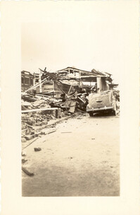
Looking east on Market Street after the tornadoes of September 29, 1938, showing the Market Sheds in ruins. A damaged car is parked along side of the debris. The Old Church of the Redeemer can be seen in the background.
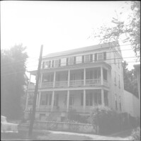
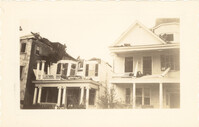
Photograph of 38 South Battery and 40 South Battery [Frederick Heinz Houses] and a portion of 42 South Battery, after the tornadoes of September 29, 1938, showing the damage done to the houses.
Photograph 19 King Street [Thomas Lamboll House] after the tornadoes of September 29, 1938, showing the damage done to the house. King Street elevation.
Photograph of City Hall after the tornadoes of September 29, 1938, showing the damage done to the building. Two trucks, including an Automatic Grocery truck, are parked in front of building. Onlookers are on the sidewalk in front of building; men stand at doorways and windows.
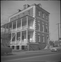
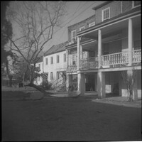
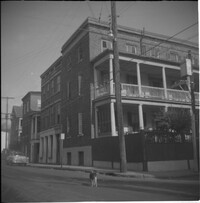
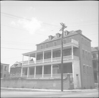
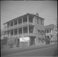
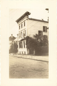
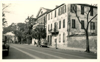
Photograph of the Timrod Hotel [ca. 101 Meeting Street], after the tornadoes of September 29, 1938, showing the damage done to the building. View of the hotel looking north on Meeting Street (southeast elevation). Infantry patrolmen stand on sidewalk by a car. Signage for Byars Drug Store is on the south elevation. [Note: The hotel was later demolished in the 1960s.]
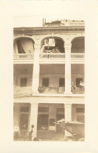
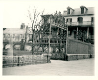
Photograph of the Timrod Hotel [ca. 101 Meeting Street], after the tornadoes of September 29, 1938, showing the damage done to the building. East elevation. Men are sitting on the second story piazza ledge. Men stand on the sidewalk by a truck that is carrying debris. [Note: The hotel was later demolished in the 1960s.]
Looking northwest on Market Street from the U.S. Custom House on East Bay Street, after the tornadoes of September 29, 1938, showing damaged and ruined Market Sheds. Also shows the damaged buildings on North Market Street. Onlookers and cars are in the street. Partial view of ca. 225 East Bay Street (now gone) is on the left.
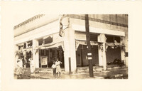
Photograph of the Sing Lee Laundry (133 King Street) after the tornadoes of September 29, 1938, showing the damage done to the building. Signs for the Robbins Bros. Circus (on Sept. 26) are posted in the windows.
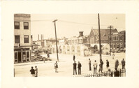
Scene on Meeting Street just south of the "Four Corners of Law" on Broad Street. Features the Federal Courthouse and Post Office and St. Michael's Church in foreground, and the County Courthouse and City Hall in background. Numerous cars are parked in front of the Federal Courthouse, with pedestrians on the sidewalk.
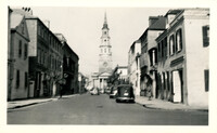
Looking north on Church Street from the northeast corner of Chalmers Street. Features buildings on the west side of the street: 129 Church, 131 Church, and the Dock Street Theater). Also in view are buildings on the east side of the street: 18 Chalmers Street, 132 Church Street, and St. Philip's Church). Cars are parked on the street.
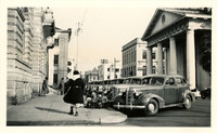
View of the intersection of Broad and Meeting Streets, featuring the Federal Courthouse and Post Office and St. Michael's Church. A car, motorcycle, and bus are on the street the street. Also shows pedestrian activity.
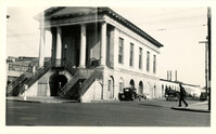
View of Market Hall, southwest elevation, including market sheds, and the corner of Market and Meeting Streets. Cars on street and pedestrian crossing the street. Cravens Delco Radio [store] on North Market Street at left.
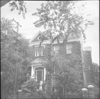
Looking north on Legare Street at 22 Legare Street (Charles Elliott House), a portion of which can be seen in the foreground (right). Man gathering leaves on the sidewalk. Car parked in background.
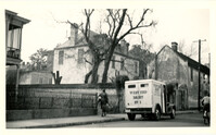
Looking west on Tradd Street at the outbuildings of 32 Legare Street (Sword Gate House). West End Dairy truck parked on street. Pedestrian on sidewalk and person riding a bike on street.
Looking north on East Battery Street from near the bend at White Point Gardens. Pedestrian is walking by White Point Gardens. Louis Desaussure House (1 East Battery) at center; Missroon House (40 East Bay Street) in the distance.
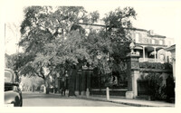
Looking west on Broad Street at 110 Broad Street (Bishop Northrop residence a/k/a William Harvey House a/k/a Ralph Izard House) and 114 Broad Street (Col. Thomas Pinckney House). Cars parked along the street.
Looking north on Church Street from Chalmers Street. Features buildings on the west side of the street: 127 Church, 129 Church, 131 Church, and the Dock Street Theater). Also in view are buildings on the east side of the street: 18 Chalmers Street, 132 Church Street, and St. Philip's Church). Cars are parked on the street.
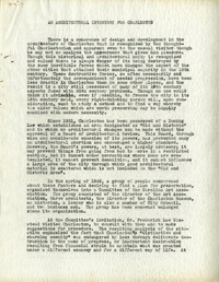
Article (offprint) "An Architectural Inventory for Charleston" and a review of This is Charleston exhibit by Helen G. McCormack from the Journal of the American Society of Architectural Historians (vol. 1, no. 3-4, Jul-Oct 1941).
Draft of article "An Architectural Inventory for Charleston" by Helen G. McCormack that would appear in the Journal of the American Society of Architectural Historians. Typed draft Includes author's handwritten edits.
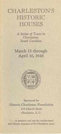
Single brochure for the 1948 Historic Charleston Foundation's Tour of Homes and 27 corresponding pamphlets about each individual home. These pamphlets contain descriptions by Samuel Gaillard Stoney (with illustrations) of each house on tour in 1948. Produced by Historic Charleston Foundation, 1948.
Compilation of original deeds, titles, and other documents related to the transfer, sale, and ownership of the double tenement at 72-74 Tradd Street, known as the Fotheringham-McNeil Tenements. Documents span from 1765 to 1961, likely representing the entire history of the ownership of the double tenement throughout that time period. Also includes blueprints and photographs. (NOTE: Fotheringham has also been spelled Fotheringham.)
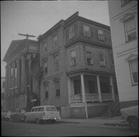
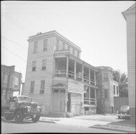
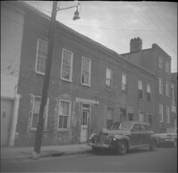
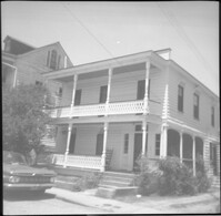
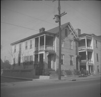
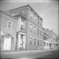
Looking east on Wentworth Street from 26 Wentworth Street (Gardner Kitchen House). Features (left to right): 26 Wentworth Street, 22-24 Wentworth Street (Francis Q. McHugh Tenements), 18-20 Wentworth Street, and 14 Wentworth Street.
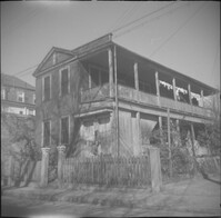
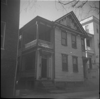
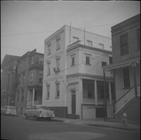
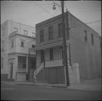
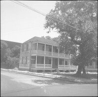
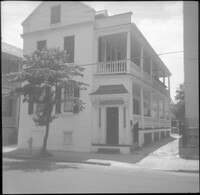
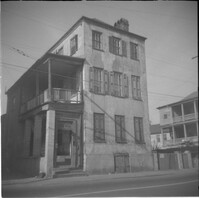
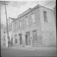
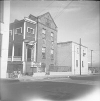
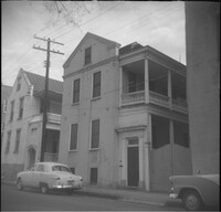
309 East Bay Street (Watson's Grocery), located at the southwest corner of East Bay and Laurens Street, before demolition. (The house at 116 Anson Street was moved to this site with the current address 39 Laurens Street.)
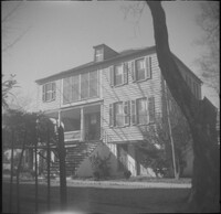
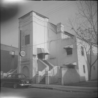
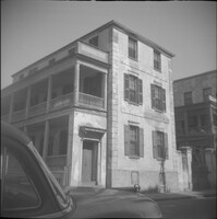
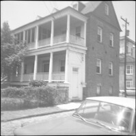
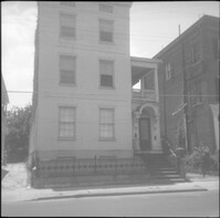
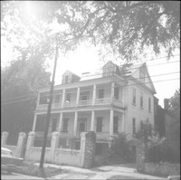
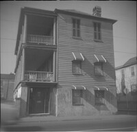
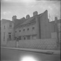
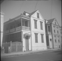
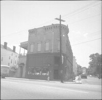
57 Society Street (William McElheran House), flanked by 55 Society Street (High School of Charleston) (left) and partial view of 59 Society Street (right).
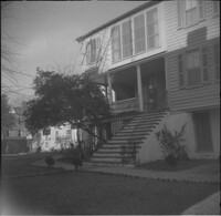
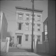
59 Society Street, flanked to its left by 55 Society Street (High School of Charleston) and 57 Society Street (William McElheran House), and to its right by 61 Society Street.
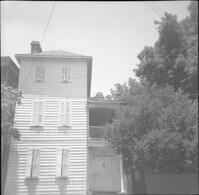


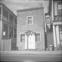
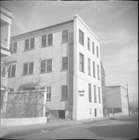

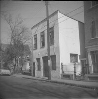
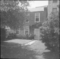
![116 Anson Street [now at 39 Laurens Street]](https://rspace.library.cofc.edu/iiif/image/48432/full/200,/0/default.jpg)