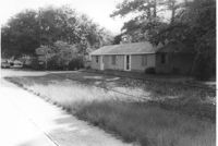
Structure on site affected by the widening of U.S. Route 17. Signs for Armstrong Tires and Charleston Tire Company in background. Presumably located in Mount Pleasant or vicinity. Surveyor notations on back of photo: "Dkt.: 10.439. Property owner: Joseph M. Bustos. Tract: 21. Station: 243+82 Lt. Date: Jul. 22, 1965. Proximity." [See collection description for explanation of surveyor notations.]
Structure on site affected by the widening of U.S. Route 17. Sign for Armstrong Tires. Presumably located in Mount Pleasant or vicinity. Surveyor notations on back of photo: "Dkt.: 10.439. Property owner: Joseph M. Bustos. Tract: 21. Station: 243+82 Lt. Date: Jul. 22, 1965. Proximity." [See collection description for explanation of surveyor notations.]
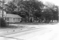
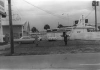
Lot and building (Basha's Garage) on site affected by the widening of U.S. Route 17. Posted signs for Basha's Garage. Presumably located in Mount Pleasant or vicinity. Surveyor notations on back of photo: "Dkt.: 10.439. Property owner: Ernest P. Basha, et al. Tract: 22-A. Station: 246+94 Lt. Date: Jul. 22, 1965. Proximity." [See collection description for explanation of surveyor notations.]
Side of building on site affected by the construction of the Crosstown. Address: 186 Spring Street. (See following two photographs.) Lot across the street in foreground. Surveyor notations on back of photo: "Dkt.: 10.524. Property owner: Mona G. Sokol. Tract: 25. Station: 65+60 CL Lt. Date: Oct. 13, 1964. In R/W - Bought." [See collection description for explanation of surveyor notations.]
Lot and Kentucky Fried Chicken, on site affected by the construction of the Crosstown. Address: 223 Spring Street. Patio [restaurant?] in background. Surveyor notations on back of photo: "Dkt.: 10.524. Property owner: Arco Investment Co. Tract: 160 and 161. Station: 17±50 Rt. Spring Street. Date: Dec. 2, 1964." [See collection description for explanation of surveyor notations.]
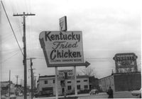
Sign for Kentucky Fried Chicken, on site affected by the construction of the Crosstown. Address: 223 Spring Street. Everett's Motel in background. Surveyor notations on back of photo: "Dkt.: 10.524. Property owner: Arco Investment Co. Tract: 160 and 161. Station: 17±50 Rt. Spring Street. Date: Dec. 2, 1964." [See collection description for explanation of surveyor notations.]
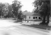
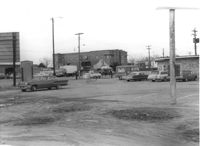
Partial view of The Fork (restaurant) and lot on site affected by the construction of the Crosstown. Address: 223 Spring Street. James Hotel [Hotel James] in background. Surveyor notations on back of photo: "Dkt.: 10.524. Property owner: The Fork Co. Inc. Tract: 156. Station: 13±00 Rt. Spring Street. Date: Dec. 2, 1964." [See collection description for explanation of surveyor notations.]
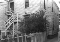
Rear view of house on site affected by the construction of the Crosstown. Address: 508 Rutledge Avenue. Surveyor notations on back of photo: "Dkt.: 10.524. Property owner: W.C. Hayes, Est. Tract: 112. Station: 86+60 Lt. Date: Dec. 1, 1964. In R/W - Bought." [See collection description for explanation of surveyor notations.]
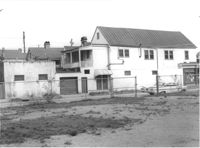
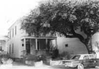
House on site affected by the construction of the Crosstown. Address: 504 Rutledge Avenue. Surveyor notations on back of photo: "Dkt.: 10.524. Property owner: Florence Britton Jones. Tract: 114. Station: 86+30 Rt. Date: Dec. 1, 1964. In R/W - Bought." [See collection description for explanation of surveyor notations.]
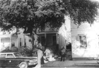
House on site affected by the construction of the Crosstown. Address: 504 Rutledge Avenue. Surveyor notations on back of photo: "Dkt.: 10.524. Property owner: Florence Britton Jones. Tract: 114. Station: 86+30 Rt. Date: Dec. 1, 1964. In R/W - Bought." [See collection description for explanation of surveyor notations.]