Search
« Previous |
2,701 - 2,750 of 2,791
|
Next »
Search Results
Date:
1960
Description:
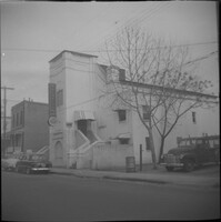
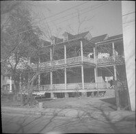
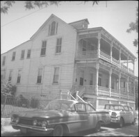
63-65 Society Street (St. Paul’s Catholic Church [German Church], later American Legion Palmetto Post 112). 61 Society Street also in view (at left).
Date:
1960
Description:
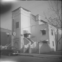
63-65 Society Street (St. Paul’s Catholic Church [German Church], later American Legion Palmetto Post 112).
Date:
1960
Description:
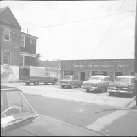
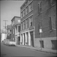
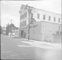
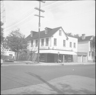
Charleston Automotive Services (63 Hasell Street), now a parking lot.
Date:
1960
Description:
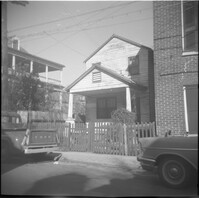
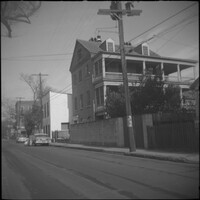
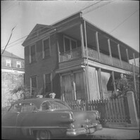
63 Charlotte Street.
Date:
1960
Description:
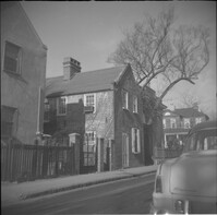
63 and 65 Anson Street (Susan Robinson Dependencies).
Date:
1960
Description:
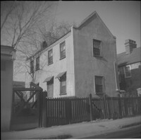
63 Anson Street (Susan Robinson Dependency).
Date:
1960
Description:
Right to left: 64 Anson Street (later demolished), 66 Anson Street (Chazal House), and 72 Anson Street (Kohne-Leslie House).
Date:
1960
Description:
Right to left: 64 Anson Street (later demolished) and 66 Anson Street (Chazal House).
Date:
1960
Description:
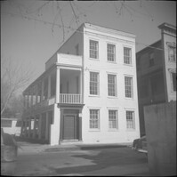
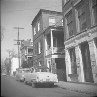
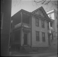
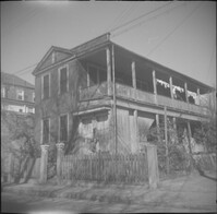
64 Society Street.
Date:
1960
Description:
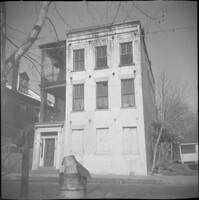
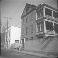
64 Hasell Street (Benjamin Smith House).
Date:
1960
Description:
Right to left: 64 Anson Street (later demolished) and 66 Anson Street (Chazal House).
Date:
1960
Description:
65-67 Hasell Street (USO Building).
Date:
1960
Description:
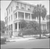
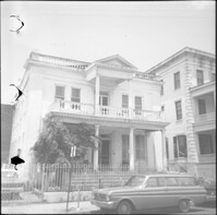
66 Society Street (Hieronymous-Roper House).
Date:
1960
Description:
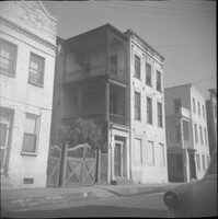
66 Hasell Street (Lazarus-Gadsden Building). Partial view of 64 Hasell Street at right.
Date:
1960
Description:
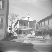
66 Society Street (Hieronymous-Roper House), flanked by 66½ Society Street (left) and 64 Society Street (right).
Date:
1960
Description:
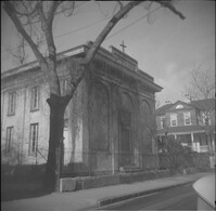
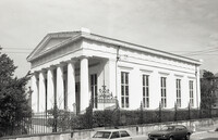
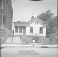
67 Anson Street (St. Stephen's Episcopal Church.
Date:
1960
Description:
67 Anson Street (St. Stephen's Episcopal Church.
Date:
1960
Description:
68 Anson Street, later demolished.
Date:
1916-03
Description:
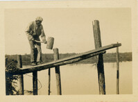
Mulberry Plantation rice field worker pounding a rice trunk gate with a wooden mallet.
Date:
1960
Description:
71 Anson Street (Thomas Doughty House).
Date:
1960
Description:
Right to left: 72 Anson Street (Kohne-Leslie House) and the original house at 74 Anson Street before its demolition.
Date:
1960
Description:
Right to left: 72 Anson Street (Kohne-Leslie House) and the original house at 74 Anson Street before its demolition.
Date:
1960
Description:
Original house with the address 73 Anson Street, demolished in 1963.
Date:
1960
Description:
74 Anson Street before its demolition. (The house originally at 15 Wall Street was moved to the site in 1966.)
Date:
1960
Description:
75 Anson Street (Joseph Legare House) before the removal of the third story ca. 1969.
Date:
1960
Description:
76 Anson Street before its demolition, located at the southeast corner of Anson and Laurens Streets.
Date:
1960
Description:
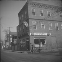
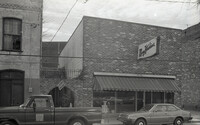
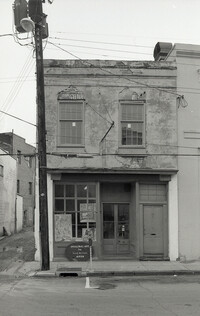
78 Anson Street (Royal Food Market), corner store located at the northeast corner of Anson and Laurens Streets, before its demolition.
Date:
1960
Description:
78 Anson Street (Royal Food Market), corner store located at the northeast corner of Anson and Laurens Streets, before its demolition.
Date:
1960
Description:
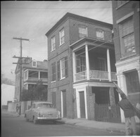
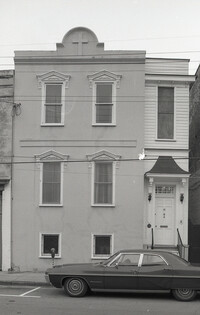
79 Anson Street (Daniel Legare House).
Date:
1960
Description:
79 Anson Street (Daniel Legare House).
Date:
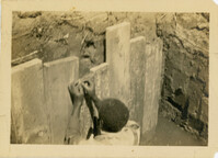
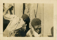
1916-03
Description:
Mulberry Plantation rice field worker completing the barrier walls on each side of the sluice.
Date:
1960
Description:
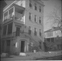
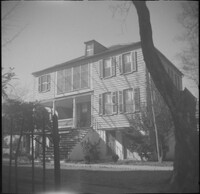
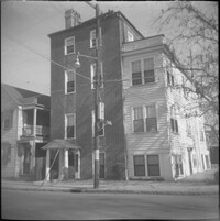
8 George Street (Sarah Daniell Lawrence House).
Date:
1960
Description:
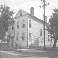
8 Wentworth Street.
Date:
1960
Description:
The original house at 82 Anson Street, later demolished to clear the lot for the relocation of the house at 86 Anson Street (Mary Smith House).
Date:
1960
Description:
The original house at 82 Anson Street, later demolished to clear the lot for the relocation of the house at 86 Anson Street (Mary Smith House).
Date:
1970-1979
Description:
Black-and-white photograph of 83 Hasell Street, street (front) elevation, conjoined with the north elevation of 235 Meeting Street. (Currently the site adjacent to the Hasell Street entrance to Charleston Place.)
Date:
1960
Description:
Right to left: 84 Anson Street before demolition and 86 Anson Street (Mary Smith House) before its relocation to its current address (82 Anson Street).
Date:
1970-1979
Description:
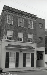
Black-and-white photograph of 85 Hasell Street (Mary Hawkins [dress shop]), street (front) elevation. To its left is an arched entry connecting 83 Hasell to 85, with the sign "Lion's Head." Building was demolished for the Hasell Street entry to Charleston Place and its parking garage.
Date:
1970-1979
Description:
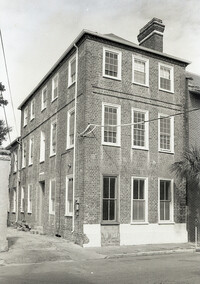
Black-and-white photograph of 86 Hasell Street (Anthony Toomer House), corner view of building, southwest elevation.
Date:
1960
Description:
86 Anson Street (Mary Smith House) prior to its relocation to its current address (82 Anson Street).
Date:
1970-1979
Description:
Black-and-white photograph of 87 Hasell Street (Original Art by Local Artists), street (front) elevation showing alleyway and buildings to the east, now the Hasell Street entry to Charleston Place and its parking garage.
Date:
1970-1979
Description:
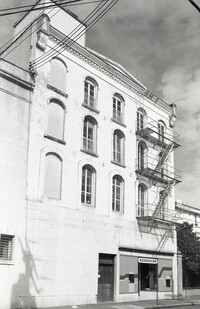
Black-and-white photograph of 89 Hasell Street, street (front) elevation.
Date:
1960
Description:
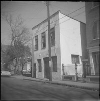
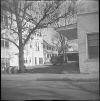
89 Alexander Street at the southwest corner of Alexander and Charlotte Streets.
Date:
1916
Description:
Mulberry Plantation rice field worker completing the barrier walls on each side of the sluice.
Date:
1960
Description:
90 Alexander Street at the southeast corner of Alexander and Charlotte Streets.
Date:
1970-1979
Description:
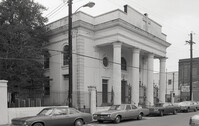
Black-and-white photograph of Kahal Kadosh Beth Elohim Synagogue (90 Hasell Street), southwest elevation, corner view.
Date:
1970-1979
Description:
Black-and-white photograph of 91 Hasell Street, street (front) elevation.
Date:
1960
Description:
George Street elevation of 91 Anson Street (St. John's Reformed Episcopal Church).
Date:
1970-1979
Description:
Black-and-white photograph of 92 Hasell Street [also known as 94 Hasell Street], the side entrance to Kerrison's Department Store, street (front) elevation. (The Kerrison's Building is an L-shaped building at 260 King).
Date:
1970-1979
Description:
Black-and-white photograph of St. Mary's Roman Catholic Church (95 Hasell Street), northeast elevation, corner view.