Lot on site affected by the widening of U.S. Route 17. Presumably located in southern Charleston County. Surveyor notations on back of photo: "Dkt.: 10.600. Property owner: Lula A. Dickenson, et al. Tract: 5. Station: 525± Lt. & Rt. Date: Sept. 18, 1968." [See collection description for explanation of surveyor notations.]
Lot on site affected by the widening of U.S. Route 17. Presumably located in southern Charleston County. Surveyor notations on back of photo: "Dkt.: 10.600. Property owner: R. Maude P. Postell, Estate. Tract: 13. Station: 613± Lt. Date: Sept. 18, 1968." [See collection description for explanation of surveyor notations.]
Lot on site affected by the widening of U.S. Route 17. Presumably located in southern Charleston County. Surveyor notations on back of photo: "Dkt.: 10.600. Property owner: Dr. T.W. Messervy. Tract: 7. Station: 545± Lt. Date: Sept. 18, 1968." [See collection description for explanation of surveyor notations.]
Lot on site affected by the widening of U.S. Route 17. Presumably located in southern Charleston County. Surveyor notations on back of photo: "Dkt.: 10.600. Property owner: Michah Jenkins. Tract: 6. Station: 546± Rt. Date: Sept. 18, 1968." [See collection description for explanation of surveyor notations.]
House on site affected by the widening of U.S. Route 17. Presumably located in Mount Pleasant or vicinity. Surveyor notations on back of photo: "Dkt.: 10.597. Property owner: George Scott. Tract: 76. Station: 438+50 Lt. Date: Sept. 17, 1968." [See collection description for explanation of surveyor notations.]
House on site affected by the widening of U.S. Route 17. Presumably located in Mount Pleasant or vicinity. Surveyor notations on back of photo: "Dkt.: 10.597. Property owner: Irene Foreman. Tract: 78. Station: 441+50 Lt. Date: Sept. 17, 1968." [See collection description for explanation of surveyor notations.]
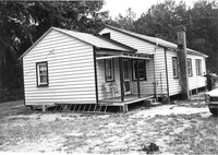
House on site affected by the widening of U.S. Route 17. Presumably located in Mount Pleasant or vicinity. Surveyor notations on back of photo: "Dkt.: 10.597. Property owner: George Scott. Tract: 76. Station: 438+50 Lt. Date: Sept. 17, 1968." [See collection description for explanation of surveyor notations.]
Entry to Boone Hall Plantation, on site affected by the widening of U.S. Route 17. Presumably located in Mount Pleasant or vicinity. Surveyor notations on back of photo: "Dkt.: 10.597. Property owner: Mrs. Nancy T. McRae. Tract: 64. Station: 384±50 Lt. Date: Sept. 17, 1968." [See collection description for explanation of surveyor notations.]
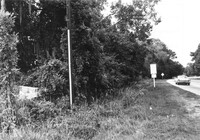
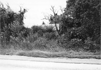
Lot on site affected by the widening of U.S. Route 17. Small house in background, obscured by trees. Presumably located in Mount Pleasant or vicinity. Surveyor notations on back of photo: "Dkt.: 10.597. Property owner: Mrs. Nancy T. McRae. Tract: 64. Station: 409+40 Lt. Date: Sept. 17, 1968." [See collection description for explanation of surveyor notations.]
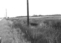
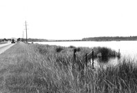
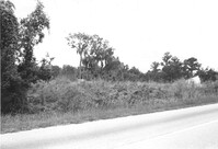
Lot and marsh land on site affected by the widening of U.S. Route 17. Presumably located in southern Charleston County. Surveyor notations on back of photo: "Dkt.: 10.600. Property owner: The Summerville Land Corp., Inc. Tract: 8. Station: 570± Rt. Date: Sept. 18, 1968." [See collection description for explanation of surveyor notations.]
Lot on site affected by the widening of U.S. Route 17. Presumably located in Mount Pleasant or vicinity. Surveyor notations on back of photo: "Dkt.: 10.597. Property owner: O.D. Hamlin. Tract: 110. Station: 479± - 487± Rt. Date: Sept. 17, 1968." [See collection description for explanation of surveyor notations.]
Lot on site affected by the widening of U.S. Route 17. Presumably located in southern Charleston County. Surveyor notations on back of photo: "Dkt.: 10.600. Property owner: The Summerville Land Corp., Inc. Tract: 8. Station: 570± Rt. Date: Sept. 18, 1968." [See collection description for explanation of surveyor notations.]
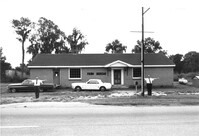
Texaco gas station on site affected by the widening of U.S. Route 17. Presumably located in southern Charleston County. Surveyor notations on back of photo: "Dkt.: 10.600. Property owner: Harold Dukes. Tract: 16-B. Station: 628± Lt. Date: Sept. 18, 1968." [See collection description for explanation of surveyor notations.]
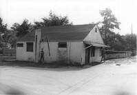
Gas station on site affected by the widening of U.S. Route 17. Presumably located in Mount Pleasant or vicinity. Surveyor notations on back of photo: "Dkt.: 10.597. Property owner: Charles Dingle. Tract: 98. Station 461±50 Rt. Date: Sept. 17, 1968." [See collection description for explanation of surveyor notations.]
Lot and house (in background) on site affected by the widening of U.S. Route 17. Presumably located in Mount Pleasant or vicinity. Surveyor notations on back of photo: "Dkt.: 10.597. Property owner: Mary B. McConnell. Tract: 71. Station: 427+ Lt. Date: Sept. 17, 1968." [See collection description for explanation of surveyor notations.]
House (rear view) on site affected by the widening of U.S. Route 17. Presumably located in Mount Pleasant or vicinity. Surveyor notations on back of photo: "Dkt.: 10.597. Property owner: Julia B. Simmons. Tract: 54. Station: 301+00 Lt. Date: Sept. 17, 1968." [See collection description for explanation of surveyor notations.]
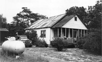
House on site affected by the widening of U.S. Route 17. Presumably located in Mount Pleasant or vicinity. Surveyor notations on back of photo: "Dkt.: 10.597. Property owner: Fay Collington, Est. Tract: 46. Station: 285+50 Rt. Date: Sept. 17, 1968." [See collection description for explanation of surveyor notations.]
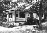
House on site affected by the widening of U.S. Route 17. Presumably located in Mount Pleasant or vicinity. Surveyor notations on back of photo: "Dkt.: 10.597. Property owner: Edward Cummings. Tract: 45. Station: 284+50 Rt. Date: Sept. 17, 1968." [See collection description for explanation of surveyor notations.]
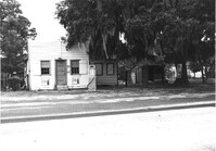
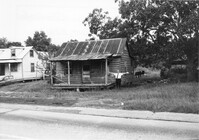
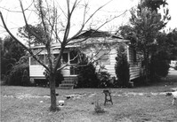
House in dilapidated condition on site affected by the widening of U.S. Route 17. Presumably located in Mount Pleasant or vicinity. Surveyor notations on back of photo: "Dkt.: 10.597. Property owner: Isaac Snype, Estate. Tract: 39. Station: 288+10 Lt. Date: Sept. 17, 1968." [See collection description for explanation of surveyor notations.]
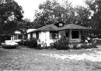
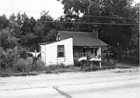
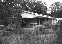
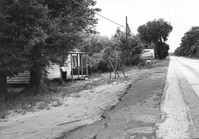
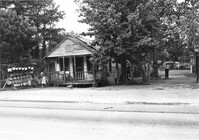
House on site affected by the widening of U.S. Route 17. Sweetgrass basket stand at right. Presumably located in Mount Pleasant or vicinity. Surveyor notations on back of photo: "Dkt.: 10.597. Property owner: Will Jones. Tract: 77-A. Station: 440+00 Lt. Date: Sept. 17, 1968." [See collection description for explanation of surveyor notations.]
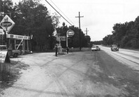
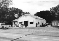
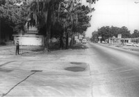
Gulf gas station and County Store on site affected by the widening of U.S. Route 17. Presumably located in Mount Pleasant or vicinity. Surveyor notations on back of photo: "Dkt.: 10.597. Property owner: Mrs. Catherine Owens, et al. Tract: 9. Station: 254+00 Rt. looking north. Date: Sept. 17, 1968." [See collection description for explanation of surveyor notations.]
Building on site affected by the widening of U.S. Route 17. Appears to have previously been a bar; Budweiser sign posted in front of building. Presumably located in Mount Pleasant or vicinity. Surveyor notations on back of photo: "Dkt.: 10.597. Property owner: Leon Burns, et al. Tract: 5. Station: 265± Lt. Date: Sept. 17, 1968." [See collection description for explanation of surveyor notations.]
House (corner view, front) on site affected by the widening of U.S. Route 17. Presumably located in Mount Pleasant or vicinity. Surveyor notations on back of photo: "Dkt.: 10.597. Property owner: Prince and Wilhelmina Gilliard. Tract: 92. Station: 457±10 Rt. Date: Sept. 17, 1968." [See collection description for explanation of surveyor notations.]
House (rear view) on site affected by the widening of U.S. Route 17. Presumably located in southern Charleston County. Surveyor notations on back of photo: "Dkt.: 10.600. Property owner: R. Arnold Postell. Tract: 14. Station: 610±35 Rt. Date: Sept. 18, 1968." [See collection description for explanation of surveyor notations.]
Lot on site affected by the widening of U.S. Route 17. Presumably located in southern Charleston County. Surveyor notations on back of photo: "Dkt.: 10.600. Property owner: R. Arnold Postell. Tract: 16. Station: 630± Rt. Date: Sept. 18, 1968." [See collection description for explanation of surveyor notations.]
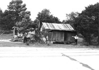
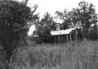
House in dilapidated condition and small outbuilding on site affected by the widening of U.S. Route 17. Presumably located in Mount Pleasant or vicinity. Surveyor notations on back of photo: "Dkt.: 10.597. Property owner: Fay Collington, Estate. Tract: 38. Station: 286± Lt. Date: Sept. 17, 1968." [See collection description for explanation of surveyor notations.]
House on site affected by the widening of U.S. Route 17. Charleston Oil Co. billboard in background. Presumably located in Mount Pleasant or vicinity. Surveyor notations on back of photo: "Dkt.: 10.597. Property owner: Luke Scoff, Est. Tract: 29. Station: 273± Rt. Date: Sept. 17, 1968." [See collection description for explanation of surveyor notations.]
Bargain Center Supermarket (side/corner view, rear) on site affected by the widening of U.S. Route 17. Presumably located in southern Charleston County. Surveyor notations on back of photo: "Dkt.: 10.600. Property owner: Vernon A. Ellis. Tract: 3. Station: 512± - 514± Rt. Date: Sept. 18, 1968." [See collection description for explanation of surveyor notations.]
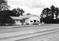
Esso gas station on site affected by the widening of U.S. Route 17. Presumably located in Mount Pleasant or vicinity. Surveyor notations on back of photo: "Dkt.: 10.597. Property owner: Mary B. McConnell. Tract: 79. Station 444+00 Lt. Date: Sept. 17, 1968." [See collection description for explanation of surveyor notations.]
Esso gas station on site affected by the widening of U.S. Route 17. Presumably located in Mount Pleasant or vicinity. Surveyor notations on back of photo: "Dkt.: 10.597. Property owner: Mary B. McConnell. Tract: 79. Station 444+00 Lt. Date: Sept. 17, 1968." [See collection description for explanation of surveyor notations.]
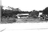
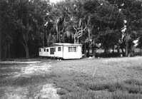
Mobile home on site affected by the widening of U.S. Route 17. Presumably located in southern Charleston County. Surveyor notations on back of photo: "Dkt.: 10.600. Property owner: John D. Postell, Jr. Tract: 15. Station: 623± Rt. Date: Sept. 18, 1968." [See collection description for explanation of surveyor notations.]
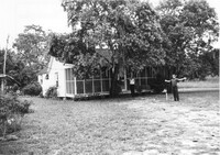
House and sweetgrass basket stand on site affected by the widening of U.S. Route 17. Presumably located in Mount Pleasant or vicinity. Surveyor notations on back of photo: "Dkt.: 10.597. Property owner: Linda Huger, Estate. Tract 84 & 85. Station: 448± Lt. Date: Sept. 17, 1968." [See collection description for explanation of surveyor notations.]
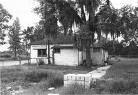
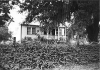
House in dilapidated condition and lot on site affected by the widening of U.S. Route 17. Presumably located in Mount Pleasant or vicinity. Surveyor notations on back of photo: "Dkt.: 10.597. Property owner: F. Gregorie, Estate. Tract: 93. Station: 458±10 Rt. Date: Sept. 17, 1968." [See collection description for explanation of surveyor notations.]
House (corner view, rear) on site affected by the widening of U.S. Route 17. Presumably located in Mount Pleasant or vicinity. Surveyor notations on back of photo: "Dkt.: 10.597. Property owner: Prince and Wilhelmina Gilliard. Tract: 92. Station: 457±10 Rt. Date: Sept. 17, 1968." [See collection description for explanation of surveyor notations.]
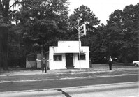
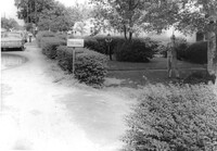
Farm Bureau building, on site affected by the widening of U.S. Route 17. Presumably located in southern Charleston County. Surveyor notations on back of photo: "Dkt.: 10.600. Property owner: Charleston County Farm Bureau. Tract: 2. Station: 507±30 Lt. Date: Sept. 18, 1968." [See collection description for explanation of surveyor notations.]
House on site affected by the widening of U.S. Route 17. Presumably located in Mount Pleasant or vicinity. Surveyor notations on back of photo: "Dkt.: 10.597. Property owner: John Gailliard. Tract: 102. Station: 466±40 Rt. Date: Sept. 17, 1968." [See collection description for explanation of surveyor notations.]
House on site affected by the widening of U.S. Route 17. Presumably located in Mount Pleasant or vicinity. Surveyor notations on back of photo: "Dkt.: 10.597. Property owner: Charles Dingle. Tract: 98. Station 462±50 Rt. Date: Sept. 17, 1968." [See collection description for explanation of surveyor notations.]
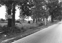
Lot on site affected by the widening of U.S. Route 17. Sign posted to tree: This land cleared by Atlantic Land Corp. Presumably located in southern Charleston County. Surveyor notations on back of photo: "Dkt.: 10.600. Property owner: Arthur J. Stark. Tract: 1. Station: 515± Lt. Date: Sept. 18, 1968." [See collection description for explanation of surveyor notations.]
Lot on site affected by the widening of U.S. Route 17. Presumably located in southern Charleston County. Surveyor notations on back of photo: "Dkt.: 10.600. Property owner: Gas Lines, Inc. & Arthur J. Stark. Tract: 1-A. Station: 506± Lt. Date: Sept. 18, 1968." [See collection description for explanation of surveyor notations.]
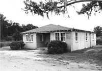
House on site affected by the widening of U.S. Route 17. Presumably located in Mount Pleasant or vicinity. Surveyor notations on back of photo: "Dkt.: 10.597. Property owner: F. Gregorie, Estate. Tract: 93. Station: 460± Rt. Date: Sept. 17, 1968." [See collection description for explanation of surveyor notations.]
House on site affected by the widening of U.S. Route 17. Presumably located in Mount Pleasant or vicinity. Surveyor notations on back of photo: "Dkt.: 10.597. Property owner: F. Gregorie, Estate. Tract: 93. Station: 460± Rt. Date: Sept. 17, 1968." [See collection description for explanation of surveyor notations.]
House on site affected by the widening of State Road 13 (Remount Road). 1548 Remount Road. Surveyor notations on back of photo: "Dkt.: 10.562. Property owner: Harry R. Parkinson, et al. Tract: 61. Date: Jul. 19, 1967." [See collection description for explanation of surveyor notations.]
House on site affected by the widening of State Road 13 (Remount Road). 1552 Remount Road. Surveyor notations on back of photo: "Dkt.: 10.562. Property owner: Robert W. Kimbel. Tract: 60. Date: Jul. 19, 1967." [See collection description for explanation of surveyor notations.]
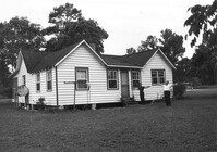
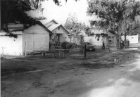
Houses on site affected by the widening of State Road 13 (Remount Road). Surveyor notations on back of photo: "Dkt.: 10.562. Property owner: James R. Robinson, Estate. Tract: 41. Date: Jul. 19, 1967." [See collection description for explanation of surveyor notations.]
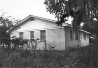
House on site affected by the widening of State Road 13 (Remount Road). Surveyor notations on back of photo: "Dkt.: 10.562. Property owner: Olivia Fleisher Estate. Tract: 38. Date: Jul. 19, 1967." [See collection description for explanation of surveyor notations.]
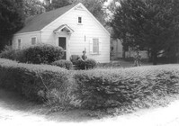
House on site affected by the widening of State Road 13 (Remount Road). Surveyor notations on back of photo: "Dkt.: 10.562. Property owner: Mrs. J.L. McFadyen. Tract: 69. Date: Jul. 19, 1967." [See collection description for explanation of surveyor notations.]
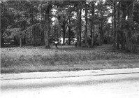
Site affected by the widening of State Road 13 (Remount Road). Surveyor notations on back of photo: "Dkt.: 10.562. Property owner: Barbara Pringle. Tract: 43. Date: Jul. 19, 1967." [See collection description for explanation of surveyor notations.]
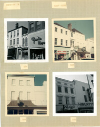
Four photographs of buildings on the east side of King Street (both color and B&W): Top left (316-320): 316 King Street (316-Rosalie Meyers) and 320 King Street (Evelyn Rubin); Top right (304-308): 304 King Street (Leroy's Jewelry Co.), 306 King Street (China Hall) and 308 King Street (Croghan's Jewel Box/The New Shoe Factory) (color photograph); Bottom left: 306 King Street (China Hall) (color photograph); Bottom right (294-296): 294 King Street (Haverty's) and 296 King Street (Levy's) (B&W photograph).
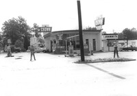
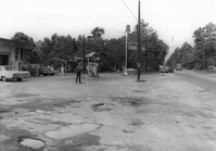
Crown gas station, on site affected by the widening of State Road 13 (Remount Road). Johnny's in back. Possibly the corner of North Rhett Avenue and Remount Road. Surveyor notations on back of photo: "Dkt.: 10.562. Property owner: Corco Realty Co. (Crown). Tract: 142. Date: Jul. 19, 1967." [See collection description for explanation of surveyor notations.]
Crown gas station, on site affected by the widening of State Road 13 (Remount Road). Possibly the corner of North Rhett Avenue and Remount Road. Surveyor notations on back of photo: "Dkt.: 10.562. Property owner: Corco Realty Co. (Crown). Tract: 142. Date: Jul. 19, 1967." [See collection description for explanation of surveyor notations.]