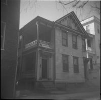
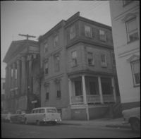
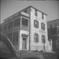
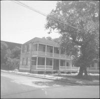
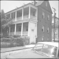
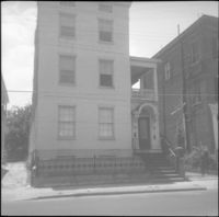
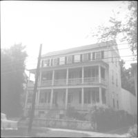
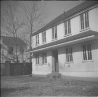
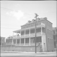
309 East Bay Street (Watson's Grocery), located at the southwest corner of East Bay and Laurens Street, before demolition. (The house at 116 Anson Street was moved to this site with the current address 39 Laurens Street.)
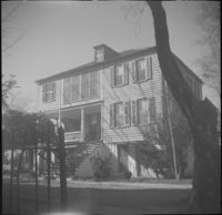
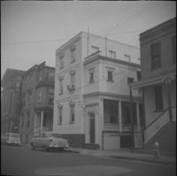
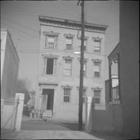
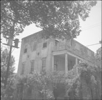
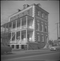
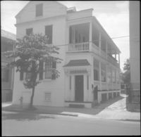
57 Society Street (William McElheran House), flanked by 55 Society Street (High School of Charleston) (left) and partial view of 59 Society Street (right).
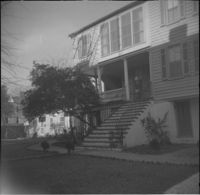
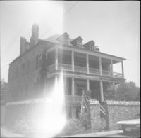
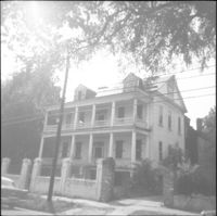
59 Society Street, flanked to its left by 55 Society Street (High School of Charleston) and 57 Society Street (William McElheran House), and to its right by 61 Society Street.
Looking east on George Street to where it ended at Anson Street before the continuation of George Street occurred. Left to right: What was 86 Anson Street, later relocated to 82 Anson Street, and the original house at 82 Anson Street, later demolished for the relocation of 86 Anson Street.
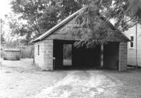
Garage on site affected by the construction of Interstate 26 (I-26). Surveyor notations on back of photo: "Dkt.: 10.471. Property owner: Otis H. Schofill. Tract: 35. Station: 5321+90 Rt. Date: Aug. 23, 1960. In R/W - Bought." [See collection description for explanation of surveyor notations.]
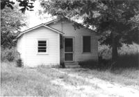
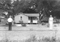
House on site affected by the construction of Interstate 26 (I-26). Surveyor notations on back of photo: "Dkt.: 10.471. Property owner: A.E. Gibbs. Tract: 30. Station: 12+50 Rt. (Ashley Phosphate Road). Date: Aug. 23, 1960. In R/W - Bought." [See collection description for explanation of surveyor notations.]
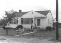
House on site affected by the construction of Interstate 26 (I-26). Surveyor notations on back of photo: "Dkt.: 10.471. Property owner: A.E. Gibbs. Tract: 29. Station: 12+50 Rt. (Ashley Phosphate Road). Date: Aug. 23, 1960. In R/W - Bought." [See collection description for explanation of surveyor notations.]
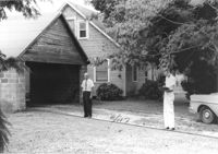
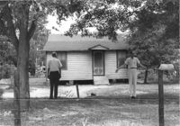
House and garage on site affected by the construction of Interstate 26 (I-26). Surveyor notations on back of photo: "Dkt.: 10.471. Property owner: Otis H. Schofill. Tract: 35. Station: 5321+90 Rt. Date: Aug. 23, 1960. In R/W - Bought." [See collection description for explanation of surveyor notations.]
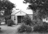
House on site affected by the construction of Interstate 26 (I-26). Surveyor notations on back of photo: "Dkt.: 10.471. Property owner: J.C. Richardson, et al. Tract: 9. Station: 5158+80 Rt. Date: Aug. 23, 1960. In R/W - Bought." [See collection description for explanation of surveyor notations.]
House on site affected by the construction of Interstate 26 (I-26). Surveyor notations on back of photo: "Dkt.: 10.471. Property owner: Jas. Hestedes Est., et al. Tract: 24. Station: 3+50 Rt. (Ashley Phosphate Road). Date: Aug. 23, 1960. Proximity." [See collection description for explanation of surveyor notations.]
House on site affected by the construction of Interstate 26 (I-26). Surveyor notations on back of photo: "Dkt.: 10.471. Property owner: E.J. Tullis. Tract: 27. Station: 7+25 Rt. (Ashley Phosphate Road). Date: Aug. 23, 1960. Proximity." [See collection description for explanation of surveyor notations.]
House on site affected by the construction of Interstate 26 (I-26). Surveyor notations on back of photo: "Dkt.: 10.471. Property owner: M.L. Querry. Tract: 25. Station: 4+00 Rt. (Ashley Phosphate Road). Date: Aug. 23, 1960. Proximity." [See collection description for explanation of surveyor notations.]
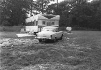
Mobile home and lot, on site affected by the construction of Interstate 26 (I-26). Surveyor notations on back of photo: "Dkt.: 10.471. Property owner: Douglas E. Bohler, et al. Tract: 90. Station: 5376± Lt. Date: Aug. 23, 1960. In R/W - Bought." [See collection description for explanation of surveyor notations.]
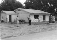
Gulf gas station on site affected by the construction of Interstate 26 (I-26). Surveyor notations on back of photo: "Dkt.: 10.471. Property owner: W.W. Holcombe. Tract: 109. Station: 5380+00 Lt. Date: Aug. 23, 1960. Proximity." [See collection description for explanation of surveyor notations.]
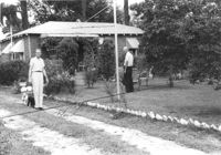
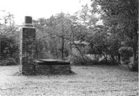
Brick structure (possibly a barbecue pit) in yard of house on site affected by the construction of Interstate 26 (I-26). Surveyor notations on back of photo: "Dkt.: 10.471. Property owner: Otis H. Schofill. Tract: 35. Station: 5322+22 Rt. Date: Aug. 23, 1960. In R/W - Bought." [See collection description for explanation of surveyor notations.]
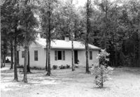
House on site affected by the construction of Interstate 26 (I-26). Surveyor notations on back of photo: "Dkt.: 10.471. Property owner: Jacquelyne E. Kaylor. Tract: 156. Station: 5486+75 Lt. Date: Aug. 23, 1960. Proximity." [See collection description for explanation of surveyor notations.]
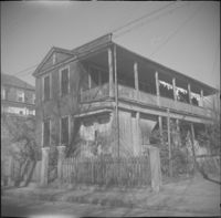
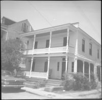
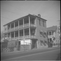
![116 Anson Street [now at 39 Laurens Street]](https://iiif.library.cofc.edu/iiif/2/48432/full/200,/0/default.jpg)