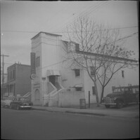
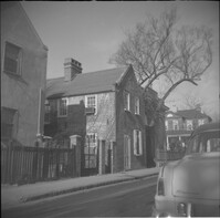
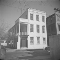
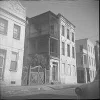
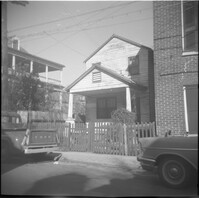
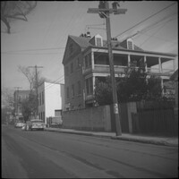
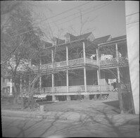
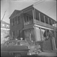
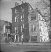
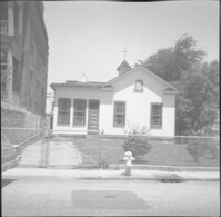
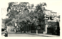
Black-and-white photograph of 83 Hasell Street, street (front) elevation, conjoined with the north elevation of 235 Meeting Street. (Currently the site adjacent to the Hasell Street entrance to Charleston Place.)
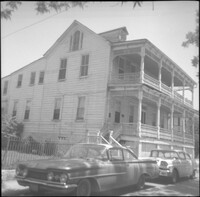
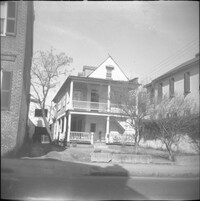
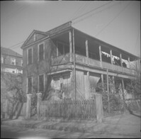
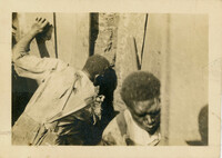
Right to left: 84 Anson Street before demolition and 86 Anson Street (Mary Smith House) before its relocation to its current address (82 Anson Street).
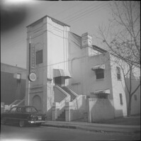
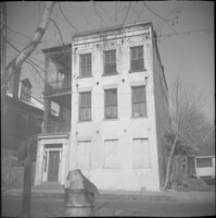
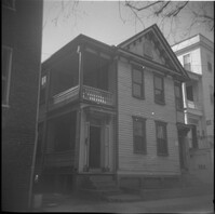
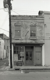
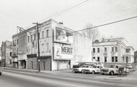
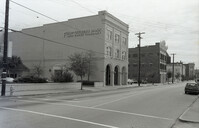
Black-and-white photograph of 85 Hasell Street (Mary Hawkins [dress shop]), street (front) elevation. To its left is an arched entry connecting 83 Hasell to 85, with the sign "Lion's Head." Building was demolished for the Hasell Street entry to Charleston Place and its parking garage.
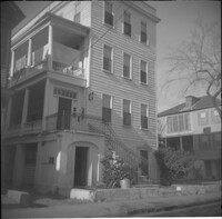
Black-and-white photograph of 87 Hasell Street (Original Art by Local Artists), street (front) elevation showing alleyway and buildings to the east, now the Hasell Street entry to Charleston Place and its parking garage.
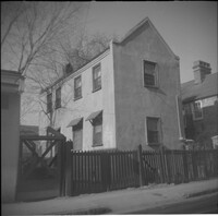
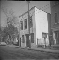
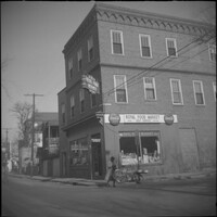
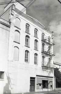
Black-and-white photograph of 92 Hasell Street [also known as 94 Hasell Street], the side entrance to Kerrison's Department Store, street (front) elevation. (The Kerrison's Building is an L-shaped building at 260 King).
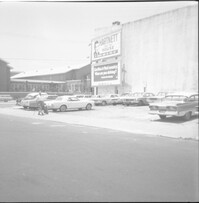
Black-and-white photograph of 97 Hasell Street, the graveyard for St. Mary's Roman Catholic Church, showing the parking lot for C.B. Prentiss (250 King Street).
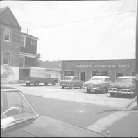
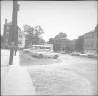
Black-and-white photograph of the east side of the 240 block of Meeting Street, from a parking lot at the corner of Meeting and Hasell Streets and showing 246 Meeting Street (Anderson Electric Co.). 248 Meeting, 250 Meeting, and 252 Meeting. Southwest elevations of 66 Hasell Street and 64 Hasell Street visible at right. (246-250 Meeting is currently a parking lot.)
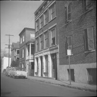
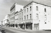
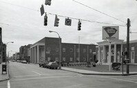
Black-and-white photograph of the east side of the 250 block of King Street, looking north from Hasell Street, starting at 254 King Street, showing 256 King Street, 258 King Street, 260 King Street, and beyond.
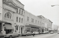
Black-and-white photograph of the west side of the 250 block of King Street, looking north, starting at 253 King Street, and showing 255 King Street, 257 King Street, 259 King Street, 265 King Street, and beyond.
A photograph album created by William Muckenfuss for Mrs. Frances A. Robb, in the 1940s. Album contains photographs of various Charleston buildings, houses, landmarks, sites, events, battleships, and people as well as other Lowcountry places. Mrs. Robb lived on Wentworth Street and several photographs are of her home and neighborhood.
A post card printed for the National Portrait Gallery in London. On the front is a portrait of George, First Lord Anson (1697-1762); on the back is a brief biography of Anson by Philip Gosse.
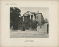
The folio, Examples of Colonial Architecture in Charleston, S.C. and Savannah, Ga., features photographic plates of some of the most important houses and buildings in Charleston and Savannah. Photographs include exterior views of the buildings, gates, and entrances, as well as interior views of fireplaces, mantels, doors, rooms, and ceilings. Compiled and photographed by Edward A. Crane and E.E. Soderholtz. Published in 1895 by the Boston Architectural Club (Boston, Mass.).
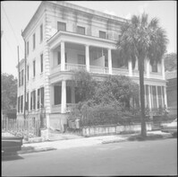
Looking north on East Battery Street from near the bend at White Point Gardens. Pedestrian is walking by White Point Gardens. Louis Desaussure House (1 East Battery) at center; Missroon House (40 East Bay Street) in the distance.
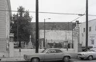
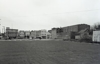
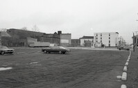
Black-and-white photograph of the view west across what was the location of Belk Department Store (232 King Street) and parking lot, now the site of Charleston Place (formerly known as Charleston Center). Shows the buildings on the west side of King Street on the 225 block: Riviera Theater (225 King), 229 King, 231 King, 233 King, 235 King, 237 King, and 239 King. Southeast elevation of 238-242 King Street at mid-right of photo.
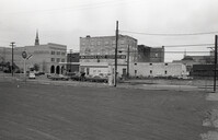
Black-and-white photograph of the view east from the corner of King Street and Market Street toward Meeting Street, across what was the location of Belk Department Store and parking lot, now the site of Charleston Place (formerly known as Charleston Center). Also in view are the rear elevations of Meeting Street buildings and the Meeting Street elevation of the Arnold-Hornik Building (112 North Market).
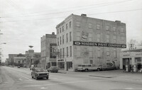
Black-and-white photograph of the view south across what was the location of Belk Department Store and parking lot, now the site of Charleston Place (formerly known as Charleston Center), to the south side of Market Street. Shows the cornier of Meeting Street and Market, Parson's Gulf Station (181-183 Meeting), Madren Paint Company (177 Meeting), and First Citizens Bank (182 Meeting).
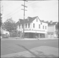
Black-and-white photograph of the west side of the 170 block of Meeting Street, looking south from the corner of Market Street. Shows Parson's Gulf Station (181-183 Meeting), Madren Paint Company (177 Meeting Street, 173 Meeting Street, and the Golden Eagle Motor Inn. (Currently the site of the Wells Fargo Banking Center.)
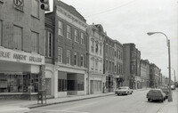
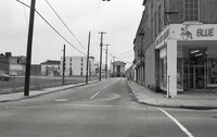
Black-and-white photograph of the view of the east side of King Street, looking south from Market Street, from 220 King Street to about 186 King Street. Shows 220 King, 218 King, 216 King, 214 King, 212 King, 210 King, 208 King, 206 King, 204 King, 202 King, 200 King, 188 King, 186 King.
Black-and-white photograph of the east side of Meeting Street looking south to from Market Street down to Cumberland Street. Shows 182 Meeting Street (First Citizens Bank), 172 Meeting Street, and other buildings since demolished.
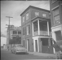
Black-and-white photograph of the west side of King Street below Market Street, starting from the southwest corner of King Street and Market Street. South Carolina Federal Savings & Loan (221 King Street) in foreground. Also shown are 219 King Street, 217 King Street, 215 King Street, and 213 King Street. (Currently the site of Majestic Square.)
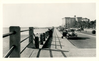
Looking west on Murray Boulevard from the bend at East Battery. Edge of White Point Gardens in view at right; Fort Sumter Hotel (now known as the Fort Sumter House at 1 King Street) in background. Cars on the road.
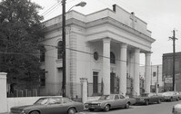
View of the intersection of Broad and Meeting Streets, featuring the Federal Courthouse and Post Office and St. Michael's Church. A car, motorcycle, and bus are on the street the street. Also shows pedestrian activity.
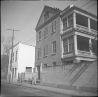
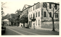
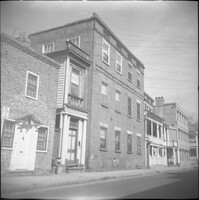
Looking west on Broad Street at 110 Broad Street (Bishop Northrop residence a/k/a William Harvey House a/k/a Ralph Izard House) and 114 Broad Street (Col. Thomas Pinckney House). Cars parked along the street.
Photographs of Charleston buildings, streets, and other sites. Includes brief history of Charleston. Presumably published by A. Wittemann (New York); printed by The Albertype Co. (New York). [2] p., [48] leaves of plates. Measures 13 x 19 cm.
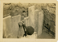
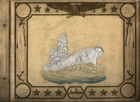
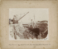
Still images found among the belongings of Henry T. Zacharias, a Charleston builder and contractor in the late 19th- and early-20th century. Zacharias built and/or repaired many notable buildings in Charleston. Includes photographs and one engraving of buildings on which he worked (or likely worked); photographs of battleships in dry dock at the Charleston Navy Yard; and a photograph of his gravesite at Magnolia Cemetery. (Note: Two of Mr. Zacharias's ledger books are in Special Collections at College of Charleston, 'Henry T. Zacharias Ledgers, 1905-1910.')
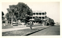
Photographs taken by Sabina Elliott Wells in 1898-1899. Wells was a Charleston artist and designer; she was also a Newcomb potter. Photographs include scenes in Charleston and the Lowcountry, in northwest South Carolina (Table Rock and vicinity), and in western North Carolina (Flat Rock and vicinity). Scans were derived from negatives donated to Historic Charleston Foundation. (Note: Wells's diaries from 1898-1899 that document some of her travels, including sites represented in these photographs, are at the South Carolina Historical Society, "Sabina E. Wells papers, 1886-1942.")
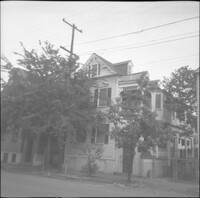
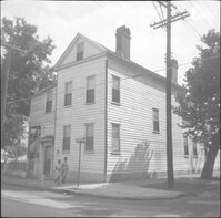
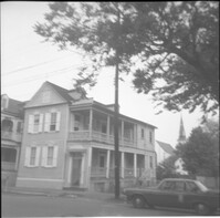
Looking east on Wentworth Street from 26 Wentworth Street (Gardner Kitchen House). Features (left to right): 26 Wentworth Street, 22-24 Wentworth Street (Francis Q. McHugh Tenements), 18-20 Wentworth Street, and 14 Wentworth Street.
Black-and-white photograph of the view looking east on Market Street at the junction of King and Market Streets, from what was the location of Belk Department Store and parking lot (left) and 220 King Street (Blue Knight Gallery) (right) down to Market Hall (background). Meeting Street elevation of the Arnold-Hornik Building (112 North Market) also in view. Vacant lot is now the site of Charleston Place / Charleston Center.
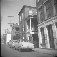
Looking east on George Street to where it ended at Anson Street before the continuation of George Street occurred. Left to right: What was 86 Anson Street, later relocated to 82 Anson Street, and the original house at 82 Anson Street, later demolished for the relocation of 86 Anson Street.
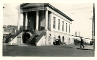
View of Market Hall, southwest elevation, including market sheds, and the corner of Market and Meeting Streets. Cars on street and pedestrian crossing the street. Cravens Delco Radio [store] on North Market Street at left.
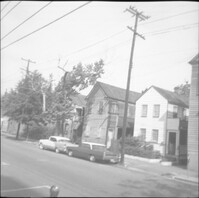
Looking north on Legare Street at 22 Legare Street (Charles Elliott House), a portion of which can be seen in the foreground (right). Man gathering leaves on the sidewalk. Car parked in background.
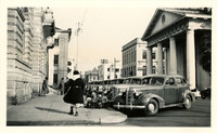
Scene on Meeting Street just south of the "Four Corners of Law" on Broad Street. Features the Federal Courthouse and Post Office and St. Michael's Church in foreground, and the County Courthouse and City Hall in background. Numerous cars are parked in front of the Federal Courthouse, with pedestrians on the sidewalk.
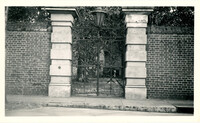
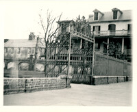
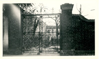
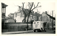
Looking west on Tradd Street at the outbuildings of 32 Legare Street (Sword Gate House). West End Dairy truck parked on street. Pedestrian on sidewalk and person riding a bike on street.