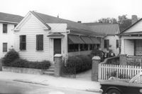
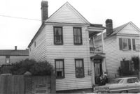
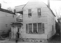
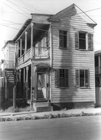
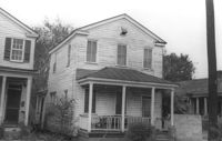
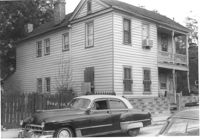
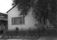
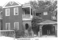
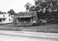
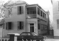
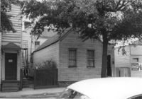
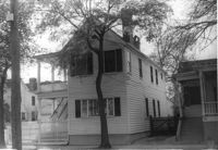
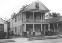
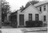
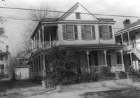
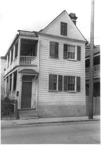
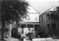
House on site affected by the construction of the Crosstown. Address: 125 Bogard Street. Surveyor notations on back of photo: "Dkt.: 10.524. Property owner: Mattie Jackson. Tract: 47. Station: 72+65 Lt. Date: Oct. 14, 1964. In R/W - Bought." [See collection description for explanation of surveyor notations.]
House on site affected by the construction of the Crosstown. Address: 125 Bogard Street. Surveyor notations on back of photo: "Dkt.: 10.524. Property owner: Mattie Jackson. Tract: 47. Station: 72+65 Lt. Date: Oct. 14, 1964. In R/W - Bought." [See collection description for explanation of surveyor notations.]
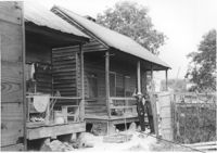
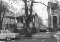
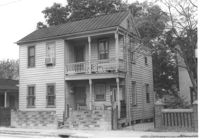
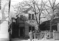
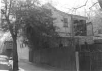
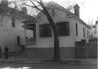
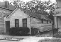
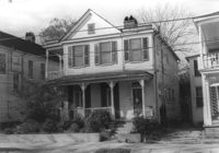
House on site affected by the construction of the Crosstown. Address: 161 Line Street. (Possibly a freedman's cottage with altered entry and porch.) Surveyor notations on back of photo: "Dkt.: 10.524. Property owner: Christopher C. Polite, Est. Tract; 94. Station: 81+90 CL. Date: Dec. 1, 1964. In R/W - Bought." [See collection description for explanation of surveyor notations.]
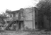
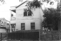
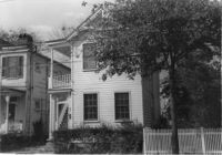
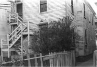
House (rear view) on site affected by the construction of the Crosstown. Address: 161 Line Street. Surveyor notations on back of photo: "Dkt.: 10.524. Property owner: Christopher C. Polite, Est. Tract; 94. Station: 81+90 CL. Date: Dec. 1, 1964. In R/W - Bought." [See collection description for explanation of surveyor notations.]
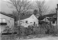
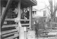
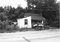
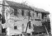
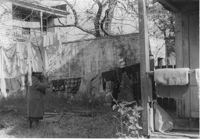
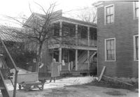
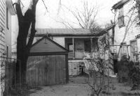
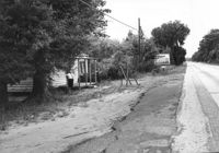
Porch of house with laundry hanging, and lot strewn with scrap wood, on site affected by the construction of the Crosstown. Address: 12 Norman Street. Surveyor notations on back of photo: "Dkt.: 10.524. Property owner: James Alston. Tract: 19. Station: 68+10 Lt. Date: Oct. 13, 1964. Portion in R/W to be removed by property owner." [See collection description for explanation of surveyor notations.]
House on site affected by the construction of the Crosstown. Address: 18-20 Wescott Street. Surveyor notations on back of photo: "Dkt.: 10.524. Property owner: Ralph E. Thornley, et al. Tract: 11. Station: 62+10 Lt. Date: Oct. 13, 1964. Portion in R/W to be removed. [See collection description for explanation of surveyor notations.]
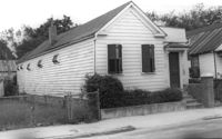
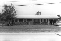
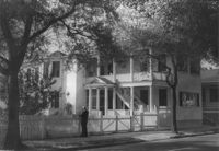
House on site affected by the construction of the Crosstown. Address: 181 Spring Street. Surveyor notations on back of photo: "Dkt.: 10.524. Property owner: Cecelia Elizabeth Cook, Est. Tract: 17. Station: 64+10 Rt. Date: Oct. 13, 1964. Partially In R/W - Bought." [See collection description for explanation of surveyor notations.]
House on site affected by the construction of the Crosstown. Address: 193 Spring Street. Surveyor notations on back of photo: "Dkt.: 10.524. Property owner: Louise A. Robertson. Tract: 13. Station: 23+75 Rt. (Spring Street). Date: Oct. 13, 1964. Portion in R/W to be removed." [See collection description for explanation of surveyor notations.]
House on site affected by the construction of the Crosstown. Address: 193 Spring Street. Surveyor notations on back of photo: "Dkt.: 10.524. Property owner: Louise A. Robertson. Tract: 13. Station: 23+75 Rt. (Spring Street). Date: Oct. 13, 1964. Portion in R/W to be removed." [See collection description for explanation of surveyor notations.]
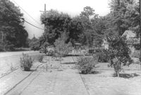
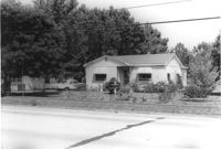
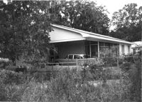
Lot and house (in background) on site affected by the widening of U.S. Route 17. Presumably located in Mount Pleasant or vicinity. Surveyor notations on back of photo: "Dkt.: 10.597. Property owner: Mary B. McConnell. Tract: 71. Station: 427+ Lt. Date: Sept. 17, 1968." [See collection description for explanation of surveyor notations.]
House (rear view) on site affected by the widening of U.S. Route 17. Presumably located in Mount Pleasant or vicinity. Surveyor notations on back of photo: "Dkt.: 10.597. Property owner: Julia B. Simmons. Tract: 54. Station: 301+00 Lt. Date: Sept. 17, 1968." [See collection description for explanation of surveyor notations.]
House on site affected by the construction of the Crosstown. Address: 3 Todd Street. Surveyor notations on back of photo: "Dkt.: 10.524. Property owner: John W. Bonaparte, et al. Tract: 118. Station: 87+75 Rt. Date: Dec. 1, 1964. In R/W - Bought." [See collection description for explanation of surveyor notations.]
House on site affected by the widening of U.S. Route 17. Presumably located in Mount Pleasant or vicinity. Surveyor notations on back of photo: "Dkt.: 10.597. Property owner: Fay Collington, Est. Tract: 46. Station: 285+50 Rt. Date: Sept. 17, 1968." [See collection description for explanation of surveyor notations.]
House on site affected by the construction of the Crosstown. Address: 10 Todd Street. Surveyor notations on back of photo: "Dkt.: 10.524. Property owner: Gabriel W. Bonaparte. Tract: 122. Station: 88+65 Rt. Date: Dec. 2, 1964. In R/W - Bought." [See collection description for explanation of surveyor notations.]
House on site affected by the construction of the Crosstown. Address: 9 Todd Street. Surveyor notations on back of photo: "Dkt.: 10.524. Property owner: Daniel Frasier. Tract: 121. Station: 87+90 Lt. Date: Dec. 2, 1964. Partially in R/W." [See collection description for explanation of surveyor notations.]
House on site affected by the widening of U.S. Route 17. Presumably located in Mount Pleasant or vicinity. Surveyor notations on back of photo: "Dkt.: 10.597. Property owner: Edward Cummings. Tract: 45. Station: 284+50 Rt. Date: Sept. 17, 1968." [See collection description for explanation of surveyor notations.]
House on site affected by the construction of the Crosstown. Address: 7 Todd Street. Surveyor notations on back of photo: "Dkt.: 10.524. Property owner: Daniel Frasier. Tract: 120. Station: 87+90 Lt. Date: Dec. 2, 1964. In R/W - Bought." [See collection description for explanation of surveyor notations.]
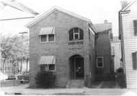
House (corner view) on site affected by the construction of the Crosstown. Address: 123 Sheppard Street. View of street corner. Surveyor notations on back of photo: "Dkt.: 10.524. Property owner: Salem Baptist Church. Tract: 137. Station: 16+60 CL Rt. N.B. lane. Date: Dec. 2, 1964. In R/W - Bought." [See collection description for explanation of surveyor notations.]
House on site affected by the construction of the Crosstown. Address: 123 Sheppard Street. Surveyor notations on back of photo: "Dkt.: 10.524. Property owner: Salem Baptist Church. Tract: 137. Station: 16+60 CL Rt. N.B. lane. Date: Dec. 2, 1964. In R/W - Bought." [See collection description for explanation of surveyor notations.]
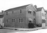
House on site affected by the construction of the Crosstown. Address: 126 Sheppard Street. Surveyor notations on back of photo: "Dkt.: 10.524. Property owner: Nathaniel M. Johnson. Tract: 134. Station: 16+70 Lt. S.B. lane. Date: Dec. 2, 1964. In R/W - Bought." [See collection description for explanation of surveyor notations.]
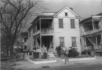
House on site affected by the construction of the Crosstown. Address: 157 President Street. Surveyor notations on back of photo: "Dkt.: 10.524. Property owner: Willie Brooks, et al. Tract: 36. Station: 69+00 Lt. Date: Oct. 14, 1964. In R/W - Bought." [See collection description for explanation of surveyor notations.]
House on site affected by the construction of the Crosstown. Address: 157 President Street. Surveyor notations on back of photo: "Dkt.: 10.524. Property owner: Willie Brooks, et al. Tract: 36. Station: 69+00 Lt. Date: Oct. 14, 1964. In R/W - Bought." [See collection description for explanation of surveyor notations.]
House on site affected by the construction of the Crosstown. Address: 119 Bogard Street (rear). Surveyor notations on back of photo: "Dkt.: 10.524. Property owner: Rebecca S. Cooper. Tract: 55. Station: 73+60 Rt. Date: Oct. 14, 1964. In R/W - Bought." [See collection description for explanation of surveyor notations.]
House on site affected by the construction of the Crosstown. Address: 162 President Street. Surveyor notations on back of photo: "Dkt.: 10.524. Property owner: Emily M. Simmons. Tract: 40. Station: 70+35 Lt. Date: Oct. 14, 1964. In R/W - Bought." [See collection description for explanation of surveyor notations.]
House on site affected by the construction of the Crosstown. Address: 152 President Street. Surveyor notations on back of photo: "Dkt.: 10.524. Property owner: Warren O. Pinckney. Tract: 38. Station: 69+60 Rt. Date: Oct. 14, 1964. Proximity." [See collection description for explanation of surveyor notations.]
House (side view, rear) on site affected by the construction of the Crosstown. Address: 3 Todd Street. Surveyor notations on back of photo: "Dkt.: 10.524. Property owner: John W. Bonaparte, et al. Tract: 118. Station: 87+75 Rt. Date: Dec. 1, 1964. In R/W - Bought." [See collection description for explanation of surveyor notations.]
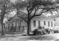
Houses (partial view) on site affected by the construction of the Crosstown. Address: 152-150 Line Street. Surveyor notations on back of photo: "Dkt.: 10.524. Property owner: John N. Peeksen. Tract: 117. Station: 86+70 Rt. Date: Dec. 1, 1964. In R/W." [See collection description for explanation of surveyor notations.]
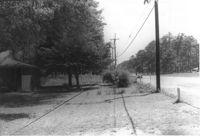
"Panoramic view" of houses on site affected by the construction of the Crosstown. Address: 152-150 Line Street. Surveyor notations on back of photo: "Dkt.: 10.524. Property owner: John N. Peeksen. Tract: 117. Station: 86+70 Rt. Date: Dec. 1, 1964. Panoramic View." [See collection description for explanation of surveyor notations.]
House on site affected by the construction of the Crosstown. Address: 10 Todd Street. Surveyor notations on back of photo: "Dkt.: 10.524. Property owner: Gabriel W. Bonaparte. Tract: 122. Station: 88+65 Rt. Date: Dec. 2, 1964. In R/W - Bought." [See collection description for explanation of surveyor notations.]
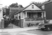
House on site affected by the construction of the Crosstown. Address: 8 Norman Street. Surveyor notations on back of photo: "Dkt.: 10.524. Property owner: Cassandra C. Curry. Tract: 21. Station: 67+30 Lt. Date: Oct. 13, 1964. In R/W - Bought." [See collection description for explanation of surveyor notations.]
House on site affected by the construction of the Crosstown. Address: 8 Norman Street. Surveyor notations on back of photo: "Dkt.: 10.524. Property owner: Cassandra C. Curry. Tract: 21. Station: 67+30 Lt. Date: Oct. 13, 1964. In R/W - Bought." [See collection description for explanation of surveyor notations.]
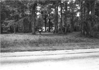
Lot and house (obscured by trees) on site affected by the widening of U.S. Route 17. Presumably located in Mount Pleasant or vicinity. Surveyor notations on back of photo: "Dkt.: 10.439. Property owner: Adolph Benton, et al. Tract: 8. Station: 234+73 to 236+73 Rt. Date: Jul. 22, 1965. Range poles on 33' & 50' R/W - Cond." [See collection description for explanation of surveyor notations.]
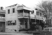
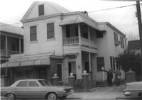
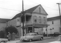
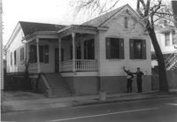
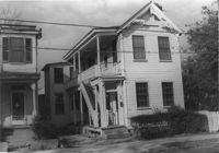
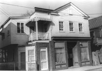
House (boarding house and tea room) on site affected by the construction of the Crosstown. Address: 199 Spring Street. Shows neon sign for Tea Room and signage advertising furnished rooms for rent. Surveyor notations on back of photo: "Dkt.: 10.524. Property owner: Elias A. Johnson, Sr. Tract: 171. Station: 22+45 Rt. Spring Street. Date: Dec. 2, 1964." [See collection description for explanation of surveyor notations.]
House (barely visible) and lot on site affected by the widening of U.S. Route 17. Presumably located in Mount Pleasant or vicinity. Surveyor notations on back of photo: "Dkt.: 10.439. Property owner: Willard B. Causey. Tract: 5. Station: 231+85 Rt. Date: Jul. 22, 1965. Proximity." [See collection description for explanation of surveyor notations.]
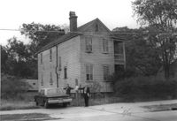
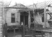
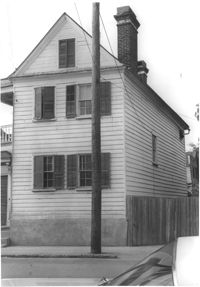
House (rear view) on site affected by the construction of the Crosstown. Address: 81 Kracke Street. Surveyor notations on back of photo: "Dkt.: 10.524. Property owner: Jerry M. Devoe. Tract: 69. Station: 77+80 Lt. Date: Oct. 14, 1964. In R/W - Bought." [See collection description for explanation of surveyor notations.]
House on site affected by the construction of the Crosstown. Address: 265 Ashley Avenue. Surveyor notations on back of photo: "Dkt.: 10.524. Property owner: William A. Dart, et al. Tract: 80. Station: 78+90 CL Rt. Date: Oct. 14, 1964. In R/W - Bought." [See collection description for explanation of surveyor notations.]
Houses on site affected by the construction of the Crosstown. Address: 81 Kracke Street. Surveyor notations on back of photo: "Dkt.: 10.524. Property owner: Jerry M. Devoe. Tract: 69. Station: 77+40 Lt. Date: Oct. 14, 1964. In R/W - Bought." [See collection description for explanation of surveyor notations.]
House on site affected by the construction of the Crosstown. Address: 81 Kracke Street. Surveyor notations on back of photo: "Dkt.: 10.524. Property owner: Jerry M. Devoe. Tract: 69. Station: 77+80 Lt. Date: Oct. 14, 1964. In R/W - Bought." [See collection description for explanation of surveyor notations.]
House (boarding house and tea room) on site affected by the construction of the Crosstown. Address: 199 Spring Street. Shows neon sign for Tea Room and signage advertising furnished rooms for rent. Surveyor notations on back of photo: "Dkt.: 10.524. Property owner: Elias A. Johnson, Sr. Tract: 171. Station: 22+45 Rt. Spring Street. Date: Dec. 2, 1964." [See collection description for explanation of surveyor notations.]
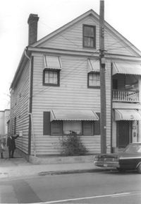
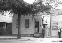
House on site affected by the construction of the Crosstown. Address: 211 Spring Street. "Furnished Rooms" sign posted by door. Surveyor notations on back of photo: "Dkt.: 10.524. Property owner: Freda C. Doscher. Tract: 165. Station: 19+70 Rt. Spring Street. Date: Dec. 2, 1964. Condemned." [See collection description for explanation of surveyor notations.]
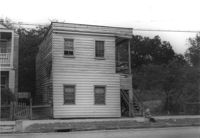
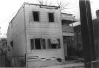
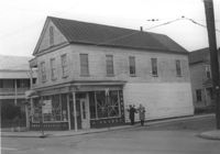
House on site affected by the construction of the Crosstown. Address: 203 Spring Street. First story is Riley's Beauty Shop. Surveyor notations on back of photo: "Dkt.: 10.524. Property owner: Samuel Riley. Tract: 169. Station: 21+65 Rt. Spring Street. Date: Dec. 2, 1964. Condemned." [See collection description for explanation of surveyor notations.]
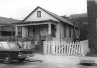
House and carport on site affected by the construction of the Crosstown. Address: 4 Norman Street. Surveyor notations on back of photo: "Dkt.: 10.524. Property owner: Madeline B. Allen, et al. Tract: 23. Station: 66+55 Lt. Date: Oct. 13, 1964. In R/W - Bought." [See collection description for explanation of surveyor notations.]
House (side view) on site affected by the construction of the Crosstown. Address: 162 President Street. Surveyor notations on back of photo: "Dkt.: 10.524. Property owner: Emily M. Simmons. Tract: 40. Station: 70+35 Lt. Date: Oct. 14, 1964. In R/W - Bought." [See collection description for explanation of surveyor notations.]
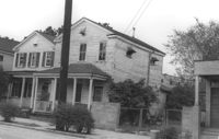
House on site affected by the construction of the Crosstown. Address: 129 Bogard Street. Surveyor notations on back of photo: "Dkt.: 10.524. Property owner: Maxine T. Freidenberg. Tract: 45. Station: 72+10 Lt. Date: Oct. 14, 1964. Portion in R/W to be removed." [See collection description for explanation of surveyor notations.]
House on site affected by the construction of the Crosstown. Address: 129 Bogard Street. Surveyor notations on back of photo: "Dkt.: 10.524. Property owner: Maxine T. Freidenberg. Tract: 45. Station: 72+10 Lt. Date: Oct. 14, 1964. Portion in R/W to be removed." [See collection description for explanation of surveyor notations.]
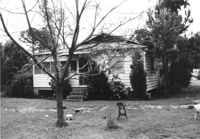
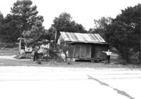
House in dilapidated condition on site affected by the widening of U.S. Route 17. Presumably located in Mount Pleasant or vicinity. Surveyor notations on back of photo: "Dkt.: 10.597. Property owner: Isaac Snype, Estate. Tract: 39. Station: 288+10 Lt. Date: Sept. 17, 1968." [See collection description for explanation of surveyor notations.]
House on site affected by the widening of U.S. Route 17. Sweetgrass basket stand at right. Presumably located in Mount Pleasant or vicinity. Surveyor notations on back of photo: "Dkt.: 10.597. Property owner: Will Jones. Tract: 77-A. Station: 440+00 Lt. Date: Sept. 17, 1968." [See collection description for explanation of surveyor notations.]
House on site affected by the construction of the Crosstown. Address: 163A Line Street [163 Line Street]. Surveyor notations on back of photo: "Dkt.: 10.524. Property owner: Ethelyn M. Parker. Tract: 95. Station: 82+50 Rt. Date: Dec. 1, 1964. In R/W - Bought." [See collection description for explanation of surveyor notations.]
House on site affected by the construction of the Crosstown. Address: 163A Line Street [163 Line Street]. Surveyor notations on back of photo: "Dkt.: 10.524. Property owner: Ethelyn M. Parker. Tract: 95. Station: 82+50 Rt. Date: Dec. 1, 1964. In R/W - Bought." [See collection description for explanation of surveyor notations.]
House on site affected by the construction of the Crosstown. Address: 161A Line Street [161 Line Street]. Surveyor notations on back of photo: "Dkt.: 10.524. Property owner: Marie Suares. Tract: 97. Station: 82+75 Rt. Date: Dec. 1, 1964. In R/W - Bought." [See collection description for explanation of surveyor notations.]
House on site affected by the construction of the Crosstown. Address: 164 Line Street. Surveyor notations on back of photo: "Dkt.: 10.524. Property owner: Mattie Mack. Tract: 98. Station: 82+60 Lt. Date: Dec. 1, 1964. Proximity." [See collection description for explanation of surveyor notations.]
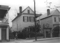
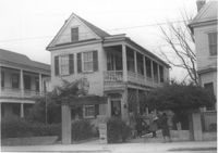
House (corner view) on site affected by the construction of the Crosstown. Address: 205 Spring Street. First story was a store front; has signage indicating its move to 216 Spring Street. View of street corner (corner of Spring Street and Courtenay Street). Surveyor notations on back of photo: "Dkt.: 10.524. Property owner: Katie Anna Meier, Est. Tract: 168. Station: 21+20 Rt. Spring Street. Date: Dec. 2, 1964." [See collection description for explanation of surveyor notations.]
House (corner view) on site affected by the construction of the Crosstown. Address: 205 Spring Street. First story was a store front; has signage indicating its move to 216 Spring Street. View of street corner (corner of Spring Street and Courtenay Street). Surveyor notations on back of photo: "Dkt.: 10.524. Property owner: Katie Anna Meier, Est. Tract: 168. Station: 21+20 Rt. Spring Street. Date: Dec. 2, 1964." [See collection description for explanation of surveyor notations.]
House on site affected by the widening of U.S. Route 17. Presumably located in Mount Pleasant or vicinity. Surveyor notations on back of photo: "Dkt.: 10.439. Property owner: Adolph Benton, et al. Tract: 8. Station: 235+20 Rt. Date: Jul. 22, 1965. Range poles on 33' & 50' R/W - Cond." [See collection description for explanation of surveyor notations.]
House on site affected by the widening of U.S. Route 17. Presumably located in Mount Pleasant or vicinity. Surveyor notations on back of photo: "Dkt.: 10.439. Property owner: W.G. Benton, et al. Tract: 7. Station: 234±15 Rt. Date: Jul. 22, 1965. Range poles on 33' & 50' R/W - Cond." [See collection description for explanation of surveyor notations.]
House on site affected by the construction of the Crosstown. Address: 269 Ashley Avenue. Surveyor notations on back of photo: "Dkt.: 10.524. Property owner: Paul Graham. Tract: 82. Station: 79+20 Lt. Date: Oct. 14, 1964. In R/W - Bought." [See collection description for explanation of surveyor notations.]
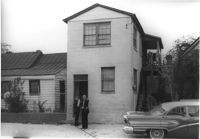
Rear corner of house on site affected by the construction of the Crosstown. Address: 6 Kennedy Street. Surveyor notations on back of photo: "Dkt.: 10.524. Property owner: Eugene Whitney. Tract: 89. Station: 81+80 Rt. Date: Oct. 14, 1964." [See collection description for explanation of surveyor notations.]
House on site affected by the construction of the Crosstown. Address: 269 Ashley Avenue. Surveyor notations on back of photo: "Dkt.: 10.524. Property owner: Paul Graham. Tract: 82. Station: 79+20 Lt. Date: Oct. 14, 1964. In R/W - Bought." [See collection description for explanation of surveyor notations.]
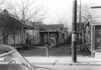
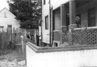
Backyard of house on site affected by the construction of the Crosstown. Address: 122 Sheppard Street. Surveyor notations on back of photo: "Dkt.: 10.524. Property owner: Archie B. Hollins. Tract: 136. Station: 17+40 Lt. S.B. lane. Date: Dec. 2, 1964. Outside R/W." [See collection description for explanation of surveyor notations.]
House (rear view) on site affected by the construction of the Crosstown. Address: 122 Sheppard Street. View looking towards street corner. Surveyor notations on back of photo: "Dkt.: 10.524. Property owner: Archie B. Hollins. Tract: 136. Station: 17+40 Lt. S.B. lane. Date: Dec. 2, 1964. In R/W - Bought." [See collection description for explanation of surveyor notations.]
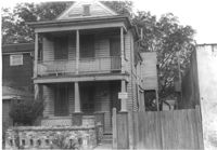
House on site affected by the construction of the Crosstown. Address: 285 Coming Street. Surveyor notations on back of photo: "Dkt.: 10.524. Property owner: Gladys S. Wilson. Tract: 151. Station: 21+40 Lt. S.B. lane. Date: Dec. 2, 1964. In R/W - Bought." [See collection description for explanation of surveyor notations.]
House on site affected by the construction of the Crosstown. Address: 285 Coming Street. Surveyor notations on back of photo: "Dkt.: 10.524. Property owner: Gladys S. Wilson. Tract: 151. Station: 21+40 Lt. S.B. lane. Date: Dec. 2, 1964. In R/W - Bought." [See collection description for explanation of surveyor notations.]
Houses on site affected by the widening of U.S. Route 17. Presumably located in Mount Pleasant or vicinity. Surveyor notations on back of photo: "Dkt.: 10.439. Property owner: Doretha B. Chavis. Tract: 15. Station: 225+00 Lt. Date: Jul. 22, 1965. Proximity." [See collection description for explanation of surveyor notations.]
House on site affected by the construction of the Crosstown. Address: 287 Coming Street. Surveyor notations on back of photo: "Dkt.: 10.524. Property owner: John T. Bowden. Tract: 152. Station: 21+50 Lt. S.B. lane. Date: Dec. 2, 1964. In R/W - Bought." [See collection description for explanation of surveyor notations.]
House on site affected by the construction of the Crosstown. Address: 287 Coming Street. Surveyor notations on back of photo: "Dkt.: 10.524. Property owner: John T. Bowden. Tract: 152. Station: 21+50 Lt. S.B. lane. Date: Dec. 2, 1964. In R/W - Bought." [See collection description for explanation of surveyor notations.]
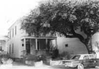
House on site affected by the construction of the Crosstown. Address: 71 Kracke Street. Surveyor notations on back of photo: "Dkt.: 10.524. Property owner: William Henry Godfrey. Tract: 66. Station: 76+10 Lt. Date: Oct. 14, 1964. Portion in R/W to be removed." [See collection description for explanation of surveyor notations.]
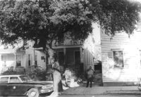
House on site affected by the construction of the Crosstown. Address: 147 President Street. Surveyor notations on back of photo: "Dkt.: 10.524. Property owner: Frank Chinners. Tract: 31. Station: 67+60 Rt. Date: Oct. 13, 1964. Partially In R/W - Bought." [See collection description for explanation of surveyor notations.]
House on site affected by the construction of the Crosstown. Address: 127 Bogard Street. Surveyor notations on back of photo: "Dkt.: 10.524. Property owner: Lucille Frasier. Tract: 46. Station: 72+40 Lt. Date: Oct. 14, 1964. Portion In R/W - Bought." [See collection description for explanation of surveyor notations.]
House on site affected by the construction of the Crosstown. Address: 127 Bogard Street. Surveyor notations on back of photo: "Dkt.: 10.524. Property owner: Lucille Frasier. Tract: 46. Station: 72+40 Lt. Date: Oct. 14, 1964. Portion In R/W - Bought." [See collection description for explanation of surveyor notations.]
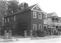
House on site affected by the construction of the Crosstown. Address: 184 Spring Street. Surveyor notations on back of photo: "Dkt.: 10.524. Property owner: Laura H. Middleton. Tract: 26. Station: 65+40 Rt. Date: Oct. 13, 1964. In R/W - Bought." [See collection description for explanation of surveyor notations.]
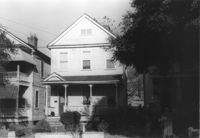
House on site affected by the construction of the Crosstown. Address: 145 President Street. Surveyor notations on back of photo: "Dkt.: 10.524. Property owner: John A. Williams, et al. Tract: 30. Station: 67+30 Rt. Date: Oct. 13, 1964." [See collection description for explanation of surveyor notations.]
House on site affected by the construction of the Crosstown. Address: 145 President Street. Surveyor notations on back of photo: "Dkt.: 10.524. Property owner: John A. Williams, et al. Tract: 30. Station: 67+30 Rt. Date: Oct. 13, 1964." [See collection description for explanation of surveyor notations.]
House (corner view, front) on site affected by the widening of U.S. Route 17. Presumably located in Mount Pleasant or vicinity. Surveyor notations on back of photo: "Dkt.: 10.597. Property owner: Prince and Wilhelmina Gilliard. Tract: 92. Station: 457±10 Rt. Date: Sept. 17, 1968." [See collection description for explanation of surveyor notations.]
House (rear view) on site affected by the widening of U.S. Route 17. Presumably located in southern Charleston County. Surveyor notations on back of photo: "Dkt.: 10.600. Property owner: R. Arnold Postell. Tract: 14. Station: 610±35 Rt. Date: Sept. 18, 1968." [See collection description for explanation of surveyor notations.]
House on site affected by the construction of the Crosstown. Address: 106 Sheppard Street. Surveyor notations on back of photo: "Dkt.: 10.524. Property owner: Annie H. Powers. Tract: 149. Station: 20+65 Rt. S.B. lane. Date: Dec. 2, 1964. In R/W - Bought." [See collection description for explanation of surveyor notations.]
House on site affected by the construction of the Crosstown. Address: 106 Sheppard Street. Surveyor notations on back of photo: "Dkt.: 10.524. Property owner: Annie H. Powers. Tract: 149. Station: 20+65 Rt. S.B. lane. Date: Dec. 2, 1964. In R/W - Bought." [See collection description for explanation of surveyor notations.]
House on site affected by the construction of the Crosstown. Address: 104 Sheppard Street. Surveyor notations on back of photo: "Dkt.: 10.524. Property owner: Rachel Bailey. Tract: 150. Station: 20+95 Rt. S.B. lane. Date: Dec. 2, 1964. In R/W - Bought." [See collection description for explanation of surveyor notations.]
House on site affected by the construction of the Crosstown. Address: 104 Sheppard Street. Surveyor notations on back of photo: "Dkt.: 10.524. Property owner: Rachel Bailey. Tract: 150. Station: 20+95 Rt. S.B. lane. Date: Dec. 2, 1964. In R/W - Bought." [See collection description for explanation of surveyor notations.]
House on site affected by the construction of the Crosstown. Address: 108 Sheppard Street. Surveyor notations on back of photo: "Dkt.: 10.524. Property owner: Abe Kirshtein. Tract: 148. Station: 20+20 Rt. S.B. lane. Date: Dec. 2, 1964. In R/W - Bought." [See collection description for explanation of surveyor notations.]
House on site affected by the construction of the Crosstown. Address: 117 Sheppard Street. Surveyor notations on back of photo: "Dkt.: 10.524. Property owner: Julia Sharpe, et al., Est. Tract: 140. Station: 17+85 Rt. N.B. lane. Date: Dec. 2, 1964. Condemned." [See collection description for explanation of surveyor notations.]
House on Sheppard Street on site affected by the widening of U.S. Route 17. Address 131 Sheppard Street. Surveyor notations on back of photo: "Dkt.: 10.524. Property owner: William Delestine, et al. Tract: 127. Station: 90+20 CL. Date: Dec. 2, 1964. In R/W - Bought." [See collection description for explanation of surveyor notations.]
House on site affected by the construction of the Crosstown. Address: 127 Sheppard Street. Surveyor notations on back of photo: "Dkt.: 10.524. Property owner: Essie W. Jenkins. Tract: 129. Station: 91+50 Rt. Date: Dec. 2, 1964. In R/W - Bought." [See collection description for explanation of surveyor notations.]
Houses on Sheppard Street (rear view) on site affected by the construction of the Crosstown. Address: 131½ Sheppard Street [131 Sheppard Street]. Surveyor notations on back of photo: "Dkt.: 10.524. Property owner: William Delestine, et al. Tract: 127. Station: 89+60 Rt. Date: Dec. 2, 1964. Proximity." [See collection description for explanation of surveyor notations.]
House on site affected by the construction of the Crosstown. Address: 506 Rutledge Avenue. Surveyor notations on back of photo: "Dkt.: 10.524. Property owner: Stephen B. Graham, et al. Tract: 113. Station: 86+50 Lt. Date: Dec. 1, 1964. In R/W - Bought." [See collection description for explanation of surveyor notations.]
House on site affected by the construction of the Crosstown. Address: 4 Norman Street. Surveyor notations on back of photo: "Dkt.: 10.524. Property owner: Madeline B. Allen, et al. Tract: 23. Station: 66+55 Lt. Date: Oct. 13, 1964. In R/W - Bought." [See collection description for explanation of surveyor notations.]
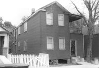
House on site affected by the construction of the Crosstown. Address: 2 Norman Street. Surveyor notations on back of photo: "Dkt.: 10.524. Property owner: Sadie Belle Weathers. Tract: 24. Station: 66+35 CL Lt. Date: Oct. 13, 1964. In R/W - Bought." [See collection description for explanation of surveyor notations.]
House on site affected by the construction of the Crosstown. Address: 2 Norman Street. Surveyor notations on back of photo: "Dkt.: 10.524. Property owner: Sadie Belle Weathers. Tract: 24. Station: 66+35 CL Lt. Date: Oct. 13, 1964. In R/W - Bought." [See collection description for explanation of surveyor notations.]
House on site affected by the construction of the Crosstown. Address: 184 Spring Street. Surveyor notations on back of photo: "Dkt.: 10.524. Property owner: Laura H. Middleton. Tract: 26. Station: 65+40 Rt. Date: Oct. 13, 1964. In R/W - Bought." [See collection description for explanation of surveyor notations.]
Rear view of house on site affected by the construction of the Crosstown. Address: 508 Rutledge Avenue. Surveyor notations on back of photo: "Dkt.: 10.524. Property owner: W.C. Hayes, Est. Tract: 112. Station: 86+60 Lt. Date: Dec. 1, 1964. In R/W - Bought." [See collection description for explanation of surveyor notations.]
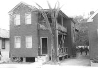
House on site affected by the construction of the Crosstown. Address: 504 Rutledge Avenue. Surveyor notations on back of photo: "Dkt.: 10.524. Property owner: Florence Britton Jones. Tract: 114. Station: 86+30 Rt. Date: Dec. 1, 1964. In R/W - Bought." [See collection description for explanation of surveyor notations.]
House on site affected by the construction of the Crosstown. Address: 504 Rutledge Avenue. Surveyor notations on back of photo: "Dkt.: 10.524. Property owner: Florence Britton Jones. Tract: 114. Station: 86+30 Rt. Date: Dec. 1, 1964. In R/W - Bought." [See collection description for explanation of surveyor notations.]
Storage shed or garage and backyard in rear of house on site affected by the construction of the Crosstown. Address: 160½ Line Street [160 Line Street]. Surveyor notations on back of photo: "Dkt.: 10.524. Property owner: John Meyer, Est. Tract: 101. Station: 83+65 Lt. Date: Dec. 1, 1964. In R/W - Bought." [See collection description for explanation of surveyor notations.]
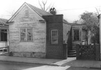
House on site affected by the construction of the Crosstown. Address: 158 Line Street. First story appears to be a store (or office) front. Signs for W.L. Metz, Jr. and H.L. Davis in window. Surveyor notations on back of photo: "Dkt.: 10.524. Property owner: William A. Williams. Tract: 102. Station: 83+70 CL. Date: Dec. 1, 1964. In R/W - Bought. [See collection description for explanation of surveyor notations.]
House (freedman's cottage) on site affected by the construction of the Crosstown. Address: 162½ Line Street [162 Line Street]. Surveyor notations on back of photo: "Dkt.: 10.524. Property owner: Frederick J. Cook. Tract: 99. Station: 82+65 Lt. Date: Dec. 1, 1964. In R/W - Bought." [See collection description for explanation of surveyor notations.]
House in dilapidated condition and small outbuilding on site affected by the widening of U.S. Route 17. Presumably located in Mount Pleasant or vicinity. Surveyor notations on back of photo: "Dkt.: 10.597. Property owner: Fay Collington, Estate. Tract: 38. Station: 286± Lt. Date: Sept. 17, 1968." [See collection description for explanation of surveyor notations.]
House on site affected by the widening of U.S. Route 17. Charleston Oil Co. billboard in background. Presumably located in Mount Pleasant or vicinity. Surveyor notations on back of photo: "Dkt.: 10.597. Property owner: Luke Scoff, Est. Tract: 29. Station: 273± Rt. Date: Sept. 17, 1968." [See collection description for explanation of surveyor notations.]
House on site affected by the construction of the Crosstown. Address: 16 Todd Street. View of street corner (corner of Todd Street and Sheppard Street). Surveyor notations on back of photo: "Dkt.: 10.524. Property owner: Wilmot J. Frasier. Tract: 125. Station: 88+80 Lt. Date: Dec. 2, 1964. In R/W - Bought." [See collection description for explanation of surveyor notations.]
House on site affected by the construction of the Crosstown. Address: 16 Todd Street. View of street corner (corner of Todd Street and Sheppard Street). Surveyor notations on back of photo: "Dkt.: 10.524. Property owner: Wilmot J. Frasier. Tract: 125. Station: 88+80 Lt. Date: Dec. 2, 1964. In R/W - Bought." [See collection description for explanation of surveyor notations.]
House on site affected by the construction of the Crosstown. Address: 120 Sheppard Street. View of street corner. Surveyor notations on back of photo: "Dkt.: 10.524. Property owner: Jackson T. Rhodes. Tract: 142. Station: 18+25 Lt. S.B. lane. Date: Dec. 2, 1964. Condemned." [See collection description for explanation of surveyor notations.]
House on site affected by the construction of the Crosstown. Address: 506 Rutledge Avenue. Surveyor notations on back of photo: "Dkt.: 10.524. Property owner: Stephen B. Graham, et al. Tract: 113. Station: 86+50 Lt. Date: Dec. 1, 1964. In R/W - Bought." [See collection description for explanation of surveyor notations.]