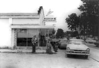
Arrow Restaurant, on site affected by the widening of State Road 13 (Remount Road). Surveyor notations on back of photo: "Dkt.: 10.562. Property owner: F.L. Parks, Jr. Tract: 3. Date: Jul. 12, 1967." [See collection description for explanation of surveyor notations.]
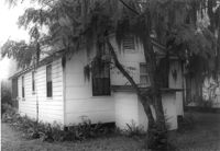
House on site affected by the widening of State Road 13 (Remount Road). Rear view. Surveyor notations on back of photo: "Dkt.: 10.562. Property owner: Charles R. Roberson. Tract: 36-A. Date: Jul. 19, 1967." [See collection description for explanation of surveyor notations.]
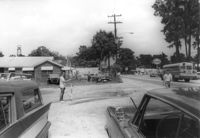
Site affected by the widening of State Road 13 (Remount Road). Surveyor notations on back of photo: "Dkt.: 10.562. Property owner: F.L. Parks, Jr. Tract: 3. Date: Jul. 12, 1967." [See collection description for explanation of surveyor notations.]
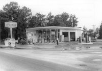
Atlantic gas station, on site affected by the widening of State Road 13 (Remount Road). Surveyor notations on back of photo: "Dkt.: 10.562. Property owner: Atlantic Refining Co. Tract: 37. Date: Jul. 19, 1967." [See collection description for explanation of surveyor notations.]
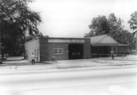
North Charleston Fire Department Station: No. 3, on site affected by the widening of State Road 13 (Remount Road). Trailer park in background. Surveyor notations on back of photo: "Dkt.: 10.562. Property owner: North Charleston Public Service. Tract: 6. Date: Jul. 12, 1967." [See collection description for explanation of surveyor notations.]
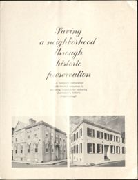
This six-page brochure provides the history, goals, and accomplishments of the Ansonborough Rehabilitation Project. Includes photographs of "before and after" scenes in the Ansonborough area. Reprinted from the Journal of Housing, Vol. 24, No. 3, April 1967.
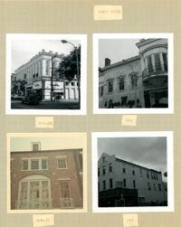
Three B&W photographs and one color photograph of buildings on the west side of King Street: Top left (319-325): 319 King Street (Bob Ellis Shoe Store), 321 King Street, 323 King Street (LeRoy's Jewelry Co.), and 325 King Street (Thom McAn); Top right: 315 King Street (Jean Meyers); Bottom left: 309-311 King Street (color photograph); Bottom right: 297 King Street (National Shirt Shop) (Arcade Theater sign on corner of building).
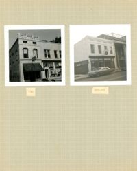
Two B&W photographs of buildings on the west side of King Street: Left (159-161): 159 King Street (Hildebrands) and 161 King Street; Right (201-203): 201 King Street (Castanes Grocery) and 203 King Street (later demolished for the construction of Victoria Center).