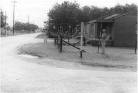
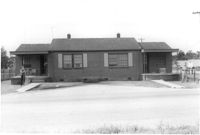
House on site affected by the widening of State Road 13 (Remount Road). View of street corner. Corner of S-10-282 (Sumner Avenue and North Rhett Avenue(?). Surveyor notations on back of photo: "Dkt.: 10.562. Property owner: Leonella Padgett. Tract: 148. Date: Jul. 19, 1967." [See collection description for explanation of surveyor notations.]
House on site affected by the widening of State Road 13 (Remount Road). Surveyor notations on back of photo: "Dkt.: 10.562. Property owner: Alline S. Crum. Tract: 139. Date: Jul. 19, 1967." [See collection description for explanation of surveyor notations.]
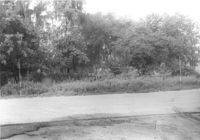
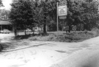
Site affected by the widening of State Road 13 (Remount Road). Surveyor notations on back of photo: "Dkt.: 10.562. Property owner: W.W. Walker, et al. Tract: 36-B. Date: Jul. 19, 1967." [See collection description for explanation of surveyor notations.]
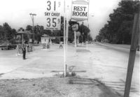
Texaco gas station, on site affected by the widening of State Road 13 (Remount Road). Neighboring Gulf gas Station: in background. Surveyor notations on back of photo: "Dkt.: 10.562. Property owner: W.L. Dyches, et al. Tract: 23. Date: Jul. 12, 1967." [See collection description for explanation of surveyor notations.]
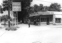
Clint's Place - Variety Store, corner of Craig Road, on site affected by the widening of State Road 13 (Remount Road). View of street corner. Surveyor notations on back of photo: "Dkt.: 10.562. Property owner: Samuel C. Rollings. Tract: 10. Date: Jul. 12, 1967." [See collection description for explanation of surveyor notations.]
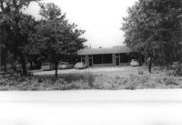
Office building with sign for Joe Grooms State Farm Insurance, on site affected by the widening of State Road 13 (Remount Road). Surveyor notations on back of photo: "Dkt.: 10.562. Property owner: Joseph J. Grooms. Tract: 18. Date: Jul. 12, 1967." [See collection description for explanation of surveyor notations.]
Office building on site affected by the widening of State Road 13 (Remount Road). Surveyor notations on back of photo: "Dkt.: 10.562. Property owner: Joseph J. Grooms. Tract: 18. Date: Jul. 12, 1967." [See collection description for explanation of surveyor notations.]
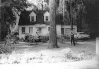
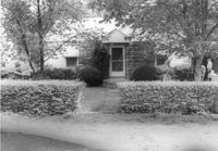
House on site affected by the widening of State Road 13 (Remount Road). 1552 Remount Road. Surveyor notations on back of photo: "Dkt.: 10.562. Property owner: Robert W. Kimbel. Tract: 60. Date: Jul. 19, 1967." [See collection description for explanation of surveyor notations.]
House on site affected by the widening of State Road 13 (Remount Road). Surveyor notations on back of photo: "Dkt.: 10.562. Property owner: Leonella Padgett. Tract: 148. Date: Jul. 19, 1967." [See collection description for explanation of surveyor notations.]
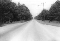
Site (affected by the widening of State Road 13 (Remount Road). Surveyor notations on back of photo: "Dkt.: 10.562. Property owner: West Virginia Pulp and Paper Co. Tract: 129. Date: Jul. 19, 1967." [See collection description for explanation of surveyor notations.]