House on site affected by the widening of U.S. Route 17. Presumably located in southern Charleston County. Surveyor notations on back of photo: "Dkt.: 10.600. Property owner: R. Arnold Postell. Tract: 14. Station: 610±35 Rt. Date: Sept. 18, 1968." [See collection description for explanation of surveyor notations.]
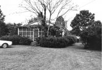
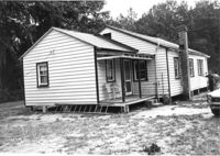
House on site affected by the widening of U.S. Route 17. Presumably located in Mount Pleasant or vicinity. Surveyor notations on back of photo: "Dkt.: 10.597. Property owner: George Scott. Tract: 76. Station: 438+50 Lt. Date: Sept. 17, 1968." [See collection description for explanation of surveyor notations.]
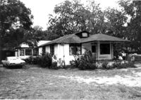
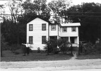
House on site affected by the widening of U.S. Route 17. Presumably located in Mount Pleasant or vicinity. Surveyor notations on back of photo: "Dkt.: 10.597. Property owner: Irene Foreman. Tract: 78. Station: 441+50 Lt. Date: Sept. 17, 1968." [See collection description for explanation of surveyor notations.]
House on site affected by the widening of U.S. Route 17. Presumably located in Mount Pleasant or vicinity. Surveyor notations on back of photo: "Dkt.: 10.597. Property owner: George Scott. Tract: 76. Station: 438+50 Lt. Date: Sept. 17, 1968." [See collection description for explanation of surveyor notations.]
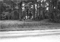
Lot and house (in background) on site affected by the widening of U.S. Route 17. Presumably located in Mount Pleasant or vicinity. Surveyor notations on back of photo: "Dkt.: 10.597. Property owner: Mary B. McConnell. Tract: 71. Station: 427+ Lt. Date: Sept. 17, 1968." [See collection description for explanation of surveyor notations.]
House (rear view) on site affected by the widening of U.S. Route 17. Presumably located in Mount Pleasant or vicinity. Surveyor notations on back of photo: "Dkt.: 10.597. Property owner: Julia B. Simmons. Tract: 54. Station: 301+00 Lt. Date: Sept. 17, 1968." [See collection description for explanation of surveyor notations.]
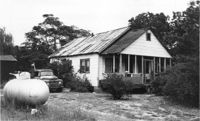
House on site affected by the widening of U.S. Route 17. Presumably located in Mount Pleasant or vicinity. Surveyor notations on back of photo: "Dkt.: 10.597. Property owner: Fay Collington, Est. Tract: 46. Station: 285+50 Rt. Date: Sept. 17, 1968." [See collection description for explanation of surveyor notations.]
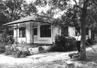
House on site affected by the widening of U.S. Route 17. Presumably located in Mount Pleasant or vicinity. Surveyor notations on back of photo: "Dkt.: 10.597. Property owner: Edward Cummings. Tract: 45. Station: 284+50 Rt. Date: Sept. 17, 1968." [See collection description for explanation of surveyor notations.]
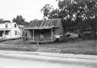
House in dilapidated condition on site affected by the widening of U.S. Route 17. Presumably located in Mount Pleasant or vicinity. Surveyor notations on back of photo: "Dkt.: 10.597. Property owner: Isaac Snype, Estate. Tract: 39. Station: 288+10 Lt. Date: Sept. 17, 1968." [See collection description for explanation of surveyor notations.]
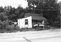
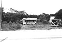
House on site affected by the widening of U.S. Route 17. Sweetgrass basket stand at right. Presumably located in Mount Pleasant or vicinity. Surveyor notations on back of photo: "Dkt.: 10.597. Property owner: Will Jones. Tract: 77-A. Station: 440+00 Lt. Date: Sept. 17, 1968." [See collection description for explanation of surveyor notations.]
Right of way--South Carolina--Charleston County, Highway planning--South Carolina--Charleston County, Vernacular architecture--South Carolina--Charleston County, Lost architecture--South Carolina--Charleston County, Dwellings--South Carolina--Charleston County✖[remove]41