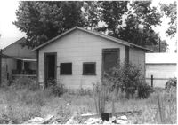
Outbuilding on site affected by the construction of Interstate 26 (I-26). Possibly on Rivers Avenue. Surveyor notations on back of photo: "Dkt.: 10.486. Property owner: Redding F. Moore. Tract: 23, 24, 25. Station: 15+90 Rt. (Line C). Date: May 30, 1961. In R/W - Bought." [See collection description for explanation of surveyor notations.]
Outbuildings on site affected by the construction of Interstate 26 (I-26). Surveyor notations on back of photo: "Dkt.: 10.480. Property owner: Joe Stephens, Est. Tract: 29. Station: 5505+50 Lt. Date: May 1, 1961. In R/W - Bought." [See collection description for explanation of surveyor notations.]
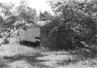
Shed on site affected by the construction of Interstate 26 (I-26). Surveyor notations on back of photo: "Dkt.: 10.480. Property owner: Ruth I. Kirby. Tract: 236. Station: 5699+30 Lt. Date: May 2, 1961. In R/W - Bought." [See collection description for explanation of surveyor notations.]
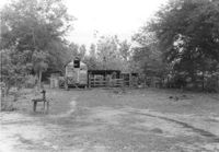
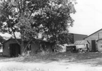
Lot and structure that appears to be a barn or stable, on site affected by the construction of Interstate 26 (I-26). Surveyor notations on back of photo: "Dkt.: 10.480. Property owner: George Hamilton, Est., et al. Tract: 30. Station: 5505+30 CL. Date: May 2, 1961. In R/W - Bought." [See collection description for explanation of surveyor notations.]
Shed on site affected by the construction of Interstate 26 (I-26). Pepsi-Cola, Camel [cigarettes] signs on front. Surveyor notations on back of photo: "Dkt.: 10.480. Property owner: Central McMillan, et al. Tract: 38. Station: 5507+90 Rt. Date: May 2, 1961. In R/W - Bought." [See collection description for explanation of surveyor notations.]
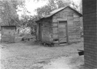
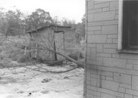
Shed in dilapidated condition on site affected by the construction of Interstate 26 (I-26). Edge of house in foreground. Surveyor notations on back of photo: "Dkt.: 10.480. Property owner: J.L. Spencer, et al. Tract: 50. Station: 5515+30 Lt. Date: May 2, 1961. In R/W - Bought." [See collection description for explanation of surveyor notations.]
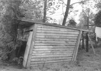
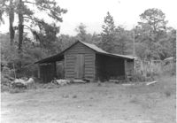
Shed/garage on site affected by the construction of Interstate 26 (I-26). Surveyor notations on back of photo: "Dkt.: 10.480. Property owner: Preston H. Mundy. Tract: 104. Station: 41+50 Line A). Date: May 2, 1961. In R/W - Bought." [See collection description for explanation of surveyor notations.]
Lot and shed on site affected by the construction of Interstate 26 (I-26). Surveyor notations on back of photo: "Dkt.: 10.480. Property owner: J.M. Fickling. Tract: 281. Station: 5731+50 Lt. (Line B). Date: May 30, 1961. Moving item." [See collection description for explanation of surveyor notations.]
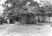
Various sheds and other structures on site affected by the construction of Interstate 26 (I-26). Surveyor notations on back of photo: "Dkt.: 10.480. Property owner: Laura B. Beaufort. Tract: 167. Station: 5681+40 Lt. Date: May 30, 1961. In R/W - Bought." [See collection description for explanation of surveyor notations.]
Shed or garage on site affected by the construction of Interstate 26 (I-26). Surveyor notations on back of photo: "Dkt.: 10.480. Property owner: Charlie C. Caldwell. Tract: 195. Station: 5688+50 Rt. Date: May 31, 1961. In R/W - Bought." [See collection description for explanation of surveyor notations.]