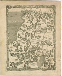
Black-and-white woodcut map of the twelve tribes of Israel. From Psalm 80: 9-12 : "Thou didst pluck up a vine out of Egypt; Thou didst drive out the nations, and didst plant it. Thou didst clear a place before it, and it took deep root, and filled the land. The mountains were covered with the shadow of it, and the mighty cedars with the boughs thereof. She sent out her branches unto the sea and her shoots unto the River." Frontispiece to Onomasticum Veteris Testamenti, sive, Tractatus philologicus quo nomina V.T. propria ad appellativorum analogiam reducta ex originibus et formis suis explicantur, cum aliarum gentium nominibus conferuntur, impositionis ratio, quantum fieri potuit, ubique ostenditur, atque adeo linguae originali noua lux affunditur by Johann Simonis, published Halae Magdeburgicae : Impensis Orphanotrophei.
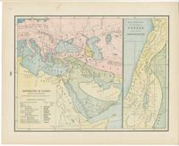
Color lithographic maps showing the dispersal of the descendants of Noah after the flood, and the twelve tribes of Israel, with additional biblical maps. From Cram's universal atlas : geographical, astronomical and historical by George F. Cram, published Chicago: George F. Cram.
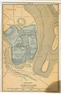
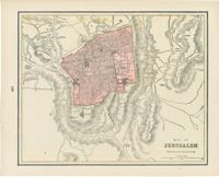
Color maps of ancient and modern Jerusalem. From A dictionary of the Bible : comprising its antiquities, biography, geography, natural history and literature by William Smith, published Philadelphia: John C. Winston Company.
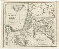
Black-and-white engraved map of places recorded in the Torah, with an inset map of eastern countries also mentioned. From The Holy Bible, containing the Old and New Testaments, together with the Apocrypha / translated out of the original tongues, and with the former translations diligently compared and revised..., published Philadelphia: M. Carey & Son.
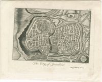
Black-and-white engraved map of Jerusalem. Engraving by John Bower. From The Holy Bible : containing the Old and New Testaments, together with the Apocrypha / translated out of the original tongues and with the former translations diligently compared and revised..., published New York: Collins and Co.
Hand-colored engraved map of Palestine. From Colton’s General atlas : containing one hundred and eighty steel plate maps and plans, on one hundred and nineteen imperial folio sheets / drawn by G. Woolworth Colton ; letter-press descriptions, geographical, statistical, and historical, by Richard Swainson Fisher, published New York: G.W. & C.B. Colton.
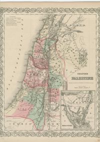
Hand-colored engraved map of Palestine, with an inset map of Jerusalem. Drawn and engraved by William H. Gamble. From Mitchell's new general atlas, containing maps of the various countries of the World, plans of cities, etc., embraced in sixty-three quarto maps, forming a series of one hundred maps and plans, together with valuable statistical tables by Samuel Augustus Mitchell, published Philadelphia: S. Augustus Mitchell, Jr.
Color lithographic map of Jerusalem. From Cram's universal atlas : geographical, astronomical and historical by George F. Cram, published Chicago: George F. Cram.
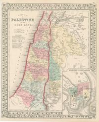
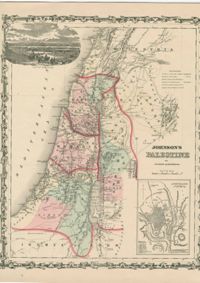
Hand-colored engraved map of Palestine, with an inset map of Jerusalem. From Johnson's new illustrated (steel plate) family atlas : with descriptions, geographical, statistical and historical published / compiled, drawn and engraved under the supervision of J. H. Colton and A. J. Johnson, published New York: Johnson and Browning.
Hand-colored engraved map of Palestine. From Colton's atlas of the world : illustrating physical and political geography, Volume 2, by George Woolworth Colton, published New York: J.H. Colton and Company.
Limit your search
William A. Rosenthall Judaica Collection - Prints and Photographs✖[remove]10