Search
« Previous |
21 - 40 of 985
|
Next »
Search Results
Date:
1971-01-19
Description:
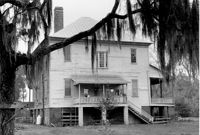
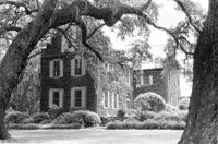
Lawson's Pond Plantation, Lawson Pond Lane. View of East (Rear) elevation. Cross, SC.;6.5" x 9.5" B/W photo. Box 2, Folder 1-4-3. One copy.
Date:
1971-01-19
Description:
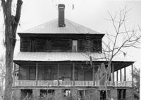
Lawson's Pond Plantation, Lawson Pond Lane. View of North (Side) elevation. Cross, SC.;6.5" x 9.5" B/W photo. Box 2, Folder 1-4-3. One copy.
Date:
1971-01-19
Description:
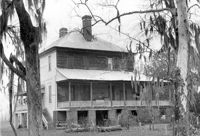
Lawson's Pond Plantation, Lawson Pond Lane. View of NE (Side and Rear) elevation. Cross, SC.;6.5" x 9.5" B/W photo. Box 2, Folder 1-4-3. One copy.
Date:
1971-01-19
Description:
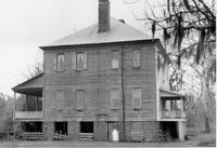
Lawson's Pond Plantation, Lawson Pond Lane. View of South (Side) elevation. Cross, SC.;6.5" x 9.5" B/W photo. Box 2, Folder 1-4-3. One copy.
Date:
1971-01-19
Description:
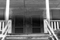
Lawson's Pond Plantation, Lawson Pond Lane. Detail View of Front Doors. West (Front) elevation. Cross, SC.;6.5" x 9.5" B/W photo. Box 2, Folder 1-4-3. One copy.
Date:
1971-01-19
Description:
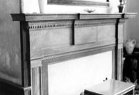
Lawson's Pond Plantation, Lawson Pond Lane. Interior View - Detail of mantle in East Front Room. NW elevation. Cross, SC.;6.5" x 9.5" B/W photo. Box 2, Folder 1-4-3. One copy.
Date:
1971-01-19
Description:
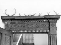
Lawson's Pond Plantation, Lawson Pond Lane. Interior View - Detail of door frame in East Front Room. West elevation. Cross, SC.;6.5" x 9.5" B/W photo. Box 2, Folder 1-4-3. One copy.
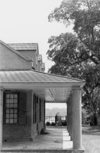
Description:
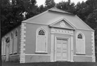
St. James Church, Goose Creek; Vestry Lane (off of Snake River Road, S.C. State Road 208). View of Front and Side elevation. Goose Creek, SC.;6.5" x 9.5" B/W photo. Box 2, Folder 1-5-1. One copy.
Description:
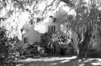
Medway Plantation, Medway Road off of U.S. Route 52. View of Side and Front. Mt. Holly, SC.;6.5" x 9.5" B/W photo. Box 2, Folder 1-5-2. One copy.
Description:
Medway Plantation, Medway Road off of U.S. Route 52. View of Rear. Mt. Holly, SC.;3.5" x 5" B/W photo. Box 2, Folder 1-5-2. One copy.
Date:
1971-05-00
Description:
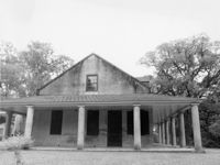
Otranto Plantation, 18 North Basilica Avenue. View of East (Rear) elevation. Hanahan, SC.;6.5" x 9.5" B/W photo. Box 2, Folder 1-5-6. One copy.
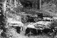
Date:
1971-05-00
Description:
Otranto Plantation, 18 North Basilica Avenue. View of foundation ruins. Hanahan, SC.;3.5" x 5" B/W photo. Box 2, Folder 1-5-6. Two copies.
Date:
1971-05-00
Description:
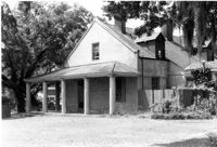
Otranto Plantation, 18 North Basilica Avenue. View of SE (Rear and Side) elevation. Hanahan, SC.;3.5" x 5" B/W photo. Box 2, Folder 1-5-6. Two copies.
Date:
1971-05-00
Description:
Otranto Plantation, 18 North Basilica Avenue. View of North (Side) elevation. Hanahan, SC.;3.5" x 5" B/W photo. Box 2, Folder 1-5-6. One copy.
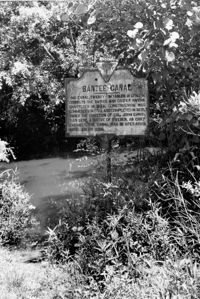
Date:
1976-06-06
Description:
Old Santee Canal. View of Historical Marker. Moncks Corner, SC.;9.5" x 6.5" B/W photo. Box 2, Folder 1-8-2. One copy.
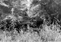
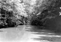
Date:
1976-06-06
Description:
Old Santee Canal. View of Lower Section. Moncks Corner, SC.;6.5" x 9.5" B/W photo. Box 2, Folder 1-8-2. One copy.
Date:
1976-06-06
Description:
Old Santee Canal. View of Lower Section. Moncks Corner, SC.;6.5" x 9.5" B/W photo. Box 2, Folder 1-8-2. One copy.
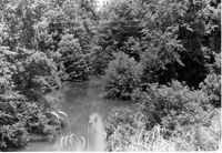
Date:
1976-06-06
Description:
Old Santee Canal. Moncks Corner, SC.;6.5" x 9.5" B/W photo. Box 2, Folder 1-8-2. One copy.
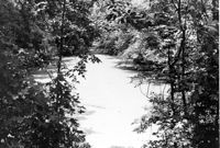
Date:
1976-06-06
Description:
Old Santee Canal. Moncks Corner, SC.;6.5" x 9.5" B/W photo. Box 2, Folder 1-8-2. One copy.
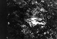
Date:
1976-06-06
Description:
Old Santee Canal. Moncks Corner, SC.;6.5" x 9.5" B/W photo. Box 2, Folder 1-8-2. One copy.