Search
« Previous |
81 - 100 of 104
|
Next »
Search Results
Date:
1945
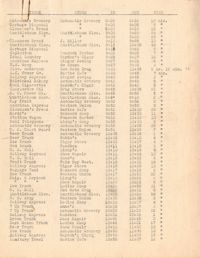
Description:
Parking survey of trucks, showing name on truck, name of store, time-in, time-out, and total time parked.
Date:
1945
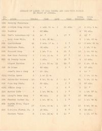
Description:
Summary of length of time trucks and cars were parked in front of stores.
Date:
[1945]
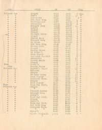
Description:
Parking survey of cars, showing type of car, store, time-in, time-out, and total time parked.
Date:
1945
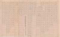
Description:
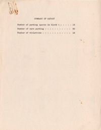
Parking survey Summary Report; location not indicated.
Date:
1945
Description:
Map of the Charleston peninsula with one area marked to indicate number of parking spaces.
Date:
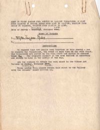
1945-11-28
Description:
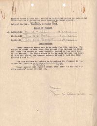
Memorandum to group leaders for "survey of estimated number of cars using curb space..." (dated Nov. 28, [1945]).
Date:
1945-11-28
Description:
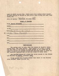
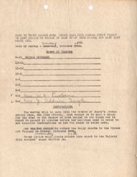
Memorandum to group leaders for "check made from second story window..." (dated Nov. 28, [1945]).
Date:
1945-11-28
Description:
Memorandum to group leaders for "check made from second story window..." (dated Nov. 28, [1945]).
Date:
1945-11-28
Description:
Memorandum to group leaders for "survey of parking violations..." (dated Nov. 28, [1945]).
Date:
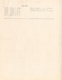
1945
Description:
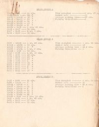
Parking survey chart with details of how long cars were parked; location not indicated.
Date:
1945
Description:
A parking violations tally sheet (presumably of area shown on attached map) with the corresponding map of the Charleston peninsula; survey area marked.
Date:
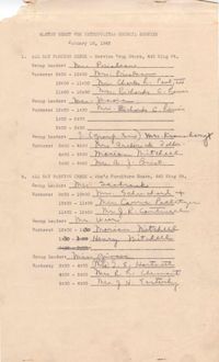
1945
Description:
Master sheet for the Metropolitan Council parking survey, listing parking check location, group leaders, shifts and workers (Jan. 16,1945).
Date:
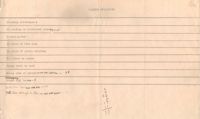
1945
Description:
Metropolitan Council traffic survey report for parking spaces 1-13 and a bus stop; location not indicated.
Date:
1944-09
Description:
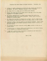
Summary of an interview done with James Altman by June S. Wing regarding parking and parking practices (Sept., 1944).
Description:
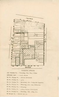
Map of area bounded by Calhoun Street, King Street, George Street, and St. Philip Street.
Description:
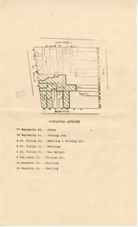
Map of area bounded by Wentworth Street, St. Philip Street, Beaufain Street, and King Street.
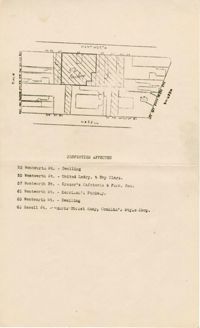
Description:
Map of area bounded by Wentworth Street, Meeting Street, Hasell Street, and King Street.
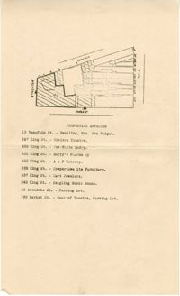
Description:
Map of area bounded by Archdale Street, Beaufain Street, King Street, and Market Street.
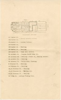
Description:
Map of area bounded by Market Street, King Street, Princess Street, and Archdale Street.