Charleston Earthquake scene. Possibly from Cook's Earthquake Views. No.68, John Kenney, Tradd Street. Charleston city directory for 1886 shows listing for John B. Kenney at 142 Tradd.
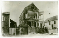
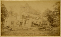
Charleston Earthquake Scene. Possibly from Cook's Earthquake Views, No.56, Alderman Murray's residence, Wentworth Street.' Charleston city directory for 1886 shows Andrew B. Murray at 175 Wentworth.
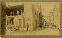
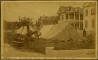
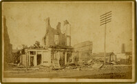
Charleston Earthquake scene. Written on front, at bottom: 'Charleston Earthquake scene - warehouse on Atlantic Wharf.' Charleston city directory for 1886 lists Atlantic Wharf at the rear of the Post Office.
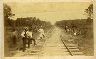
Charleston Earthquake scene. Handwritten on reverse: '9 mile bottom - South Carolina railroad - chasm on left. Track was originally a tangent. Caused by earthquake, 1886. Track cut of line.'
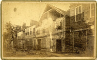
Caption: 'Cook's Earthquake Views of Charleston and Vicinity. Taken after the 31st of August, 1886. No.93, No.11 King Street.' Written on front, at bottom: 'Charleston Earthquake scene - Private residence on King St. near South Battery.'
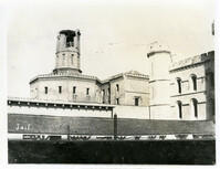
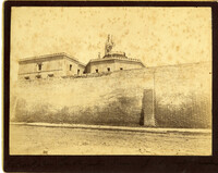
Caption: 'Charleston Earthquake. Photographs by Dr. E.P. Howland, taken on his visit to Charleston and the earthquake region of Ten Mile Hill and Summerville. Over 150 Photographs were taken. Charleston Jail and cracked wall, unsafe and condemned.'
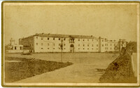
Caption: 'Cook's Earthquake Views of Charleston and Vicinity. Taken after the 31st of August, 1886. No.12, Citadel Academy.' Shows Citadel when located on Marion Square.
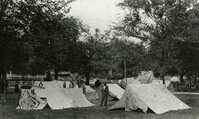
Caption: 'Cook's Earthquake Views of Charleston and Vicinity. Taken after the 31st of August, 1886. No.86, tents, Rutledge St[reet] Terrace.' Handwritten at bottom, front: 'Charleston Earthquake views - tents on Rutledge Terrace.'
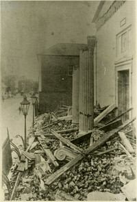
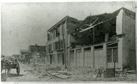
Charleston Earthquake scene. Copy of No.24 of Cook's Earthquake views. Shows damage to the buildings on the north side of Market Street, including the Sailor's Home.