Search
« Previous |
101 - 200 of 228
|
Next »
Search Results
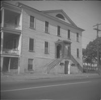
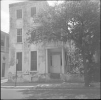
Date:
1960
Description:
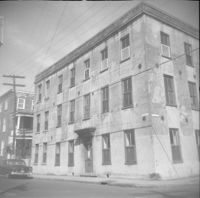
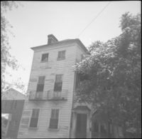
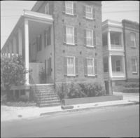
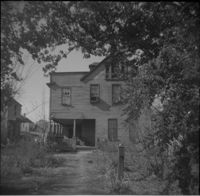
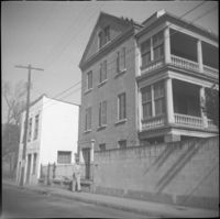
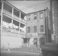
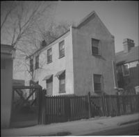
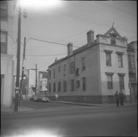
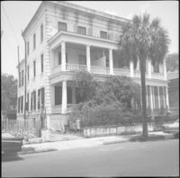
44 Society Street.
Date:
1960
Description:
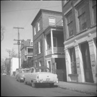
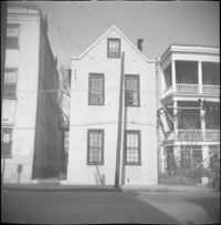
32 Anson Street, which had been located at the northeast corner of Anson and Hasell Streets, later demolished. 45 Hasell Street at right.
Date:
1960
Description:
32 Anson Street, which had been located at the northeast corner of Anson and Hasell Streets, later demolished.
Date:
1960
Description:
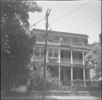
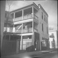
Right to left: 48-50 Anson Street and 52 Anson Street (Thomas Wallace and Martin Dowd Tenements).
Date:
1960
Description:
45 Anson Street, later demolished.
Date:
1960
Description:
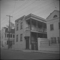
35 Wentworth Street
Date:
1960
Description:
Wentworth Street elevation of 52 Anson Street, located at the southeast corner of Anson and Wentworth Streets.
Date:
1960
Description:
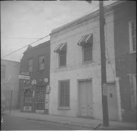
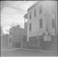
Right to left: 42 Anson Street and 44 Anson Street (Galloway's Grocery).
Date:
1960
Description:
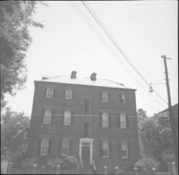
52 Anson Street, located at the southeast corner of Anson and Wentworth Streets.
Date:
1960
Description:
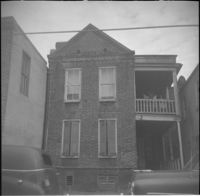
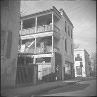
46 Anson Street (Thomas Wallace House).
Date:
1960
Description:
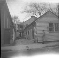
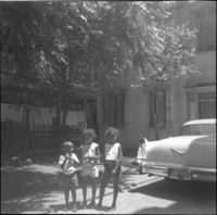
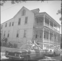
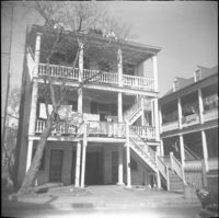
51 Laurens Street. Three children stand by a car in the driveway.
Date:
1960
Description:
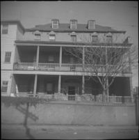
49 Laurens Street (William Monies House).
Date:
1960
Description:
50 Laurens Street (Adams-Ingraham House)
Date:
1960
Description:
55 Laurens Street (James Jervey House).
Date:
1960
Description:
53 Laurens Street (James Marsh House).
Date:
1960
Description:
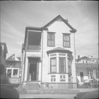
47 Laurens Street.
Date:
1960
Description:
51 Laurens Street.
Date:
1960
Description:
52 Laurens Street.
Date:
1960
Description:
31 Hasell Street.
Date:
1960
Description:
28 Wentworth Street. 26 Wentworth also in view (right).
Date:
1960
Description:
27 Wentworth Street flanked by 25 Wentworth (left).
Date:
1960
Description:
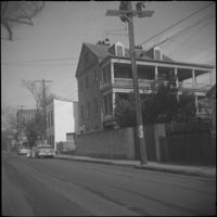
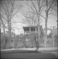
Unidentified house on East Bay Street, east side of street, likely within the 320 block, since demolished.
Date:
1960
Description:
322 East Bay Street (right), 324 East Bay Street (middle), partial view of 326 East Bay Street (left), since demolished.
Date:
1960
Description:
The original house at 82 Anson Street, later demolished to clear the lot for the relocation of the house at 86 Anson Street (Mary Smith House).
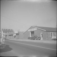
Date:
1960
Description:
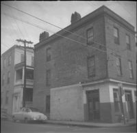
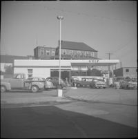
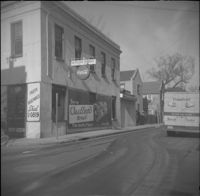
Gulf gas station located at 299 East Bay Street, northwest corner of East Bay Street and Society Street.
Date:
1960
Description:
Right to left: 84 Anson Street before demolition and 86 Anson Street (Mary Smith House) before its relocation to its current address (82 Anson Street).
Date:
1960
Description:
311 East Bay Street (Stephen Shrewsbury House), located at the corner of East Bay Street and Laurens Street. Laurens Street elevation.
Date:
1960
Description:
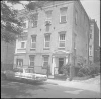
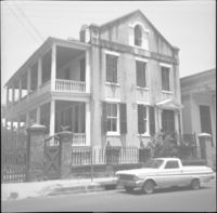
321 East Bay Street (Blake-Grimke House).
Date:
1960
Description:
321 East Bay Street (Blake-Grimke House).
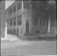
Date:
1960
Description:
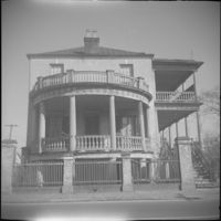
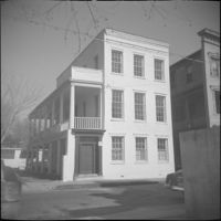
52 Hasell Street (Gibbons-Gilliland House).
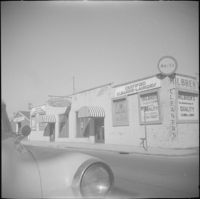
Date:
1960
Description:
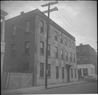
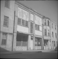
Businesses located at the northeast corner of East Bay Street and Vernon Street: Milbren's Laundry and Dry Cleaning (334 East Bay Street) and Fort Sumter Paper Co. (336 East Bay Street), since demolished.
Date:
1960
Description:
Fort Sumter Paper Co. (336 East Bay Street) and Sam Solomon Co. (338 East Bay Street), since demolished.
Date:
1960
Description:
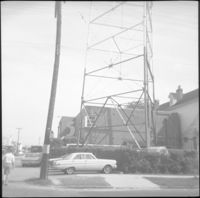
WCSC Channel 5 building (485 East Bay Street) and tower.
Date:
1960
Description:
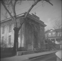
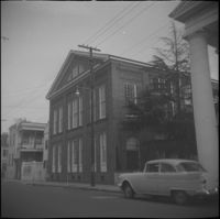
43 Wentworth Street (St. Andrew's Lutheran Church).
Date:
1960
Description:
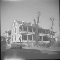
332 East Bay Street (Robert Primerose House).
Date:
1960
Description:
332 East Bay Street (Robert Primerose House).
Date:
1960
Description:
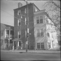
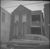
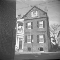
19 Wentworth Street (William Lebby House).
Date:
1960
Description:
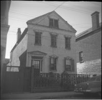
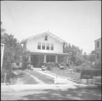
8 George Street (Sarah Daniell Lawrence House).
Date:
1960
Description:
64 Society Street.
Date:
1960
Description:
12 George Street, since demolished.
Date:
1960
Description:
14 George Street (Middleton-Pinckney House), when it was the Commissioner of Public Works [Water Works] building.
Date:
1960
Description:
3-5 Wentworth Street. Partial view of 289 East Bay Street at left edge.
Date:
1960
Description:
34 Anson Street (Mary Lanneau House), flanked by 36-40 Anson Street which was later demolished.
Date:
1960
Description:
66 Society Street (Hieronymous-Roper House), flanked by 66½ Society Street (left) and 64 Society Street (right).
Date:
1960
Description:
43 Wentworth Street (St. Andrew's Lutheran Church).
Date:
1960
Description:
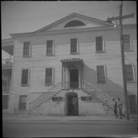
67 Anson Street (St. Stephen's Episcopal Church.
Date:
1960
Description:
35 Wentworth Street
Date:
1960
Description:
30 Society Street.
Date:
1960
Description:
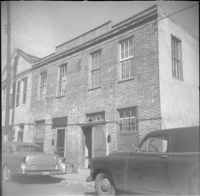
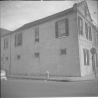
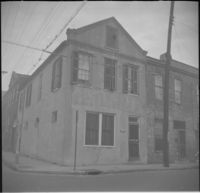
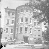
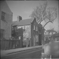
47 Hasell Street, located at the southwest corner of Hasell Street and Anson Street.
Date:
1960
Description:
Left to right: 40 Hasell Street, partial view of 38 Hasell Street.
Date:
1960
Description:
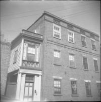
42 Hasell Street (George Cannon House).
Date:
1960
Description:
46 Anson Street (Thomas Wallace House).
Date:
1960
Description:
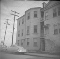
4 Wentworth Street.
Date:
1960
Description:
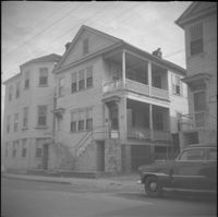
8 Wentworth Street.
Date:
1960
Description:
6 Wentworth Street.
Date:
1960
Description:
41 Hasell Street.
Date:
1960
Description:
43 Anson Street.
Date:
1960
Description:
325 East Bay Street, since demolished.
Date:
1960
Description:
325 East Bay Street, since demolished.
Date:
1960
Description:
38 Society Street, flanked by partial views of 40 Society Street (Juliana Dupre House) (left) and 36 Society Street (Henry Street House) (right).
Date:
1960
Description:
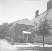
50 Hasell Street (St. Johannes Lutheran Church Rectory).
Date:
1960
Description:
328 East Bay Street (Andrew Moffett House).
Date:
1960
Description:
51 Hasell Street (Glover House/Mary Baker Eddy House).
Date:
1960
Description:
Anson Street elevation of 29 Wentworth Street.
Date:
1960
Description:
36 Hasell Street.
Date:
1960
Description:
29 Wentworth Street.
Date:
1960
Description:
Right to left: 72 Anson Street (Kohne-Leslie House) and the original house at 74 Anson Street before its demolition.
Date:
1960
Description:
59 Anson Street, corner store located at the southwest corner of Anson and Society Streets. W. Wineglass Antiques Repairs-Upholstery.
Date:
1960
Description:
59 Anson Street, corner store located at the southwest corner of Anson and Society Streets. W. Wineglass Antiques Repairs-Upholstery.
Date:
1960
Description:
59 Anson Street, corner store located at the southwest corner of Anson and Society Streets. W. Wineglass Antiques Repairs-Upholstery.
Date:
1960
Description:
60 Anson Street (Robert M. Venning House), located at the southeast corner of Anson and Society Streets.
Date:
1960
Description:
61 Anson Street (Kestler's Market), corner store located at the northwest corner of Anson and Society Streets.
Date:
1960
Description:
63 and 65 Anson Street (Susan Robinson Dependencies).
Date:
1960
Description:
10 Wentworth Street (Charles W. Seignious House).
Date:
1960
Description:
63 Anson Street (Susan Robinson Dependency).
Date:
1960
Description:
37 Wentworth Street. View of 33 Wentworth at far left, partial view of 35 Wentworth at immediate left, and a column of St. Johannes Lutheran Church at right.
Date:
1960
Description:
40 Wentworth Street (McIntosh Auto Top Shop), flanked by partial view of 42 Wentworth Street (left) and by 38 Wentworth Street (right).
Date:
1960
Description:
25 Wentworth Street (Margaretta Hube House). Partial view of 23 Wentworth Street (James J. Jeffords House) at left edge.
Date:
1960
Description:
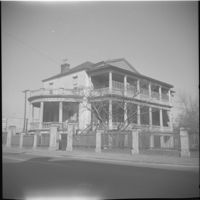
270 Meeting Street (Daniel Hart House), located at the southeast corner of Meeting Street and Society Street.
Date:
1960
Description:
33 Wentworth Street (William Proctor House), flanked by 31 Wentworth Street (left) and 35 Wentworth Street (right).
Date:
1960
Description:
12 Wentworth Street (William C. Armstrong House), before removal of front piazza.
Date:
1960
Description:
22-24 Wentworth Street (Francis Q. McHugh Tenements).
Date:
1960
Description:
29 Society Street (John W. Robinson Tenement).
Date:
1960
Description:
64 Hasell Street (Benjamin Smith House).
Date:
1960
Description:
Left to right: 23 Society Street and 25 Society Street, later demolished. The houses were at the southwest corner of Society Street and East Bay Street.
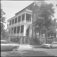
Date:
1960
Description:
Humble Oil gas station (288 Meeting Street), located at the southeast corner of Meeting Street and George Street. Later demolished.
Date:
1960
Description:
Left to right: 23 Society Street, 25 Society Street, and partial view of 27 Society Street. All were later demolished.
Date:
1960
Description:
27 Society Street flanked by partial views of 25 Society Street (left) and 29 Society Street. 25 and 27 Society Street were later demolished.
Date:
1960
Description:
Society Street elevation of 272 Meeting Street, conjoined with 66½ Society Street, located at the northeast corner of Meeting Street and Society Street.
Date:
1960
Description:
Society Street elevation of 270 Meeting Street (Daniel Hart House), located at the southeast corner of Meeting Street and Society Street.
Date:
1960
Description:
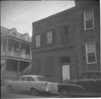
44 Hasell Street (James Stocker House).
Date:
1960
Description:
31 Wentworth Street.
Date:
1960
Description:
43 Hasell Street.
Date:
1960
Description:
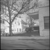
The house originally located at 116 Anson Street being moved to its new location at 39 Laurens Street.
Date:
1960
Description:
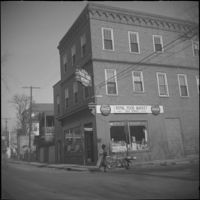
78 Anson Street (Royal Food Market), corner store located at the northeast corner of Anson and Laurens Streets, before its demolition.
Date:
1960
Description:
Right to left: 72 Anson Street (Kohne-Leslie House) and the original house at 74 Anson Street before its demolition.
Date:
1960
Description:
Right to left: 64 Anson Street (later demolished) and 66 Anson Street (Chazal House).
Date:
1960
Description:
68 Anson Street, later demolished.
Date:
1960
Description:
60 Anson Street (Robert M. Venning House), located at the southeast corner of Anson and Society Streets.
Date:
1960
Description:
86 Anson Street (Mary Smith House) prior to its relocation to its current address (82 Anson Street).


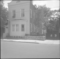
![116 Anson Street [now at 39 Laurens Street]](https://iiif.library.cofc.edu/iiif/2/48431/full/200,/0/default.jpg)